Yuusuu: Difference between revisions
mNo edit summary |
mNo edit summary |
||
| Line 40: | Line 40: | ||
| [[Marugame Prefecture]] | [[Muroran Prefecture]] | [[Uresino Prefecture]] |<hr/> | | [[Marugame Prefecture]] | [[Muroran Prefecture]] | [[Uresino Prefecture]] |<hr/> | ||
}} | }} | ||
| country_largest_city = | | country_largest_city = {{flagicon image|Flag of Ishikawa Okinawa.JPG}} [[Isikawa]] | ||
| country_largest_city_population = | | country_largest_city_population = 6,954,000 | ||
| population = tbd | | population = tbd | ||
|timezone1 = | |timezone1 = | ||
| Line 50: | Line 50: | ||
'''Yuusuu''' ({{wp|Japanese language|Senrian}}: {{lang|ko-Hang-KR|유우쑤우}}, ''Yuusuu''; {{wp|Kanji|Gyoumon}}: {{lang|ja|裕州}}) is the third-largest island in the [[Senrian archipelago]] and one of the "main islands" of [[Senria]]. It is located to the southwest of [[Kousuu]] across the [[Kahoumon Strait]] and [[Bay of Hisui]], to the south of [[Kisima]] and [[Rousima]] across the [[Ransou Inland Sea]], and to the northeast of [[Gyousuu]] across the [[Rakkomon Strait]]. | '''Yuusuu''' ({{wp|Japanese language|Senrian}}: {{lang|ko-Hang-KR|유우쑤우}}, ''Yuusuu''; {{wp|Kanji|Gyoumon}}: {{lang|ja|裕州}}) is the third-largest island in the [[Senrian archipelago]] and one of the "main islands" of [[Senria]]. It is located to the southwest of [[Kousuu]] across the [[Kahoumon Strait]] and [[Bay of Hisui]], to the south of [[Kisima]] and [[Rousima]] across the [[Ransou Inland Sea]], and to the northeast of [[Gyousuu]] across the [[Rakkomon Strait]]. | ||
[geography and climate] | Yuusuu can be broadly divided into three regions: a mountainous northern strip along the Ransou Inland Sea, a distinctive belt of flatland following the course of the [[Great Senrian Fault System]], and a large and particularly mountainous southern region. [geography and climate] | ||
The Senrian archipelago's second-largest island by population, Yuusuu contains the southernmost and westernmost reaches of the [[ | The Senrian archipelago's second-largest island by population, Yuusuu contains the southernmost and westernmost reaches of the [[Kouryuukaidou]] {{wp|megalopolis}}, which runs the length of the island from [[Ubeyama]] to [[Utimura]] before continuing to Kousuu. Yuusuu's largest city is [[Isikawa]], Senria's third largest; other major urban centers include Ubeyama, [[Hukuyama]], [[Kanaya]], [[Toyotori]], and Utimura. [population and economics] Yuusuu is directly connected to Kousuu by road and to both Kousuu and Yuusuu by rail. | ||
==Etymology== | ==Etymology== | ||
Latest revision as of 07:58, 13 January 2024
This article is incomplete because it is pending further input from participants, or it is a work-in-progress by one author. Please comment on this article's talk page to share your input, comments and questions. Note: To contribute to this article, you may need to seek help from the author(s) of this page. |
| Native name: 유우쑤우 (Senrian) | |
|---|---|
 | |
| Geography | |
| Location | Senria |
| Archipelago | Senrian archipelago |
| Administration | |
| Prefectures | |
| Largest settlement | |
| Demographics | |
| Population | tbd (20XX) |
| Ethnic groups | Senrians |
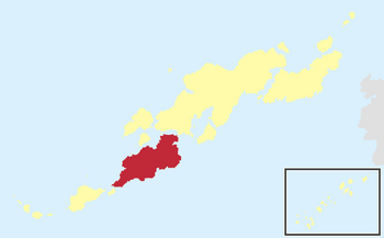
Yuusuu (Senrian: 유우쑤우, Yuusuu; Gyoumon: 裕州) is the third-largest island in the Senrian archipelago and one of the "main islands" of Senria. It is located to the southwest of Kousuu across the Kahoumon Strait and Bay of Hisui, to the south of Kisima and Rousima across the Ransou Inland Sea, and to the northeast of Gyousuu across the Rakkomon Strait.
Yuusuu can be broadly divided into three regions: a mountainous northern strip along the Ransou Inland Sea, a distinctive belt of flatland following the course of the Great Senrian Fault System, and a large and particularly mountainous southern region. [geography and climate]
The Senrian archipelago's second-largest island by population, Yuusuu contains the southernmost and westernmost reaches of the Kouryuukaidou megalopolis, which runs the length of the island from Ubeyama to Utimura before continuing to Kousuu. Yuusuu's largest city is Isikawa, Senria's third largest; other major urban centers include Ubeyama, Hukuyama, Kanaya, Toyotori, and Utimura. [population and economics] Yuusuu is directly connected to Kousuu by road and to both Kousuu and Yuusuu by rail.
