Template:Gylian regions: Difference between revisions
Jump to navigation
Jump to search
mNo edit summary |
mNo edit summary |
||
| Line 53: | Line 53: | ||
|colspan=7|Data from the 2015 census conducted by the [[Gylian administrative agencies#Unaffiliated agencies|Bureau of Statistics and Accounting]]. | |colspan=7|Data from the 2015 census conducted by the [[Gylian administrative agencies#Unaffiliated agencies|Bureau of Statistics and Accounting]]. | ||
|} | |} | ||
<noinclude> | |||
[[Category:Gylias templates]] | |||
</noinclude> | |||
Revision as of 11:58, 6 March 2019
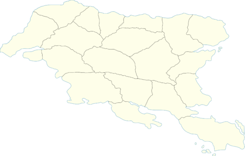
| Map | Regions | |||||
|---|---|---|---|---|---|---|
| Name | Abbr. | Capital | Area (km²) | Population | GDP share (%) | |
| Salxar | SL | Şet | 77,390 | 180,605 | 2,37% | |
| Makarces | MK | Jaţe | 52,925 | 166,547 | 2,35% | |
| Gacar | GC | Razyn | 58,362 | 179,782 | 2,45% | |
| Gerşyr | GE | Mytin | 61,453 | 186,870 | 2,70% | |
| Arxaþ | AR | Xakalen | 105,906 | 793,657 | 5,05% | |
| Alţira | AŢ | Senik | 83,733 | 832,199 | 5,02% | |
| Tandar | TA | Taksær | 96,738 | 716,065 | 4,77% | |
| Kausania | KA | Dáuzas | 104,466 | 1,390,009 | 5,65% | |
| Mişeyáke | MŞ | Zaul | 112,408 | 2,325,549 | 6,58% | |
| Sváen | SV | Lavryş | 17,001 | 1,049,825 | 5,15% | |
| Elena | EL | Argyrokastron | 65,344 | 1,612,902 | 6,15% | |
| Arsad | AR | Kaéraþ | 108,304 | 701,747 | 4,87% | |
| Envadra | EN | Mayt | 113,781 | 822,477 | 5,20% | |
| Nezyál | NE | Kyman | 65,451 | 1,332,369 | 6,04% | |
| Tomes | TO | Iásas | 132,662 | 1,771,319 | 5,93% | |
| Ḑarna | ḐR | Geksian | 87,464 | 1,423,263 | 5,15% | |
| Aðuna | AÐ | Sivat | 92,421 | 1,412,178 | 5,35% | |
| Herlan | HE | Arnak | 70,941 | 1,585,098 | 6,25% | |
| Nauras | NA | Náras | 59,801 | 1,230,391 | 6,19% | |
| Nerveiík-Iárus-Daláyk | NID | Andral | 141,776 | 2,456,347 | 6,78% | |
| Data from the 2015 census conducted by the Bureau of Statistics and Accounting. | ||||||