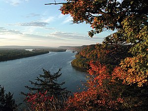
Addle River
| Addle River | |
|---|---|
 | |
| Etymology | Samuel T Addle |
| Location | |
| Country | Zamastan |
| Province | Pahl, Redeemer’s Land, Verdesia, Landeda |
| Cities | Riverview, Coalmont, Abagene, Duncan, Addleview, Emerald, Landeda |
| Physical characteristics | |
| Source | Chapman's Spring |
| - location | near Lake Louise |
| - length | 295 mi (475 km) |
| - elevation | 9,100 ft (2,800 m) |
| Mouth | Cantalle Ocean |
- location | Landeda, Landeda |
| Length | 3,341 mi (5,377 km) |
The Addle River is the longest river in Zamastan. Rising in the northern Louise Mountains near Lake Louise, the Addle flows south for 3,341 miles (5,377 kilometers) before entering into the Cantalle Ocean at Landeda. It is the third-longest river system in the world. Many tributaries feed into the Addle, and many distributaries branch off of it, including the Zian and Valonda Rivers. The river flows through both densely and sparsely populated areas, including the Emerald Metropolitan Region. It flows through the center of the province of Pahl, and creates the eastern border between Pahl and Redeemer’s Land at Addleview, and then creates the border between Verdesia and Landeda provinces.
For over 12,000 years, people have depended on the Addle River and its tributaries as a source of sustenance and transportation. More than ten major groups of Catica First Nations populated the watershed, most leading a nomadic lifestyle and dependent on enormous bison herds that roamed through the Alanis Plains. The first Adulans encountered the river in the late seventeenth century, and the region became part of Zamastan through the 1824 Pahlan Purchase and the 1881 Tregueux Annexation. Pioneers headed west en masse beginning in the 1830s, first by covered wagon, then by the growing numbers of steamboats that entered service on the river. Conflict between settlers and native kingdoms in the watershed led to some of the most longstanding and violent confrontations in expansion. The onset of the Parabocan War was largely fought over control of the Addle.
During the 20th century, the Addle River basin was extensively developed for irrigation, flood control, and the generation of hydroelectric power. Fifteen dams impound the main stem of the river, with hundreds more on tributaries. Meanders have been cut off and the river channelized to improve navigation, reducing its length by almost 200 miles (320 km) from pre-development times. Although the lower Addle valley is now a populous and highly productive agricultural and industrial region, heavy development has taken its toll on wildlife and fish populations as well as water quality.