S'Lanter
This article is incomplete because it is pending further input from participants, or it is a work-in-progress by one author. Please comment on this article's talk page to share your input, comments and questions. Note: To contribute to this article, you may need to seek help from the author(s) of this page. |
The Okur-Federation of The S'Lanter S'Lanter Okur-Federativnl | |
|---|---|
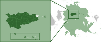
 Location on Pelia continent | |
| Status | Independent State |
| Capital | Velmegun |
| Largest | Akan'aktid |
| Official languages | Okur'langun |
| Demonym(s) | S'Lanter-lun (sing), S'Lanter (adj), S'Lanter (plur) |
| Government | Federal heptarchic representative republic |
• Principal General | Grekor pol Tegiz |
| Independent | |
| Population | |
• 1610 AR census | 101,432,390 |
| GDP (nominal) | estimate |
• Total | Ξ5.64 trillion (₭2.12 trillion PRK) |
• Per capita | ₭20,990.10 |
| Gini (1610) | .38.7 low |
| HDI (1610) | 0.821 very high |
| Currency | Okur'azhk (Ξ) (OZK) |
| Date format | mm/dd/yyyy |
| Driving side | right |
| Calling code | +7 |
| Internet TLD | .sl |
The Okur-Federation of The S'Lanter, commonly referred as The S'Lanter, is a landlocked nation located in the southwest of Lumaria on the continent of Pelia. It consists of 87 holts (federal districts) and five unincorporated territories. With a population of over 100 million, it is the most populous country in Lumaria and in Pelia. It is the predominate nationstate of the Okurluns, a species of sapient bipedal Okur'oden. While Okurluns make up 96.3% of the population, members of other species claim citizenship in the Okur-Federation.
Etymology
S'Lanter is roughly translated to "kindred", the term becoming a national nomer in the early 1500s as Okurlun tribes unified under the Prat'chk clan.
History
Origin of the Okurluns
Kveutonian experimentation
Exodus of the Okurluns
First proto-state of the Okurluns
Tribal states period
During the Aglācā period
Warring holts
Rivalry of the Prat'chk and the Sulikashvili Vong
Unification of the Okurluns
Lead up to the Brothers War
Foundation of the S'Lanter
Modern history
Geography
S'Lanter geographic borders are defined in the west by the Olki Alps, the Trans-Lumarian Steppe in the north, the R'ffti River Valley in the south, and the Trans-Lumarian Aligriftor Lake in the east. While the majority of the land area consists of the open grassland of the Blue Steppe, there are meadows, deciduous forests, isolated mountain ranges, and cold, arid plateaus.

