States of Aucuria: Difference between revisions
m (→List) |
m (→List) |
||
| Line 182: | Line 182: | ||
|- | |- | ||
| [[New Ruttland]] | | [[New Ruttland]] | ||
| style="text-align: center;" | ''Naujoji | | style="text-align: center;" | ''Naujoji Ruttuija'' | ||
| style="text-align: center;" | NR | | style="text-align: center;" | NR | ||
| [[File:Flag of New Ruttland.png|border|100px]] | | [[File:Flag of New Ruttland.png|border|100px]] | ||
Revision as of 16:53, 7 October 2021
| State | |
|---|---|
| Also known as: Valstija (in Ruttish) | |
| Category | Federated state |
| Location | Aucuria |
| Number | 19 |
| Populations | Smallest: Largest: |
| Areas | Smallest: Largest: |
| Government | State government |
| Subdivisions | County Municipality |
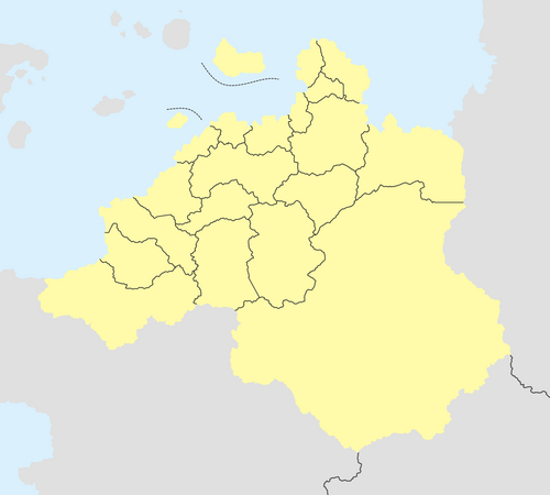
The states of Aucuria (Ruttish: Aukurijos valstijos, sing. valstija) are the first-level administrative divisions, of which there are currently nineteen, which together form the Aucurian Republic. These states are accorded a certain degree of autonomy, with their own constitutions and elected governments, shared jurisdiction with the federal government over their territories, and the ability to collect taxes and pass their own civil and criminal laws subordinate to those of the federal government.
Each state is further subdivided into counties, which are in turn further divided into municipalities.
History
[initial new ruttland-cutinsua stuff, before the provinces]
[ruttish provinces]
[eleven founding states]
[dabrauskas creates three more]
[the remainder steadily trickle in]
Proposals for new states
[proposals for a federal district of kalnaspilis]
[calls for st casimir and catherine islands to get their own state]
Timeline
Government
[state gov't structure]
[relations between state and federal gov't; between state and local gov't]
List
| State | Name in Ruttish | Postal code | Flag | Capital | Largest city | Area | Population (2014) | Density | Date of admission | № deputies |
|---|---|---|---|---|---|---|---|---|---|---|
| Bendrieji Laukai | Bendrieji Laukai | BL | 
|
Katniava | Katniava | tbd km2 | 6,269,796 | tbd | tbd XX, 1XXX | 42 |
| Cataris | Kataris | KA | 
|
Vilkietai | Vilkietai | tbd km2 | 766,093 | tbd | tbd XX, 1XXX | 10 |
| Chanchamaya | Čančamaja | ČA | 
|
Čačapojas | Suljanas | tbd km2 | 3,649,056 | tbd | tbd XX, 1XXX | 32 |
| Chucisaca | Čukisaka | ČU | 
|
Andavaila | Andavaila | tbd km2 | 3,862,586 | tbd | tbd XX, 1XXX | 32 |
| Juoda | Juoda | JU | 
|
Molėtai | Molėtai | tbd km2 | 1,071,858 | tbd | tbd XX, 1XXX | 14 |
| Kajapas | Kajapas | KJ | 
|
Velykopolė | Velykopolė | tbd km2 | 2,107,888 | tbd | tbd XX, 1XXX | 22 |
| Kestutia | Kestutija | KE | 
|
Naujoji Šilokrautė | Naujoji Šilokrautė | tbd km2 | 1,668,940 | tbd | tbd XX, 1XXX | 20 |
| Kunturiri | Kunturiri | KU | 
|
Oruras | Oruras | tbd km2 | 1,045,283 | tbd | tbd XX, 1XXX | 14 |
| Leikauskas | Leikauskas | LE | 
|
Ačukalas | Fresenburgas | tbd km2 | 1,348,743 | tbd | tbd XX, 1XXX | 16 |
| Magdaliete | Magdalietė | MA | 
|
Biržuventis | Biržuventis | tbd km2 | 874,470 | tbd | tbd XX, 1XXX | 12 |
| New Ruttland | Naujoji Ruttuija | NR | 
|
Apvaizda | Apvaizda | tbd km2 | 5,717,996 | tbd | tbd XX, 1XXX | 40 |
| Oroncota | Oronkota | OR | 
|
Pukalpa | Pukalpa | tbd km2 | 578,046 | tbd | tbd XX, 1XXX | 8 |
| Pakrashchia | Pakraščija | PA | 
|
Vykintopolė | Vykintopolė | tbd km2 | 1,645,568 | tbd | tbd XX, 1XXX | 20 |
| Sidabria | Sidabrija | SI | 
|
Kalnaspilis | Kalnaspilis | tbd km2 | 7,244,702 | tbd | tbd XX, 1XXX | 44 |
| Suduva | Suduva | SU | 
|
Tiškevičiai | Tiškevičiai | tbd km2 | 712,186 | tbd | tbd XX, 1XXX | 10 |
| Šventasis Silvestras | Šventasis Silvestras | SL | 
|
Tauragė | Uostas Kuprevičius | tbd km2 | 1,246,705 | tbd | tbd XX, 1XXX | 16 |
| Šventasis Steponas | Šventasis Steponas | ST | 
|
Mariunis | Mariunis | tbd km2 | 3,095,645 | tbd | tbd XX, 1XXX | 28 |
| Šventoji Elžbieta | Šventoji Elžbieta | EL | 
|
Koncepcija | Koncepcija | tbd km2 | 924,372 | tbd | tbd XX, 1XXX | 12 |
| Tucatia | Tukatija | TU | 
|
Piliukas | Piliukas | tbd km2 | 393,577 | tbd | tbd XX, 1XXX | 4 |
