Tarpeia
State of Tarpeia
| |
|---|---|
 Flag  Coat of arms | |
| Motto: Concordia Apostolum | |
| Anthem: Inno del Mare Hymn of the Sea | |
 | |
| Country | Etruria |
| Status | Constituent state within a Federation |
| Annexation in Etruria | 1962 |
| Autonomous Region | 1963 |
| Constituent State | 1979 |
| Capital | Centuripe |
| Government | |
| • Type | Parliamentary republic in a federation |
| • Body | State Assembly |
| • Prefect of State | Nero Orlando (MT) |
| • Deputy Prefect | Serafina Galvagno (MT) |
| Area | |
| • Total | 10,481 km2 (4,047 sq mi) |
| Population (2020) | |
| • Total | 1,700,655 |
| • Density | 162.26/km2 (420.3/sq mi) |
| Demonym | Tarpeian |
| GDP | |
| • Total | $ million |
| • Per capita | $ |
| Area code | +101 |
| Official languages | Vespasian Novalian |
| Patron saint | Saint Paul |
Tarpeia is a state located in southwestern Etruria. It is bordered to the west by the Acheolian Sea, to the north by the country of Piraea, to the east and northeast by the state of Novalia, and to the south by XX. Due to its geographical shape and its Acheolian coast line, it is also known as the Tarpeian Corridor (Corridoio Tarpea). With a total land area of XX,XXX it is the Xth largest state in Etruria, and with a population of 1.7 million it is the 12th most populous state in Etruria. It's capital and largest city is Ghiutrave, other major cities of the state include Scaccianari and San Pietro supra Giove.
The region of modern day Tarpeia was inhabitated by predominately a variety of Samnii tribes, before being colonised by Ancient Piraea, who brought with them Piraean culture, language, religion and virtues. Through the Piraean presence in Tarpeia and to the east in Etruria proper, the Solarian civilisation drew considerable influences. The region remained under Piraean control for much of 2nd century BC, until expansion by the Solarian Republic saw it, alongside Piraea itself be conquered. Under Solarian dominion, the region rapidly grew in population as the Republic exploited the vast deposits of tin and copper, while its fertile soil was used to feed the rapidly growing city of Solaria. To support these materials and goods being consumed by the city, the Republic constructed the Via Acheulia, connecting the port city of Camerium with Solaria, bisecting modern-day Tarpeia. In 83 BC, the region was absorbed into the politico-religious boundary known as the Maius Pomerium, which denoted the territory to governed directly by the Senate. In 132 AD, the area directly east of Scaccianari, was the site of the Battle of Scianarium, one of the largest slave revolts in Solarian history.
During the late Imperial Period (300-435 AD), the region was invaded and settled by a variety of Marolevic tribes who migrated from the west. Among these settling tribes were those who would go on to form the ethnic Novalians and Miruvians, while the collapse of Imperial authority also saw the return of Piraeans to the region. Following the collapse of the Solarian Empire in 435 AD, the region fractured into various tribal polities until the rise of the First Piraean Empire, which it was formally annxed in 1085. In the early 12th century, coastal Tarpeia was seized by the Most Exalted Republic of Povelia and would remain under Povelian control until the 18th century. Under Povelian dominion, the ports and harbours of the coast were utilised for Povelian trade with Amathia and Soravia, with Ghiutrave emerging as the largest and wealthiest of the trade cities. During the 14th and 15th centuries, the coast was regularly raided by Satrian corsairs and Pardarian pirates, until the Povelian navy crushed piracy during the Wars of the Sea (1420-1438).
In 1749, the region was conquered by the Grand Principality of Alikianos following the Tarpeian War (1747-1749), but would fall under control of the First Etrurian Republic in 1788 during the First Etrurian Revolutionary War. This marked the beginning of Tarpeia's association with the united Etrurian polity. The Etrurian Republic used Tarpeia as a springboard to invade southern Piraea, while Ghiutrave was rapildy developed to provide shelter and supplies as a naval anchorage. Much of coastal Tarpeia would return to Piraean control, with the area including Scaccianari would be absorbed into the United Kingdom of Etruria in 1810. This area, having been de-populated during the Revolutionary Wars, was settled by predominately Novalians at the behest of the Etrurian monarchy, while the ethnic Vespasians along the coast became increasingly nationalistic and yearned for reunification. The areas under Piraean control, saw dramatic shifts in demography, as thousands of Piraeans were mandated to settle in rural and urban areas.
Tarpeia was the first region to be attacked by Etrurian forces during the Great War, which the Etrurian 2nd Army seizing Ghiutrave in late 1927, this was followed by the subsequent invasion of Piraea itself by Etruria owing to the former's alliance with Functionalist Gaullica. Following the end of the Great War, Tarpeia in its entirety returned to Etrurian control and rapidly, rights and freedoms were denied to the sizeable Piraean population. In 1938, the Legionary Reaction resulted in the establishment of the Greater Solarian Republic, which instituted the Etrurianisation of Tarpeia, this involved the forced displacement of ethnic Piraeans out of the cities and towns, the renaming of settlements and then ultimately, a ban on the speaking and writing of Piraean. With the outbreak of the Solarian War in 1943, the Etrurianisation process escalated into the massacring of ethnic Piraeans and their deportation to Piraea. An estimated 90,000 Piraean civilians were killed during the eight-year period, though with the defeat of the GSR in 1946, a majority of Tarpeia returned to Piraean control under the Treaty of Ashcombe.
From 1946 until 1960, the region was governed under the First Piraean Republic and became a hotbed for both, far-left politics and that of the far-right. It became a safe haven for many prominent Novalian left-wing nationalists, who used Tarpeia as a base to stir nationalist sentiments in Novalia in the aim of securing an independent socialist republic, while ethnic Vespasians regularly agitated for reunification with Etruria and instigated protests and low-level terrorist activity against Piraean authorities. In 1960, Etruria's Third Republic was overthrown by the military who established a military regime, ostensibly in response to the growing Western Emergency. Citing the sanctuary provided to enemies of the state, the Etrurian military government launched a full-scale invasion of Tarpeia and the Aprocorona Islands, seizing the territory from Piraea with little to no resistance. The region was proclaimed a Federal Autonomous Region in 1963, Tarpeia would remain under military occupation until 1979, when it was formally admitted into the Etrurian Federation as a state. Since 1960, the region has witnessed significant investments by the Etrurian government, becoming one of the most productive agricultural regions in Etruria. Coastal Tarpeia has also become a major tourist destination and home to a sizeable expat population drawn from across Euclea.
History
Pre-history
Ancient
Piraean colonisation
Solarian Conquest
Middle ages
Modern
Etrurianisation
Post-Solarian War
Invasion and reunification with Etruria
Present
Geography
Tarpeia is located in southwestern Etruria, bordering Piraea to the north, XX to the south and the state of Novalia to the east. It is bound to the west by the Acheolian Sea, of which it has a 1,043km long coastline, including the Aprocorona Islands. The shape of Tarpeia and its geographical nature of linking Etruria with the Acheolian Sea has lent the state the unofficial name of the Tarpeian Corridor (Corridoio Tarpea), which was introduced in the early 20th century as a geopolitial moniker. Tarpeia has a total area of 10,481 km2 (4,047 sq mi), making it the Xth largest state in Etruria.
Tarpeia is divided into four distinct geographical regions; Insular Tarpeia (Tarpea Insulare), Coastal Tarpeia (Costiera Tarpea), the Corridor (Il Corridoio) and the Piraean Foothills (Pedemontana del Pirea). Each region has varying unique features, that have come to define human development and economic activity. Insular Tarpeia, including the Aprocorona Islands and the inhabitated coastal islands of San Paolo Maggiore and San Pietro Minore. Both islands are beleived to be the product of rising sea levels caused by the end of the ice age, rather than being formed through volcanic activity. As such, the distance between the islands and the coast is only 40km at its widest point, while the sea depth is only 85m at its deepest. Tarpeia's highest point, Monte Nettuno is located on San Paolo Maggiore, at 780m (2,559 ft). The Aprocorona Islands, located 120km northwest of Tarpeia are a volcanic archipelago and are comprised of Aprocorona, Efesto, Demetra, Scheria and Eurinome. The islands of Aprocorona, Efesto and Scheria are inhabitated and due to their volcanic history have a rich fertile soil.
Coastal Tarpeia, is defined by its steep cliffs, coves, grottos and karst topography. The coastline of mainland Tarpeia is 802km long, and hosts hundreds of coves, caves and inlets, it is one of the most indented coastlines on the Acheolian Sea. Coastal Tarpeia is lined to the east by a series of hills and rocky heights that run north-to-south parallel to the coast, providing flat terrain along the coast, before rising to an average height of 300m to the east.
Il Corridoio, is the largest geographical region of Tarpeia and covers the southern half of Tarpeia and the east up to the border with Novalia. This region is predominately flat and marked by several large deciduous forests and several small rivers, notably the Raša River, which originates in the Tarantines in central Novalia, and descends westward, following the route of the Solarian Road, Via Acheulia. It finds its delta several miles north of Ghiutrave.
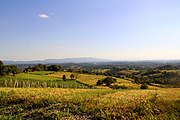
The Pedemontana del Pirea, runs along the entire northern reaches of Tarpeia, straddling the border with Piraea, hence the region's name. The foothills are predominately karst in nature, which vary in height but do not exceed 500 meters (1,640 ft). The region is dominated by streams, small deciduous forests and ravines, the area is used mostly for agriculture, but was historically the site of Solarian mining industries, extracting copper and tin.

A typical sight within the Pedemontana del Pirea

Grotta delle Sirene, a world famous grotto near Porto di Apostoli

The Aprocorona Islands

A hidden beach within Coastal Tarpeia

San Paolo Maggiore in summer
Farmland in central Tarpeia


.jpg)
.jpg)

Climate
Politics and government
 |
 Tribune Movement (22) Confidence and supply (6) Workers and Farmers Union (6) People's Opposition (12) Social Democratic Party (6) Liberty Party of Tarpeia (4) PR (2) |
The political order and governance of Tarpeia is defined by the Constitution of Tarpeia, which acts as the basic law of the state and provides guaranteed rights and freedoms for the citizens of the state. Like all states in Etruria, Tarpeia operates a parliamentary republican system, with the executive branch dependenant upon the confidence of the legislative, while the judicial branch is separate and independent.

The government of Tarpeia is led by the Prefect of State, who is the leader of the largest party or coalition in the State Assembly. The Prefect upon securing office appoints members of the Assembly to form his or her state cabinet, as well as Deputy Prefect of State. The State Assembly of Tarpeia has 40 members who are elected from single-member constituencies every five or four years, while the Prefect has the right to dissolve the State Assembly upon securing permission from the President of the Federation. The incumbent Prefect of State is Nero Orlando, who entered office following the 2018 Tarpeian state election, his deputy is Serafina Golvagno.
In the 2018 state election, the electoral system was changed to first past the post system, resulting in a majority of one for the Tribune Movement, though they secured a confidence and supply agreement with the Farmers and Workers Union, with their six seats. The main opposition party in Tarpeia is the Social Democratic Party, while the Liberal Party of Tarpeia and far-left Popular Renewal constitute the minor opposition.
Status
Tarpeia's annexation into Etruria following Operation Zodiaco in 1960 remains unrecognised by virtually every international organisation, including the Community of Nations, Euclean Community and most governments. While the initial international response was confined mostly to diplomatic measures and economic sanctions against the military regime (1960-1984), little to no direct effort was made to restore Tarpeia to Piraea. Following the restoration of democracy and the establishment of the Etrurian Fourth Republic in 1984, many of the sanctions introduced in 1960 were lifted as the international community sought to consolidate the new democratic order. The lack of international recognition has limited Tarpeia's industrial development, leading the Etrurian state to invest heavily in agriculture and tourism to foster economic growth and improvements to living standards.
The post-junta government under President Miloš Vidović though initially open to negotiations with Piraea walked back and instead, focused on facilitating greater autonomy and freedom for Piraean-majority areas of the state. Junta-era restrictions on the official use of Piraean were lifted and a policy of right-to-return was offered for Piraeans who fled Tarpeia following Operation Zodiac. In 1985, the SDP government lifted the ban on Piraean-centric political parties in Tarpeia and Etruria at large. The Vidović-led government in 1987 considered entering negotiations with Piraea to see Tarpeia's presence within Etruria be recognised, which in turn, was hoped would lead to international recognition - this second attempt at entering talks was scuppered by an aggressive campaign by the centre-right Etrurian Federalist Party (PFE).
In 1994, the PFE won the federal election and under President Nicolò Grassi, introduced a policy of refusing negotiations unless the agreed outcome would be the Piraean and international recognition of Tarpeia as Etrurian territory. However, in 1995, the Grassi government produced a proposal for establishing Tarpeia as a special economic area, in which goods and people could cross the border into Tarpeia freely without checks or customs. This proposal was blocked by the Farmers and Workers Union, the PFE's coalition partner, which claimed such a policy would allow Marolevic migrants to enter Etruria via Piraea.
In 2002, the SDP returned to government under Vinko Begović, opted to pursue the policy of "quiet status-quo", in which the Etrurian government would not raise the issue nor officially pursue negotiations, but would respond if the issue was raised by Piraea. Due to the lack of international support or interest, little effort on part of Piraea was made to secure a settlement over Tarpeia. This would remain the case for over a decade to the present.
According to opinion polls conducted in 2013, 88% of Piraeans in Tarpeia support "a negotiated solution", while 36% Etrurians (Vespasians, Carinthians and Novalians together) support negotiations. 60% of Etrurians oppose negotiations, of the 60%, 98% believe that the current situation is "satisfactory."
Economy
As of 2020, the GDP of Tarpeia was estimated to be $22.547 billion, making it the XXth largest in Etruria. Throughout most of the region's history, agriculture and fisheries had been the primary source for capital and employment, however, since the 1970s, Tarpeia has seen significant growth in services, driven primarily through investments into the tourism industry. As of 2020, services accounted for 63% of Tarpeia's economic output, followed by agriculture at 18%, industry and mining at 15% and public services at 4%. Approximiately 1.3 million people visit Tarpeia per-annum, including an estimated 600,000 domestic tourists from Etruria itself.
Agriculture
Agriculture, including fishing has long been the foundational sector of the Tarpeian economy from as early as the Piraean colonisation during antiquity. The sector however, suffered immensely during Tarpeia's turbulent past but recovered during the mid-20th century. The vast majority of farms in Tarpeia are family owned, while an estimated 30% of ariable land is owned by large agribusinesses such as CeresAgri, which is Etruria's largest corporate producer of wine and olive oil. Central Tarpeia is the primary source for agricultural produce, while the coast has become one of the fastest growing sources for blue water fish. Tarpeia's largest agricultural outputs include maize, sugar beet, wheat, barley, soyabeans, rapeseeds, sunflower seeds, grapes, and potatoes.

Industry
Tarpeia's industrial sector is geographically concentrated in two regions, Ghiutrave and Scaccianari and take two distinct forms within these regions. Ghiutrave is home to Tarpeia's relatively young shipbuilding industry, specialising in cargo carriers, large fishing vessels and ferries. The city is home to the Ghiutrave-Nettuno Shipyard, which produces between 200 and 250 vessels of varying sizes and tonnage per year. Scaccianari is Tarpeia's centre for automobile and chemical production, with several car plants operating in the city, Scaccianari also houses one of Etruria's largest sugar factories, producing ethonol and sugar from the region's sugar beet.
Tarpeia's mining industry, historically Solaria's largest source for copper and tin, is now centralised around the extraction and refining of bauxite. Several coal mines remain in operation but are expected to be closed by the 2030s.
Tourism

Tourism is Tarpeia's most lucerative and fastest growing industry. Tourism and services in general, employs an estimated 59% of Tarpeia's labour force, with the figure rising to 80% for those aged between 18-24. The Etrurian federal government has invested heavily in the development of tourism in the state since the 1970s - initially for domestic visitors, and from the 1980s for international travellers. The region has seen federal investment into cultural activities, events and in 1999, the Etrurian government established a duty-free zone across Coastal Tarpeia (Costiera Tarpea).

Tarpeia is one of Etruria's most popular destinations for nautical tourism, ecotourism and long-term package holidays at resorts and chain hotels. In 2020, an estimated 1.7 million people visited the state, of whom around 700,000 were domestic visitors from Etruria and the remainder were drawn from Eastern Euclea and Asteria Superior. The state provides visitors with a large variety of historical and cultural sites, as well as highly rated beaches and natural beauty.
In 2018, the Tarpeian state government together with the Etrurian federal government funded and advertised the Via Acheulia Walk, a walking and camping event in which tourists may travel the length of the Via Acheulia from Ghiutrave to Solaria, 1,194 km to the east. This was joined by the Via di San Paolo Apostolo, a pilgrim's way which follows the journey of Saint Paul following his shipwrecking to Solaria to face trial. Both the Via Acheulia and Via di San Paolo include accomodation provided by the Solarian Catholic Church.and select hotel and hostel chains. The Via di San Paolo Apostolo and the Via Achuelia walk draw an estimated 980,000 travellers per year.