Oriental Sea: Difference between revisions
No edit summary |
|||
| Line 56: | Line 56: | ||
File:Port_of_Split_from_the_air_1.jpg|[[Ladnica]], [[Zacotia]] | File:Port_of_Split_from_the_air_1.jpg|[[Ladnica]], [[Zacotia]] | ||
File:Serantes_Panoramica.jpg|[[Rostva]], [[Luepola]] | File:Serantes_Panoramica.jpg|[[Rostva]], [[Luepola]] | ||
File:Sea_view,_Langeron,_Odessa1.jpg|Spokino Bereh, [[Vorochia]] | File:Sea_view,_Langeron,_Odessa1.jpg|[[Spokino Bereh]], [[Vorochia]] | ||
File:Fiolent_Sevastopol_2009_G1.jpg|Venaya, [[Aitic Federation]] | File:Fiolent_Sevastopol_2009_G1.jpg|Venaya, [[Aitic Federation]] | ||
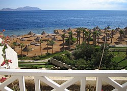
File:SharmView.jpg|[[Hamajar]], [[Ashal]] | File:SharmView.jpg|[[Hamajar]], [[Ashal]] | ||
| Line 62: | Line 62: | ||
File:Antalyabeach.JPG|[[Hadin]], [[Sirad]] | File:Antalyabeach.JPG|[[Hadin]], [[Sirad]] | ||
File:شاطئ_دير_البلح_horizon_adjusted.jpg|[[Kulan]] | File:شاطئ_دير_البلح_horizon_adjusted.jpg|[[Kulan]] | ||
File:Port_of_Thessaloniki.png|Hamid Rassan, [[Mahsadar]] | File:Port_of_Thessaloniki.png|[[Hamid Rassan]], [[Mahsadar]] | ||
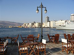
File:2._Kordon.JPG|[[Sakaban]], [[Caraq Union]] | File:2._Kordon.JPG|[[Sakaban]], [[Caraq Union]] | ||
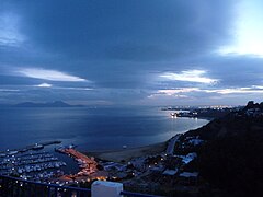
File:Golfe_de_Tunis_et_port_de_Sidi_Bou_Saïd.jpg|[[Libira]], [[Ekalla]] | File:Golfe_de_Tunis_et_port_de_Sidi_Bou_Saïd.jpg|[[Libira]], [[Ekalla]] | ||
File:غسق_الليل_في_رمضان_من_على_شاطئ_عين_الذئاب_في_مدينة_الدار_البيضاء_المغربية.jpg|[[Makharia]] | File:غسق_الليل_في_رمضان_من_على_شاطئ_عين_الذئاب_في_مدينة_الدار_البيضاء_المغربية.jpg|[[Makharia]] | ||
File:Jebel_musa_from_benzu.jpg|Phedoun, [[Poniscia]] | File:Jebel_musa_from_benzu.jpg|[[Phedoun]], [[Poniscia]] | ||
</gallery> | </gallery> | ||
[[Category:Vasarden]] | [[Category:Vasarden]] | ||
[[Category:Geography of Vasarden]] | [[Category:Geography of Vasarden]] | ||
{{Vasarden Topics}} | {{Vasarden Topics}} | ||
Latest revision as of 19:46, 16 September 2020
| Oriental Sea | |
|---|---|
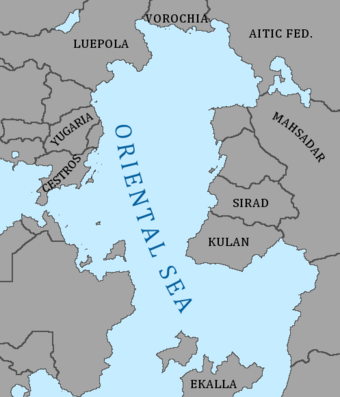
 Map of the Oriental Sea | |
| Type | Sea |
| Primary inflows | Cercian Ocean, Bhasari Ocean, Jutska |
| Basin countries | Expand 19 |
| Surface area | TBD |
| Average depth | TBD |
| Max. depth | TBD |
| Islands | TBA |
The Oriental Sea is a sea connecting the Cercian Ocean to the Bhasari Ocean and isolating Tusola from Patyria and Oridia. It is bordered by Patyria to the north and northwest; by Oridia to the east; by Ekalla and the Ekallan Straits to the south; by Tusola to the southwest; and by the Straits of Vell to the west. It is officially classified by the Oceaonographic Commission of the International Assembly as an offshoot of the Bhasari Ocean, but historically it has been treated as a separate body of water. It stretches over 3000 kilometers north-south from the Bay of Beuje to the Cape of Gold (the easternmost point of Ekalla), and over 1600 kilometers east-west at its widest latitude, just south of the coast of Kulan.
Gallery
Venaya, Aitic Federation


