Sea of Velar: Difference between revisions
m (1 revision imported) |
Revision as of 21:30, 28 January 2019
This article is incomplete because it is pending further input from participants, or it is a work-in-progress by one author. Please comment on this article's talk page to share your input, comments and questions. Note: To contribute to this article, you may need to seek help from the author(s) of this page. |
| Sea of Velar | |
|---|---|
| File:Sea of Velar.png | |
| Location | West Astyria |
| Type | Sea |
| Primary outflows | Straits of Jajich |
| Basin countries | Andamonia, Dangish Empire, Isles of Velar, Trellin, Txekrikar |
| Surface area | 734,125 km² 283,447 sq. miles |
| Shore length1 | 11,272.5 km 7,004.4 miles |
| Frozen | never |
| Islands | |
| Settlements | |
| 1 Shore length is not a well-defined measure. | |
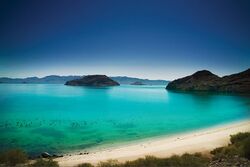
The Sea of Velar, sometimes referred to as the Strait of Trellin, is an equatorial mediterranean sea in western Astyria, connected to the Sea of Jajich by the Straits of Jajich, which are 110 kilometres wide at their traditional meeting point. With the exception of the Straits, the sea is almost entirely enclosed by land. It divides Trellin into two roughly equal portions, north and south, and is bounded to the north by Trellin and the Dangish Empire, to the east by Cathanas and to the south by Trellin, Txekrikar and Andamonia.
The sea's mean surface area is 734,125 square kilometres, bounded by a total shoreline 16,617.5 kilometres long, including the shores of its islands and 11,272.5 without them. There are fifty seven islands larger than five square kilometres in area and nine larger than one hundred.
The average depth varies across the sea, but ranges between 1,200 and 1,600 metres in the west, and 800-1,200 metres in the central regions and 1,400-1,800 metres in the east.
History
The shores of the Sea of Velar have been inhabited since prehistoric times, its rich waters being an important source of food for many of the early civilisations to develop there. Among the first civilisations to rise were the Velaric culture on the central islands and the Perenden civilisation in Andamonia. Trade routes spread across the entire sea, passing through the Straits of Jajich to the growing Hyseran Empire.
In the Middle Ages, the Kingdom of the Isles of Velar dominated the sea's central islands and much of its northern coast. It came into frequent conflict with the Principality of Txekrikar, which controlled swathes of land west to the Bight of Ternos, and the Grand Duchy of Ja'ekha. Trellinese merchants established a series of strategic trading posts across the sea, on various natural harbours that became known as the Trophy Ports.
Geography

Coastal countries
Five countries have coastlines along the Sea of Velar. They are:
- Northern shore (west to east):
 Trellin,
  Dangish Empire
 - Eastern shore: Cathanas
- Southern shore (west to east): Southern
 Trellin,
  Txekrikar,
  Andamonia
 - Island countries:
 Isles of Velar