Alvinia
This article is incomplete because it is pending further input from participants, or it is a work-in-progress by one author. Please comment on this article's talk page to share your input, comments and questions. Note: To contribute to this article, you may need to seek help from the author(s) of this page. |
Alvinia | |
|---|---|
 | |
| Languages | Cuthish Hesurian Pintachee Sarracese Shuelan |
| Religions | Semitarism (83.1%) No religion (7.2%) Other (9.7%) |
| Demonym(s) | Alvinian |
| Countries and dependancies | |
| Population | |
• Estimate | 31,117,803 |
| GDP (PPP) | 2018 estimate |
• Total | $894.4 billion |
| GDP (nominal) | 2018 estimate |
• Total | $228.0 billion |
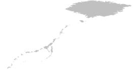
Alvinia (Cuthish: Alvinia; Hesurian: Alwinien; Sarracese: l'Alvïnie), also referred to as the Alvines and the Alvinian Archipelago, is a continent and geographical region that makes up almost all of the landmass of Aurorum's western hemisphere. With an area of X square kilometers (X sq mi) and a 2018 estimated population of 31.1 million inhabitants, Alvinia is the smallest and least populous of the continents of Aurorum.
Alvinia is surrounded to the west by the Iremic Ocean and to the east by the Agric Ocean, while island arcs delineate the interior Godrican and Alvinian Sea. The continent is subdivided into three major archipelagos: the centrally located Greater Alvines, the northeastern X Archipelago, and the western Lesser Alvines (which include the Windward and Leeward Islands); the Agric region of Snaeland may also be considered part of Berea due to its cultural distinction, but is geographically related to Alvinia. Alvinia encompasses three sovereign island countries: Algaria, Chelagey, Edwardia, and Ochoccola; and two dependent territories: Mascyllary Akawhk and Nordic Snaeland. The three largest islands, Godrica, Algaria, and Edwardia, are collectively referred to as the Emperor Islands.
The island chain extends 8,000 kilometers (4,971 miles) from northeast to southwest, and is geologically dominated by rugged and mountaineous, often times volcanically active islands in distinctive island arcs. However, some islands are of non-volcanic origin and particularly flat, such as X, and many islands feature coral reef formations and ancient lakes. The highest mountain is X in Ochoccola with an established height of 4,288 m (14,068 ft), while the the Alvinian Trench, situated in the Iremic Ocean, is the deepest oceanic trench with a maximum depth of 11,038 m (36,214 ft) at the Tartarus Deep. Almost all of Alvinia lies on the Agric and Alvinian Plates, which currently is in the process of forcing the Pamiran Plate, and to a lesser extent the Hährnig Plate, to subduct beneath the former, a process responsible for the creation of the Alvinian Arc as a quasi-mountain range running along the archipelago's length; meanwhile, some islands of the Lesser and Greater Alvines are situated on the smaller Alvinian Plate.
Human habitation of Alvinia began with the gradual migration of Melavronesian peoples from Mavronesia between 7,000 to 600 years ago, making the Alvinia the last continent to be populated by homo sapiens and the conclusion to the early human migration period as a whole, and finalizing the settlement by Alvinia's indigenous peoples. First contact with Bereans occured with X. The voyages of Cuthish explorer Wesley Middelton from 1505 to 1512 revealed Alvinia as a "New World" to Bereans, and inaugurated a long-lasting period of Berean exploration and colonization of Alvinia, as well as resulting in the Middeltonian exchange and the enslavement of the indigenous Alvinians. Berean powers such as Cuthland, Sarrac and the Købmandslaug subjugated and colonized the continent, later followed by Aldia, Lavaria, Falland and Norden in the Age of Discovery and the early modern period, and populated Alvinia with mass Berean emigration, many of whom being indentured servants. The 19th century saw the beginning of the gradual decolonization of the archipelago with the Algarian Revolutionary War in 1818 and the Chelageyan War of Independence in 1830, though most modern-day Alvinian states would acquire their independence only in the mid-20th century.
Extent
Sovereign states and dependent territories
| Arms | Flag | Country / Territory | Area | Population | Population density | Capital city | Name(s) in official language(s) |
|---|---|---|---|---|---|---|---|
| Commonwealth of Algaria | X | 15,859,994 | X | Marienburg (executive) Windhoek (legislative) Olvara (judicial) |
Meanwealþ of Algarsland Gemeinstaat Algarien | ||
| Commonwealth of Akawhk (Crowned Republic of Mascylla) |
1,015 km2 (392 sq mi) |
2,086,221 | 2,103.0/km2 (5,446.7/sq mi) |
Marthasbucht | Gemeinstaat Akohk Este Emvnicetv Akcohkv | ||
| Chelagey Confederal Republic | 47,376 km2 (18,292 sq mi) |
4,446,869 | 93.9/km2 (243.1/sq mi) |
Digalua | Shuelahi Ayeli Udotlv Anilasdalv République confédérale du Chélagey | ||
| Ochoccolan State | 139,202 km2 (53,746 sq mi) |
10,662,427 | 76.6/km2 (198.4/sq mi) |
Socapatoy | Oiwacvkvla em Tv'lwv Ococcolish Ric | ||
| Snaeland (Nordic Kingdom) |
978,662 km2 (377,864 sq mi) |
148,513 | 0.15/km2 (0.39/sq mi) |
Askelsborg | Qaqortoqnunaat |
