Auralia: Difference between revisions
Philimania (talk | contribs) |
|||
| (94 intermediate revisions by 2 users not shown) | |||
| Line 1: | Line 1: | ||
{{Region_icon_Gentu}} | {{Region_icon_Gentu}} | ||
{{wip}} | {{Gentu wip}} | ||
{{Infobox country | {{Infobox country | ||
| Line 8: | Line 8: | ||
|image_flag = File:Auralia Flag.png | |image_flag = File:Auralia Flag.png | ||
|alt_flag = Flag of Auralia | |alt_flag = Flag of Auralia | ||
|image_coat = File:Auralia COA.png | |image_coat = File:Auralia COA complex.png | ||
|alt_coat = Coat of Arms of Auralia | |alt_coat = Coat of Arms of Auralia | ||
|national_motto = | |national_motto = "We will endure" | ||
|national_anthem = | |national_anthem = X | ||
|image_map = [[File:Auralia Map.png|250px|frameless]] | |image_map = [[File:Auralia Map.png|250px|frameless]] | ||
|alt_map = | |alt_map = | ||
| Line 20: | Line 20: | ||
|capital = [[Ironey]] | |capital = [[Ironey]] | ||
|largest_city = [[Hinser]] | |largest_city = [[Hinser]] | ||
|official_languages = | |official_languages = [[Auralian language|Auralian]] | ||
|national_languages = | |national_languages = [[Hestandan language|Hestandan]]{{·}}[[Veragese language|Veragese]] | ||
|regional_languages = | |regional_languages = | ||
|languages_type = <!--Other type of languages --> | |languages_type = <!--Other type of languages --> | ||
|languages = <!--Other languages list--> | |languages = <!--Other languages list--> | ||
|ethnic_groups = 78% [[Auralian | |ethnic_groups = 78% [[Auralian people|Auralian]]<br>12.6% [[Oranland|Oranish]]<br>9.4% Others | ||
|ethnic_groups_year = | |ethnic_groups_year = 2000 | ||
|religion = 62.1% [[Terranity]]<br>20% {{wp|Atheism|No religion}}<br>17.9 Others | |||
|religion_year = 1999 | |||
|demonym = Auralian | |demonym = Auralian | ||
|government_type = {{wp|Parliamentary}}<br>{{wp|elective monarchy}} | |government_type = {{wp|Parliamentary}}<br>{{wp|elective monarchy}} | ||
|leader_title1 = [[ | |leader_title1 = [[Monarch of Auralia|King]] | ||
|leader_name1 = Matchino Chilarrie | |leader_name1 = Matchino Chilarrie | ||
|leader_title3 = [[Speaker of the Chamber (Auralia)|Speaker of the Chamber]] | |leader_title3 = [[Speaker of the Chamber (Auralia)|Speaker of the Chamber]] | ||
| Line 39: | Line 41: | ||
|leader_title6 = [[Chief of Staff (Auralia)|Chief of Staff]] | |leader_title6 = [[Chief of Staff (Auralia)|Chief of Staff]] | ||
|leader_name6 = Wanmoor Canya | |leader_name6 = Wanmoor Canya | ||
|sovereignty_type = History | |legislature = [[Auralian Parliament|Parliament]] | ||
|upper_house = [[Haycato]] | |||
|lower_house = [[Representers]] | |||
|sovereignty_type = [[History of Auralia|History]] | |||
|sovereignty_note = | |sovereignty_note = | ||
|established_event1 = Auralian | |established_event1 = [[Auralian people|Human habitation]] | ||
|established_date1 = | |established_date1 = c. 20,000 BP | ||
|established_event2 = | |established_event2 = [[Auralia#Oranish exploration and colonisation|Discovery]] | ||
|established_date2 = | |established_date2 = 3 Marto 1530 | ||
|established_event3 = | |established_event3 = [[Flonesian Scramble]] | ||
|established_date3 = | |established_date3 = 24 Memesa 1543-7 Phupu 1582 | ||
|established_event4 = Independence | |established_event4 = [[Flonesian War]] | ||
| | |established_date4 = 7 Phupu 1582-16 Tebax 1586 | ||
|area_rank = | |established_event5 = [[Auralia#Contemporary Age|Independence]] | ||
|established_date5 = 21 Hunyo 1964 | |||
|established_event6 = [[Constitution of Auralia|Current constitution]] | |||
|established_date6 = 9 Pulungana 1969 | |||
|area_rank = X | |||
|area_magnitude = | |area_magnitude = | ||
|area = | |area = | ||
|area_km2 = | |area_km2 = 4,455,907 | ||
|area_sq_mi = | |area_sq_mi = | ||
|area_footnote = <!-- optional footnote for area --> | |area_footnote = <!-- optional footnote for area --> | ||
|percent_water = | |percent_water = 0.19 | ||
|area_label = Total | |area_label = Total | ||
|area_label2 = <!-- label below area_label (optional) --> | |area_label2 = <!-- label below area_label (optional) --> | ||
|area_dabodyalign = <!-- text after area_label2 (optional) --> | |area_dabodyalign = <!-- text after area_label2 (optional) --> | ||
|population_estimate = {{increase}}19,258,000 | |population_estimate = {{increase}}19,258,000 | ||
|population_estimate_rank = | |population_estimate_rank = X | ||
|population_estimate_year = | |population_estimate_year = 1999 | ||
|population_census = {{increase}}19,008,182 | |population_census = {{increase}}19,008,182 | ||
|population_census_year = | |population_census_year = 1998 | ||
|population_density_km2 = | |population_density_km2 = 4.3 | ||
|population_density_sq_mi = | |population_density_sq_mi = 11.2 | ||
|population_density_rank = | |population_density_rank = X | ||
|GDP_PPP = {{IncreaseNeutral}}$967.3 billion | |GDP_PPP = {{IncreaseNeutral}}$967.3 billion | ||
|GDP_PPP_rank = | |GDP_PPP_rank = X | ||
|GDP_PPP_year = | |GDP_PPP_year = 1998 | ||
|GDP_PPP_per_capita = {{IncreaseNeutral}}$49,350 | |GDP_PPP_per_capita = {{IncreaseNeutral}}$49,350 | ||
|GDP_PPP_per_capita_rank = | |GDP_PPP_per_capita_rank = X | ||
|GDP_nominal = {{decrease}}$1.001 trillion | |GDP_nominal = {{decrease}}$1.001 trillion | ||
|GDP_nominal_rank = | |GDP_nominal_rank = X | ||
|GDP_nominal_year = | |GDP_nominal_year = 2000 | ||
|GDP_nominal_per_capita = {{decrease}}$49,733 | |GDP_nominal_per_capita = {{decrease}}$49,733 | ||
|GDP_nominal_per_capita_rank = | |GDP_nominal_per_capita_rank = X | ||
|Gini = 29.7 | |Gini = 29.7 | ||
|Gini_rank = | |Gini_rank = X | ||
|Gini_year = | |Gini_year = 1996 | ||
|Gini_category = | |Gini_category = | ||
|Gini_change = increase | |Gini_change = increase | ||
|HDI = 0.91 | |HDI = 0.91 | ||
|HDI_rank = | |HDI_rank = X | ||
|HDI_year = | |HDI_year = 2000 | ||
|HDI_category = | |HDI_category = | ||
|HDI_change | |HDI_change = increase | ||
|currency = [[Auralian Arok]] (AUA, ᐂ) | |currency = [[Auralian Arok]] (AUA, ᐂ) | ||
|date_format = dd-mm-yyyy | |date_format = dd-mm-yyyy | ||
| time_zone = [[Global Time Standard|MTS-1]] (Auralian Standard Time) | |||
| drives_on = right | |||
|cctld = .au | |||
|calling_code = +11 | |||
|p1 = Paqueon Aralona | |||
|flag_p1 = Paqueon Aralona Flag.png | |||
|p2 = New Rubenis | |||
|flag_p2 = Seronia-Sotha Flag.png | |||
}} | }} | ||
'''Auralia''' ({{wp|Tetun language|Auralian}}: Áurallià), officially called the '''Auralian Commonwealth''', is a country in Central [[Flonesia]]. Auralia is situated on the main island of [[Flonesia]] named [[Aralona]] and thus borders only one nation to the southwest, | '''Auralia''' ({{wp|Tetun language|Auralian}}: Áurallià), officially called the '''Auralian Commonwealth''', is a country in Central [[Flonesia]]. Auralia is situated on the main island of [[Flonesia]] named [[Aralona]] and thus borders only one nation to the southwest, X. [[Ironey]], Auralia's {{wp|capital}} city, and [[Hinser]] as the most populous cities are the two main cultural and economic centres of Auralia. Other major cities include [[Helmer (Auralia)|Helmer]], [[Uraka]], [[Goalai]], [[Dawlun]], [[Damien]], [[Urande]] and [[Himmers]]. With an estimated population of 19,258,000 and a land area of {{convert|4,458,800|km2|abbr=on}}, Auralia is both the second-most populous and second largest country in Flonesia. Auralia is a {{wp|Parliamentary}} {{wp|elective monarchy}} ever since its independence in 1964 from the [[Paqueon Empire]]. The current {{wp|monarch}} is Matchino Chilarrie, elected in 1995. | ||
The area of what is now Auralia was once settled by [[Flonesian people|Flonesian]] tribes before their genetics splited from their seafaring cousins around 1,000 BCE. Following | The area of what is now Auralia was once settled by [[Flonesian people|Flonesian]] tribes before their genetics splited from their seafaring cousins around 1,000 BCE. Following 1500, modern day Auralia was colonized by the [[Paqueon Empire]] in an event known as the [[Flonesian Scramble]]. After the [[Great War (Gentu)|Great War]] ended in 1934, Auralia declared independence from Paqueonia in 1964. | ||
Today, Auralia is cultural powerhouse and is one of the best destination for tourism with over 75 million tourists in | Today, Auralia is cultural powerhouse and is one of the best destination for tourism with over 75 million tourists in 1996. With a large {{wp|economy}} and a high {{wp|Human Development Index|HDI}}, Auralia is a well developed nation. Additionally, it ranks highly in {{wp|education}}, political and {{wp|personal freedom}}, {{wp|healthcare}}, and {{wp|life expectancy}}. | ||
== Etymology == | == Etymology == | ||
'' | |||
The word ''Auralia'' derives from the {{wp|Latin|Alarican}} word of the same pronounciation for ''golden''. When X first began visiting and mapping [[Flonesia]] in the 16th century, the name ''Terra Auralia'' was naturally applied to the new territories of modern day Auralia and X due to the large abundance of gold found in the mountain and hills of [[Aralona]]. The name Auralia was popularised by the explorer [[Alf Weiss]], who said it was "more agreeable to the ear, and an assimilation to the names of the other great portions of Gentu". | |||
== History == | == History == | ||
=== Early History === | === Early History === | ||
[[File:Aboriginal-rock-art-depositphotos.jpg|thumb|left|Auralian rock art in the [[Windella]] rock shelter in northern Auralia.]] | |||
Human habitation of Auralia is known to have begun about 20,000 years ago, with the migration of people by land bridges and short sea crossings from what is now eastern Hesterath. The [[Windella]] rock shelter in northern Auralia near [[Uraka]] is recognised as the oldest site showing the presence of humans in Auralia as well as Aralona. The oldest human remains found there, which have been dated to around 15,000 years ago. These people were the ancestors of modern Indigenous Auralians. Aboriginal Auralian culture is one of the oldest continual cultures on Gentu. | |||
At the time of first Oranish contact, most Indigenous Auralians were {{wp|hunter-gatherer}}s with complex economies and societies. Archaeological finds in the 1980s suggest that a population of 800,000 could have been sustained. Indigenous Auralians have an oral culture with spiritual values based on reverence for the land and the [[Warul belief]]. The northern coasts and waters of Auralia were visited sporadically for trade by [[Flonesian people]] from what is now X and X. | |||
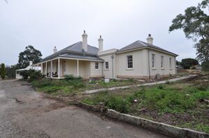
=== Oranish exploration and colonisation === | |||
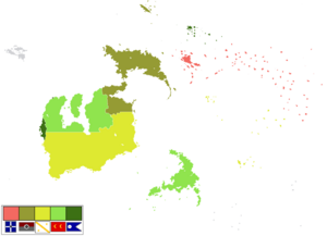
[[File:Nuevo Ahorrar.jpg|thumb|left|[[Nacercasa]] is the oldest Oranish structure in Auralia and a GEKSO site.]] | |||
The first recorded Oranish sighting of Auralia, and the first recorded Oranish landfall on Aralona, are attributed to the [[Seronia-Sotha]]ns. The first ship and crew to chart the Aralonan coast and meet with Aboriginal people was the ''Jansan'' captained by Sothan navigator, [[Alf Weiss]]. He sighted the coast of [[Uraka Peninsula]] in early 1530, and made landfall on 3 Marto 1530 at the tip of the peninsula near the modern city of [[Uraka]]. Later that year, Paqueon explorer [[Mateo Lago]] sailed through and navigated the southern Aralonan coast claiming territory of what is now [[Damien]] as part of the [[Paqueon Empire]]. However, no attempt at settlement was made on Aralona until 1542 after the Paqueons charted the whole of the western and southern coastlines and named the island continent "New Paqueonia". The first Oranish settlment on Aralona appeared in southern Auralia named [[Nuevo Ahorrar]] (what is now [[Helmer (Auralia)|Helmer]]) when the Paqueon government sent a fleet of ships, the [[Paqueon Third Fleet|Third Fleet]], under the command of Alf Weiss, to establish a new colony in the area on 18 Pulungana 1542 a date which later became [[Auralia day|Auralia's national day]]. | |||
[[File:Flonesian Scramble.png|thumb|left|Map of Flonesia c. 1582 right after the [[Flonesian Scramble]].]] | |||
In northern Auralia, [[Seronia-Sothan]] navigator [[Heiner Kapp von Volda]] established a colony in Uraka on 24 Memesa 1543 marking the beginning of the [[Flonesian Scramble]], an event that saw the rapid colonisation of Flonesia by colonial powers and enslavement of approximately 3.2 million indigenous people. Oranish powers continued to push into other areas of island in the mid 16th century, initially along the coast. From 1559 to 1560, [[Silvio Hartmann]], [[Denis Otto]] and [[Jacob Ehmann]] explores the [[Auralian Rainforest]] and X desert, opening the interior of Aralona to Oranish settlement. By 1580, [[Palon Empire|Paloa]], [[Paqueon Empire|Paqueonia]], the [[Omaran Empire|Omaran]], and [[Seronia-Sotha]]n empires had conquered all Aralonan territory. | |||
=== Flonesian War === | |||
[[File:1028970 slice.jpg|thumb|left|Depiction of the [[Battle of Sherley]], one of the earliest battles of the [[Flonesian War]].]] | |||
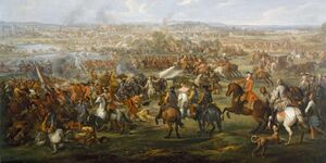
Over the course of the Flonesian Scramble, relations between the 4 competing powers were tense. On 7 Phupu 1582, a skirmish occurred on the colonial border of Paqueonia and the Omaran Empire. [[Arbrim IV]], sultan of the Omaran seized this opportunity to declare war on Paqueonia sparking the [[Flonesian War]]. The Paqueon army in Flonesia under the leadership of General [[Victor Catalá]] scored major victories over the Omarans such as the [[Battle of Urunde]] or [[Battle of Sherley|Sherley]]. By Disemba, both sides of the conflict had lost a rough total of 300,000 soldiers —most of which died of {{wp|malaria}}— not counting civilian casualties. | |||
The war eventually encompassed every other powers on Aralona in Enero of 1583 when Paloa signed a pact with the Omaran bring them into the war which in turn allowed Seronia-Sotha to have a {{wp|casus belli}} on declaring war on Paloa. On 13 Memesa 1583, [[Siege of Ironey|Ironey was sieged]] by the Palons which caused the death of about 90,000 soldiers, the most deadilest in the war. From Memesa 1583 to Hunyo of 1584, Victor Catalá and Seronian general [[Jūsmiņš Osis]] [[Paqueon-Sereno-Sothan invasion of the Omaran|invaded Omaran controlled territory]] in Aralona and succeeded in driving the bulk of the Omaran army of the island. Meanwhile, Paqueon forces under the command of [[Enrique Charpantier]] managed to successfully expel Palon forces off of Aralona in Enero of 1584. | |||
The remaining two years of the war was characterised by {{wp|guerilla warfare}} btween remenants of the Omaran and Palon army before both states surrendered on 16 Tebax 1586 in exchange for the return of all remaining soldiers in Aralona, ending the war. The [[Nuevo Ahorrar Peace Conference]] which took place soon after their surrender saw the end of an Omaran and Palon presence over the island and allowed Paqueonia and Seronia-Sotha to solidify their holf over Aralona with Sereno-Sothan dominance over the northern region of the continent, and a Paqueon presence in the south. Additionally, the war also saw the displacement of millions of native Flonesians and the near extinction of the Iolana Culture. | |||
=== Early Modern Era and the Long Nineteenth Century === | |||
The time from 1586 to 1602 is distinguished by relative peace in the region. It ended in Marto of 1602 with the start of the [[War of 1602]] between the [[Paqueon Empire|Paqueon]] and [[Neragese Empire]]s which later led to the involvement of 5 other main combatants: [[Seronia-Sotha]], [[Palon Empire|Paloa]], the [[Omaran Empire|Omaran]], [[Eudocian Republic|Eudocia]], and [[Zhao]] dynasty. In Aralona, Paqueonia and Seronia-Sotha fought over the northern region of Auralia. At the end of the war in Enero 1615, the [[Treaty of Amia]] saw the divison of Serono-Sothan and Paqueon controlled Aralona at the 16th parallel south. | |||
During the [[Great Enlightenment]], Auralian pioneers such [[Jens Zimmerson]] and [[Finnja Feuerstein]] both of whom developed the {{wp|Boolean algebra|Zimmersonan algebra}}; and [[Santiago Castelano]] who is known for his contribution in the development of {{wp|anaesthesia}} during the 1740s along with Neragese physician [[Garwin Roberts]] contributed to the scientific revolution that differentiate the Great Enlightenment from other revolutions in the history of Gentu. | |||
New technology brought about during the [[Industrial Revolution (Gentu)|Industrial Revolution]] helped make transportation in Auralia faster and more reliable with the construction of railroads, and, as a result of Auralia's flatness, a lot of canals which helped the transportation of {{wp|coal}} of which there was a large abundant of in the central region, and other goods. This allowed Paqueonia to be a large exporter of coal during the late 18th century to early 20th century to the point in which the empire had a monopoly in the coal market. | |||
In 1757, the [[Paqueon Aralona]]n government begun introducing new policies, resulting in the mass forced relocation of thousands of indigenous Aralonans. This eventually culminated in the starting of the [[Winakan Rebellion]] in Enero of 1766. The rebellion conducted {{wp|guerrilla warfare}} in the rainforests and deserts of Aralona as well as raids on villages and towns, although battles in cities such as the 1768 [[Battle of Urunde]] also occurred. They proved to be a thorn in the [[Paqueon Empire]]'s side. By the height of guerrilla attacks in 1773, casaulties on both sides were approximated to be around 2 million. The conflict ended 26 Pusper 1781 with the [[Treaty of Goalai]] which removed the government's policies of forced relocation and granted indigenous Aralonans full citizenship within Paqueon Aralona, and by proxy, the empire as well. | |||
The late 18th century as well as the turn of the 19th saw the governings of 4 of the most recognisable figures in Auralian (and [[Matarina]]n) history: [[Izan Ferreiro]] from 1786 to 1791, [[Eneko Páez]] from 1791 to 1803, [[Jose Santolaria]] from 1803 to 1810, and [[Eric Bacque]] from 1810 to 1824. Under their reigns, Aralona underwent numerous reforms including the building of new roads, improvements in workers' quality of life, and {{wp|universal healthcare}}. | |||
''TBA'' | ''TBA'' | ||
=== Contemporary Age === | |||
=== | |||
''TBA'' | ''TBA'' | ||
== Geography == | == Geography == | ||
Auralia is situated in the northern region of the island of [[Aralona]] being bordered by only the nation of X to the south. The nation is bordered by the [[White Sea (Gentu)|White Sea]] to the north and west, the [[Biscay Sea]] to the south, and the [[South Nullaric Ocean]] to the east. The seas and oceans around Auralia are filled with {{wp|coral reef}}. The biggest reef being the [[Great Orion Reef]], the worlds second largest reef, which lies 500 km from the southern coast and extends for over 2,000 km (1,200 mi) on all directions. | |||
Auralia is situated in the northern region of the island of [[Aralona]] being bordered by only the nation of | |||
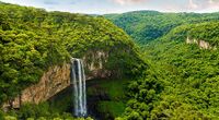
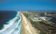
Auralia's most prominent geographical feature is its [[Auralian Rainforest|large rainforest]] that covers over 73.5% of the nation's land area. Auralia's geography is relatively flat, its highest point being [[Mount Highno|Mt. Highno]], 754 meters above {{wp|sea level}} at the central region of the country. The southern region of the country is dominated by plains which is the most densely populated of all of Auralia's regions (59.7/km<sup>2</sup>). To the southwest is the [[ | Auralia's most prominent geographical feature is its [[Auralian Rainforest|large rainforest]] that covers over 73.5% of the nation's land area. Auralia's geography is relatively flat, its highest point being [[Mount Highno|Mt. Highno]], 754 meters above {{wp|sea level}} at the central region of the country. The southern region of the country is dominated by plains which is the most densely populated of all of Auralia's regions (59.7/km<sup>2</sup>). To the southwest is the [[X]] desert which acts as a natural border between the nation and X. | ||
The territorial extent of Auralia is | The territorial extent of Auralia is {{convert|4,458,800|km2|abbr=on}}; this makes Auralia the 2nd largest nation in [[Flonesia]] and the Xth in the world. Despite Auralia's size, their are only 2 major rivers that flow through the nation: [[Cylon]] and [[Hinsen]]; they are 863 km and 1298 km long respectively. Additionally, Due to its geological activity and diverse landscape, Auralia is a deposit for numerous natural resources and biodiverse habitats. | ||
{{Gallery | {{Gallery | ||
| Line 133: | Line 189: | ||
|Aerial view of the southern coast of Auralia | |Aerial view of the southern coast of Auralia | ||
}} | }} | ||
=== Topography === | |||
''TBA'' | |||
=== Climate === | === Climate === | ||
| Line 138: | Line 198: | ||
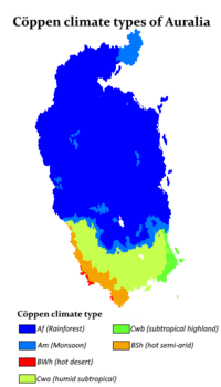
[[File:Auralia Climate Map.png|thumb|200px|left|{{wp|Köppen climate classification|Cöppen climate classification}} of Auralia.]] | [[File:Auralia Climate Map.png|thumb|200px|left|{{wp|Köppen climate classification|Cöppen climate classification}} of Auralia.]] | ||
The climate of Auralia is significantly influenced by ocean currents, including the | The climate of Auralia is significantly influenced by ocean currents, including the X and X. Much of the northern and central part of the country has a tropical, predominantly summer-rainfall. The southern part of the country has a {{wp|Mediterranean climate|X climate}}. The southwest is arid to semi-arid. | ||
Driven by {{wp|climate change}}, average temperatures have risen more than 2°C since 1960. Associated changes in rainfall patterns and climate extremes exacerbate existing issues such as droughts | Driven by {{wp|climate change}}, average temperatures have risen more than 2°C since 1960. Associated changes in rainfall patterns and climate extremes exacerbate existing issues such as droughts and {{wp|forestfires}}. 1994 was Auralia's warmest recorded year, and the 1995–1996 forestfire was the country's worst on record. | ||
=== Biodiversity === | === Biodiversity === | ||
Being a nation with a vast rainforests, Auralia is one of 17 megadiverse countries. Fungi typify that diversity—an estimated 250,000 species—of which only 5% have been described—occur in Auralia. Because of the continent's great age, extremely variable weather patterns, and long-term geographic isolation, much of Auralia's {{wp|biota}} is unique. About 85% of flowering plants, 84% of mammals, more than 45% of birds, and 89% of in-shore, temperate-zone fish are endemic. Auralia has at least 755 species of reptile, more than any other country in Gentu. Despite Flonesia's megadiversity as a whole, it is the only continent that developed without feline species. Feral cats may have been introduced in the 17th century by | [[File:Emu.ab40226.width-800.7025164.jpg|thumb|An {{wp|Emu}}.]] | ||
Being a nation with a vast rainforests, Auralia is one of 17 megadiverse countries. Fungi typify that diversity—an estimated 250,000 species—of which only 5% have been described—occur in Auralia. Because of the continent's great age, extremely variable weather patterns, and long-term geographic isolation, much of Auralia's {{wp|biota}} is unique. About 85% of flowering plants, 84% of mammals, more than 45% of birds, and 89% of in-shore, temperate-zone fish are endemic. Auralia has at least 755 species of reptile, more than any other country in Gentu. Despite Flonesia's megadiversity as a whole, it is the only continent that developed without feline species. Feral cats may have been introduced in the 17th century by X shipwrecks, and later in the 18th century by X settlers. They are now considered a major factor in the decline and extinction of many vulnerable and endangered native species. | |||
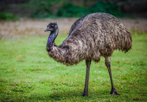
Auralian rainforests are mostly made up of evergreen species, particularly {{wp|eucalyptus}} trees in the less arid regions. Among well-known Flonesian animals are the monotremes; a host of {{wp|marsupials}}, including the {{wp|kangaroo}} which is the national animal of Auralia, {{wp|wombat}}, and {{wp|birds}} such as the {{wp|emu}} and the {{wp|kookaburra}}. Auralia is home to many dangerous animals including some of the most venomous snakes in the world. The {{wp|dingo|bingo}} was introduced by | Auralian rainforests are mostly made up of evergreen species, particularly {{wp|eucalyptus}} trees in the less arid regions. Among well-known Flonesian animals are the monotremes; a host of {{wp|marsupials}}, including the {{wp|kangaroo}} which is the national animal of Auralia, {{wp|wombat}}, and {{wp|birds}} such as the {{wp|emu}} and the {{wp|kookaburra}}. Auralia is home to many dangerous animals including some of the most venomous snakes in the world. The {{wp|dingo|bingo}} was introduced by X people who traded with local Auralians around 1000 BCE. Many animal and plant species became extinct soon after first human settlement; others have disappeared since X settlement, among them the {{wp|thylacine|hydran}}. | ||
As of | As of 2000, 73.5% of Auralia's area was covered in rainforests and at least 24%, was devoted to {{wp|agriculture}}, two-thirds used for {{wp|pastures}} and greenlands and the remainder for actual agricultural activities. The protection and preservation of nature is defined by the Constitution as a public duty and designated policy target; ecological protection is served and guaranteed through 34 national parks, 12 biosphere reserves, 235 nature parks and thousands of nature protection areas, landscape protection areas and natural memorials. | ||
== Politics == | == Politics == | ||
[[File:Auralia Parliament House.jpg|thumb|left|Parliament House, [[Ironey]]]] | |||
{{multiple image|total_width = 300 | |||
| caption_align = center | |||
| image1 = Ken_Wyatt_cropped.jpg | |||
| caption1 = '''Matchino Chilarrie'''<br><small>[[Monarchy of Auralia|King of Auralia]]</small><br>since 1995 | |||
| image2 = Malarndirri_McCarthy.jpg | |||
| caption2 = '''Canya Jerong'''<br><small>[[Speaker of the Chamber (Auralia)|Speaker of the Chamber of Auralia]]</small><br>since 1995 | |||
}} | |||
Auralia is a {{wp|Parliamentary}} {{wp|elective monarchy}}. The country has maintained a stable {{wp|liberal democratic}} political system under its constitution. The Auralian system of government combines elements derived from the political systems of the X (a fused executive, constitutional monarchy and strong party discipline) and the X (federalism, a written constitution and strong bicameralism with an elected upper house), along with distinctive local features. | |||
The federal government is separated into three branches: | |||
* Legislature: the bicameral Parliament, comprising the elected monarch, the [[Haycato]], and the [[Representers]]; | |||
* Executive: the [[Federal Executive Council|Federal Executive Council of Auralia]], which in practice gives legal effect to the decisions of the cabinet, comprising the prime minister and other ministers of state appointed by the governor-general on the advice of Parliament; | |||
* Judiciary: the [[High Court of Auralia]] and other federal courts, whose judges are appointed by the elected monarch on advice of Parliament. | |||
The current {{wp|monarch}} is Matchino Chilarrie, elected in 1995, and the [[Speaker of the Chamber (Auralia)|Speaker of the Chamber]] is Canya Jerong. In the [[Haycato]] (the upper house), there are 78 members: six from each individual state. The [[Representers]] (the lower house) has 151 members elected from single-member electoral divisions, commonly known as "electorates" or "seats", allocated to states on the basis of population. Elections for both chambers are normally held every three years simultaneously; [[Haycato]] members have overlapping six-year terms. Elections for monarchs are held when the current monarch resigns or dies and they can hold power for the rest of their lives if they so wish. | |||
=== Administrative divisions === | |||
Auralia's federal system is represented and exercised through its 13 states. The states are then subdivided into [[districts of Auralia|districts]] as the smallest unit of administrations. | |||
Districts are subject to the individual laws of the states, and therefore considerably variable, however in compliance with the supreme Constitution. [[Representers]] councils of the districts are directly voted by the public, and enact local laws and decisions based on the larger state's actions and legal situation; while each subject or level maintains bodies of delegates, solely the legislature of the state and its government is politically relevant to the entire country, seated in the state's capital. | |||
{| class="wikitable" style="font-size:85%" | |||
|- | |||
! Map !! State !! Capital city !! Largest city !! Population<br><small>(Disemba 1999)</small> | |||
|- | |||
| rowspan="24" |<center>[[File:Auralia Province Map.png|300px]] | |||
</center> | |||
! colspan="5" |Subdivision | |||
|- | |||
| [[File:Gandga.png|25px]] Gandga || Herffing || Herffing || 2,421,400 | |||
|- | |||
| [[File:Minan.png|25px]] Minan || Urande || Urande || 2,467,850 | |||
|- | |||
| [[File:Jungla.png|25px]] Jungla || Dawlun || Liga || 2,769,100 | |||
|- | |||
| [[File:Auralia Flag.png|25px]] Ironey || — || — || 1,279,900 | |||
|- | |||
| [[File:Kitdagie.png|25px]] Kitdagie || Denel || Himmers || 1,270,500 | |||
|- | |||
| [[File:Quamberry.png|25px]] Quamberry || Uraka || Uraka || 767,200 | |||
|- | |||
| [[File:Keyer.png|25px]] Keyer || Sherley || Sherley || 496,010 | |||
|- | |||
| [[File:Mangoo.png|25px]] Mangoo || Goalai || — || 974,300 | |||
|- | |||
| [[File:Yambie.png|25px]] Yambie || Lincoln || Lincoln || 285,800 | |||
|- | |||
| [[File:Munda.png|25px]] Munda || Wandie || Damien || 2,453,290 | |||
|- | |||
| [[File:Mayra.png|25px]] Mayra || Amia || Amia || 200,100 | |||
|- | |||
| [[File:Tamrie.png|25px]] Tamrie || Hinser || Hinser || 3,720,190 | |||
|- | |||
| [[File:Mulya.png|25px]] Mulya || Helmer || Gigaroo || 152,360 | |||
|- | |||
| style="background:#EAECF0" | [[File:Auralia Flag.png|25px]] Auralian Commonwealth || style="background:#EAECF0" | [[Ironey]] || style="background:#EAECF0" | [[Hinser]] || style="background:#EAECF0" | 19,258,000 | |||
|} | |||
=== Corruption === | |||
''TBA'' | |||
=== Foreign relations === | |||
''TBA'' | ''TBA'' | ||
=== Military === | |||
[[File:Ironey Class FFG pic.jpg|thumb|An Ironey Class frigate.]] | |||
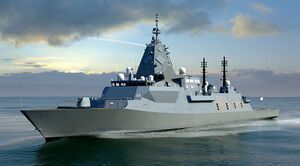
Auralia's armed forces — the Auralian Armed Force (AAF) — comprise the Royal Auralian Navy (RAN), the Royal Auralian Army and the Royal Auralian Air Force (RAAF), in total numbering 77,439 personnel (including 47,563 regulars and 29,876 reservists) as of Pulungana 1998. The titular role of Commander-in-Chief is vested in the Minister of Defense, Quadport Wyeallicbah, who appoints a Chief of the Defence Force from one of the armed services on the advice of the Parliament. | |||
In the 1995–1996 budget, defence spending comprised 5% of GDP, representing the world's Xth largest defence budget. Auralia has been involved in the [[Union of Realms]] and regional peacekeeping, disaster relief, as well as armed conflicts from the X War onwards. | |||
Auralia's military position is demonstrated by its status as a recognized nuclear weapons state since the testing of its first nuclear device in X, having both ratified and signed the [[X Nuclear-Test-Ban Treaty]] in X and the [[X Nuclear Non-Proliferation Treaty]] in X. Its current nuclear weapons stockpile (as of 2000) encompasses 276 active warheads. | |||
== Economy == | == Economy == | ||
With a nominal {{wp|gross domestic product}} (GDP) of $1.001 trillion in 2000, the economy of Auralia is the single largest one in [[Flonesia]] and the X-largest economy in the world, as well as the X-largest one measured by PPP. Auralia is considered to be a developed country with the X-highest {{wp|Human Development Index}} of the world. Auralia's economic viability is mainly derived from its policy model of numerous small and medium-sized enterprises, which are especially effective and moreoften world market leaders in specialised industrial sectors. Furthermore, the {{wp|human potential}} of Auralia with sufficient education and a large innovation culture are seen as integral to the success of the Auralian economy. Auralia's economy is defined as a highly developed and free-market-oriented {{wp|social market economy}}. The entirety of economic productivity is brought about by 1.07% in the primary industrial (agriculture), 38.4% in the secondary (tourism) and 60.5% in the tertiary (industry) sectors. | |||
=== Energy === | |||
In 1997, Auralia's energy sources were coal (53.4%), hydropower (24.1%), natural gas (15.5%), liquid/gas fossil fuel-switching plants (3.4%), oil (2.9%), and other renewable resources like wind power, solar energy, and bioenergy (0.7%). During the 21st century, Auralia has been trending to generate more energy using renewable resources and less energy using fossil fuels. | |||
In Tebax 1999, Auralia's government set a goal to achieve 20% of all energy in the country from renewable sources by 2019. | |||
=== Transport and infrastructure === | |||
[[File:New Winkoo.jpg|thumb|The New Winkoo airport in [[Ironey]].]] | |||
The protection and preservation of nature is defined by the Constitution as a public duty and designated policy target, Auralia witnesses small-scale traffic and needs for transport accesibility. Therefore, the transport of goods and people are done mostly by sea and air. This means Auralia has one of the least densest and longest {{wp|road network}} in the world, with less than 4,000 kilometres of navigable {{wp|roads}}, and 2,000 kilometres of the nation's highway network. As of 2000, 11.2 million passenger cars were registered in the country, while the total number of all motor vehicles and trailers accounted to roughly 18.4 million in the same year. | |||
Auralia is also host to only 16 {{wp|airports}} as of 1996, one of the lowest densities of runways per country in the world. Despite that, Auralia is an active location of {{wp|air travel}}, due to the nation's large tourism industry. The [[New Winkoo Airport]] in [[Ironey]] is the largest airport in Auralia in terms of passenger arrivals (at 53.1 million passengers) and second-largest by metric tons of cargo in 1997. Auralia's airline [[Áurallià Airlines]] operates from [[New Winkoo Airport]] as well as [[Hinsers Airport]] intercontinental connections, and numerous other airlines provide domestic and international flights as well. Due to Auralia's dependancy on import and export, trade by sea is integral. Auralia maintains a number of seaports, the largest of which by amount of cargo are [[Uraka]], [[Damien]] and [[Herffing]]. | |||
== Demographics == | |||
Auralia has a population of approximately 19.3 million according to its 1999 census estimate, thus making it the X most populous country in [[Flonesia]] X of X with around X inhabitants, the X-most populous in Gentu. Despite its population size, it stands at a relatively small population density of 17.7 people per square kilometre (45.9 per sq mi) and high rate of urbanisation. Being a developed country, Auralia's average {{wp|life expectancy}} at birth measures at around 85.5 years and a {{wp|fertility rate}} of 2.02 children per woman. Historically the rate of reproduction remained above-average with 3.49 children in the 1970s, but deteriorated significantly since then with a period of the death rate of Auralia exceeding its birth rate and a slightly shrinking population between 1980 and 1990. However, Auralia since then adovcated immigration to the country and introduced efforts to stimulate population growth; increased birth rates and migration numbers curbed the low fertility rate and supported population growth since 1991. Auralia's population, like other developed countries, is aging as well: the average age is estimated at 47.3 years, making it the X oldest population in the world. | |||
=== Major cities === | |||
Auralia is highly urbanised, with 68% of the population living in the [[Greater Ironey]] Areas in 1997. Metropolitan areas with more than one million inhabitants are Ironey, Herffing, Urande, Damien and Hinser. | |||
{{Largest cities | |||
| name = Largest cities of Auralia | |||
| country = Auralia | |||
| stat_ref = ''2000 census'' | |||
| list_by_pop = | |||
| class = info | |||
| div_name = State | |||
| div_link = | |||
|city_1 = Hinser | |||
|div_1 = Tamrie | |||
|pop_1 = 3,107,020 | |||
|city_2 = Urande | |||
|div_2 = Minan | |||
|pop_2 = 1,664,370 | |||
|city_3 = Ironey | |||
|div_3 = Ironey | |||
|pop_3 = 1,279,900 | |||
|city_4 = Herffing | |||
|div_4 = Gandga | |||
|pop_4 = 1,156,400 | |||
|city_5 = Damien | |||
|div_5 = Munda | |||
|pop_5 = 1,002,350 | |||
|city_6 = Liga | |||
|div_6 = Jungla | |||
|pop_6 = 874,150 | |||
|city_7 = Uraka | |||
|div_7 = Quamberry | |||
|pop_7 = 703,640 | |||
|city_8 = Himmers | |||
|div_8 = Kitdagie | |||
|pop_8 = 696,810 | |||
|city_9 = Denel | |||
|div_9 = Kitdagie | |||
|pop_9 = 574,700 | |||
|city_10 = Goalai | |||
|div_10 = Mangoo | |||
|pop_10 = 554,260 | |||
|city_11 = Wandie | |||
|div_11 = Munda | |||
|pop_11 = 537,710 | |||
|city_12 = Sherley | |||
|div_12 = Keyer | |||
|pop_12 = 456,400 | |||
|city_13 = Dawlun | |||
|div_13 = Jungla | |||
|pop_13 = 391,970 | |||
|city_14 = Lincoln | |||
|div_14 = Yambie | |||
|pop_14 = 264,200 | |||
|city_15 = Herzogau | |||
|div_15 = Falia | |||
|pop_15 = 240,725 | |||
|city_16 = Amia | |||
|div_16 = Mayra | |||
|pop_16 = 155,040 | |||
|city_17 = Gigaroo | |||
|div_17 = Mulya | |||
|pop_17 = 94,650 | |||
|city_18 = Helmer (Auralia)|Helmer | |||
|div_18 = Mulya | |||
|pop_18 = 52,400 | |||
|city_19 = Tumila | |||
|div_19 = Minan | |||
|pop_19 = 36,780 | |||
|city_20 = Mair | |||
|div_20 = Keyer | |||
|pop_20 = 14,980 | |||
}} | |||
=== Ancestry and immigration === | |||
''TBA'' | |||
=== Language === | |||
{{bar box | |||
|title=First languages in Auralia (Census 1999) | |||
|titlebar=#ddd | |||
|float=right | |||
|bars= | |||
{{bar percent|[[Auralian language|Auralian]]|red|42.7}} | |||
{{bar percent|[[Hestandan language|Hestandan]]|yellow|39.2}} | |||
{{bar percent|[[Veragese language|Veragese]]|blue|15.8}} | |||
{{bar percent|Undeclared|black|0.1}} | |||
{{bar percent|Others|grey|2.3}} | |||
}} | |||
Auralia's official language is [[Auralian language|Auralian]] since 1968. Although [[Hestandan language|Hestandan]] is also a widely spoken language in Auralia. [[Auralian Hestandan]] is a major variety of the language with a distinctive accent and lexicon, and differs slightly from other varieties of Neragese in grammar and spelling. | |||
According to the Disemba 1999 census, Auralia is spoken by 42.7% of the population as a first language, Hestandan at 39.2%, [[Veragese language|Veragese]] at 15.8%, 0.1% were undefined, and other languages at 2.3% including [[Auralian Aboriginal]] languages which were believed to have numbered in the 300s at the time of first Oranish contact, of which fewer than ten are still in daily use by all age groups. At the time of the census, there were only 74,947 Aboriginals who are known to speak an Aboriginal language. In terms of second language, 32% speaks Auralian, 25% speaks Hestandan, 17% speaks Veragese, 12% speaks [[Qiuese language|Qiuese]], 9% speaks X, 4.7% speaks other languages, and 0.3% are undeclared. Auralia also has a {{wp|sign language}} which is spoken by about 12,000 people. | |||
=== Religion === | |||
[[File:Church in Auralia.jpg|thumb|X Church in Hinser.]] | |||
Auralia has no {{wp|state religion}}; Section 104 of the [[Auralian Constitution]] prohibits the federal government from making any law to establish any religion, impose any religious observance, or prohibit the free exercise of any religion. In the 1995 census, 62.1% of Auralians were counted as [[Terranity]], 20% of the population reported having no religion; 8.2% identify with other religions, the largest of these being [[X]] (2.6%), followed by [[X]] (2.4%), [[X]] (1.9%), [[X]] (0.5%) and [[X]] (0.4%). The remaining 9.7% of the population did not provide an adequate answer. Those who reported having no religion increased from 12% in 1985 to 17% in 2011 to 20% in 1995. | |||
The animist beliefs of Aralonans have been practised for many thousands of years. Aralona's spirituality is known as [[X]] and it places a heavy emphasis on belonging to the land. The collection of stories that it contains shaped Aboriginal law and customs. Aboriginal art, story and dance continue to draw on these spiritual traditions. Since X settlement in X, X has been the largest religion practised in Aralona. X churches have played an integral role in the development of education, health and welfare services in Auralia. Multicultural immigration since the [[X War]] has led to X, X, X, X and X growing in Auralia over the past half-century. | |||
''TBA'' | ''TBA'' | ||
== | |||
=== Magic === | |||
''TBA'' | |||
=== Health === | |||
Auralia's life expectancy is the [[List of countries and dependencies by life expectancy on Gentu|X highest]] in Gentu at around 85.5 years. | |||
Total expenditure on health (including private sector spending) is around 12.3% of GDP. Auralia introduced universal health care in 1805. Known as [[Helcheck]], it is now nominally funded by an income tax surcharge known as X, currently at 2%. The states manage hospitals and attached outpatient services, while the nation funds the Pharmaceutical Benefits Scheme (subsidising the costs of medicines) and general practice. | |||
''TBA'' | |||
=== Education === | |||
School attendance, or registration for {{wp|home schooling}}, is compulsory throughout Auralia. Education is the responsibility of the individual states so the rules vary between states, but in general children are required to attend school from the age of about 5 until about 16. In some states (e.g., Kitdagie, Keyer and Mulya), children aged 16–17 are required to either attend school or participate in vocational training, such as an {{wp|apprenticeship}}. | |||
Auralia has 14 government-funded universities and 2 private universities, as well as a number of other specialist institutions that provide approved courses at the higher education level. The X places Auralia among the most expensive nations to attend university. There is a state-based system of vocational training, known as X, and many trades conduct apprenticeships for training new tradespeople. About 58% of Auralians aged from 25 to 64 have vocational or tertiary qualifications, and the tertiary graduation rate of 49% is the highest among X countries. 30.9% of Auralia's population has attained a higher education qualification, which is among the highest percentages in Gentu. | |||
''TBA'' | ''TBA'' | ||
== Culture == | == Culture == | ||
=== Arts === | |||
Auralia has over 100,000 [[ancient rock art]] sites, and traditional designs, patterns and stories infuse contemporary Auralian art, "the last great art movement of the 20th century" according to critic Gibagee Billingarra; its exponents include Mornay Toucceey. Early colonial artists from X showed a fascination with the unfamiliar land. The impressionistic works of Jippan Imberbe, Puntabung Yallaferra and other members of the Xth-century [[Diddumo School]]—the first "distinctively Auralian" movement in X art—gave expression to nationalist sentiments in the lead-up to Commonwealth. The {{wp|national}} and state galleries maintain collections of local and international art. Auralia has one of the world's highest attendances of art galleries and museums per head of population. | |||
[[Auralian literature]] grew slowly in the decades following X settlement though ancient oral traditions, many of which have since been recorded in writing, are much older. In the Xs, Ejee Brojah posthumously became the first Auralian poet to attain a wide readership. Wanorra Jarragia is the namesake of Auralian's most prestigious literary prize. Its first recipient, Coorabin Mordego, went on to win the [[X Prize]] in Literature in X. Auralian X Prize winners include Pilibung Wonges, Wobbing Jilbonger, and Jumpe Moolyal. Authors Maouigah Copperbung, Namagilly Hortee, Jimlooda Werrigee playwright Balgowie Werrinmurri and poet Drell Knemessing are also renowned. | |||
=== Architecture === | |||
''TBA'' | |||
=== Media === | |||
''TBA'' | |||
=== Cuisine === | |||
Most Auralian groups subsisted on a simple {{wp|hunter-gatherer}} diet of native fauna and flora, otherwise called {{wp|bush tucker}}. The first settlers introduced X and X cuisine to the continent. This influence is seen in the enduring popularity of several X dishes such as X, and in quintessential Auralian dishes such as the [[Auralian meat pie]], which is derived from the X. Post-[[X War]] immigration transformed Auralian cuisine. For instance, Southen X migrants helped to build a thriving Auralian coffee culture which gave rise to Auralian coffee drinks such as the X, while [[Hesterath]] migration led to dishes such as the X-influenced X and X, as well as a distinct Auralian X cuisine. | |||
''TBA'' | |||
=== Sport and recreation === | |||
''TBA'' | ''TBA'' | ||
{{Template:Auraliatopics}} | |||
{{Template:GentuInfo}} | {{Template:GentuInfo}} | ||
[[Category:Countries in Gentu]] | [[Category:Countries in Gentu]] | ||
[[Category:Auralia]] | |||
[[Category:Flonesia]] | |||
[[Category:Countries]] | |||
Latest revision as of 11:04, 5 January 2023
This article is a work in progress. Any information here may not be final as changes are often made to make way for improvements or expansion of lore-wise information about Gentu. Please comment on this article's talk page to share your input, comments and questions. Note: To contribute to this article, contact User:Philimania. |
Auralian Commonwealth Áurallià | |||||||||
|---|---|---|---|---|---|---|---|---|---|
| Motto: "We will endure" | |||||||||
| Anthem: X | |||||||||
 Map of Auralia | |||||||||
 Location of Auralia (Green) in Flonesia (Dark Grey) | |||||||||
| Capital | Ironey | ||||||||
| Largest city | Hinser | ||||||||
| Official languages | Auralian | ||||||||
| Recognised national languages | Hestandan · Veragese | ||||||||
| Ethnic groups (2000) | 78% Auralian 12.6% Oranish 9.4% Others | ||||||||
| Religion (1999) | 62.1% Terranity 20% No religion 17.9 Others | ||||||||
| Demonym(s) | Auralian | ||||||||
| Government | Parliamentary elective monarchy | ||||||||
• King | Matchino Chilarrie | ||||||||
| Canya Jerong | |||||||||
| Riana Maouigah | |||||||||
| Quadport Wyeallicbah | |||||||||
| Wanmoor Canya | |||||||||
| Legislature | Parliament | ||||||||
| Haycato | |||||||||
| Representers | |||||||||
| History | |||||||||
| c. 20,000 BP | |||||||||
| 3 Marto 1530 | |||||||||
| 24 Memesa 1543-7 Phupu 1582 | |||||||||
| 7 Phupu 1582-16 Tebax 1586 | |||||||||
| 21 Hunyo 1964 | |||||||||
| 9 Pulungana 1969 | |||||||||
| Area | |||||||||
• Total | 4,455,907 km2 (1,720,435 sq mi) (X) | ||||||||
• Water (%) | 0.19 | ||||||||
| Population | |||||||||
• 1999 estimate | |||||||||
• 1998 census | |||||||||
• Density | 4.3/km2 (11.1/sq mi) (X) | ||||||||
| GDP (PPP) | 1998 estimate | ||||||||
• Total | |||||||||
• Per capita | |||||||||
| GDP (nominal) | 2000 estimate | ||||||||
• Total | |||||||||
• Per capita | |||||||||
| Gini (1996) | low (X) | ||||||||
| HDI (2000) | very high (X) | ||||||||
| Currency | Auralian Arok (AUA, ᐂ) | ||||||||
| Time zone | MTS-1 (Auralian Standard Time) | ||||||||
| Date format | dd-mm-yyyy | ||||||||
| Driving side | right | ||||||||
| Calling code | +11 | ||||||||
| Internet TLD | .au | ||||||||
| |||||||||
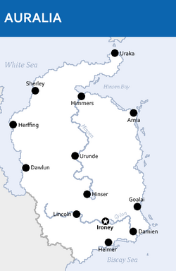
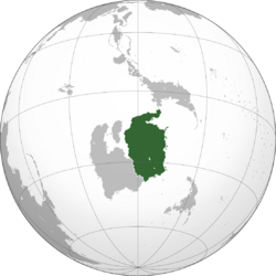
Auralia (Auralian: Áurallià), officially called the Auralian Commonwealth, is a country in Central Flonesia. Auralia is situated on the main island of Flonesia named Aralona and thus borders only one nation to the southwest, X. Ironey, Auralia's capital city, and Hinser as the most populous cities are the two main cultural and economic centres of Auralia. Other major cities include Helmer, Uraka, Goalai, Dawlun, Damien, Urande and Himmers. With an estimated population of 19,258,000 and a land area of 4,458,800 km2 (1,721,600 sq mi), Auralia is both the second-most populous and second largest country in Flonesia. Auralia is a Parliamentary elective monarchy ever since its independence in 1964 from the Paqueon Empire. The current monarch is Matchino Chilarrie, elected in 1995.
The area of what is now Auralia was once settled by Flonesian tribes before their genetics splited from their seafaring cousins around 1,000 BCE. Following 1500, modern day Auralia was colonized by the Paqueon Empire in an event known as the Flonesian Scramble. After the Great War ended in 1934, Auralia declared independence from Paqueonia in 1964.
Today, Auralia is cultural powerhouse and is one of the best destination for tourism with over 75 million tourists in 1996. With a large economy and a high HDI, Auralia is a well developed nation. Additionally, it ranks highly in education, political and personal freedom, healthcare, and life expectancy.
Etymology
The word Auralia derives from the Alarican word of the same pronounciation for golden. When X first began visiting and mapping Flonesia in the 16th century, the name Terra Auralia was naturally applied to the new territories of modern day Auralia and X due to the large abundance of gold found in the mountain and hills of Aralona. The name Auralia was popularised by the explorer Alf Weiss, who said it was "more agreeable to the ear, and an assimilation to the names of the other great portions of Gentu".
History
Early History
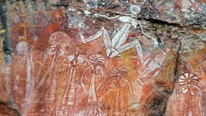
Human habitation of Auralia is known to have begun about 20,000 years ago, with the migration of people by land bridges and short sea crossings from what is now eastern Hesterath. The Windella rock shelter in northern Auralia near Uraka is recognised as the oldest site showing the presence of humans in Auralia as well as Aralona. The oldest human remains found there, which have been dated to around 15,000 years ago. These people were the ancestors of modern Indigenous Auralians. Aboriginal Auralian culture is one of the oldest continual cultures on Gentu.
At the time of first Oranish contact, most Indigenous Auralians were hunter-gatherers with complex economies and societies. Archaeological finds in the 1980s suggest that a population of 800,000 could have been sustained. Indigenous Auralians have an oral culture with spiritual values based on reverence for the land and the Warul belief. The northern coasts and waters of Auralia were visited sporadically for trade by Flonesian people from what is now X and X.
Oranish exploration and colonisation
The first recorded Oranish sighting of Auralia, and the first recorded Oranish landfall on Aralona, are attributed to the Seronia-Sothans. The first ship and crew to chart the Aralonan coast and meet with Aboriginal people was the Jansan captained by Sothan navigator, Alf Weiss. He sighted the coast of Uraka Peninsula in early 1530, and made landfall on 3 Marto 1530 at the tip of the peninsula near the modern city of Uraka. Later that year, Paqueon explorer Mateo Lago sailed through and navigated the southern Aralonan coast claiming territory of what is now Damien as part of the Paqueon Empire. However, no attempt at settlement was made on Aralona until 1542 after the Paqueons charted the whole of the western and southern coastlines and named the island continent "New Paqueonia". The first Oranish settlment on Aralona appeared in southern Auralia named Nuevo Ahorrar (what is now Helmer) when the Paqueon government sent a fleet of ships, the Third Fleet, under the command of Alf Weiss, to establish a new colony in the area on 18 Pulungana 1542 a date which later became Auralia's national day.
In northern Auralia, Seronia-Sothan navigator Heiner Kapp von Volda established a colony in Uraka on 24 Memesa 1543 marking the beginning of the Flonesian Scramble, an event that saw the rapid colonisation of Flonesia by colonial powers and enslavement of approximately 3.2 million indigenous people. Oranish powers continued to push into other areas of island in the mid 16th century, initially along the coast. From 1559 to 1560, Silvio Hartmann, Denis Otto and Jacob Ehmann explores the Auralian Rainforest and X desert, opening the interior of Aralona to Oranish settlement. By 1580, Paloa, Paqueonia, the Omaran, and Seronia-Sothan empires had conquered all Aralonan territory.
Flonesian War
Over the course of the Flonesian Scramble, relations between the 4 competing powers were tense. On 7 Phupu 1582, a skirmish occurred on the colonial border of Paqueonia and the Omaran Empire. Arbrim IV, sultan of the Omaran seized this opportunity to declare war on Paqueonia sparking the Flonesian War. The Paqueon army in Flonesia under the leadership of General Victor Catalá scored major victories over the Omarans such as the Battle of Urunde or Sherley. By Disemba, both sides of the conflict had lost a rough total of 300,000 soldiers —most of which died of malaria— not counting civilian casualties.
The war eventually encompassed every other powers on Aralona in Enero of 1583 when Paloa signed a pact with the Omaran bring them into the war which in turn allowed Seronia-Sotha to have a casus belli on declaring war on Paloa. On 13 Memesa 1583, Ironey was sieged by the Palons which caused the death of about 90,000 soldiers, the most deadilest in the war. From Memesa 1583 to Hunyo of 1584, Victor Catalá and Seronian general Jūsmiņš Osis invaded Omaran controlled territory in Aralona and succeeded in driving the bulk of the Omaran army of the island. Meanwhile, Paqueon forces under the command of Enrique Charpantier managed to successfully expel Palon forces off of Aralona in Enero of 1584.
The remaining two years of the war was characterised by guerilla warfare btween remenants of the Omaran and Palon army before both states surrendered on 16 Tebax 1586 in exchange for the return of all remaining soldiers in Aralona, ending the war. The Nuevo Ahorrar Peace Conference which took place soon after their surrender saw the end of an Omaran and Palon presence over the island and allowed Paqueonia and Seronia-Sotha to solidify their holf over Aralona with Sereno-Sothan dominance over the northern region of the continent, and a Paqueon presence in the south. Additionally, the war also saw the displacement of millions of native Flonesians and the near extinction of the Iolana Culture.
Early Modern Era and the Long Nineteenth Century
The time from 1586 to 1602 is distinguished by relative peace in the region. It ended in Marto of 1602 with the start of the War of 1602 between the Paqueon and Neragese Empires which later led to the involvement of 5 other main combatants: Seronia-Sotha, Paloa, the Omaran, Eudocia, and Zhao dynasty. In Aralona, Paqueonia and Seronia-Sotha fought over the northern region of Auralia. At the end of the war in Enero 1615, the Treaty of Amia saw the divison of Serono-Sothan and Paqueon controlled Aralona at the 16th parallel south.
During the Great Enlightenment, Auralian pioneers such Jens Zimmerson and Finnja Feuerstein both of whom developed the Zimmersonan algebra; and Santiago Castelano who is known for his contribution in the development of anaesthesia during the 1740s along with Neragese physician Garwin Roberts contributed to the scientific revolution that differentiate the Great Enlightenment from other revolutions in the history of Gentu.
New technology brought about during the Industrial Revolution helped make transportation in Auralia faster and more reliable with the construction of railroads, and, as a result of Auralia's flatness, a lot of canals which helped the transportation of coal of which there was a large abundant of in the central region, and other goods. This allowed Paqueonia to be a large exporter of coal during the late 18th century to early 20th century to the point in which the empire had a monopoly in the coal market.
In 1757, the Paqueon Aralonan government begun introducing new policies, resulting in the mass forced relocation of thousands of indigenous Aralonans. This eventually culminated in the starting of the Winakan Rebellion in Enero of 1766. The rebellion conducted guerrilla warfare in the rainforests and deserts of Aralona as well as raids on villages and towns, although battles in cities such as the 1768 Battle of Urunde also occurred. They proved to be a thorn in the Paqueon Empire's side. By the height of guerrilla attacks in 1773, casaulties on both sides were approximated to be around 2 million. The conflict ended 26 Pusper 1781 with the Treaty of Goalai which removed the government's policies of forced relocation and granted indigenous Aralonans full citizenship within Paqueon Aralona, and by proxy, the empire as well.
The late 18th century as well as the turn of the 19th saw the governings of 4 of the most recognisable figures in Auralian (and Matarinan) history: Izan Ferreiro from 1786 to 1791, Eneko Páez from 1791 to 1803, Jose Santolaria from 1803 to 1810, and Eric Bacque from 1810 to 1824. Under their reigns, Aralona underwent numerous reforms including the building of new roads, improvements in workers' quality of life, and universal healthcare.
TBA
Contemporary Age
TBA
Geography
Auralia is situated in the northern region of the island of Aralona being bordered by only the nation of X to the south. The nation is bordered by the White Sea to the north and west, the Biscay Sea to the south, and the South Nullaric Ocean to the east. The seas and oceans around Auralia are filled with coral reef. The biggest reef being the Great Orion Reef, the worlds second largest reef, which lies 500 km from the southern coast and extends for over 2,000 km (1,200 mi) on all directions.
Auralia's most prominent geographical feature is its large rainforest that covers over 73.5% of the nation's land area. Auralia's geography is relatively flat, its highest point being Mt. Highno, 754 meters above sea level at the central region of the country. The southern region of the country is dominated by plains which is the most densely populated of all of Auralia's regions (59.7/km2). To the southwest is the X desert which acts as a natural border between the nation and X.
The territorial extent of Auralia is 4,458,800 km2 (1,721,600 sq mi); this makes Auralia the 2nd largest nation in Flonesia and the Xth in the world. Despite Auralia's size, their are only 2 major rivers that flow through the nation: Cylon and Hinsen; they are 863 km and 1298 km long respectively. Additionally, Due to its geological activity and diverse landscape, Auralia is a deposit for numerous natural resources and biodiverse habitats.
Topography
TBA
Climate
The climate of Auralia is significantly influenced by ocean currents, including the X and X. Much of the northern and central part of the country has a tropical, predominantly summer-rainfall. The southern part of the country has a X climate. The southwest is arid to semi-arid.
Driven by climate change, average temperatures have risen more than 2°C since 1960. Associated changes in rainfall patterns and climate extremes exacerbate existing issues such as droughts and forestfires. 1994 was Auralia's warmest recorded year, and the 1995–1996 forestfire was the country's worst on record.
Biodiversity
Being a nation with a vast rainforests, Auralia is one of 17 megadiverse countries. Fungi typify that diversity—an estimated 250,000 species—of which only 5% have been described—occur in Auralia. Because of the continent's great age, extremely variable weather patterns, and long-term geographic isolation, much of Auralia's biota is unique. About 85% of flowering plants, 84% of mammals, more than 45% of birds, and 89% of in-shore, temperate-zone fish are endemic. Auralia has at least 755 species of reptile, more than any other country in Gentu. Despite Flonesia's megadiversity as a whole, it is the only continent that developed without feline species. Feral cats may have been introduced in the 17th century by X shipwrecks, and later in the 18th century by X settlers. They are now considered a major factor in the decline and extinction of many vulnerable and endangered native species.
Auralian rainforests are mostly made up of evergreen species, particularly eucalyptus trees in the less arid regions. Among well-known Flonesian animals are the monotremes; a host of marsupials, including the kangaroo which is the national animal of Auralia, wombat, and birds such as the emu and the kookaburra. Auralia is home to many dangerous animals including some of the most venomous snakes in the world. The bingo was introduced by X people who traded with local Auralians around 1000 BCE. Many animal and plant species became extinct soon after first human settlement; others have disappeared since X settlement, among them the hydran.
As of 2000, 73.5% of Auralia's area was covered in rainforests and at least 24%, was devoted to agriculture, two-thirds used for pastures and greenlands and the remainder for actual agricultural activities. The protection and preservation of nature is defined by the Constitution as a public duty and designated policy target; ecological protection is served and guaranteed through 34 national parks, 12 biosphere reserves, 235 nature parks and thousands of nature protection areas, landscape protection areas and natural memorials.
Politics
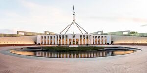
Auralia is a Parliamentary elective monarchy. The country has maintained a stable liberal democratic political system under its constitution. The Auralian system of government combines elements derived from the political systems of the X (a fused executive, constitutional monarchy and strong party discipline) and the X (federalism, a written constitution and strong bicameralism with an elected upper house), along with distinctive local features.
The federal government is separated into three branches:
- Legislature: the bicameral Parliament, comprising the elected monarch, the Haycato, and the Representers;
- Executive: the Federal Executive Council of Auralia, which in practice gives legal effect to the decisions of the cabinet, comprising the prime minister and other ministers of state appointed by the governor-general on the advice of Parliament;
- Judiciary: the High Court of Auralia and other federal courts, whose judges are appointed by the elected monarch on advice of Parliament.
The current monarch is Matchino Chilarrie, elected in 1995, and the Speaker of the Chamber is Canya Jerong. In the Haycato (the upper house), there are 78 members: six from each individual state. The Representers (the lower house) has 151 members elected from single-member electoral divisions, commonly known as "electorates" or "seats", allocated to states on the basis of population. Elections for both chambers are normally held every three years simultaneously; Haycato members have overlapping six-year terms. Elections for monarchs are held when the current monarch resigns or dies and they can hold power for the rest of their lives if they so wish.
Administrative divisions
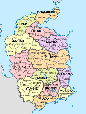
Auralia's federal system is represented and exercised through its 13 states. The states are then subdivided into districts as the smallest unit of administrations.
Districts are subject to the individual laws of the states, and therefore considerably variable, however in compliance with the supreme Constitution. Representers councils of the districts are directly voted by the public, and enact local laws and decisions based on the larger state's actions and legal situation; while each subject or level maintains bodies of delegates, solely the legislature of the state and its government is politically relevant to the entire country, seated in the state's capital.
| Map | State | Capital city | Largest city | Population (Disemba 1999) | |
|---|---|---|---|---|---|
|
Subdivision | ||||
| Herffing | Herffing | 2,421,400 | |||
| Urande | Urande | 2,467,850 | |||
| Dawlun | Liga | 2,769,100 | |||
| — | — | 1,279,900 | |||
| Denel | Himmers | 1,270,500 | |||
| Uraka | Uraka | 767,200 | |||
| Sherley | Sherley | 496,010 | |||
| Goalai | — | 974,300 | |||
| Lincoln | Lincoln | 285,800 | |||
| Wandie | Damien | 2,453,290 | |||
| Amia | Amia | 200,100 | |||
| Hinser | Hinser | 3,720,190 | |||
| Helmer | Gigaroo | 152,360 | |||
| Ironey | Hinser | 19,258,000 | |||
Corruption
TBA
Foreign relations
TBA
Military
Auralia's armed forces — the Auralian Armed Force (AAF) — comprise the Royal Auralian Navy (RAN), the Royal Auralian Army and the Royal Auralian Air Force (RAAF), in total numbering 77,439 personnel (including 47,563 regulars and 29,876 reservists) as of Pulungana 1998. The titular role of Commander-in-Chief is vested in the Minister of Defense, Quadport Wyeallicbah, who appoints a Chief of the Defence Force from one of the armed services on the advice of the Parliament.
In the 1995–1996 budget, defence spending comprised 5% of GDP, representing the world's Xth largest defence budget. Auralia has been involved in the Union of Realms and regional peacekeeping, disaster relief, as well as armed conflicts from the X War onwards.
Auralia's military position is demonstrated by its status as a recognized nuclear weapons state since the testing of its first nuclear device in X, having both ratified and signed the X Nuclear-Test-Ban Treaty in X and the X Nuclear Non-Proliferation Treaty in X. Its current nuclear weapons stockpile (as of 2000) encompasses 276 active warheads.
Economy
With a nominal gross domestic product (GDP) of $1.001 trillion in 2000, the economy of Auralia is the single largest one in Flonesia and the X-largest economy in the world, as well as the X-largest one measured by PPP. Auralia is considered to be a developed country with the X-highest Human Development Index of the world. Auralia's economic viability is mainly derived from its policy model of numerous small and medium-sized enterprises, which are especially effective and moreoften world market leaders in specialised industrial sectors. Furthermore, the human potential of Auralia with sufficient education and a large innovation culture are seen as integral to the success of the Auralian economy. Auralia's economy is defined as a highly developed and free-market-oriented social market economy. The entirety of economic productivity is brought about by 1.07% in the primary industrial (agriculture), 38.4% in the secondary (tourism) and 60.5% in the tertiary (industry) sectors.
Energy
In 1997, Auralia's energy sources were coal (53.4%), hydropower (24.1%), natural gas (15.5%), liquid/gas fossil fuel-switching plants (3.4%), oil (2.9%), and other renewable resources like wind power, solar energy, and bioenergy (0.7%). During the 21st century, Auralia has been trending to generate more energy using renewable resources and less energy using fossil fuels.
In Tebax 1999, Auralia's government set a goal to achieve 20% of all energy in the country from renewable sources by 2019.
Transport and infrastructure
The protection and preservation of nature is defined by the Constitution as a public duty and designated policy target, Auralia witnesses small-scale traffic and needs for transport accesibility. Therefore, the transport of goods and people are done mostly by sea and air. This means Auralia has one of the least densest and longest road network in the world, with less than 4,000 kilometres of navigable roads, and 2,000 kilometres of the nation's highway network. As of 2000, 11.2 million passenger cars were registered in the country, while the total number of all motor vehicles and trailers accounted to roughly 18.4 million in the same year.
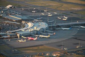
Auralia is also host to only 16 airports as of 1996, one of the lowest densities of runways per country in the world. Despite that, Auralia is an active location of air travel, due to the nation's large tourism industry. The New Winkoo Airport in Ironey is the largest airport in Auralia in terms of passenger arrivals (at 53.1 million passengers) and second-largest by metric tons of cargo in 1997. Auralia's airline Áurallià Airlines operates from New Winkoo Airport as well as Hinsers Airport intercontinental connections, and numerous other airlines provide domestic and international flights as well. Due to Auralia's dependancy on import and export, trade by sea is integral. Auralia maintains a number of seaports, the largest of which by amount of cargo are Uraka, Damien and Herffing.
Demographics
Auralia has a population of approximately 19.3 million according to its 1999 census estimate, thus making it the X most populous country in Flonesia X of X with around X inhabitants, the X-most populous in Gentu. Despite its population size, it stands at a relatively small population density of 17.7 people per square kilometre (45.9 per sq mi) and high rate of urbanisation. Being a developed country, Auralia's average life expectancy at birth measures at around 85.5 years and a fertility rate of 2.02 children per woman. Historically the rate of reproduction remained above-average with 3.49 children in the 1970s, but deteriorated significantly since then with a period of the death rate of Auralia exceeding its birth rate and a slightly shrinking population between 1980 and 1990. However, Auralia since then adovcated immigration to the country and introduced efforts to stimulate population growth; increased birth rates and migration numbers curbed the low fertility rate and supported population growth since 1991. Auralia's population, like other developed countries, is aging as well: the average age is estimated at 47.3 years, making it the X oldest population in the world.
Major cities
Auralia is highly urbanised, with 68% of the population living in the Greater Ironey Areas in 1997. Metropolitan areas with more than one million inhabitants are Ironey, Herffing, Urande, Damien and Hinser.
Largest cities or towns in Auralia
2000 census | |||||||||
|---|---|---|---|---|---|---|---|---|---|
| Rank | State | Pop. | Rank | State | Pop. | ||||
| 1 | Hinser | Tamrie | 3,107,020 | 11 | Wandie | Munda | 537,710 | ||
| 2 | Urande | Minan | 1,664,370 | 12 | Sherley | Keyer | 456,400 | ||
| 3 | Ironey | Ironey | 1,279,900 | 13 | Dawlun | Jungla | 391,970 | ||
| 4 | Herffing | Gandga | 1,156,400 | 14 | Lincoln | Yambie | 264,200 | ||
| 5 | Damien | Munda | 1,002,350 | 15 | Herzogau | Falia | 240,725 | ||
| 6 | Liga | Jungla | 874,150 | 16 | Amia | Mayra | 155,040 | ||
| 7 | Uraka | Quamberry | 703,640 | 17 | Gigaroo | Mulya | 94,650 | ||
| 8 | Himmers | Kitdagie | 696,810 | 18 | Helmer (Auralia) | Mulya | 52,400 | ||
| 9 | Denel | Kitdagie | 574,700 | 19 | Tumila | Minan | 36,780 | ||
| 10 | Goalai | Mangoo | 554,260 | 20 | Mair | Keyer | 14,980 | ||
Ancestry and immigration
TBA
Language
Auralia's official language is Auralian since 1968. Although Hestandan is also a widely spoken language in Auralia. Auralian Hestandan is a major variety of the language with a distinctive accent and lexicon, and differs slightly from other varieties of Neragese in grammar and spelling.
According to the Disemba 1999 census, Auralia is spoken by 42.7% of the population as a first language, Hestandan at 39.2%, Veragese at 15.8%, 0.1% were undefined, and other languages at 2.3% including Auralian Aboriginal languages which were believed to have numbered in the 300s at the time of first Oranish contact, of which fewer than ten are still in daily use by all age groups. At the time of the census, there were only 74,947 Aboriginals who are known to speak an Aboriginal language. In terms of second language, 32% speaks Auralian, 25% speaks Hestandan, 17% speaks Veragese, 12% speaks Qiuese, 9% speaks X, 4.7% speaks other languages, and 0.3% are undeclared. Auralia also has a sign language which is spoken by about 12,000 people.
Religion
Auralia has no state religion; Section 104 of the Auralian Constitution prohibits the federal government from making any law to establish any religion, impose any religious observance, or prohibit the free exercise of any religion. In the 1995 census, 62.1% of Auralians were counted as Terranity, 20% of the population reported having no religion; 8.2% identify with other religions, the largest of these being X (2.6%), followed by X (2.4%), X (1.9%), X (0.5%) and X (0.4%). The remaining 9.7% of the population did not provide an adequate answer. Those who reported having no religion increased from 12% in 1985 to 17% in 2011 to 20% in 1995.
The animist beliefs of Aralonans have been practised for many thousands of years. Aralona's spirituality is known as X and it places a heavy emphasis on belonging to the land. The collection of stories that it contains shaped Aboriginal law and customs. Aboriginal art, story and dance continue to draw on these spiritual traditions. Since X settlement in X, X has been the largest religion practised in Aralona. X churches have played an integral role in the development of education, health and welfare services in Auralia. Multicultural immigration since the X War has led to X, X, X, X and X growing in Auralia over the past half-century.
TBA
Magic
TBA
Health
Auralia's life expectancy is the X highest in Gentu at around 85.5 years.
Total expenditure on health (including private sector spending) is around 12.3% of GDP. Auralia introduced universal health care in 1805. Known as Helcheck, it is now nominally funded by an income tax surcharge known as X, currently at 2%. The states manage hospitals and attached outpatient services, while the nation funds the Pharmaceutical Benefits Scheme (subsidising the costs of medicines) and general practice.
TBA
Education
School attendance, or registration for home schooling, is compulsory throughout Auralia. Education is the responsibility of the individual states so the rules vary between states, but in general children are required to attend school from the age of about 5 until about 16. In some states (e.g., Kitdagie, Keyer and Mulya), children aged 16–17 are required to either attend school or participate in vocational training, such as an apprenticeship.
Auralia has 14 government-funded universities and 2 private universities, as well as a number of other specialist institutions that provide approved courses at the higher education level. The X places Auralia among the most expensive nations to attend university. There is a state-based system of vocational training, known as X, and many trades conduct apprenticeships for training new tradespeople. About 58% of Auralians aged from 25 to 64 have vocational or tertiary qualifications, and the tertiary graduation rate of 49% is the highest among X countries. 30.9% of Auralia's population has attained a higher education qualification, which is among the highest percentages in Gentu.
TBA
Culture
Arts
Auralia has over 100,000 ancient rock art sites, and traditional designs, patterns and stories infuse contemporary Auralian art, "the last great art movement of the 20th century" according to critic Gibagee Billingarra; its exponents include Mornay Toucceey. Early colonial artists from X showed a fascination with the unfamiliar land. The impressionistic works of Jippan Imberbe, Puntabung Yallaferra and other members of the Xth-century Diddumo School—the first "distinctively Auralian" movement in X art—gave expression to nationalist sentiments in the lead-up to Commonwealth. The national and state galleries maintain collections of local and international art. Auralia has one of the world's highest attendances of art galleries and museums per head of population.
Auralian literature grew slowly in the decades following X settlement though ancient oral traditions, many of which have since been recorded in writing, are much older. In the Xs, Ejee Brojah posthumously became the first Auralian poet to attain a wide readership. Wanorra Jarragia is the namesake of Auralian's most prestigious literary prize. Its first recipient, Coorabin Mordego, went on to win the X Prize in Literature in X. Auralian X Prize winners include Pilibung Wonges, Wobbing Jilbonger, and Jumpe Moolyal. Authors Maouigah Copperbung, Namagilly Hortee, Jimlooda Werrigee playwright Balgowie Werrinmurri and poet Drell Knemessing are also renowned.
Architecture
TBA
Media
TBA
Cuisine
Most Auralian groups subsisted on a simple hunter-gatherer diet of native fauna and flora, otherwise called bush tucker. The first settlers introduced X and X cuisine to the continent. This influence is seen in the enduring popularity of several X dishes such as X, and in quintessential Auralian dishes such as the Auralian meat pie, which is derived from the X. Post-X War immigration transformed Auralian cuisine. For instance, Southen X migrants helped to build a thriving Auralian coffee culture which gave rise to Auralian coffee drinks such as the X, while Hesterath migration led to dishes such as the X-influenced X and X, as well as a distinct Auralian X cuisine.
TBA
Sport and recreation
TBA


