Portal:Gentu
Introduction
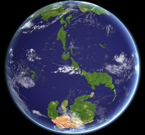
Gentu is the third planet from the Sun in the Gentu System. About 67% of Gentu's surface is made up of the ocean. The remaining 33% of Gentu's surface is land, consisting of continents and islands. Gentu's surface layer is formed of several slowly moving tectonic plates, interacting to produce mountain ranges, volcanoes and earthquakes. Gentu formed over 4.5 billion years ago. During the first billion years of Gentu's history, the ocean formed and then life developed within it. the modern Humans emerged 250,000 years ago and have grown to a population of over 12.4 billion in 1950 and a population of over 14 billion as of 2000. Because of the rapid growth in population, Gentu is currently being threatened by social, economic, and agricultural collapse. Combined with humanity's dependency on Gentu's biosphere and natural resources for their survival, pollution, as well as civil disorder, wars, and famines, Gentu's climate, soils, waters and ecosystems is being threatened, causing the displacement of millions of people, refugee crises, rise of sea level, and widespread extinction of other life.
Important Links
Get in touch with me by sending a message on IIwiki and I will respond to you as quickly as possible. :)
High resolution maps:
Selected Article
The Aquamic Ocean, also known as the Megalon Ocean by the Ancient Pylosan and Calidum, is Gentu XXX largest ocean. It covers a surface area of 65,106,141 km2 (25,137,622 sq mi) or approximately 7.08% of the water on Gentu's surface. It is bordered by Hesterath to the north and northwest; Oranland and Naphtora to the west; Flonesia to the east; and the Southern Ocean to the south. Along its core, the Aquamic Ocean has some large marginal or regional seas such as the Horapon Sea, the Nanhai Sea, the White Sea, the Gulf of Urgan, and the Gulf of Tevrick. (See more...)Selected Image
2000 population pyramid of Hoy Kok.
In the News
- 32 people are injured when a train collides with a bus in Godfrey, Le-Grand-Godfrey, Cavala.
- Ut enim ad minim veniam, quis nostrud exercitation ullamco laboris nisi ut aliquip ex ea commodo consequat.
- Lorem ipsum dolor sit amet, consectetur adipiscing elit, sed do eiusmod tempor incididunt ut labore et dolore magna aliqua. Ut enim ad minim veniam, quis nostrud exercitation ullamco laboris nisi ut aliquip ex ea commodo consequat.
- Duis aute irure dolor in reprehenderit in voluptate velit esse cillum dolore eu fugiat nulla pariatur. Excepteur sint occaecat cupidatat non proident, sunt in culpa qui officia deserunt mollit anim id est laborum.
- Excepteur sint occaecat cupidatat non proident, sunt in culpa qui officia deserunt mollit anim id est laborum.
- Lorem ipsum dolor sit amet, consectetur adipiscing elit, sed do eiusmod tempor incididunt ut labore et dolore magna aliqua.
- Ut enim ad minim veniam, quis nostrud exercitation ullamco laboris nisi ut aliquip ex ea commodo consequat.
Ongoing: Lorem ipsum dolor
In this month
- 1059 – The Paqueonia breaks away from the Dardonan Empire, beginning the Paqueon Revolutionary War.
- 1582 – A skirmish occurred on the colonial border of the Paqueon and Omaran Empire in Flonesia, starting the Flonesian War.
- 1820 – The Great Coalition War ends after a victorious albeit deadly Sothan campaign ended in the fall of the Sothan capital to Cavalan hands.
- 1951 – The Wettänkrieg begins with the start of the Wermark Crisis, a confrontation between Neragon and the NUR following a Neragese intervention in the politics of the newly formed state of Mareasia.
TBA
TBA Duis aute irure dolor in reprehenderit in voluptate velit esse cillum dolore eu fugiat nulla pariatur. Excepteur sint occaecat cupidatat non proident, sunt in culpa qui officia deserunt mollit anim id est laborum.
Maps
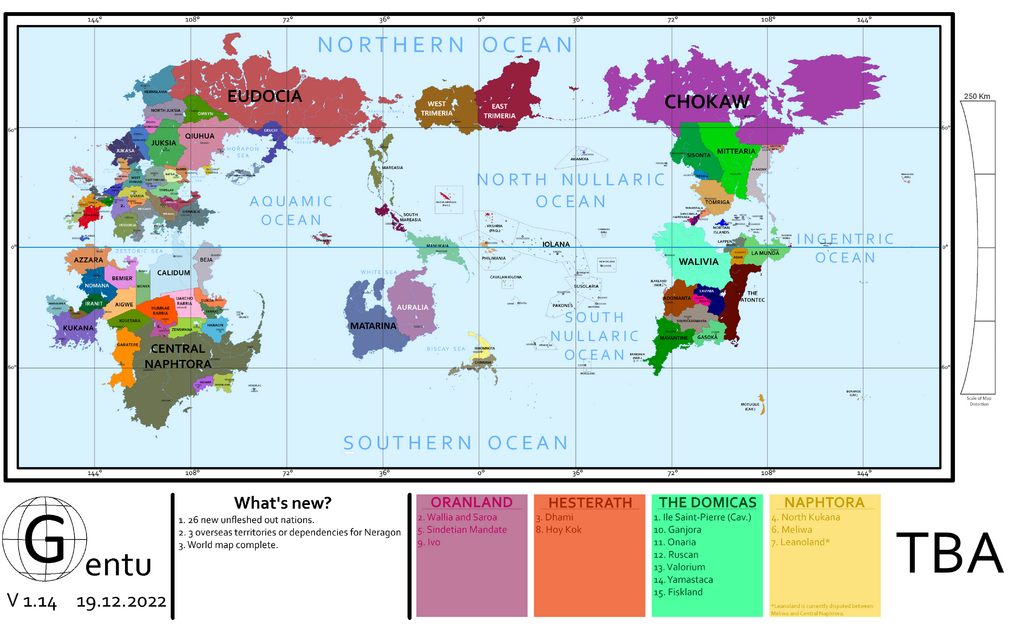
Equirectangular Projection Map |
---|
Plate tectonics map with their movement and recent volcanic activities |
---|
Topographic Map |
---|
(Rough) Climate Map |
---|
Equal World Projection |
---|
Natural World Projection |
---|
Ocean Current Map |
---|
Ocean Topography Map |
---|