Zanzali: Difference between revisions
m (Pop brought back in line.) |
(Rewritten after re-app.) |
||
| (2 intermediate revisions by 2 users not shown) | |||
| Line 1: | Line 1: | ||
{{Region_icon_Ajax}} | {{Region_icon_Ajax}} | ||
{{Infobox country | {{Infobox country | ||
|conventional_long_name | | conventional_long_name = Kingdom of Zanzali<br> <small>script<small>([[Izanzi language|Izanzi]])</small> <br> ''Ahaupara yiNyjanjali''</small> | ||
|native_name | | native_name = | ||
|common_name | | common_name = Zanzali | ||
|image_flag | | image_flag = Flag of Zanzali.svg | ||
|alt_flag | | alt_flag = | ||
|image_coat | | image_coat = Coat of Arms of Zanzali.svg | ||
|alt_coat | | alt_coat = | ||
|symbol_type | | symbol_type = Coat of Arms | ||
|national_motto | | national_motto = <small>''"script."'' <br> "shizanzi." <br> "english."</small> | ||
|national_anthem | | national_anthem = [[script]]<br> 'shizanzi' <br> <small>("Jewel of the Karaihe")</small><br> | ||
[[File:MediaPlayer.png|link=https://www.youtube.com/watch?v=BtJaaI6s2o8]] | [[File:MediaPlayer.png|link=https://www.youtube.com/watch?v=BtJaaI6s2o8]] | ||
|royal_anthem | | royal_anthem = | ||
|other_symbol_type | | other_symbol_type = | ||
|other_symbol | | other_symbol = | ||
|image_map | | image_map = Political map of Zanzali.png | ||
|map_width | | map_width = 275px | ||
|alt_map | | alt_map = | ||
|map_caption | | map_caption = Political Map of Zanzali | ||
|image_map2 | | image_map2 = | ||
|map2_width | | map2_width = 275px | ||
|alt_map2 | | alt_map2 = | ||
|map_caption2 | | map_caption2 = | ||
|capital | | capital = [[Maziko]] | ||
|largest_city | | largest_city = [[Babamamba]] | ||
|official_languages | | official_languages = [[Izanzi language|Izanzi]] | ||
|national_languages | | national_languages = | ||
|regional_languages | | regional_languages = {{hlist | {{wp|Hiri Motu|Tuganani}} | {{wp|Maori language|Onekawan}} | {{wp|Malagasy language|Nyelele}} | [[Zanzali#Language|approximately 30 others]] }} | ||
|languages_type | | languages_type = <!--Other type of languages --> | ||
|languages | | languages = <!--Other languages list--> | ||
|ethnic_groups | | ethnic_groups = {{hlist | 73% [[AwaZanzi people|AwaZanzi]] | 8% {{wp|Motu people|Tuganani}} | 6% {{wp|Aboriginal Australians|Gunyari}} | 3% {{wp|Maori people|Onekawan}} | 10% Other }} | ||
}} | | ethnic_groups_year = <!--Year of ethnic data (if provided)--> | ||
|ethnic_groups_year | | religion = {{Collapsible list | ||
|religion | |||
|titlestyle = background:transparent;text-align:left;font-weight:normal;font-size:100%; | |titlestyle = background:transparent;text-align:left;font-weight:normal;font-size:100%; | ||
|title = List of religions| | |title = List of religions | 81% [[N'nhivara]] | 7% [[White Path]] | 5% [[Azdarin]] | 3% [[Cozauism]] |[[Zanzali#Religion|Other]] }} | ||
|demonym | | demonym = MaZanzi (sing.)<br>AwaZanzi (pl.) | ||
|government_type | | government_type = {{wp|Unitary state|Unitary}} {{wp|Parliamentary system|parliamentary}} {{wp|constitutional monarchy}} | ||
|leader_title1 | | leader_title1 = [[King]] | ||
|leader_name1 | | leader_name1 = [[<<NAME>>]] | ||
|leader_title2 | | leader_title2 = [[Bandhala]] (chancellor? political leader) | ||
|leader_name2 | | leader_name2 = [[<<NAME>>]] | ||
|leader_title3 | | leader_title3 = [[Prime Minister]]? | ||
|leader_name3 | | leader_name3 = [[<<NAME>>]] | ||
|legislature | | legislature = [[legislature (Zanzali)|legislature]] | ||
|upper_house | | upper_house = | ||
|lower_house | | lower_house = | ||
|sovereignty_type | | sovereignty_type = Independence | ||
|sovereignty_note | | sovereignty_note = from [[Mutul|the Mutul]] | ||
|established_event1 | | established_event1 = [[Tahamaja Empire|Tahamaja]] colony | ||
|established_date1 | | established_date1 = 936-1353 CE | ||
|established_event2 | | established_event2 = Pirate republics | ||
|established_date2 | | established_date2 = 1353-1680 | ||
|established_event3 | | established_event3 = [[Yajawil of Maok'ab|Maok'ab]] client state | ||
|established_date3 | | established_date3 = 1680 - 5 July 1841 | ||
|established_event4 | | established_event4 = Kingdom of Zanzali | ||
|established_date4 | | established_date4 = 23 May 1889 - February 7 1931 | ||
|area_rank | | established_date5 = 12 August 1935 | ||
|area_magnitude | | established_event5 = Current constitution | ||
|area | | area_rank = | ||
|area_km2 | | area_magnitude = | ||
|area_sq_mi | | area = | ||
|area_footnote | | area_km2 = 1,208,864 | ||
|percent_water | | area_sq_mi = 466,745 | ||
|area_label | | area_footnote = | ||
|area_label2 | | percent_water = 6 | ||
|area_dabodyalign | | area_label = Total area | ||
|population_estimate | | area_label2 = | ||
|population_estimate_rank | | area_dabodyalign = | ||
|population_estimate_year | | population_estimate = | ||
|population_census | | population_estimate_rank = | ||
|population_census_year | | population_estimate_year = | ||
|population_density_km2 | | population_census = 39,819,280 | ||
|population_density_sq_mi | | population_census_year = 2020 | ||
|population_density_rank | | population_density_km2 = 32.9 | ||
|GDP_PPP | | population_density_sq_mi = 85.3 | ||
|GDP_PPP_rank | | population_density_rank = | ||
|GDP_PPP_year | | GDP_PPP = | ||
|GDP_PPP_per_capita | | GDP_PPP_rank = | ||
|GDP_PPP_per_capita_rank | | GDP_PPP_year = | ||
|GDP_nominal | | GDP_PPP_per_capita = | ||
|GDP_nominal_rank | | GDP_PPP_per_capita_rank = | ||
|GDP_nominal_year | | GDP_nominal = $1,122,236,640,000 | ||
|GDP_nominal_per_capita | | GDP_nominal_rank = | ||
|GDP_nominal_per_capita_rank = | | GDP_nominal_year = 2020 | ||
|Gini | | GDP_nominal_per_capita = $24,500 | ||
|Gini_rank | | GDP_nominal_per_capita_rank = | ||
|Gini_year | | Gini = 44.3 | ||
|Gini_change | | Gini_rank = | ||
|Gini_category | | Gini_year = 2020 | ||
|HDI | | Gini_change = decrease | ||
|HDI_rank | | Gini_category = | ||
|HDI_year | | HDI = 0.804 | ||
|HDI_change | | HDI_rank = | ||
|HDI_category | | HDI_year = 2020 | ||
|currency | | HDI_change = decrease | ||
|currency_code | | HDI_category = | ||
|time_zone | | currency = currency (Z$) | ||
|utc_offset | | currency_code = ZZC | ||
|time_zone_DST | | time_zone = | ||
|antipodes | | utc_offset = +2 | ||
|date_format | | time_zone_DST = | ||
|DST_note | | antipodes = | ||
|utc_offset_DST | | date_format = dd/mm/yyyy | ||
|drives_on | | DST_note = | ||
|cctld | | utc_offset_DST = | ||
|calling_code | | drives_on = right | ||
|image_map3 | | cctld = .ZZ | ||
|alt_map3 | | calling_code = +258 | ||
|footnote_a | | image_map3 = | ||
| alt_map3 = | |||
| footnote_a = | |||
}} | }} | ||
'''Zanzali''' ({{IPAc-en|z|ɑː|n|z||ɑ:|l|iː}}; | '''Zanzali''' ({{IPAc-en|z|ɑː|n|z||ɑ:|l|iː}}; [[Izanzi language|Izanzi]]: [script], ''Nyjanjali''), officially the '''Kingdom of Zanzali''' ([[Izanzi language|Izanzi]]: [script], ''Ahaupara yiNyjanjali''), is a country in southeastern [[Ajax#Malaio|Malaio]] situated between the [[Karaihe Sea]] and [[Vespanian Ocean]], bordering [[Pulau Keramat]] to the north, [[Pulacan]] to the west, and [[Onekawa-Nukanoa]] to the east. Its population of 39,819,280 is concentrated primarily on the tropical north coast and subtropical southeast coast, with much of the rest of its 1,208,864 km<sup>2</sup> (466,745 mi<sup>2</sup>) area being arid and relatively sparsely populated. The capital of Zanzali is [[Maziko]], and the largest city is [[Babamamba]], which caps the western end of the [[MaZanzi Karaihe Megalopolis]], a sprawling {{wp|conurbation}} home to over half of Zanzali's population that also includes other major cities such as [[Dankada]], [[Tampalu]], and [[Sangara]]. Its majority and official language is [[Izanzi language|Izanzi]], the southernmost {{wp|Bantu languages|Komontu}} language. | ||
For much of prehistory, Zanzali was occupied by various {{wp|Motu people|Tuganani}}, {{wp|Macro-Gunwinyguan languages|Gunyari}}, and {{wp|San people|xKhasi}} peoples, who would eventually be pushed out of the region, or otherwise assimilated, by {{wp|Bantu migration|Komontu migrants}} who began arriving in the early 500s CE. Beginning in the 10th century CE, the area that is now Zanzali was utilized as a {{wp|penal colony}} by the [[Tahamaja Empire]], where criminals and dissidents from throughout the [[Ozeros Sea|Ozeros]] region were sent to work mining {{wp|gemstones}} and growing {{wp|coffea|coffee}} and {{wp|Nut (food)|nuts}} alongside local {{wp|Bantu people|Komontu}}, {{wp|Papuan people|Tuganani}}, and {{wp|Aboriginal Australians|Gunyari}} tribes. The mixing of these groups gave rise to the [[AwaZanzi]], which today are the largest group in Zanzali. This constant influx of criminal elements led to the region becoming known for its skilled mercenaries, smugglers, and pirates, who eventually became the main authorities in Zanzali after the collapse of the Tahamaja in the 1300s, leading to the rise of many {{wp|Pirate haven|pirate republics}} in the region. These republics came under the suzerainty of the [[Mutul|Mutulese]] [[Yajawil of Maok'ab]] by the late 17th century. In 1841, the MaZanzi polities gained their independence from the yajawil, and unified under King <<FOUNDER_NAME>>. <<FOUNDER_NAME>>'s son, <<FOUNDER_SON_NAME>> would abdicate the throne in 1931 following the devastation of the [[Great Kayatman War]], being replaced with the <<NEW_MONARCH>> following the [[Lily Revolution]] and ensuing [[MaZanzi Civil War]]. | |||
Zanzali is a {{wp|unitary state|unitary}} {{wp|constitutional monarchy}} which practices {{wp|devolution}} across 9 [[Zanzali#Administrative divisions|viceroyalties]]. Executive power is shared between the [[Monarchy of Zanzali|King of the Azanzi]] and the [[bandhala]], who serve at the behest of the National Assembly (''Nanjama kiKonam''), a unicameral legislature of 300 members. The [[Trucial Courts]] hold judicial power, including the ability to review the validity of laws, elections, and referendums. Zanzali is a member of many international organizations, such as the [[Association of Ozeros Nations]], the [[Forum of Nations]], the [[Equatorial Trade Forum]], the [[Vespanian Exchange Institute]], and the [[Joint Space Agency]]. It has a developed economy, with a {{wp|GDP per capita}} of $24,500, with major industries including tourism, textiles, and specialty instrument manufacturing. Industrial agriculture and food processing is also a major component of the economy, with {{wp|coffee}}, {{wp|seafood}}, {{wp|tobacco}}. and {{wp|spices}}, particularly {{wp|vanilla}}, being mainstays. | |||
==Etymology== | |||
Zanzali's endonym is ''Nyjanjale'', which is of uncertain etymology but speculated to derive from a variety of {{wp|Macro-Gunwinyguan languages|Gunyaric}} words, including ''njanjalin'' ("leaf"), ''mamiṇinjali'' ("clay"), ''jangalin'' ("eucalyptus"), or maybe ''angigalije'' ("man"). The first known written instance of ''Nyjanjale'' is found in harbor records from 13th century [[Tanjung Huriang]], where it is transcribed by Mataram merchants as ''Sanjalay''. Historically, it was spelled and pronounced in many different ways, including ''Yanshala'', ''Nagoli'', and ''Kankole''. | |||
Strictly grammatically speaking, the country should be referred to as ''PoNyjanjale''{{efn|In modern times, “PoNyjanjale” is typically only used in poetic or nationalistic contexts.}}, but because the term ''Nyjanjale'' has undergone such major linguistic and contextual evolution over the past thousand years, the term is understood now to refer specifically to the entity that is the modern Kingdom of Zanzali (''Ahaupara yiNyjanjale''). | |||
Historical back-formation resulted in the term ''Nyjanji'' becoming the standard term for the ethnic group called the ''MaZanzi'' (or, more archaically, the Zanzalese). Due to the difficulty of the "''nyja''" sound (/ɲd͡ʒa/, a voiced velar/palatal nasal followed by a voiced postalveolar affricate) for non-native speakers, it has been historically rendered as an "Nz" or "Nj" sound instead, and further simplified to the contemporary term ''Zanzi'', which can then be given grammatical affixes. | |||
A common folk etymology claims that the name Zanzali derives from the Middle ShiZanzi verb ''tsandza'', "to weave, to love", which forms the word ''PoTsandzale'', "this beloved country. It has also been suggested that the adjective ''mazantsi'', "south", had some influence. | |||
== Geography and | Before the widespread adoption of ''Nyjanjale'', the area encompassing modern Zanzali was variously called ''Thanakata'' (from {{wp|Javanese languag|Mataram}} ''tanah kidul'', "south shore", the origin of the name of modern [[Dankada]]) and Besirang (from Mataram ''pesisir ireng'', "black coast") by foreigners. | ||
==Geography== | |||
[[File:Topographic map of Zanzali.png|left|thumb|250px|Topographic map of Zanzali.]] | |||
Zanzali is approximately 1,208,864 km<sup>2</sup> (466,745 square miles) in area, located on the southern edge of Malaio between the [[Karaihe Sea]], an inlet of the Ozeros Sea, and the [[Bay of Lakamma]] on the [[Vespanian Ocean]]. It borders [[Onekawa-Nukanoa]] to the east along the [[Hanaki River]] and the [[Javinassa peninsula]] of [[Pulau Keramat]] to the northwest, where the border is defined by the [[Javinassa Mountains]]. The Javinassas then lower into the [[Djebe Highlands]] to the south, which forms the major part of Zanzali’s western border with [[Pulacan]], | |||
Zanzali's physical landscape shows a marked contrast between its northern and southern regions. The north features {{wp|Southern Zanzibar–Inhambane coastal forest mosaic|Southern Karaihe coastal forests}}, interspersed with coastal swamplands, notably the {{wp|East African mangroves|East Malaioan mangrove forests}} and {{wp|Zambezian coastal flooded savanna|MaZanzi flooded savanna}}. These ecosystems support thriving fishing, agriculture, and tourism industries while hosting thousands of diverse species. | |||
The country's major waterways include the [[Nok River|Nok]], [[Mbizi River|Mbizi]], [[Umawu River|Umawu]], and [[Hanaki River|Hanaki]] rivers, listed west-to-east by their estuaries. These rivers flow northward from the interior hills into the Karaihe Sea, creating numerous lakes, swamps, and floodplains. The Hanaki River stands as the widest, reaching 22 kilometers (13.6 miles) at its broadest point, while the Nok River extends the furthest, covering 1220 kilometers (695 miles) from Lake Ntsidwe to its outlet near X. | |||
Moving inland, the landscape transitions to tropical savanna and {{wp|Eastern miombo woodlands|coastal miyombo woodlands}}, with a notable elevation increase. Historically, rapids and waterfalls made major waterways unnavigable until 20th-century lock and canal construction. | |||
The interior comprises mainly {{wp|Zambezian and mopane woodlands|mobane woodlands}} in river valleys and drier {{wp|Southern miombo woodlands|interior miyombo woodlands}} in elevated areas. The {{wp|xeric shrublands}} of the [[Manyunyu Desert]] occupy the middle and southwest. High plateaus interrupt this landscape, featuring {{wp|Southern Rift montane forest–grassland mosaic|Malaioan montane forests and grasslands}}. These highlands form the southern terminus of the [[Great Spine of Malaio]]. | |||
The southern coast exhibits two distinct biomes: {{wp|Fynbos#Ecoregions|Lakamma shrublands}} along most of the coast, and, from Cape X eastward, the {{wp|KwaZulu–Cape coastal forest mosaic|X coastal forest mosaic}}, which transitions into {{wp|Eastern Australian temperate forests|Karoaroa temperate forests}} near Onekawa-Nukanoa. The {{wp|Southeast Australia temperate forests|X temperate forest}} caps the X peninsula's southern end. | |||
===Climate=== | |||
[[File:Climate map of Zanzali.png|left|thumb|250px|{{wp|Köppen climate classification|Köppen climate types}} of Zanzali.]] | [[File:Climate map of Zanzali.png|left|thumb|250px|{{wp|Köppen climate classification|Köppen climate types}} of Zanzali.]] | ||
The country's climate varies significantly between regions. The northern coast experiences a {{wp|tropical monsoon climate|tropical}} climate, while the interior and southern coast are predominantly {{wp|arid climate|arid}}. | |||
The northern coastal region receives substantial rainfall during monsoon season (May to November), with some areas recording over 1500 millimeters (60 inches) annually. Coastal temperatures remain relatively stable, typically ranging between 25°C-30°C (77°F-86°F). | |||
The interior experiences a {{wp|semi-arid climate|semi-arid}} climate, with temperatures similar to the coast but experiencing significantly less rainfall, typically below 500 millimeters (20 inches) annually. The [[Manyunyu Desert]] approaches a {{wp|hot arid climate}}, receiving less than 120 millimeters of annual rainfall. | |||
Highland areas feature a {{wp|Oceanic_climate#Subtropical_highland_variety_(Cfb,_Cwb,_Cwc)|subtropical highland temperate}} climate with mild, consistent temperatures ranging from 10°C-22°C (50°F-76°F) year-round. | |||
Zanzali is also on the southern edge of the [[Karaihe Ecological Intermediate Zone]], a transitional area wherein three distinct biogeographical regions meet: the Malaio | The southern coast features a {{wp|Mediterranean climate|Periclean climate}}, transitioning to a humid subtropical climate in the east. Uniquely, the X peninsula's southern extremity approaches an {{wp|oceanic climate}} and is the only region of Zanzali that regularly experiences hail and light snowfall. | ||
=== Biodiversity=== | |||
Zanzali is also on the southern edge of the [[Karaihe Ecological Intermediate Zone]], a transitional area wherein three distinct biogeographical regions meet: the Malaio Spine savannas, the Ozeros tropical rainforests, and the Onekawan temperate woodlands, all centered around the Karaihe Coral Archipelago, a group of atolls and coral reefs throughout the Karaihe Sea which form one of the largest concentrations of coral and marine life in the world, protected by the internationally-administrated [[Karaihe International Marine Preserve]]. The Intermediate Zone features diverse flora and fauna from each of these regions, and Zanzali in particular hosts {{wp|giraffes}}, both {{wp|Asian elephant|Ozerosi}} and {{wp|African elephant|Malaioan elephants}}, {{wp|rhinoceroses}}, and other animals, which contributes to a thriving eco-tourism sector and zoological community. | |||
{{Gallery | {{Gallery | ||
| Line 146: | Line 171: | ||
|File:Virunga National Park Landscape.jpg | |File:Virunga National Park Landscape.jpg | ||
|alt1= | |alt1= | ||
| Clouds form over | | Clouds form over Taburu in <<NAME>> National Park. | ||
|File:A lone giraffe in Nairobi National Park.jpg | |File:A lone giraffe in Nairobi National Park.jpg | ||
|alt2= | |alt2= | ||
| A lone giraffe in | | A lone giraffe in <X> National Park. | ||
|File:Haiphong 106.70132E 20.84440N.jpg | |File:Haiphong 106.70132E 20.84440N.jpg | ||
|alt3= | |alt3= | ||
| Aerial view of the | | Aerial view of the Umawu River Delta. | ||
|File:Mangrove Ecopark.jpg | |File:Mangrove Ecopark.jpg | ||
|alt4= | |alt4= | ||
|Birds take flight in a | |Birds take flight in a <X> mangrove forest. | ||
|File:Wooden boat off-shore in Mombasa's Marine Park.jpg | |File:Wooden boat off-shore in Mombasa's Marine Park.jpg | ||
|alt5= | |alt5= | ||
|A boat floats near shallow coral reefs in | |A boat floats near shallow coral reefs in <X>. | ||
}} | }} | ||
== History == | ==History == | ||
[[File:Kuk New Guinea 2002.jpg|right|thumb|250px|Aerial photo of the Diyome swampland, birthplace of the ancient Tiom civilization.]] | [[File:Kuk New Guinea 2002.jpg|right|thumb|250px|Aerial photo of the Diyome swampland, birthplace of the ancient Tiom civilization.]] | ||
The eastern coast of Malaio is one of the oldest continually inhabited regions on Earth. Stone tools exacavated from archaeological sites in Zanzali's northwest have been dated back to as early as 100,000 years ago, and fossil specimens elsewhere have been dated as from between | The eastern coast of Malaio is one of the oldest continually inhabited regions on Earth. Stone tools exacavated from archaeological sites in Zanzali's northwest have been dated back to as early as 100,000 years ago, and fossil specimens elsewhere have been dated as from between 200,000 and 300,000 years ago. Zanzali's indigenous inhabitants are believed to have been various {{wp|Khoisan languages|xKhasi-speaking}} peoples, who practiced hunter-gatherer lifestyles among the lakes and savannas. | ||
Approximately 6,000 years ago, {{wp|Proto-Austronesian language|Proto-Karaihean}} speakers began settling the coasts of southeastern Malaio, displacing xKhasi-speakers and pushing them further into the hinterlands | Approximately 6,000 years ago, {{wp|Proto-Austronesian language|Proto-Karaihean}} speakers began settling the coasts of southeastern Malaio, displacing xKhasi-speakers and pushing them further into the hinterlands and eventually developing into the {{wp|Indigenous people of New Guinea|Tuganani}} and {{wp|Macro-Gunwinyguan languages|Gunyari}} peoples. In the swamplands of northwestern Zanzali, around 3500 BCE, the Tuganani [[Tiom civilization]] became one of the {{wp|cradles of civilization}}. The Tiomi practiced sophisticated environmental engineering through the draining of swamps and irrigation of surrounding areas, allowing them to cultivate crops such as {{wp|bannanas}}, {{wp|sugar cane}}, and {{wp|taro}}. They also practiced a form of early {{wp|ironworking}}. Tiomi city-states dotted the coast of the Karaihe Sea and saw frequently trade and conflict with Proto-Onekawan and xKhasi groups on their frontiers. Archaeological finds suggest that Tiomi goods were traded as far as modern [[Fahran]] and [[Kajera]]. The Tiom civilization began to decline around 1000 BCE, possibly due to a prolonged drought in the region. | ||
[[File:Animal products; (1877) (14774397124).jpg|left|thumb|250px|19th century depiction of cattle in a 5th century Komontu village.]] | [[File:Animal products; (1877) (14774397124).jpg|left|thumb|250px|19th century depiction of cattle in a 5th century Komontu village.]] | ||
Beginning around 200-500 CE, the final stages of the millennia-long {{wp|Bantu migrations|Komontu migrations}} began to reach southern Malaio. Practicing {{wp|slash and burn agriculture}} alongside | Beginning around 200-500 CE, the final stages of the millennia-long {{wp|Bantu migrations|Komontu migrations}} began to reach southern Malaio. Practicing {{wp|slash and burn agriculture}} alongside {{wp|nomadic pastorialism|nomadic cattle pastorialism}}, they initially migrated south along the coast before reaching what is now western Zanzali. From here, they gradually spread out and began to mix with the local populations, eventually forming the foundations of the modern MaZanzi ethnic group. Further migration southeast along the coast was prevented by aggressive defense of their territory by Onekawan tribes. This is the subject of a mythical folktale in the region which has many variations, but is broadly described a century-long conflict between tribes on both sides of the Hanaki River. | ||
While these Proto- | While these Proto-MaZanzi groups ceased to be nomadic, they formed polities much larger than an individual large village during this period. Large herds of cattle, which were novel for surrounding Kairehean populations, often represented the collective wealth of the village. While Komontu beef was a popular export in the region, cheese took several centuries to catch on. By the late 700s CE, the Proto-MaZanzi were also beginning to serve as middlemen between groups in the southern Malaioan interior and the greater Ozeros Sea region, moving gold, ivory, and slaves north, and in the process attracting the attention of the budding Tahamaja Empire. | ||
=== | ===Age of Pearls=== | ||
[[File:Muzium Negara (8361189511).jpg|right|thumb|250px|Model of an 11th century Tahamajan ''wakang''.]] | [[File:Muzium Negara (8361189511).jpg|right|thumb|250px|Model of an 11th century Tahamajan ''wakang''.]] | ||
In the early 900s CE, military expeditions from the [[Tahamaja|Grand Tahamaja]] began arriving along the coastline of modern Zanzali in the beginning of the period now termed the [[Age of Pearls]]. Having fully consolidated control over their home islands, [[Za’gree]] elites sought avenues for economic expansion throughout the Karaihe and lower Ozeros. This began with trading outposts on the coast, and gradually expanded to include tributaries further inland. However, the inhospitable terrain prevented full-scale colonization beyond the immediate coastline. | |||
Tahamaja rule also brought [[N'nhivara]] to the MaZanzi coast. Many MaZanzi tribes converted en mass, either due to the mass adoption of immigrants or in order to secure favorable arrangements with Tahamajan authorities. Temples and monasteries became centers of political and economic importance, bringing consistent development and resources in their wake. Typically, these Mzanzi converts would syncretize N'nhivara with traditional folk religion, incorporating beliefs about a {{wp|Sky deity#Sub-Saharan Africa|creator-and-sky god}} and {{wp|ancestor worship}}. | |||
[[File:Majapahit,_Piggy_Bank.jpg|left|thumb|250px|Late Tahamajan terracotta piggy bank, 14th century.]]Although the region was initially valued for its connections to the interior's gold and ivory trades, under Tahamaja rule it quickly became a major center for the production of {{wp|sugarcane}} and {{wp|spices}} (such as {{wp|nutmeg}} and {{wp|cinnamon}}) as well. In 933, Pelutama [[Garaj Ritarja Anukana]], not wanting to enslave large numbers of locals for fear of disrupting the steady flow of valuable goods from the interior, ordered that coastal plantations be populated with enslaved criminals and political dissidents from throughout the Tahamaja. This resulted in an influx of diverse cultures from throughout the Ozeros as enormous numbers of prisoners were pressed into hard labor each year, ballooning the population. Between 933 and 1000, it is estimated that the territory's population grew as much as 300-500%. These imported ethnicities were generally assimilated into existing Proto-MaZanzi clans, either as side effect of Tahamajan bargaining or by choice of individuals fleeing slavery or purchasing their own freedom, gradually creating a vast ShiZanzi-speaking {{wp|creole}} group which would become the majority population of the region, encompassing Komontu, Tuganani, Gunyari, and countless pan-Ozerosi influences. | |||
The sheer number of criminals and political dissidents among the original colonial population fueled a rich, boisterous tradition of rebellion against Tahamajan authorities. This took many forms, ranging from defiance of colonial borders and taxes to open insurrections. {{wp|Fraud}}, {{wp|smuggling}}, and {{wp|free movement}} of entire groups of people were common. As military service was a relatively straightforward way to secure one's freedom, and generally took less time than saving up enough money to purchase freedom, the region also became famous for its sailors and mercenaries, particularly versatile ''{{wp|Aruval|ikrele}}''-wielding troops who were known to be as capable on horseback as trudging through coastal swamplands. These troops were used extensively by the Tahamaja in military campaigns throughout the Ozeros alongside many other auxiliaries, such as the Onekawan [[Tahamaja_Empire#Kaiponu_Tau.C4.81|Kaiponu Tauā]]. | |||
With the [[Siriwang Eruption|eruption of Mt. Siriwang]] in 1353, the Tahamaja entered a period of violent decline. In the Karaihe, this took the form of local administrators being replaced by regional warlords, often mercenary commanders tied to local clans. By the year 1400, the last vestiges of colonial governance had crumbled and given rise to nearly thirty independent MaZanzi polities. | |||
===Age of Fire=== | |||
[[File:Arab ship or Indian ocean ship from Ajayib al-Hind.jpg|right|thumb|250px|Depiction of a MaZanzi ''dawa'', unknown Fahrani artist circa 1430 CE.]] | |||
The period following the collapse of the Tahamaja in Zanzali is historiographically referred to as the [[Age of Fire]]. Fierce competition between warlords and minor principalities or republics became the norm, and the cultural concept of ''[[shehena]]'' fully crystalized. ''Shehena'' encompasses the concept of treasure or cargo brought back from raids or trade expeditions, which is then redistributed among the clan and community in order to bolster the reputation of the ones who retrieved it. This would rapidly become the focal point of MaZanzi politics in the power vacuum left by the Tahamaja, resulting in many families sending their sons abroad, either as warriors or merchants, to bring back new wealth, spreading MaZanzi individuals across the Ozeros while simultaneously importing vast foreign cultural and economic influences in return. Piracy, ritualistic battles, and major public works projects became the norm, particularly among the coastal states, but no MaZanzi polities managed to deliberately project power outside of their immediate Karaihe neighborhood. | |||
Eventually, the N'nhivara monastaries and temples that had once served as the epicenters of Tahamaja economic power re-emerged as the arbiters of disputes between warlords. Seen as neutral middlemen, N'nhivara monks would be entrusted as mediators and guardians of the peace; in many areas, they would resume their economic role, this time receiving a portion of ''shehena'' from all local rulers to be redistributed to the needy or to organize key industries, such as {{wp|papermaking}} or {{wp|dyeworks}}. Thus, the temples were locked into a constantly shifting balance of power the with warlords and magistrates, masked by their religious and economic functions. Their actual, functional power ranged from purely ceremonial, giving legitimacy to the rule of local lords, such as in [[X]], to being the ''de facto'' authorities in a region, such as in [[X]]. | |||
In 1463, the [[Gharib]] {{wp|qadi}} [[az-Zubayri]] arrived in Kabaweyo, becoming leader of the nascent [['Iifae]] community there. Founder of the [[Zubayriyah]] tariqa, he spread [[Azdarin]] to Zanzali and the southern Ozeros region. Characterized by lenient positions on taboos, veneration of local spirits, and the use of music, hashish, and dancing in worship, Zubayriyah grew popular in the region and, to varying extents, syncretized well with N'nhivara and local folk religions. With time, this led to increased contact and trade with [[Fahran]] and the northern Ozeros region. By the mid-1500s, Zanzali was a thriving center of the Azdarin faith, known as a pluralistic safehaven and entrepot throughout the region, connecting the Gharib, Zacapine, Pulaui, and Kayatmani worlds. | |||
=== | ===Maok'ab period=== | ||
[[File:Hindu_temple_in_Nairobi_Kenya.jpg|right|thumb|250px|The Divine House of Itzamna in Babamamba, the first White Path temple built in Zanzali, completeted in 1644.]] | |||
During the 17th century, much of the Ozeros came under the suzerainty of the [[Mutulese Global Circuit|Mutulese empire]]. Mutulese trade companies, the [[Nuk Nahob]], began establishing trade ports throughout the region, from which they established a {{wp|monopsony}} over valuable goods and controlled shipping in the Ozeros Sea and Makrian Ocean. While the Divine Throne did not establish direct colonial control over much of the region, many groups throughout the Ozeros were heavily employed as mercenaries and sailors by the various Nuk Nahob, and workers or slaves were moved huge distances to meet economic desires, contributing to massive migrations of peoples across the region in what is sometimes described as a resurrection of the dynamics of the Grand Tahamaja. In 1680, the Mutulese possessions along the southeastern Malaio coast, from [[Sina’uia]] to [[Montunui]], were integrated into the [[Yajawil of Maok'ab]], which Zanzali would remain under until it gained independence in 1841. | |||
Zanzali benefited greatly from arrival of the Mutulese. Increasing amounts of international trade opened new avenues for the collection of ''shehena'', through trade, service, and piracy; Mutulese plantation owners imported {{wp|vanilla}} and {{wp|chocolate|kakaw}} to grow as cash crops, and also introduced [[Agriculture_in_the_Mutul#Methods_of_Culture|raised field agriculture]] throughout Zanzali's vast coastal swamplands and interior river valleys. Gold, ivory, and gemstones funneled from the interior were also highly valued by Mutulese companies seeking to compete with Zacapine interests in Pulacan, leading to several proxy wars in the continental interior. | |||
[[File:Ruwanwelisaya.jpg|left|thumb|250px|Mausoleum of <<NAME PROPHET>> in Babamamba, built in 1711.]] | |||
MaZanzi piracy in the Ozeros was largely tolerated by the Mutulese for some time, seen as a rounding error, compared to the vast amounts of trade flowing through the region, that would be more expensive to fix than to let go. This changed with the [[First Shamabalese Great War]] from 1638-1645, which saw a massive influx of Mutulese military forces into the Ozeros, and gave the Mutul both the pretense and capability to crack down on the MaZanzi pirate-lords once and for all. Mutulese trade ports and districts in Zanzali asserted political-military authority over the surrounding cities; holdings were reorganized under the authority of ''batabs'' ("mayors"), pro-Mutul and Mutul-educated elites who handled matters of security, justice, and taxation. Over time, the ''batabs'' began sharing responsibilties with the Nn'hivara monastaries in an attempt to keep local lords weak. | |||
Following the Tsurushimese revolution of 1750, the Mutulese empire in the Ozeros and Makrian entered a terminal decline. Seventy years later, during the Second War for Kahei, the Mutulese definitively lost control over most of their possessions in the region. Finally, the [[Arthuristan Ultimatum]] of 1841 marked the end of the Mutul's colonial empire. The Kingdom of Zanzali emerged as an independent country in 1841 under the rule of [[Elikhulu Kalalo]], the Prince of Babamamba. The Mutulese bureaucracy took roughly a generation to fully dissolve, being progressively replaced by an emerging class of well-educated aristocratic professionals. | |||
=== | ===Unification to Great Kayatman War === | ||
[[File:King_Elikhulu Kalalo_portrait|right|thumb|250px|1885 portrait of Elikhulu Ukhozi by <<NAME ARTIST>>.]] | |||
Elikhulu's rule focused on industrialization and catching up, both economically and militarily, with Zanzali's larger neighbors. The king invited numerous foreign experts and thinkers to Zanzali, seeking to devise a unique economic model and secure modern military technologies. [[Sante Reze|Rezese]] consultants were instrumental in divising a long-term development plan, leveraging newly discovered deposits of chromium and cobalt, alongside well-established gold, cotton, and leather industries, to establish Zanzali as an international center for textile production and the manufacturing of precision tools and machined parts. [[Alanahr|Alanahri]] advisors encouraged the development of a wide-reaching railway network and a large engineering corps as the focus of Zanzali's military doctrine, and also founded the [[Al-Palij Military College]] in Babamamba. Massive industrialand agricultural estates were consolidated under the ownership of a class of intermediate nobles, the [[awoji]]. Elikhulu died of pancreatitis in 1915 at age 66, and was succeeded by his nephew, Jama, by way of his sister Mzimasi. | |||
These industrialization programs coincided with the rise of ultranationalism and militarism throughout the lower Ozeros region. With Mutulese rule passing out of living memory, many former colonies sought to assert their legitimacy as sovereign regional powers in the face of continued neocolonial encroachments. Around the Karaihe Sea, this often took the form of [[Neo-Tahamajaism]], which looked to the Grand Tahamaja as a golden age to emulate. In Zanzali, Neo-Tahamajaism placed an emphasis on the MaZanzi ethnic group's mixed ancestry, claiming that all Tuganani, Gunyari, and Komontu groups in southeastern Malaio were, in effect, MaZanzi, and should be ruled by the government in Babamamba. | |||
This rhetoric eventually led subterfuge in and attempted annexation of several territories neighboring Zanzali which had large MaZanzi minorities, including [[Ngāti Waimoto]] in Onekawa-Nukanoa, [[Tshekedi]] in Pulacan, and [[Siva'uia]] in Pualau Keramat. In 1927, this culminated in the MaZanzi invasion of Onekawa-Nukanoa, beginning the [[Hanaki War]], which is widely considered to be the opening phase of the [[Great Kayatman War]]. This conflict would pit Zanzali against much of the great Ozeros and Kayatman region, supported primarily by the [[Shenzhou Empire]], [[Lusoña]], and, until 1928 when it switched sides, Pulau Keramat. The Great Kayatman War was extremely destructive and marked the end of Zanzali's attempts at being a regional power. | |||
[[File:Soldiers of the 11th East African Division crossing the River Chindwin by ferry before moving towards the village of Shwegyin, Burma, December 1944. SE923.jpg|right|thumb|250px|MaZanzi troops crossing the Hanaki River as part of the [[Ngāti Waimato]] campaign, 1927.]] | |||
An estimated 10-15% of the entire population of Zanzali at the time perished in the course of the Great Kayatman War, largely attributed to a concurrent {{wp|typhus}} epidemic exacerbated by wartime conditions and deadly battles. Economic ruin and demographic collapse resulting from the war and epidemic led to widespread unrest in Zanzali. King Jama died on July 18th, 1929 at age 55 due to complications from typhus, causing his 23 year old nephew Mongezi, by way of Jama's aunt Zanele, to inherit the throne. | |||
=== | === Lily Revolution to present === | ||
By 1930, economic and political chaos began to severely impact the MaZanzi war machine as supplies and forces were stretched thin and the general population began to reach its breaking point. As Zanzali began to suffer severe military setbacks on the Western Front, Jama was overthrown in the [[Lily Revolution]], in which, in response to a series of popular protests, a military faction calling themselves the [[Tigers of March]] seized control of the government. Led by Colonel [[Zenzo Yowari]], the Tigers promised to end the war and steer the government in a more populist direction. | |||
== | ==Government and politics== | ||
[[File:COB Palace8.jpg|right|thumb|250px|The <<NAME>>, seat of the Yengxoxo, seen from across the Umawa River in Babamamba.]] | |||
[[File:Papua_New_Guinea_1991-039_Parliament_House,_Port_Moresby_(33351725760).jpg|right|thumb|250px|The <<NAME>>, seat of the Yengxoxo, seen from across the Umawa River in Babamamba.]] | |||
=== | ===Law=== | ||
[[File:Traffic Warden.jpg|left|thumb|250px|Traffic officer on duty in Obuzime.]] | |||
=== Health === | ===Foreign relations=== | ||
===Military=== | |||
[[File:Helicopter_over_flooded_Central_Mozambique.jpg|right|thumb|250px|Military helicopter surveying a flooded area during the 2014 Umayeye Floods.]] | |||
===Administrative subdivisions=== | |||
Zanzali is divided into 9 [[Viceroyalties of Zanzali|viceroyalties]] (<<NAME TRANSLATION>>), which are provinces that are governed by viceroys (''oolasha basowenza'', "acting-kings") with considerable autonomy via power devolved from the central government. | |||
==Economy== | |||
===Agriculture=== | |||
[[File:Bales of cotton (30183539480).jpg|left|thumb|250px|Bales of cotton in Isibaka.]] | |||
Despite being a relatively small country, Zanzali boasts a diverse agricultural industry, producing a variety of crops such as maize, beans, coffee, cotton, and bananas. The country's diverse terrain and tropical climate provide ideal growing conditions for these crops. Since the 1970s, Zanzali has also seen a rise in the cultivation of specialty crops, such as avocados, macadamia nuts, and mangoes, for export to international markets. This has created new economic opportunities for farmers and has helped to diversify the country's agricultural offerings. Additionally, the government has been promoting sustainable agriculture practices, with a focus on conservation and protection of the environment. In addition to traditional crops, Zanzali has a growing aquaculture sector, focused on producing high-quality fish and other seafood for both domestic and export markets, including shrimp, tuna, and shellfish. The government has provided support for the development of this sector, including investment in hatcheries, processing facilities, and marketing. Cattle and poultry are the primary livestock raised in Zanzali. | |||
The government of Zanzali has been working to improve the agricultural sector, with a focus on modernizing the industry and increasing productivity. This has included investing in infrastructure and providing support for small-scale farmers. Since the 1890s, an extensive network of canals and dams has been developed to ensure that farmers have access to water throughout the year, even during periods of drought. | |||
===Tourism=== | |||
[[File:Elephant and tourists at Ngorongoro Crater.jpg|right|thumb|250px|Tourists observing wild elephants in the Inkaba Lowlands.]] | |||
===Energy=== | |||
[[File:Kariba_dam.jpg|left|thumb|250px|The <NAME> Dam along the Mbizi River is the largest power plant in Zanzali.]] | |||
==Demographics== | |||
[[File:Ati woman 2.jpg|right|thumb|250px|A MaZanzi woman at a market in Lembalemba.]] | |||
According to the 2020 census, Zanzali had a population of 39,819,280, making it the least populous country in southern [[Malaio]]. | |||
{{Template:Largest cities in Zanzali}} | |||
===Languages=== | |||
===Religion=== | |||
[[File:Hindus_in_Ghana_celebrating_Ganesh_Chaturti.jpg|left|thumb|250px|MaGaqo in Ntyambo celebrating Amabambakonaha.]] | |||
===Education=== | |||
The core of the modern MaZanzi government rests upon the Granda Malasa's ''yokwakheka'' (literally "composition [process]") colleges, wherein members of the clergy are trained and certified in a vast array of specialties ranging from {{wp|finance}}, to {{wp|engineering}}, {{wp|urban planning}}, and more, thus turning the clergy into the backbone of the country's professional class. They can then be trained in {{wp|jurisprudence}} and {{wp|policy studies}}, allowing them to take on leadership and judicial roles under the title ''umgweba''. Due to the far-reaching effects of the ''yokwakheka'' on the educational system, approximately 30% of Zanzali's domestic-born population holds some sort of clerical title. | |||
===Health=== | |||
==Culture== | |||
[[File:Tana Toraja, Palawa, painted front of a tongkonan (6823231508).jpg|right|thumb|250px|Examples of traditional woodwork and painting in southern Babamamba.]] | |||
===Architecture=== | |||
{{Gallery | |||
|title= | |||
|width=200 |height=140 | |||
|align=center | |||
|footer= | |||
|mode=nolines | |||
|File:Tongkonan Toraja.jpg | |||
|alt1= | |||
| Traditional houses in western Lembalemba. | |||
|File:Arunachalam_temple_from_a_nearby_hill.jpg | |||
|alt2= | |||
| A Mutulese-style campus in Kabaweyo. | |||
|File:Singki', Rantepao, North Toraja Regency, South Sulawesi, Indonesia - panoramio.jpg | |||
|alt3= | |||
| An example of a modern building using traditional architectural styles in Babamamba. | |||
|File:Shennanroad Zhuzilin Junction East2021.jpg | |||
|alt4= | |||
| <<NAME>> Center in downtown Babamamba, the tallest building in Zanzali at 306 meters (1004 feet). | |||
}} | |||
=== | ===Clothing=== | ||
[[File:Colourful_Skirts_at_Seychelles_Market.jpg|left|thumb|250px|Colourful skirts at a Umgxobozho market.]] | |||
=== Cuisine === | ===Cuisine=== | ||
[[File:Zanzibar pizza.jpg|right|thumb|250px|Zanzali pizza served at a food cart in Babamamba.]] | |||
{{notelist|50em}} | |||
{{Template:Ajax info pages}} | {{Template:Ajax info pages}} | ||
[[Category:Ajax]] | [[Category:Ajax]] | ||
[[Category:Zanzali]] | [[Category:Zanzali]] | ||
Latest revision as of 21:46, 15 February 2025
 Flag
 Coat of Arms
| |
| Motto: "script." "shizanzi." "english." | |
| Anthem: script 'shizanzi' ("Jewel of the Karaihe") | |
 Political Map of Zanzali | |
| Capital | Maziko |
| Largest city | Babamamba |
| Official languages | Izanzi |
| Recognised regional languages | |
| Ethnic groups | |
| Religion | List of religions
|
| Demonym(s) | MaZanzi (sing.) AwaZanzi (pl.) |
| Government | Unitary parliamentary constitutional monarchy |
• King | [[<<NAME>>]] |
• Bandhala (chancellor? political leader) | [[<<NAME>>]] |
| [[<<NAME>>]] | |
| Legislature | legislature |
| Independence from the Mutul | |
• Tahamaja colony | 936-1353 CE |
• Pirate republics | 1353-1680 |
• Maok'ab client state | 1680 - 5 July 1841 |
• Kingdom of Zanzali | 23 May 1889 - February 7 1931 |
• Current constitution | 12 August 1935 |
| Area | |
• Total area | 1,208,864 km2 (466,745 sq mi) |
• Water (%) | 6 |
| Population | |
• 2020 census | 39,819,280 |
• Density | 32.9/km2 (85.2/sq mi) |
| GDP (nominal) | 2020 estimate |
• Total | $1,122,236,640,000 |
• Per capita | $24,500 |
| Gini (2020) | medium |
| HDI (2020) | very high |
| Currency | currency (Z$) (ZZC) |
| Time zone | UTC+2 |
| Date format | dd/mm/yyyy |
| Driving side | right |
| Calling code | +258 |
| Internet TLD | .ZZ |
Zanzali (/zɑːnzɑːliː/; Izanzi: [script], Nyjanjali), officially the Kingdom of Zanzali (Izanzi: [script], Ahaupara yiNyjanjali), is a country in southeastern Malaio situated between the Karaihe Sea and Vespanian Ocean, bordering Pulau Keramat to the north, Pulacan to the west, and Onekawa-Nukanoa to the east. Its population of 39,819,280 is concentrated primarily on the tropical north coast and subtropical southeast coast, with much of the rest of its 1,208,864 km2 (466,745 mi2) area being arid and relatively sparsely populated. The capital of Zanzali is Maziko, and the largest city is Babamamba, which caps the western end of the MaZanzi Karaihe Megalopolis, a sprawling conurbation home to over half of Zanzali's population that also includes other major cities such as Dankada, Tampalu, and Sangara. Its majority and official language is Izanzi, the southernmost Komontu language.
For much of prehistory, Zanzali was occupied by various Tuganani, Gunyari, and xKhasi peoples, who would eventually be pushed out of the region, or otherwise assimilated, by Komontu migrants who began arriving in the early 500s CE. Beginning in the 10th century CE, the area that is now Zanzali was utilized as a penal colony by the Tahamaja Empire, where criminals and dissidents from throughout the Ozeros region were sent to work mining gemstones and growing coffee and nuts alongside local Komontu, Tuganani, and Gunyari tribes. The mixing of these groups gave rise to the AwaZanzi, which today are the largest group in Zanzali. This constant influx of criminal elements led to the region becoming known for its skilled mercenaries, smugglers, and pirates, who eventually became the main authorities in Zanzali after the collapse of the Tahamaja in the 1300s, leading to the rise of many pirate republics in the region. These republics came under the suzerainty of the Mutulese Yajawil of Maok'ab by the late 17th century. In 1841, the MaZanzi polities gained their independence from the yajawil, and unified under King <<FOUNDER_NAME>>. <<FOUNDER_NAME>>'s son, <<FOUNDER_SON_NAME>> would abdicate the throne in 1931 following the devastation of the Great Kayatman War, being replaced with the <<NEW_MONARCH>> following the Lily Revolution and ensuing MaZanzi Civil War.
Zanzali is a unitary constitutional monarchy which practices devolution across 9 viceroyalties. Executive power is shared between the King of the Azanzi and the bandhala, who serve at the behest of the National Assembly (Nanjama kiKonam), a unicameral legislature of 300 members. The Trucial Courts hold judicial power, including the ability to review the validity of laws, elections, and referendums. Zanzali is a member of many international organizations, such as the Association of Ozeros Nations, the Forum of Nations, the Equatorial Trade Forum, the Vespanian Exchange Institute, and the Joint Space Agency. It has a developed economy, with a GDP per capita of $24,500, with major industries including tourism, textiles, and specialty instrument manufacturing. Industrial agriculture and food processing is also a major component of the economy, with coffee, seafood, tobacco. and spices, particularly vanilla, being mainstays.
Etymology
Zanzali's endonym is Nyjanjale, which is of uncertain etymology but speculated to derive from a variety of Gunyaric words, including njanjalin ("leaf"), mamiṇinjali ("clay"), jangalin ("eucalyptus"), or maybe angigalije ("man"). The first known written instance of Nyjanjale is found in harbor records from 13th century Tanjung Huriang, where it is transcribed by Mataram merchants as Sanjalay. Historically, it was spelled and pronounced in many different ways, including Yanshala, Nagoli, and Kankole.
Strictly grammatically speaking, the country should be referred to as PoNyjanjale[a], but because the term Nyjanjale has undergone such major linguistic and contextual evolution over the past thousand years, the term is understood now to refer specifically to the entity that is the modern Kingdom of Zanzali (Ahaupara yiNyjanjale).
Historical back-formation resulted in the term Nyjanji becoming the standard term for the ethnic group called the MaZanzi (or, more archaically, the Zanzalese). Due to the difficulty of the "nyja" sound (/ɲd͡ʒa/, a voiced velar/palatal nasal followed by a voiced postalveolar affricate) for non-native speakers, it has been historically rendered as an "Nz" or "Nj" sound instead, and further simplified to the contemporary term Zanzi, which can then be given grammatical affixes.
A common folk etymology claims that the name Zanzali derives from the Middle ShiZanzi verb tsandza, "to weave, to love", which forms the word PoTsandzale, "this beloved country. It has also been suggested that the adjective mazantsi, "south", had some influence.
Before the widespread adoption of Nyjanjale, the area encompassing modern Zanzali was variously called Thanakata (from Mataram tanah kidul, "south shore", the origin of the name of modern Dankada) and Besirang (from Mataram pesisir ireng, "black coast") by foreigners.
Geography
Zanzali is approximately 1,208,864 km2 (466,745 square miles) in area, located on the southern edge of Malaio between the Karaihe Sea, an inlet of the Ozeros Sea, and the Bay of Lakamma on the Vespanian Ocean. It borders Onekawa-Nukanoa to the east along the Hanaki River and the Javinassa peninsula of Pulau Keramat to the northwest, where the border is defined by the Javinassa Mountains. The Javinassas then lower into the Djebe Highlands to the south, which forms the major part of Zanzali’s western border with Pulacan,
Zanzali's physical landscape shows a marked contrast between its northern and southern regions. The north features Southern Karaihe coastal forests, interspersed with coastal swamplands, notably the East Malaioan mangrove forests and MaZanzi flooded savanna. These ecosystems support thriving fishing, agriculture, and tourism industries while hosting thousands of diverse species.
The country's major waterways include the Nok, Mbizi, Umawu, and Hanaki rivers, listed west-to-east by their estuaries. These rivers flow northward from the interior hills into the Karaihe Sea, creating numerous lakes, swamps, and floodplains. The Hanaki River stands as the widest, reaching 22 kilometers (13.6 miles) at its broadest point, while the Nok River extends the furthest, covering 1220 kilometers (695 miles) from Lake Ntsidwe to its outlet near X.
Moving inland, the landscape transitions to tropical savanna and coastal miyombo woodlands, with a notable elevation increase. Historically, rapids and waterfalls made major waterways unnavigable until 20th-century lock and canal construction.
The interior comprises mainly mobane woodlands in river valleys and drier interior miyombo woodlands in elevated areas. The xeric shrublands of the Manyunyu Desert occupy the middle and southwest. High plateaus interrupt this landscape, featuring Malaioan montane forests and grasslands. These highlands form the southern terminus of the Great Spine of Malaio.
The southern coast exhibits two distinct biomes: Lakamma shrublands along most of the coast, and, from Cape X eastward, the X coastal forest mosaic, which transitions into Karoaroa temperate forests near Onekawa-Nukanoa. The X temperate forest caps the X peninsula's southern end.
Climate

The country's climate varies significantly between regions. The northern coast experiences a tropical climate, while the interior and southern coast are predominantly arid.
The northern coastal region receives substantial rainfall during monsoon season (May to November), with some areas recording over 1500 millimeters (60 inches) annually. Coastal temperatures remain relatively stable, typically ranging between 25°C-30°C (77°F-86°F).
The interior experiences a semi-arid climate, with temperatures similar to the coast but experiencing significantly less rainfall, typically below 500 millimeters (20 inches) annually. The Manyunyu Desert approaches a hot arid climate, receiving less than 120 millimeters of annual rainfall.
Highland areas feature a subtropical highland temperate climate with mild, consistent temperatures ranging from 10°C-22°C (50°F-76°F) year-round.
The southern coast features a Periclean climate, transitioning to a humid subtropical climate in the east. Uniquely, the X peninsula's southern extremity approaches an oceanic climate and is the only region of Zanzali that regularly experiences hail and light snowfall.
Biodiversity
Zanzali is also on the southern edge of the Karaihe Ecological Intermediate Zone, a transitional area wherein three distinct biogeographical regions meet: the Malaio Spine savannas, the Ozeros tropical rainforests, and the Onekawan temperate woodlands, all centered around the Karaihe Coral Archipelago, a group of atolls and coral reefs throughout the Karaihe Sea which form one of the largest concentrations of coral and marine life in the world, protected by the internationally-administrated Karaihe International Marine Preserve. The Intermediate Zone features diverse flora and fauna from each of these regions, and Zanzali in particular hosts giraffes, both Ozerosi and Malaioan elephants, rhinoceroses, and other animals, which contributes to a thriving eco-tourism sector and zoological community.
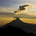
Clouds form over Taburu in <<NAME>> National Park.

A lone giraffe in <X> National Park.
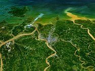
Aerial view of the Umawu River Delta.

Birds take flight in a <X> mangrove forest.

A boat floats near shallow coral reefs in <X>.


History

The eastern coast of Malaio is one of the oldest continually inhabited regions on Earth. Stone tools exacavated from archaeological sites in Zanzali's northwest have been dated back to as early as 100,000 years ago, and fossil specimens elsewhere have been dated as from between 200,000 and 300,000 years ago. Zanzali's indigenous inhabitants are believed to have been various xKhasi-speaking peoples, who practiced hunter-gatherer lifestyles among the lakes and savannas.
Approximately 6,000 years ago, Proto-Karaihean speakers began settling the coasts of southeastern Malaio, displacing xKhasi-speakers and pushing them further into the hinterlands and eventually developing into the Tuganani and Gunyari peoples. In the swamplands of northwestern Zanzali, around 3500 BCE, the Tuganani Tiom civilization became one of the cradles of civilization. The Tiomi practiced sophisticated environmental engineering through the draining of swamps and irrigation of surrounding areas, allowing them to cultivate crops such as bannanas, sugar cane, and taro. They also practiced a form of early ironworking. Tiomi city-states dotted the coast of the Karaihe Sea and saw frequently trade and conflict with Proto-Onekawan and xKhasi groups on their frontiers. Archaeological finds suggest that Tiomi goods were traded as far as modern Fahran and Kajera. The Tiom civilization began to decline around 1000 BCE, possibly due to a prolonged drought in the region.
_(14774397124).jpg)
Beginning around 200-500 CE, the final stages of the millennia-long Komontu migrations began to reach southern Malaio. Practicing slash and burn agriculture alongside nomadic cattle pastorialism, they initially migrated south along the coast before reaching what is now western Zanzali. From here, they gradually spread out and began to mix with the local populations, eventually forming the foundations of the modern MaZanzi ethnic group. Further migration southeast along the coast was prevented by aggressive defense of their territory by Onekawan tribes. This is the subject of a mythical folktale in the region which has many variations, but is broadly described a century-long conflict between tribes on both sides of the Hanaki River.
While these Proto-MaZanzi groups ceased to be nomadic, they formed polities much larger than an individual large village during this period. Large herds of cattle, which were novel for surrounding Kairehean populations, often represented the collective wealth of the village. While Komontu beef was a popular export in the region, cheese took several centuries to catch on. By the late 700s CE, the Proto-MaZanzi were also beginning to serve as middlemen between groups in the southern Malaioan interior and the greater Ozeros Sea region, moving gold, ivory, and slaves north, and in the process attracting the attention of the budding Tahamaja Empire.
Age of Pearls
.jpg)
In the early 900s CE, military expeditions from the Grand Tahamaja began arriving along the coastline of modern Zanzali in the beginning of the period now termed the Age of Pearls. Having fully consolidated control over their home islands, Za’gree elites sought avenues for economic expansion throughout the Karaihe and lower Ozeros. This began with trading outposts on the coast, and gradually expanded to include tributaries further inland. However, the inhospitable terrain prevented full-scale colonization beyond the immediate coastline.
Tahamaja rule also brought N'nhivara to the MaZanzi coast. Many MaZanzi tribes converted en mass, either due to the mass adoption of immigrants or in order to secure favorable arrangements with Tahamajan authorities. Temples and monasteries became centers of political and economic importance, bringing consistent development and resources in their wake. Typically, these Mzanzi converts would syncretize N'nhivara with traditional folk religion, incorporating beliefs about a creator-and-sky god and ancestor worship.

Although the region was initially valued for its connections to the interior's gold and ivory trades, under Tahamaja rule it quickly became a major center for the production of sugarcane and spices (such as nutmeg and cinnamon) as well. In 933, Pelutama Garaj Ritarja Anukana, not wanting to enslave large numbers of locals for fear of disrupting the steady flow of valuable goods from the interior, ordered that coastal plantations be populated with enslaved criminals and political dissidents from throughout the Tahamaja. This resulted in an influx of diverse cultures from throughout the Ozeros as enormous numbers of prisoners were pressed into hard labor each year, ballooning the population. Between 933 and 1000, it is estimated that the territory's population grew as much as 300-500%. These imported ethnicities were generally assimilated into existing Proto-MaZanzi clans, either as side effect of Tahamajan bargaining or by choice of individuals fleeing slavery or purchasing their own freedom, gradually creating a vast ShiZanzi-speaking creole group which would become the majority population of the region, encompassing Komontu, Tuganani, Gunyari, and countless pan-Ozerosi influences.
The sheer number of criminals and political dissidents among the original colonial population fueled a rich, boisterous tradition of rebellion against Tahamajan authorities. This took many forms, ranging from defiance of colonial borders and taxes to open insurrections. Fraud, smuggling, and free movement of entire groups of people were common. As military service was a relatively straightforward way to secure one's freedom, and generally took less time than saving up enough money to purchase freedom, the region also became famous for its sailors and mercenaries, particularly versatile ikrele-wielding troops who were known to be as capable on horseback as trudging through coastal swamplands. These troops were used extensively by the Tahamaja in military campaigns throughout the Ozeros alongside many other auxiliaries, such as the Onekawan Kaiponu Tauā.
With the eruption of Mt. Siriwang in 1353, the Tahamaja entered a period of violent decline. In the Karaihe, this took the form of local administrators being replaced by regional warlords, often mercenary commanders tied to local clans. By the year 1400, the last vestiges of colonial governance had crumbled and given rise to nearly thirty independent MaZanzi polities.
Age of Fire

The period following the collapse of the Tahamaja in Zanzali is historiographically referred to as the Age of Fire. Fierce competition between warlords and minor principalities or republics became the norm, and the cultural concept of shehena fully crystalized. Shehena encompasses the concept of treasure or cargo brought back from raids or trade expeditions, which is then redistributed among the clan and community in order to bolster the reputation of the ones who retrieved it. This would rapidly become the focal point of MaZanzi politics in the power vacuum left by the Tahamaja, resulting in many families sending their sons abroad, either as warriors or merchants, to bring back new wealth, spreading MaZanzi individuals across the Ozeros while simultaneously importing vast foreign cultural and economic influences in return. Piracy, ritualistic battles, and major public works projects became the norm, particularly among the coastal states, but no MaZanzi polities managed to deliberately project power outside of their immediate Karaihe neighborhood.
Eventually, the N'nhivara monastaries and temples that had once served as the epicenters of Tahamaja economic power re-emerged as the arbiters of disputes between warlords. Seen as neutral middlemen, N'nhivara monks would be entrusted as mediators and guardians of the peace; in many areas, they would resume their economic role, this time receiving a portion of shehena from all local rulers to be redistributed to the needy or to organize key industries, such as papermaking or dyeworks. Thus, the temples were locked into a constantly shifting balance of power the with warlords and magistrates, masked by their religious and economic functions. Their actual, functional power ranged from purely ceremonial, giving legitimacy to the rule of local lords, such as in X, to being the de facto authorities in a region, such as in X.
In 1463, the Gharib qadi az-Zubayri arrived in Kabaweyo, becoming leader of the nascent 'Iifae community there. Founder of the Zubayriyah tariqa, he spread Azdarin to Zanzali and the southern Ozeros region. Characterized by lenient positions on taboos, veneration of local spirits, and the use of music, hashish, and dancing in worship, Zubayriyah grew popular in the region and, to varying extents, syncretized well with N'nhivara and local folk religions. With time, this led to increased contact and trade with Fahran and the northern Ozeros region. By the mid-1500s, Zanzali was a thriving center of the Azdarin faith, known as a pluralistic safehaven and entrepot throughout the region, connecting the Gharib, Zacapine, Pulaui, and Kayatmani worlds.
Maok'ab period

During the 17th century, much of the Ozeros came under the suzerainty of the Mutulese empire. Mutulese trade companies, the Nuk Nahob, began establishing trade ports throughout the region, from which they established a monopsony over valuable goods and controlled shipping in the Ozeros Sea and Makrian Ocean. While the Divine Throne did not establish direct colonial control over much of the region, many groups throughout the Ozeros were heavily employed as mercenaries and sailors by the various Nuk Nahob, and workers or slaves were moved huge distances to meet economic desires, contributing to massive migrations of peoples across the region in what is sometimes described as a resurrection of the dynamics of the Grand Tahamaja. In 1680, the Mutulese possessions along the southeastern Malaio coast, from Sina’uia to Montunui, were integrated into the Yajawil of Maok'ab, which Zanzali would remain under until it gained independence in 1841.
Zanzali benefited greatly from arrival of the Mutulese. Increasing amounts of international trade opened new avenues for the collection of shehena, through trade, service, and piracy; Mutulese plantation owners imported vanilla and kakaw to grow as cash crops, and also introduced raised field agriculture throughout Zanzali's vast coastal swamplands and interior river valleys. Gold, ivory, and gemstones funneled from the interior were also highly valued by Mutulese companies seeking to compete with Zacapine interests in Pulacan, leading to several proxy wars in the continental interior.

MaZanzi piracy in the Ozeros was largely tolerated by the Mutulese for some time, seen as a rounding error, compared to the vast amounts of trade flowing through the region, that would be more expensive to fix than to let go. This changed with the First Shamabalese Great War from 1638-1645, which saw a massive influx of Mutulese military forces into the Ozeros, and gave the Mutul both the pretense and capability to crack down on the MaZanzi pirate-lords once and for all. Mutulese trade ports and districts in Zanzali asserted political-military authority over the surrounding cities; holdings were reorganized under the authority of batabs ("mayors"), pro-Mutul and Mutul-educated elites who handled matters of security, justice, and taxation. Over time, the batabs began sharing responsibilties with the Nn'hivara monastaries in an attempt to keep local lords weak.
Following the Tsurushimese revolution of 1750, the Mutulese empire in the Ozeros and Makrian entered a terminal decline. Seventy years later, during the Second War for Kahei, the Mutulese definitively lost control over most of their possessions in the region. Finally, the Arthuristan Ultimatum of 1841 marked the end of the Mutul's colonial empire. The Kingdom of Zanzali emerged as an independent country in 1841 under the rule of Elikhulu Kalalo, the Prince of Babamamba. The Mutulese bureaucracy took roughly a generation to fully dissolve, being progressively replaced by an emerging class of well-educated aristocratic professionals.
Unification to Great Kayatman War
Elikhulu's rule focused on industrialization and catching up, both economically and militarily, with Zanzali's larger neighbors. The king invited numerous foreign experts and thinkers to Zanzali, seeking to devise a unique economic model and secure modern military technologies. Rezese consultants were instrumental in divising a long-term development plan, leveraging newly discovered deposits of chromium and cobalt, alongside well-established gold, cotton, and leather industries, to establish Zanzali as an international center for textile production and the manufacturing of precision tools and machined parts. Alanahri advisors encouraged the development of a wide-reaching railway network and a large engineering corps as the focus of Zanzali's military doctrine, and also founded the Al-Palij Military College in Babamamba. Massive industrialand agricultural estates were consolidated under the ownership of a class of intermediate nobles, the awoji. Elikhulu died of pancreatitis in 1915 at age 66, and was succeeded by his nephew, Jama, by way of his sister Mzimasi.
These industrialization programs coincided with the rise of ultranationalism and militarism throughout the lower Ozeros region. With Mutulese rule passing out of living memory, many former colonies sought to assert their legitimacy as sovereign regional powers in the face of continued neocolonial encroachments. Around the Karaihe Sea, this often took the form of Neo-Tahamajaism, which looked to the Grand Tahamaja as a golden age to emulate. In Zanzali, Neo-Tahamajaism placed an emphasis on the MaZanzi ethnic group's mixed ancestry, claiming that all Tuganani, Gunyari, and Komontu groups in southeastern Malaio were, in effect, MaZanzi, and should be ruled by the government in Babamamba.
This rhetoric eventually led subterfuge in and attempted annexation of several territories neighboring Zanzali which had large MaZanzi minorities, including Ngāti Waimoto in Onekawa-Nukanoa, Tshekedi in Pulacan, and Siva'uia in Pualau Keramat. In 1927, this culminated in the MaZanzi invasion of Onekawa-Nukanoa, beginning the Hanaki War, which is widely considered to be the opening phase of the Great Kayatman War. This conflict would pit Zanzali against much of the great Ozeros and Kayatman region, supported primarily by the Shenzhou Empire, Lusoña, and, until 1928 when it switched sides, Pulau Keramat. The Great Kayatman War was extremely destructive and marked the end of Zanzali's attempts at being a regional power.

An estimated 10-15% of the entire population of Zanzali at the time perished in the course of the Great Kayatman War, largely attributed to a concurrent typhus epidemic exacerbated by wartime conditions and deadly battles. Economic ruin and demographic collapse resulting from the war and epidemic led to widespread unrest in Zanzali. King Jama died on July 18th, 1929 at age 55 due to complications from typhus, causing his 23 year old nephew Mongezi, by way of Jama's aunt Zanele, to inherit the throne.
Lily Revolution to present
By 1930, economic and political chaos began to severely impact the MaZanzi war machine as supplies and forces were stretched thin and the general population began to reach its breaking point. As Zanzali began to suffer severe military setbacks on the Western Front, Jama was overthrown in the Lily Revolution, in which, in response to a series of popular protests, a military faction calling themselves the Tigers of March seized control of the government. Led by Colonel Zenzo Yowari, the Tigers promised to end the war and steer the government in a more populist direction.
Government and politics

.jpg)
Law

Foreign relations
Military

Administrative subdivisions
Zanzali is divided into 9 viceroyalties (<<NAME TRANSLATION>>), which are provinces that are governed by viceroys (oolasha basowenza, "acting-kings") with considerable autonomy via power devolved from the central government.
Economy
Agriculture
.jpg)
Despite being a relatively small country, Zanzali boasts a diverse agricultural industry, producing a variety of crops such as maize, beans, coffee, cotton, and bananas. The country's diverse terrain and tropical climate provide ideal growing conditions for these crops. Since the 1970s, Zanzali has also seen a rise in the cultivation of specialty crops, such as avocados, macadamia nuts, and mangoes, for export to international markets. This has created new economic opportunities for farmers and has helped to diversify the country's agricultural offerings. Additionally, the government has been promoting sustainable agriculture practices, with a focus on conservation and protection of the environment. In addition to traditional crops, Zanzali has a growing aquaculture sector, focused on producing high-quality fish and other seafood for both domestic and export markets, including shrimp, tuna, and shellfish. The government has provided support for the development of this sector, including investment in hatcheries, processing facilities, and marketing. Cattle and poultry are the primary livestock raised in Zanzali.
The government of Zanzali has been working to improve the agricultural sector, with a focus on modernizing the industry and increasing productivity. This has included investing in infrastructure and providing support for small-scale farmers. Since the 1890s, an extensive network of canals and dams has been developed to ensure that farmers have access to water throughout the year, even during periods of drought.
Tourism

Energy

Demographics

According to the 2020 census, Zanzali had a population of 39,819,280, making it the least populous country in southern Malaio.
| Rank | Viceroyalty | Pop. | |||||||
|---|---|---|---|---|---|---|---|---|---|
 Babamamba  Kabaweyo |
1 | Babamamba | Babamamba | 7,580,937 |  Umayeye Dankada | ||||
| 2 | Kabaweyo | Kabaweyo | 5,759,724 | ||||||
| 3 | Umayeye | Umayeye | 4,344,587 | ||||||
| 4 | Dankada | Kabaweyo | 3,192,639 | ||||||
| 5 | Belabwane | Dankada | 2,958,836 | ||||||
| 6 | Umgxobozho | Umgxobozho | 2,274,387 | ||||||
| 7 | Ntyambo | Babamamba | 1,758,458 | ||||||
| 8 | Lembalemba | Lembalemba | 1,383,121 | ||||||
| 9 | Diyome | Umgxobozho | 791,153 | ||||||
| 10 | Obuzime | Obuzime | 685,326 | ||||||
Languages
Religion

Education
The core of the modern MaZanzi government rests upon the Granda Malasa's yokwakheka (literally "composition [process]") colleges, wherein members of the clergy are trained and certified in a vast array of specialties ranging from finance, to engineering, urban planning, and more, thus turning the clergy into the backbone of the country's professional class. They can then be trained in jurisprudence and policy studies, allowing them to take on leadership and judicial roles under the title umgweba. Due to the far-reaching effects of the yokwakheka on the educational system, approximately 30% of Zanzali's domestic-born population holds some sort of clerical title.
Health
Culture
.jpg)
Architecture
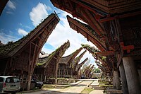
Traditional houses in western Lembalemba.
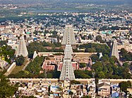
A Mutulese-style campus in Kabaweyo.

An example of a modern building using traditional architectural styles in Babamamba.

<<NAME>> Center in downtown Babamamba, the tallest building in Zanzali at 306 meters (1004 feet).


Clothing

Cuisine

- ↑ In modern times, “PoNyjanjale” is typically only used in poetic or nationalistic contexts.