Mniohuta
Confederation of Mniohuta ᐅᔭᑌ ᒼᓂᐅᐦᑕ 1 official name
| |||
|---|---|---|---|
| Motto: «ᐁᓬ ᖧᐊᑲ ᓬᔪᑎᔦᑭᔭ, ᐅᐘᐁᐃᓬᐊ᙮» "In great endeavour, union." | |||
| Anthem: ᐅᐩᐊᑌ ᐅᓬᐅᐘᐣ Oyáte Olówaŋ "Song of the Nation" | |||
| People's Hymn: ᑭᑭᙾ ᓬuᑕ ᐦᐁᐦᐁᐱᔭ Kikiŋ Luta ȟehépiya "For the Scarlet Hills". | |||
 Location of Mniohuta on Earth. Members of the Norumbian People's Alliance in Blue. | |||
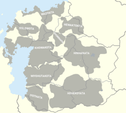
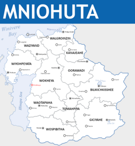 Political Map of Mniohuta | |||
| Capital | Wokheya | ||
| Largest city | Walgroinzin | ||
| Official languages | Mniyapi | ||
| Recognised regional languages | |||
| Ethnic groups (2020) | [a] | ||
| Religion | List of religions
| ||
| Demonym(s) | Mniohutan Mniohuti (plural) | ||
| Government | Parliamentary federated constitutional monarchy | ||
• Premier | Chaska Chimaka | ||
• Great Chief | Odakota Akecheta | ||
| Legislature | Conclave of the Confederacy | ||
| Conclave of Elders | |||
| Conclave of the People | |||
| Formation | |||
• Event | Around 12,000 BCE | ||
• Founding of Wokheya | 935 BCE | ||
• Asherionic Wars | 1805 | ||
• Articles of Confederation | April 14th, 1822 | ||
• Absorption of the Republic of Waziyand | January 20th, 1846 | ||
• The Spring Constitution | November 3rd, 1865 | ||
| Area | |||
• Total area | 897,115 km2 (346,378 sq mi) | ||
• Water (%) | 5 | ||
| Population | |||
• 2020 census | 29,874,102 | ||
• Density | 30.19/km2 (78.2/sq mi) | ||
| GDP (nominal) | 2020 estimate | ||
• Total | $457,073,760,600 | ||
• Per capita | $15758 | ||
| Gini (2015) | low | ||
| HDI (2015) | very high | ||
| Currency | Mniohutan mazaska (₼) | ||
| Time zone | UTC -5 | ||
| Date format | dd/mm/yyyy | ||
| Driving side | right | ||
| Calling code | +68 | ||
| Internet TLD | .mt | ||
Mniohuta (/mniːoʊhʊtjæ/ muh-nee-O-hu-ta), officially the Confederacy of Mniohuta, is a country in northeastern Norumbia. Its consulates cover a landmass of around 897,115 square kilometers (346,378 square miles), bordered by Elatia to the Northwest across the Hinapa strait, the Hinapa Sea to the West, Winivere Bay to the North, Awasin and Moxaney to the Northeast, Chenes to the West, and Gristol-Serkonos to the South. The majority of the 29,000,000 citizens of Mniohuta live in major cities such as Walgroinzin or in the central plains along the many rivers that snake along the thanzanye plain. Wokheya is the capital of the country while Walgroinzin is the largest and most populous city in the country. Mniohuta is characterised by a largely indigenous population, with a significant Ottonian-Mniohuti creole group, and a handful of other minorities from nearby states.
Various indigenous peoples have inhabited what is now the thanzanye plain since at least 12,000 BCE, remaining largely nomadic until the foundation of what is today Wokheya in 925 BCE by members of the Thituwan tribe and the formation of similar settlements in Mniwa and Oskopa in the following years. Unlike many of its neighbours, the central portion of Mniohuta has never been colonised or settled by a foreign power, with indigenous people living largely undisturbed due to a number of geographic barriers. A handful of Ottonian settlers and fur-trappers made their home on the Northern shore of the country, journeying down from the colony in Wazheganon in search of wealth and open space who formed what is today the consulates of Walgroinzin and Waziyand. While traditionally it was believed that the arrival of the Ottonians was the first contact of indigenous Mniohuti with outsiders, modern historians believe that Haratago nomads and explorers passed through the prairies of central Mniohuta at some point in the 10th or 11th century en route to modern day Elatia and Enyama.
By 1500 BCE, many tribes of the thanzanye plain had organised themselves into proper cooperative city-states which co-existed with a number of still nomadic tribes, both having traditionally tribal governments; though, in the case of the city-states many were beginning to form more complex governments. While conflicts between tribes were not uncommon, evident in the warrior-hunter culture, the states were also marked by their willingness to compromise and settle disputes in less violent manners such as game hunting matches and lacrosse (čháŋškopa) tournaments. This largely amicable culture was reflected in willingness to barter and interact (and in certain cases, integrate) with the Ottonian settlements along the Northern coast. Despite the growing centralisation of Mniohuti city-states, it was not until the arrival of Asherion in the mid-1800s that the idea of creating a proper nation-state was more thoroughly popularised.
Representatives from Mniohuta including the Chief of Wokheya and founder of the confederation, Spotted Eagle (Gleškáŋblí), would participate as delegates in the Federative Republic of Great Norumbia's short-lived legislature before the republic's collapse at the hands of the coalition. Upon his return to Wokheya, Spotted Eagle called for a meeting of the tribes in what would be called the Eight Fires Council, an effort to achieve consensus on the formation of a state and to continue in spirit the revolutionary ideals of Asheiron with Mniohuti characteristics. The Council ended after a month of deliberation with the signing of the Articles of Confederation, formalising the role of Great Chief in the early confederation and allowing the confederacy to send representatives to the Congress of Thessalona to negotiate land claims. From the Congress, the Confederation of Mniohuta was formally recognised as a sovereign state alongside the Republic of Waziyand. A decade later the now largely creole and indigenous Republic of Waziyand was peacefully absorbed into the Confederation, leading soon after to the addition of democratic concessions to the Articles of Confederation which would later lead to the writing of the Spring Constitution (Wiwíla Wóopȟe). Contemporary Mniohutan history has largely been characterised by tensions with Elatia over the ceding of the Wiyopeyata peninsula as a result of a Numerian rebellion, an action reversed in 1993 after unrest in the region lead to a popular movement to rejoin Mniohuta.
The Government of Mniohuta is a libertarian socialist federation in the Council Democracy (Thiyóthipi School) and co-operative traditions, with a nationally elected Premier who acts as a representative of the nation and presides over the conclave of the people, and a council elected Great Chief who serves a largely ceremonial and spiritual role within the nation. Since the signing of the Spring Constitution in 1865 a system of conclavism has been a key part of Mniohutan politics, with 580,000 nested conclaves at its base, it is a system that is heavily dependent on almost total participation and consensus of the populace. At the national level Mniohuta has a bicameral legislature with a Conclave of the People and Council of Elders; however, the Conclave of the People has de jure total control over national decision making. The Council of Elders exists in its role largely as an advisory body, with the only real responsibility of the Council being to elect a Great Chief upon the death or recall of the previous and to rubber-stamp legislation.
Because of its political evolutionary path, the traditional economic systems of the early Mniohutan city-states evolved into a system of co-operative economics, with basic-needs traditionally being decommodified and most businesses being a hybrid of consumer and worker cooperatives (or are otherwise owned by the state). Major industries and exports include diamonds, iron, textiles, forest products, shipbuilding, railway engineering, and tourism. Mniohuta ranks highly in international measurements of political freedoms and participation, government transparency, education, and quality of life. International experts consider Mniohuta to be a middle power with a geopolitically strategic and central role on the continent. It is a member of a number of international organisations such as the International Observatory of Labor, Osawanon community, and is a founding member of the Norumbian People's Alliance (Hahowin).
Etymology
The origins of the name Mniohuta stem from the Mniyapi word Mnióhuta (ᒼᓂᐅᐦuᑕ) which roughly translates into english as "Land by the Sea" or "Land of Coasts". The first use of the word Mniohuta was uncovered in a letter from the Third Chief of Wokheya, Lion Chaser (Igmútȟuwá) of the khowakota tribe to Golden Eagle (Wíyamázkazi) of the Mnokiwoju tribe in which he invited his fellow chief to join the settlement "Rest your weary legs, new life springs from our land by the lake like the yarrow from the grasses." The term gradually became synonymous with Wokheya and many of the other settlements and tribes that dotted the shores of the Hinapa Sea, growing more popular as it spread inland through word of mouth of the nomadic tribes moving inland during the summers. While the term Thituwan was more popular for describing the people of the Mniohutan prairies than its modern demonym, describing the land as one by the lake was the most conventional as most tribes would eventually make their way back to it during the winter resting season. In winter counts the name was most frequently recorded, especially in documents after 1258 CE, with the name finding itself equally applicable for the settlements in Skhabela and Oskopa. When first contact was established with Ottonian trappers, the first natives they had encountered were the Waziyaki tribe of the Northern coast, with the trappers using the tribe's name and combining it with the Ottonian word "land" to create Waziyand which became synonymous with Mniohuta as an exonym. Following the adoption of the article of confederation a few formal names were considered, but Mniohuta rose to the top for how general it was and how frequently the term had become and when the delegates arrived at the Congress of Thessalona it became the internationally recognised name of the country. While this was largely done out of the wishes of the Thituwan people, this was also to avoid confusion with then then newly created republic of Waziyand to the North.
Demonyms
While a handful of nicknames for the land persist, there is a general sense of consistency when referring to the country outside of the realm of minority languages such as Wazhewen. In its noun form "Mniohutan" is almost universally considered the preferable term, with the adjective "Mniohuti" largely only being used to describe the population though is sometimes used to replace the noun in certain regional dialects.
Official title
Officially, the country is referred to as the Confederacy of Mniohuta (Mniyapi: Oyáte Mnióhuta, ᐅᔭᑌ ᒼᓂᐅᐦᑕ), a name enshrined in the national constitution since the writing of the first articles of confederacy to officiate their role as a nation state. While Mniohuta has strayed far from its confederal roots and shares far more characteristics with a federation in the modern era, it is still regularly referred to colloquially as "The Confederation" because of its history. While a referendum in 2003 on the matter of removing the title of "Confederacy" from the official title of Mniohuta in exchange for a national prefix such as federation or kingdom, there was very little popular support for the change and it ultimately was voted down by the conclave of the people.
Geography
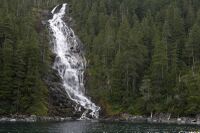
Making up a total land area of 977,728 km2, Mniohuta is the third smallest country on the Norumbian continent and is geographically central. Along the northern border of the confederacy is Winivere bay and to its West is the Hinapa strait and the Hinapa sea. Bodies of water aside, the northern Wazepiya Mountain Range is the major defining feature of Mniohuta's north and provides the majority of the country's mineral wealth. The Wazepiya range is also home to one of the highest mountains in the country and in the Winivere Cordillera, Mount Wichahcala, which stands at 4,421 meters. In the Southeast are the Osowanon Mountains which mark the primary border between Mniohuta and several of its neighbours. The heart of the nation is largely defined by the Thanzanye Basin River System which stretches from both mountain ranges through its tributaries down to the nation's southern coastline. To the nation's East across the Hinapa strait is Elatia, to the south is Gristol-Serkonos, to the West is Chenes and a narrow strip of land connecting it to Moxaney, and to its Northeast is Awasin.
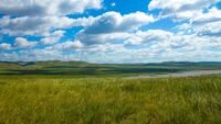
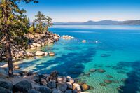
While the mountains remain prominent geographical features for the nation, the vast majority of the country is enveloped by the Thanzanye Plain. Running through the central section of the country is the Mnisose River which runs through Wokheya, and its distributary the Wazaze River which, similar to its parent river, empties into the Hinapa sea. While a majority of the water that flows into the aforementioned rivers comes from the mountains, Lake Oskopa and Lake Ciz also serve as major reservoirs that feed into the river system (though they themselves get a majority of their water from mountain snow-melt, glacial melt, and runoff). Lake Oskopa is the largest freshwater lake in the country, occupying roughly 2,158 km2 and reaching a maximum depth of around 706 meters, it is the remnant of a prehistoric lake known as Lake Iya which at one point connected to the Hinapa sea at the conclusion of the Last Glacial Maximum.
Climate

Mniohuta's climate is largely defined by its Semi-arid climate, with warm, humid Summers and Springs driven by warm air blown North from Gristol-Serkanos which bring rains and summer storms to the flat and hilly prairies that compose most of the nation's heartland. The north is far colder, with the Wazepiya Mountains acting as a natural barrier that limits the cold winds from The Boeric to Mniohuta's north. Winters often bring heavy snow to the north, often bringing meters worth of snow each winter; while the Thanzanye Plain often gets at least a few centimeters each season, with the stray snowstorm sometimes bringing more in particularly cold years. Along most of the major mountain ranges and peaks in both the North and South of the country are thick boreal forests that provide shelter for much of Mniohuta's megafauna alongside grassy steppes. Temperature coniferous forests are rarer but can be found in particularly high densities along the Southwest. Because of the unusual geography of the country there are a number of small cold deserts in the North, the most notable of which being Čhasmú pahá (ᐨᐦᐊᐢᒪ ᐸᐦᐊ), a protected reserve south of Osmaka.
The Northeast of the country is largely characterised by its subboreal climate which keeps the North temperate and dry in the Summers and cold and wet in the Winters. Despite the mountainous terrain, there are a number of flat lands and natural ports that are ideal including, most famously, the port at Walgroinzin which shields ships from the rough winter seas and stray ice bergs and is one of the largest natural harbours in the country. Grasslands in the Northeast and West are usually lightly forested and closer to cold steppes seen in other countries in the north of Belisaria. Much like in other parts of the country there are a number of sizeable boreal forest scattered about the North. Because of shifting plates along the coast, seismic and volcanic activity in this part of the country being a re-occurring historical theme: most notably with the eruption of Mount Pȟáŋéta's major eruption in 1982.
Western Mniohuta's coast along the Hinapa sea is much like the rest of the country's heartland, largely featuring low hanging cliffs and flat shores that meet the rich prairies and West-flowing rivers. Because of the largely flat terrain and occasional mixing of cold and warm weather, cities in the heartland of the country are especially at risk for natural disasters such as tornadoes. Thunderstorms are also a frequent feature of Western summers, with hail damage being an occasional concern in the Spring when warm winds from the South meet the cooler winter winds from Elatia.
Biodiversity
Mniohuta is home to a wide variety of endemic species, with thousands of native plants being recorded in the Journal of Multifariousness and a wide selection of herbivores and carnivores also being scattered throughout the country. In terms of plant life, a wide variety of wild flowers including the Thanzanye Poppy are especially common in the Spring and last through the Summer. Certain species of flower such as the Utahu-čhaŋȟlóǧaŋ (ᐊᑕᐦᐊ ᐨᐦᐊᐣᐦᓬᐅᐸᐣ) grow year-round and are very frequently used in traditional herbal medicine and tea. In the handful
of cold deserts scattered throughout the country, a number of Cactaceae species thrive, including some more well known varieties such as peyote (Uŋȟčéla, ᐊᐣᐦᒉᓬᐊ) which have historically been used for cultural and religious ceremonies. More common along the mountains and wetter coasts of the north is the Wazepiya Pine which accounts for a majority of the coniferous trees that exist throughout the country, though especially highly concentrated in the Wazepiya mountains.
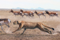
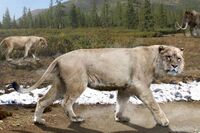
Mniohuta is also home to a wide variety of land-based mammals and megafauna which have thrived in the last two centuries due to conservation efforts and selective hunting. Mniohuta is particularly well known for its variety of Pantherinae and other species of the Felidae family; many of which are believed to have evolved from Prairie Lions to fill specific biological niches, among these species are: Prairie Cheetahs and Mountain Lions. The Norumbian Grey Wolf can also be found in scattered packs along the Wazepiya Mountains feeding largely off stray herds of Bison and White-tailed deer and are often found in competition with Mountain Lions. The Forest Pygmy Mastadon can be found in small herds throughout the north of Mniohuta, though are largely limited to mountains because of historical over-hunting. Bison are the most common of the larger herbivores in the country, often constituting herds of hundreds that migrate across the Thanzanye Plain depending on weather and prevalence of grazing lands.
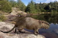
The Thanzanye Basin River System is home to a wide variety of fish and other water-based wildlife, including a number of semi-aquatic mammals such as the Norumbian River Otter, Mniohuti Castador, and Norumbian Mink. Salmon are a common feature along Mniohuti rivers, often migrating from the lakes in Mniohuta's East to the Hinapa Sea in the late Summer to early Winter. Other than salmon, other fish such as Mnisose Pikeminnow, Huíyata, Ištápiya, and Hóbu among other smaller minnows and the like are common. Overfishing had driven many of Mniohuta's fish to the endangered status in the last century, but thanks to conservation efforts started in the 1960s and more sustainable fishing efforts their populations have largely recovered over the course of the last three decades. Along the north coast and in the Hinapa sea larger sea faring creatures such as walruses, beluga whales, orcas, bowhead whales, White-beaked dolphins, and Ringed seals are common features and can often be spotted from shore along the country's many coasts.
Casitdors are the largest members of the Castoridae family and among the largest water-faring herbivores in the country.
History
Evidence of human habitation in what is now Mniohuta dates back to at least 10,000 BCE as early nomadic humans travelled South from present day Wazheganon and Awasin to the Thituwan basin. Oral tradition and archaeological records show that the early settlers were largely nomadic, following herds of mastadons and bison and engaging in the hunting and gathering of wild plants. As tribes grew bigger and herds split apart people spread across the prairie and even further to the North and would, on occasion, re-convene at certain geographic points such as modern day Wokheya and Mount Hanshke in order to trade and share goods. This tradition gradually evolved into the annual Sun Dance, a tradition that has persisted into the modern day.
Gradually dialects began to form and minor differences in languages such as Khowakota and Winhanayapi began to develop, kept only from drifting into their own language categories by the regular interaction of tribes. As the tribes became more distinct, certain inter-tribal rivalries would come and go, but very little permanent warfare was had other than occasional competition over herds of bison. One such battle, described in oral tradition as The Three Bison War (Yámniéȟčaka Okíčhize, ᔭᒼᓂᐁᐦᒐᑲ ᐅᑭᐨᐦᐃᓭ) led to the clashing of the Wiyohutakota and the Iyothata tribes over a breeding pair of bison that led to three days of bloodshed that concluded with what is perceived today as a tornado interrupting the battle and the marriage of two warriors from the opposing tribes. While often what evidence of this period exists largely through oral tradition that was put onto paper in the 19th century, Mniohutan scholars both religious and secular believe that they are all largely based on true stories mixed in with elements of hyperbole and mysticism. Many scholars hold that through the annual Sun Dance these stories and legends would be passed between shamans who would then eventually add their own twists which is where a majority of the elements of mysticism are believed to have come from. Archaeological records from epigraphic inscriptions at dig sites across the country tend also to lend credence to these stories, with the Tale of the Lion's Cub (Ohúŋkakaŋ Tȟamúčhiŋčála, ᐅᐦᐅᐣᑲᑲᐣ ᖬᒼuᐨᐦᐃᐣᒐᓬᐊ) being inscribed in its entirety on a rock near Ipha with a lion's skull and that of its human companion placed beneath the inscription. While critics object to the validity of some of these tales, particularly the mystical elements employed, most in Mniohutan society still consider the lessons taught by them to be fundamental to early education and cultural preservation.
Gradually life within Mniohuta began to grow more pastoral as populations of the indigenous people continued to increase in number. While hunting Bison and other large mammals was no less important to a majority of the tribes, certain tribes began to domesticate buffalo calves which began to evolve into a method more frequently practised. These domesticated buffalo would travel with the tribes, acting as a reserve of food in low hunting seasons and providing milk, cheese, and occasionally meat. Alongside domestication of buffalo, long term agriculture also became a growing practice, with many tribes often planting maize, beans, and squash which began to overtake the gathering of wild plants as an essential part of Mniohutan diets in their fall and spring camps. Early attempts at drying and storing foods for later use became more frequently employed, but were not immediately used because of the difficulty of transporting large amounts of food without the use of pack animals. It was around this time that other important practices grew in popularity, with tribal communalism having always been something of a common phenomenon as people were often keen to share with other members of the tribe in exchange for favors or other goods; but, it was at this point in history that it became ingrained not only into the culture, but also into religion. The importance of the tribe (Oyáte, ᐅᔭᑌ) as a social unit over the individual was increasingly stressed by shamans, with Kinship networks (Thiyóšpaye, ᖨᔪᐢᐸᔦ) also playing an essential role in this structure, particularly in terms of they layout of tribal camps.
The Era of Ash
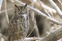
As populations continued to grow, the plains and forests of Mniohuta were beginning to be faced with an onslought of overhunting. Species such as the Forest Pygmy Mastadon and Norumbian Castador were pushing well into the realm of being endangered species, and several large bird species that had been native to their portion of the continent had been driven to extinction. While buffalo herds were not particularly endangered, there was growing competition between tribes over them which culminated in a series of small-scale wars which fueled rivalries that only worsened the situation.
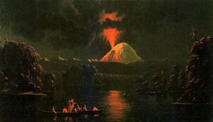
In the Summer of 835 AD, Mount Pȟétawókh (fire lodge, ᑊᐦᐁᑕᐓᐠᐦ) had a massive eruption, covering much of the Thanzanye plain in ash and drowning the skies for a period of 6-8 months. Pyroclastic flows also wiped out a number of minor settlements that had been situated within a few kilometers of the volcano, with harrowing tales from refugees from the initial disaster working their way into legend. The initial affect was a regional cooling that lead to a weak growing period and the dying out of many grasses across the plains and the death of many buffalo. The ensuing famine killed roughly 25% of the indingenous population, and lead to the migration of many Thituwan from various tribes to the North seeking new pastures and farming land in the South of modern Wazheganon.
This period was viewed by most shaman as a punishment from the Great Spirit (Wakȟáŋ Tȟáŋka, ᐘᐠᐦᐊᐣ ᖬᐣᑲ) for overhunting the land and is viewed by most modern historians as one of the main reasons for the expediting of the shift towards sedentary life. At the next year's Sun Dance, shamans emphasized the importance of nature and sustainability, and pointed to the limited impact on more agriculture centered communities during the Era of Ash as evidence that this was not what the gods had wanted. The buffalo and other animals were considered brothers, and to hunt them for anything other than the sustenance of oneself or one's community would bring dishonor and bad luck. Likewise, this lead to a number of religious reforms which turned the region's primary faith into a more organized tool for enacting social change and solidified the importance of the Thiyóšpaye (Kinship network, ᖨᔪᐢᐸᔦ) as a social unit. As the ash subsided and the lands grew more fertile, the Mniohuti were well on their way towards forming city states.
City States Period
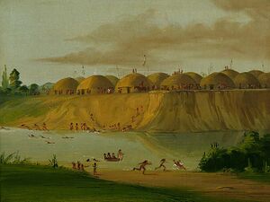
Wokheya was the first of the permanent settlements to form in 935 BCE, acting as a long-term settlement for those who were either too old, too young, too physically impaired, or were generally uninterested in continuing to migrate. Traditionally the area had been used as a Summer camp by the Khowakota Oyáte (Khowakota Nation, ᐠᐦᐅᐘᑯᑕ ᐊᑎᐅᐣ), but was occasionally populated in the Fall and Winter by those who were too weak to join the tribe in their travels in tandem with those who were apart of their Thiyóšpaye. It is believed that because of the importance of the Thiyóšpaye more people were gradually drawn to live in settlements such as Wokheya in order to avoid divisions within
these social groupings. It is also believed that because predators such as the prairie lion and wolves would sometimes raid these settlements in their early days more men were required to defend it which expedited settlement. As the settlement continued to grow, more advanced agriculture practices began to develop alongside long-term drying and storing methods to keep populations fed year-round. In order to more efficiently keep out predators, wooden walls were constructed and earthen lodges began to replace the more mobile tipis used by those who were migrating.
By 908 BCE, Wokheya began to develop into a proper settlement, with many of the early forms of consensus decision making that influenced modern Mniohutan politics beginning to shape up. During the migratory period, Thiyóšpaye would meet to elect a representative to the Omníčiye (camp council, ᐅᒼᓂᒋᔦ) who would meet in the Wókheya (council tent, ᐓᐠᐦᐁᔭ), a process that would also be implemented in modern Wokheya and from which the city would earn its name. Despite the shift towards sedentary life, certain Thiyóšpaye would travel to Mount Hanshke for the annual Sun Dance from which these ideals of sedentary life would begin to grow in practice. By 912 BCE Mniwa was founded and in 3 CE Oskopa was founded upon similar ideals. While the stretch of time between the formation of these two cities was rather quick, it took at least a century before more of the tribes began to more widely apply these systems of settlement. The formation of Wangca (Wáŋča,ᐘᐣᒐ) in what is today Walgroinzin in 107 CE marked a pivotal point as it marked the beginning of irregular trade with the tribes of what is now Western Awasin and Wazheganon. It was through this trade that an early relationship began to develop between these regions, allowing for the sharing of ideas and early exchanges of technologies. It is believed this was through this trade that Haratago nomads came to briefly discover Mniohuta around 1200 CE amidst travel through the region en route to what is today Elatia and Enyama. Legends of the peaceful nature of this encounter generally provided a strong basis for amicable relations with Ottonian fur trappers when they arrived in the 1600s; but, also served as something of a warning of ill-omens as a series of previously unknown foreign diseases swept through the region and led to population declines in most of the major settlements.
As settlements began to develop and progress, unique styles inspired by traditional structures such as the Thiyúktaŋ style of house building began to grow in popularity. While Earthen lodges such as the Makȟá-thípi (ᒪᐠᐦᐊ-ᖨᐱ) remained in frequent use for important structures such as the Wókheya and traditional meeting halls, above-ground houses and other such structures began to take greater precedence as underground spaces were consumed by food storage or used for burial of family members. It was at this point that new structures such as the Wakhyuná (sharing lodge, ᐘᐠᐦᐩᓇ) were introduced in order to provide for the entire community, with multiple Wakhyunás being scattered across cities. Typically, these structures were overseen by the growing class of shaman who would be tasked with managing distribution and ensuring that all who were able to contribute would do so. While not contributing to these structures was not necessarily a punishable offense, it was considered a moral and spiritual obligation for the sake of one'sThiyóšpaye and standing within a community, so few refused and those who were unable to contribute were still granted access.
Asherionic Wars
The Eight Fires Council
The Spring Constitution and Industrialization
The Wiyopeyata Peninsula War
Mniohuta-Elatian Cold War
Contemporary History
Government and politics
Premier
Chief of the Council
Mniohuta is a federal, libertarian socialist council republic in the communalist tradition. TEXT TEXT TEXT TEXT. The Chief of the Council of the House of... premier .
Law
Legal system.
Mniohuta and also description.
Foreign relations
Since the Title and resulting political ...
Military
When the
Constituencies
Description of civil organization and of prefectures(?).
| Commonwealth | Capital | Population | |
|---|---|---|---|
| File:Flag of Walzenia modern.png Mniohuta - Confederacy of Mniohuta | Capital | Population | |
| File:Flag asd.svg Name - Name title | Zorai | 6,201,418 |
Economy
what the.
Agriculture
Energy
Tourism
Transporation
Science and technology
Demographics
With a population of X then Y Template:Largest cities in Mniohuta
Ethnic groups
DESCRIPTION THATS REALLY AWESOME:
- NAME 1: YEAH BABY.
- NAME 2: WHEN WHEN YOU.
Additionally, there are countless immigrant communities which do not fit into any of these groups.
Languages
awesome text.
Religion
Mniohuta time baby..
Education
H.
Health
H.
Culture
1
Architecture
Mnio ysdgjesngewojgweewg.
- Swaglord21 002.jpg
Yeah.
- Wowthatscrazy.jpg
Description.
Cinema
Maybe
Clothing
Swag.
Cuisine
time to talk to hiero.
Holidays
swag day.
Literature
edgar allen ur mom.
Sports
woooo sports ball baby.
- ↑ Since the unification of the eight tribes most of the more minor tribes were absorbed by the larger ethnic groups such as the Thituwan, Hetuwa, Mniwa, or were already fairly closely related.


