Old Gough City: Difference between revisions
Jump to navigation
Jump to search
(Created page with "{{Infobox settlement |name = Old Gough City |native_name = |native_name_lang = <!-- ISO 639-1 code e.g. "fr" for French. If more than one, use {{lang}} instead --> |settlement_type = District |image_skyline = {{Photomontage | photo1a = Old Gough City Hall.jpg | photo1b = | photo1c = | photo1d = | photo1e = | photo2a = Colonial Government HQ.jpg | photo2b = | photo2c = | photo2d = | photo2e = | photo3a = Rainb...") |
No edit summary |
||
| Line 36: | Line 36: | ||
| photo6d = | | photo6d = | ||
| photo6e = | | photo6e = | ||
| photo7a = | | photo7a = Old City Street 2.jpg | ||
| photo7b = | | photo7b = | ||
| photo7c = | | photo7c = | ||
Revision as of 02:49, 4 May 2024
Old Gough City | |
|---|---|
District | |
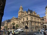
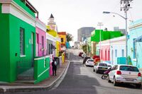
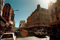
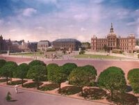
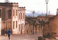
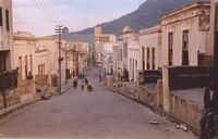
From top to bottom: Old Gough City Hall, Old Colonial Government HQ, Rainbow Row, historic Main Street, Old City Square, residential neighborhood streets, | |
| Country | New Gough Island |
| District | Old Gough City |
| Government | |
| • District Administrator | John Waitland ( CUP) |
| Area | |
| • Land | 10 sq mi (30 km2) |
| • Urban | 10 sq mi (30 km2) |
| Population (2024) | |
| • District | 132,000 |
| • Density | 13,200/sq mi (5,100/km2) |
| Demonym | Old City Resident |
Old Gough City is a district in New Gough Island. It is the most historic and densely populated area in the country. It is home to historic landmarks and homes. There are 4 neighborhoods in the district: Rainbow Row, Old Downtown, Uptown, North End
Neighborhoods

