Gallatin: Difference between revisions
Jump to navigation
Jump to search
(Created page with "{{Infobox settlement |name = Gallatin |native_name = |native_name_lang = <!-- ISO 639-1 code e.g. "fr" for French. If more than one, use {{lang}} instead --> |settlement_type = Capital City and Region |image_skyline = {{Photomontage | photo1a = NGI - Imgur.jpg | photo1b = | photo1c = | photo1d = | photo1e = | photo2a = NGI - Imgur (1).jpg | photo2b = | photo2c = | photo2d = | photo2e = | photo3a = NGI - Imgur...") |
No edit summary |
||
| (114 intermediate revisions by the same user not shown) | |||
| Line 1: | Line 1: | ||
{{DISPLAYTITLE:Port Victoria}} | |||
{{Infobox settlement | {{Infobox settlement | ||
|name = | |name = Port Victoria | ||
|native_name = | |native_name = | ||
|native_name_lang = <!-- ISO 639-1 code e.g. "fr" for French. If more than one, use {{lang}} instead --> | |native_name_lang = <!-- ISO 639-1 code e.g. "fr" for French. If more than one, use {{lang}} instead --> | ||
|settlement_type = Capital City | |settlement_type = Capital City | ||
|image_skyline = | |image_skyline = | ||
{{Photomontage | {{Photomontage | ||
| photo1a = | | photo1a = Port Victoria Skyline.jpg | ||
| photo1b = | | photo1b = | ||
| photo1c = | | photo1c = | ||
| photo1d = | | photo1d = | ||
| photo1e = | | photo1e = | ||
| photo2a = NGI | | photo2a = Mansion District NGI.jpg | ||
| photo2b = | | photo2b = | ||
| photo2c = | | photo2c = | ||
| photo2d = | | photo2d = | ||
| photo2e = | | photo2e = | ||
| photo3a = NGI | | photo3a = NGI 12.jpg | ||
| photo3b = | | photo3b = | ||
| photo3c = | | photo3c = | ||
| photo3d = | | photo3d = | ||
| photo3e = | | photo3e = | ||
| photo4a = NGI | | photo4a = NGI National Assembly Building.jpg | ||
| photo4b = | | photo4b = | ||
| photo4c = | | photo4c = | ||
| photo4d = | | photo4d = | ||
| photo4e = | | photo4e = | ||
| photo5a = | | photo5a = NGI Supreme Court.jpg | ||
| photo5b = | | photo5b = | ||
| photo5c = | | photo5c = | ||
| photo5d = | | photo5d = | ||
| photo5e = | | photo5e = | ||
| photo6a = | | photo6a = NGI Cheif Executive Res.jpg | ||
| photo6b = | | photo6b = | ||
| photo6c = | | photo6c = | ||
| photo6d = | | photo6d = | ||
| photo6e = | | photo6e = | ||
| photo7a = | | photo7a = NZ-New Gough Island Images.jpg | ||
| photo7b = | | photo7b = | ||
| photo7c = | | photo7c = | ||
| photo7d = | | photo7d = | ||
| photo7e = | | photo7e = | ||
| photo8a = | | photo8a = NZ-New Gough Island Images 2.jpg | ||
| size = | | size = | ||
| spacing = <!-- Number indicating width of spacing between the images (default: 1) --> | | spacing = <!-- Number indicating width of spacing between the images (default: 1) --> | ||
| Line 54: | Line 54: | ||
|imagesize = | |imagesize = | ||
|image_alt = | |image_alt = | ||
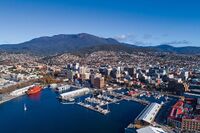
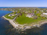
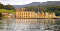
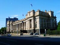
|image_caption = From top to bottom: | |image_caption = From top to bottom: Port Victoria skyline, Mansion District, New Gough Island National History Museum, New Gough Island National Assembly Building, New Gough Island Supreme Court Building, New Gough Island Executive Mansion, Battey Point Neighborhood, Old Town Port Victoria | ||
|flag_alt = | |flag_alt = | ||
|image_seal = | |image_seal = | ||
| Line 77: | Line 76: | ||
|subdivision_name = [[New Gough Island]] | |subdivision_name = [[New Gough Island]] | ||
|subdivision_type1 = Region | |subdivision_type1 = Region | ||
|subdivision_name1 = | |subdivision_name1 = South East Islands | ||
|subdivision_type2 = | |subdivision_type2 = Municipality | ||
|subdivision_name2 = | |subdivision_name2 = [[Gallatin| Port Victoria]] | ||
|subdivision_type3 = | |subdivision_type3 = | ||
|subdivision_name3 = | |subdivision_name3 = | ||
| Line 88: | Line 87: | ||
|seat = | |seat = | ||
|government_footnotes = | |government_footnotes = | ||
|leader_party = | |leader_party = [[Liberal Democratic Party (New Gough Island)|LDP]] | ||
|leader_title = | |leader_title = Mayor | ||
|leader_name = James Parker | |leader_name = James Parker | ||
|unit_pref = US<!-- or UK --> | |unit_pref = US<!-- or UK --> | ||
| Line 104: | Line 103: | ||
|area_blank2_title = | |area_blank2_title = | ||
<!-- square miles --> | <!-- square miles --> | ||
|area_total_sq_mi = | |area_total_sq_mi = 50 | ||
|area_land_sq_mi = 36 | |area_land_sq_mi = 36 | ||
|area_water_sq_mi = | |area_water_sq_mi = 14 | ||
|area_urban_sq_mi = 284 | |area_urban_sq_mi = 284 | ||
|area_rural_sq_mi = | |area_rural_sq_mi = | ||
|area_metro_sq_mi = | |area_metro_sq_mi = 2,800 | ||
|area_blank1_sq_mi = | |area_blank1_sq_mi = | ||
|area_blank2_sq_mi = | |area_blank2_sq_mi = | ||
| Line 127: | Line 126: | ||
|elevation_ft = | |elevation_ft = | ||
|population_footnotes = | |population_footnotes = | ||
|population_as_of = | |population_as_of = 2024 | ||
|population_total = | |population_total = 154,000 | ||
|population_density_sq_mi = | |population_density_sq_mi = 4,277.8 | ||
|population_urban = | |population_urban = 578,000 | ||
|population_metro = 1, | |population_density_urban_sq_mi = 2,035.2 | ||
|population_metro = 1,098,000 | |||
|population_density_metro_sq_mi = 392.1 | |||
|population_note = | |population_note = | ||
|population_demonym = | |population_demonym = Port Victorian | ||
|timezone1 = | |timezone1 = | ||
|utc_offset1 = | |utc_offset1 = | ||
| Line 147: | Line 148: | ||
|footnotes = | |footnotes = | ||
}} | }} | ||
'''Port Victoria''' is the capital city of the New Gough Island. It is the 5th largest city of New Gough Island. The Greater Port Victoria is the second largest metro area in the country home to 1.098 million people. | |||
==Neighborhoods== | |||
==Sister Cities== | |||
[[Králowec, F.D.]], [[Morrawia]] (2000) | |||
{{Template:Anteria info pages}} | |||
[[Category:Anteria]] | |||
[[Category:New Gough Island]] | |||
Revision as of 16:01, 10 May 2024
Port Victoria | |
|---|---|
Capital City | |
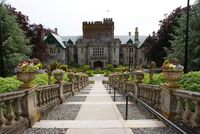
From top to bottom: Port Victoria skyline, Mansion District, New Gough Island National History Museum, New Gough Island National Assembly Building, New Gough Island Supreme Court Building, New Gough Island Executive Mansion, Battey Point Neighborhood, Old Town Port Victoria | |
| Country | New Gough Island |
| Region | South East Islands |
| Municipality | Port Victoria |
| Government | |
| • Mayor | James Parker (LDP) |
| Area | |
| • Capital City | 50 sq mi (100 km2) |
| • Land | 36 sq mi (90 km2) |
| • Water | 14 sq mi (40 km2) |
| • Urban | 284 sq mi (740 km2) |
| • Metro | 2,800 sq mi (7,000 km2) |
| Population (2024) | |
| • Capital City | 154,000 |
| • Density | 4,277.8/sq mi (1,651.7/km2) |
| • Urban | 578,000 |
| • Urban density | 2,035.2/sq mi (785.8/km2) |
| • Metro | 1,098,000 |
| • Metro density | 392.1/sq mi (151.4/km2) |
| Demonym | Port Victorian |
Port Victoria is the capital city of the New Gough Island. It is the 5th largest city of New Gough Island. The Greater Port Victoria is the second largest metro area in the country home to 1.098 million people.
Neighborhoods
Sister Cities
Králowec, F.D., Morrawia (2000)
