North New Gough Island Wildlands: Difference between revisions
No edit summary |
No edit summary |
||
| (3 intermediate revisions by the same user not shown) | |||
| Line 151: | Line 151: | ||
|footnotes = | |footnotes = | ||
}} | }} | ||
'''North New Gough Island Wildlands''' is a district in New Gough Island. It is the largely a rural and nature filled area in the country. It is home to the North New Gough Island National Forest and Park. There are 5 neighborhoods in the district: Bohemian Bay, Forest Village, North Wildlands Rural Area, South Wildlands Rural Area, and North Cape Village. | '''North New Gough Island Wildlands''' is a district in [[New Gough Island]]. It is the largely a rural and nature filled area in the country. It is home to the North New Gough Island National Forest and Park. There are 5 neighborhoods in the district: Bohemian Bay, Forest Village, North Wildlands Rural Area, South Wildlands Rural Area, and North Cape Village. | ||
==Neighborhoods== | ==Neighborhoods== | ||
The most populated neighborhood in the North New Gough Island Wildlands is Bohemian Bay located on the west side of the island. The Forest Village is located on the south side of the island by The New Gough Island Strait Bridge. While the North Cape Village is located on the northern most part of the island, and thus the northern most point of the country. The North and South Wildlands Rural Areas area rural areas that are heavily forested and mountainous. The North New Gough Island National Park and Forest is in both neighborhoods. It takes up, 100 sq mi (260 sq km) in area. It is home to the tallest mountain in the country, Mount Blandan which is 5,789 feet (1,764.5 meters) tall. | |||
{| class="wikitable sortable" | {| class="wikitable sortable" | ||
|+ Neighborhoods of North New Gough Island Wildlands | |+ Neighborhoods of North New Gough Island Wildlands | ||
| Line 159: | Line 160: | ||
! Neighborhood !! Population !! Land Area || Population Density | ! Neighborhood !! Population !! Land Area || Population Density | ||
|- | |- | ||
| Bohemian Bay || 18,000 || {{convert|3|sqmi|km2|abbr=on}} || | | Bohemian Bay || 18,000 || {{convert|3|sqmi|km2|abbr=on}} || 6,000 people per sq mi (2,307.7 people per sq km) | ||
|- | |- | ||
| Forest Village || 12,000 || {{convert|10|sqmi|km2|abbr=on}} || | | Forest Village || 12,000 || {{convert|10|sqmi|km2|abbr=on}} || 1,200 people per sq mi (461.5 people per sq km) | ||
|- | |- | ||
| North Cape Village || 3,000 || {{convert|2|sqmi|km2|abbr=on}} || | | North Cape Village || 3,000 || {{convert|2|sqmi|km2|abbr=on}} || 1,500 people per sq mi (576.9 people per sq km) | ||
|- | |- | ||
| North Wildlands Rural Area || 10,000 || {{convert|694.55|sqmi|km2|abbr=on}} || | | North Wildlands Rural Area || 10,000 || {{convert|694.55|sqmi|km2|abbr=on}} || 14.4 people per sq mi (5.6 people per sq km) | ||
|- | |- | ||
| South Wildlands Rural Area || 20,000 || {{convert|644|sqmi|km2|abbr=on}} || | | South Wildlands Rural Area || 20,000 || {{convert|644|sqmi|km2|abbr=on}} || 31.1 people per sq mi (12 people per sq km) | ||
|} | |} | ||
==Climate== | ==Climate== | ||
The climate of North New Gough Island is mostly highland subtropical to tropical under the influence of a marine monsoon. It is the rainiest place in the country. The island also has the coldest temperatures recorded in the country. Despite being north of South New Gough Island, it has a cooler wetter climate because of the forest cover and mountainous terrain. | |||
{{Weather box | {{Weather box | ||
| name = Weather | | name = Weather | ||
Latest revision as of 17:22, 5 May 2024
North New Gough Island Wildlands | |
|---|---|
District | |
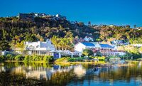
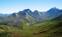
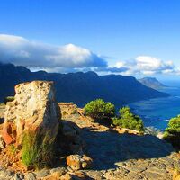
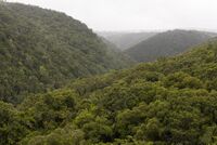
From top to bottom: Bohemian Bay, Forest Village, Mount Blandan, Mountains Along the Sea, Subtropical highland forest, cloud forest | |
| Country | New Gough Island |
| District | North New Gough Island Wildlands |
| Government | |
| • District Administrator | Jake Maine (WFP) |
| Area | |
| • District | 1,353.55 sq mi (3,505.7 km2) |
| • Land | 1,353.55 sq mi (3,505.7 km2) |
| • Urban | 15 sq mi (40 km2) |
| • Rural | 1,338.55 sq mi (3,466.8 km2) |
| Population (2024) | |
| • District | 63,000 |
| • Density | 46.5/sq mi (18.0/km2) |
| • Urban | 33,000 |
| • Urban density | 2,200/sq mi (800/km2) |
| • Rural | 30,000 |
| • Rural density | 22.4/sq mi (8.6/km2) |
| Demonym | North Wildlander |
North New Gough Island Wildlands is a district in New Gough Island. It is the largely a rural and nature filled area in the country. It is home to the North New Gough Island National Forest and Park. There are 5 neighborhoods in the district: Bohemian Bay, Forest Village, North Wildlands Rural Area, South Wildlands Rural Area, and North Cape Village.
Neighborhoods
The most populated neighborhood in the North New Gough Island Wildlands is Bohemian Bay located on the west side of the island. The Forest Village is located on the south side of the island by The New Gough Island Strait Bridge. While the North Cape Village is located on the northern most part of the island, and thus the northern most point of the country. The North and South Wildlands Rural Areas area rural areas that are heavily forested and mountainous. The North New Gough Island National Park and Forest is in both neighborhoods. It takes up, 100 sq mi (260 sq km) in area. It is home to the tallest mountain in the country, Mount Blandan which is 5,789 feet (1,764.5 meters) tall.
| Neighborhood | Population | Land Area | Population Density |
|---|---|---|---|
| Bohemian Bay | 18,000 | 3 sq mi (7.8 km2) | 6,000 people per sq mi (2,307.7 people per sq km) |
| Forest Village | 12,000 | 10 sq mi (26 km2) | 1,200 people per sq mi (461.5 people per sq km) |
| North Cape Village | 3,000 | 2 sq mi (5.2 km2) | 1,500 people per sq mi (576.9 people per sq km) |
| North Wildlands Rural Area | 10,000 | 694.55 sq mi (1,798.9 km2) | 14.4 people per sq mi (5.6 people per sq km) |
| South Wildlands Rural Area | 20,000 | 644 sq mi (1,670 km2) | 31.1 people per sq mi (12 people per sq km) |
Climate
The climate of North New Gough Island is mostly highland subtropical to tropical under the influence of a marine monsoon. It is the rainiest place in the country. The island also has the coldest temperatures recorded in the country. Despite being north of South New Gough Island, it has a cooler wetter climate because of the forest cover and mountainous terrain.
| Month | Jan | Feb | Mar | Apr | May | Jun | Jul | Aug | Sep | Oct | Nov | Dec | Year |
|---|---|---|---|---|---|---|---|---|---|---|---|---|---|
| Record high °F (°C) | 82 (28) |
82 (28) |
81 (27) |
79 (26) |
73 (23) |
70 (21) |
72 (22) |
77 (25) |
86 (30) |
89 (32) |
90 (32) |
88 (31) |
90 (32) |
| Average high °F (°C) | 71.3 (21.8) |
70.4 (21.3) |
68.9 (20.5) |
65.6 (18.7) |
62.3 (16.8) |
59.0 (15.0) |
60.8 (16.0) |
64.1 (17.8) |
72.2 (22.3) |
77.2 (25.1) |
78.4 (25.8) |
74.6 (23.7) |
68.7 (20.4) |
| Daily mean °F (°C) | 65.2 (18.4) |
64.3 (17.9) |
62.5 (16.9) |
59.3 (15.2) |
55.2 (12.9) |
51.9 (11.1) |
53.2 (11.8) |
57.1 (13.9) |
63.2 (17.3) |
67.4 (19.7) |
69.8 (21.0) |
67.7 (19.8) |
61.4 (16.3) |
| Average low °F (°C) | 59.0 (15.0) |
58.1 (14.5) |
56.1 (13.4) |
52.9 (11.6) |
48.1 (8.9) |
44.8 (7.1) |
45.6 (7.6) |
50.1 (10.1) |
54.2 (12.3) |
57.5 (14.2) |
61.2 (16.2) |
60.8 (16.0) |
54.0 (12.2) |
| Record low °F (°C) | 47 (8) |
44 (7) |
41 (5) |
36 (2) |
32 (0) |
30 (−1) |
34 (1) |
39 (4) |
45 (7) |
50 (10) |
53 (12) |
50 (10) |
30 (−1) |
| Average rainfall inches (mm) | 20.1 (510) |
22.1 (560) |
18.4 (470) |
12.1 (310) |
5.8 (150) |
4.1 (100) |
2.4 (61) |
4.8 (120) |
5.2 (130) |
5.9 (150) |
7.1 (180) |
14.8 (380) |
122.8 (3,121) |
| Average rainy days (≥ 0.1) | 20 | 22 | 18 | 14 | 10 | 7 | 3 | 4 | 5 | 8 | 10 | 16 | 137 |
| Source: New Gough Island Weather Service | |||||||||||||
| Month | Jan | Feb | Mar | Apr | May | Jun | Jul | Aug | Sep | Oct | Nov | Dec | Year |
|---|---|---|---|---|---|---|---|---|---|---|---|---|---|
| Record high °F (°C) | 90 (32) |
88 (31) |
86 (30) |
83 (28) |
81 (27) |
77 (25) |
80 (27) |
86 (30) |
92 (33) |
97 (36) |
101 (38) |
98 (37) |
101 (38) |
| Average high °F (°C) | 78.1 (25.6) |
76.8 (24.9) |
75.8 (24.3) |
72.4 (22.4) |
68.1 (20.1) |
65.8 (18.8) |
69.1 (20.6) |
74.1 (23.4) |
78.1 (25.6) |
82.9 (28.3) |
84.1 (28.9) |
80.9 (27.2) |
75.5 (24.2) |
| Daily mean °F (°C) | 73.6 (23.1) |
72.5 (22.5) |
71.0 (21.7) |
67.7 (19.8) |
63.1 (17.3) |
60.3 (15.7) |
62.4 (16.9) |
67.1 (19.5) |
71.2 (21.8) |
75.2 (24.0) |
77.7 (25.4) |
75.9 (24.4) |
69.8 (21.0) |
| Average low °F (°C) | 69.0 (20.6) |
68.1 (20.1) |
66.1 (18.9) |
62.9 (17.2) |
58.1 (14.5) |
54.8 (12.7) |
55.6 (13.1) |
60.1 (15.6) |
64.2 (17.9) |
67.5 (19.7) |
71.2 (21.8) |
70.8 (21.6) |
64.0 (17.8) |
| Record low °F (°C) | 57 (14) |
54 (12) |
51 (11) |
46 (8) |
42 (6) |
40 (4) |
44 (7) |
49 (9) |
55 (13) |
60 (16) |
63 (17) |
60 (16) |
40 (4) |
| Average rainfall inches (mm) | 15.1 (380) |
18.1 (460) |
12.4 (310) |
8.1 (210) |
6.8 (170) |
4.1 (100) |
3.4 (86) |
5.8 (150) |
6.2 (160) |
6.9 (180) |
10.1 (260) |
13.8 (350) |
110.8 (2,816) |
| Average rainy days (≥ 0.1) | 20 | 22 | 18 | 14 | 10 | 9 | 5 | 6 | 8 | 10 | 11 | 16 | 149 |
| Source: New Gough Island Weather Service | |||||||||||||

