Greycott: Difference between revisions
Jump to navigation
Jump to search
No edit summary |
No edit summary |
||
| Line 7: | Line 7: | ||
|image_skyline = | |image_skyline = | ||
{{Photomontage | {{Photomontage | ||
| photo1a = | | photo1a = Skyline of Old Flatiron .jpg | ||
| photo1b = | | photo1b = | ||
| photo1c = | | photo1c = | ||
| photo1d = | | photo1d = | ||
| photo1e = | | photo1e = | ||
| photo2a = | | photo2a = Broad Street.jpg | ||
| photo2b = | | photo2b = | ||
| photo2c = | | photo2c = | ||
| photo2d = | | photo2d = | ||
| photo2e = | | photo2e = | ||
| photo3a = | | photo3a = Residential neighborhood of Flatiron.jpg | ||
| photo3b = | | photo3b = | ||
| photo3c = | | photo3c = | ||
| photo3d = | | photo3d = | ||
| photo3e = | | photo3e = | ||
| photo4a = | | photo4a = Port and industrial area.jpg | ||
| photo4b = | | photo4b = | ||
| photo4c = | | photo4c = | ||
| photo4d = | | photo4d = | ||
| photo4e = | | photo4e = | ||
| photo5a = | | photo5a = | ||
| photo5b = | | photo5b = | ||
| photo5c = | | photo5c = | ||
| photo5d = | | photo5d = | ||
| photo5e = | | photo5e = | ||
| photo6a = | | photo6a = | ||
| photo6b = | | photo6b = | ||
| photo6c = | | photo6c = | ||
| Line 42: | Line 42: | ||
| photo7d = | | photo7d = | ||
| photo7e = | | photo7e = | ||
| photo8a = | | photo8a = | ||
| photo9a = | | photo9a = | ||
| photo10a = | | photo10a = | ||
| size = | | size = | ||
| spacing = <!-- Number indicating width of spacing between the images (default: 1) --> | | spacing = <!-- Number indicating width of spacing between the images (default: 1) --> | ||
| Line 56: | Line 56: | ||
|imagesize = | |imagesize = | ||
|image_alt = | |image_alt = | ||
|image_caption = From top to bottom: | |image_caption = From top to bottom: Flats (Apartments) buildings of Flatiron, Broad Street a major street in Flatiron, A typical residential street | ||
|image_flag = | |image_flag = | ||
|flag_alt = | |flag_alt = | ||
| Line 78: | Line 78: | ||
|subdivision_type = Country | |subdivision_type = Country | ||
|subdivision_name = [[New Gough Island]] | |subdivision_name = [[New Gough Island]] | ||
|subdivision_type1 = | |subdivision_type1 = District | ||
|subdivision_name1 = | |subdivision_name1 = [[Greycott| Old Flatiron]] | ||
|subdivision_type2 = | |subdivision_type2 = | ||
|subdivision_name2 = | |subdivision_name2 = | ||
|subdivision_type3 = | |subdivision_type3 = | ||
|subdivision_name3 = | |subdivision_name3 = | ||
| Line 90: | Line 90: | ||
|seat = | |seat = | ||
|government_footnotes = | |government_footnotes = | ||
|leader_party = | |leader_party = [[Liberal Democratic Party (New Gough Island)| LDP]] | ||
|leader_title = | |leader_title = District Administrator | ||
|leader_name = Lisa Haddock | |leader_name = Lisa Haddock | ||
|unit_pref = US<!-- or UK --> | |unit_pref = US<!-- or UK --> | ||
| Line 106: | Line 106: | ||
|area_blank2_title = | |area_blank2_title = | ||
<!-- square miles --> | <!-- square miles --> | ||
|area_total_sq_mi = | |area_total_sq_mi = 50 | ||
|area_land_sq_mi = | |area_land_sq_mi = 40 | ||
|area_water_sq_mi = | |area_water_sq_mi = 10 | ||
|area_urban_sq_mi = | |area_urban_sq_mi = 30 | ||
|area_rural_sq_mi = | |area_rural_sq_mi = | ||
|area_metro_sq_mi = | |area_metro_sq_mi = | ||
|area_blank1_sq_mi = | |area_blank1_sq_mi = | ||
|area_blank2_sq_mi = | |area_blank2_sq_mi = | ||
| Line 129: | Line 129: | ||
|elevation_ft = | |elevation_ft = | ||
|population_footnotes = | |population_footnotes = | ||
|population_as_of = | |population_as_of = 2024 | ||
|population_total = | |population_total = 280,000 | ||
|population_density_sq_mi = | |population_density_sq_mi = 7,000 | ||
| | |population_density_urban_sq_mi = 9,333 | ||
|population_metro = | |population_metro = | ||
|population_note = | |population_note = | ||
|population_demonym = | |population_demonym = Flatironer | ||
|timezone1 = | |timezone1 = | ||
|utc_offset1 = | |utc_offset1 = | ||
| Line 149: | Line 149: | ||
|footnotes = | |footnotes = | ||
}} | }} | ||
''' | '''Old Flatiron''' is a district in New Gough Island. It is home to the Port of New Gough Island and the New Gough Island International Airport. It is also the poorest and most crime ridden area in the country. There are 10 neighborhoods in the district: Port and Industrial Area (non residential),New Gough Island International Airport (non residential), Broad Street Corridor, Davison Estates, Flatiron, Old Portlands, West Georgia, East Georgia, Kingston, and Cove Estates. | ||
== | ==Neighborhoods== | ||
{{Template:Anteria info pages}} | {{Template:Anteria info pages}} | ||
Revision as of 01:59, 4 May 2024
Old Flatiron | |
|---|---|
District | |
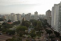
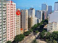
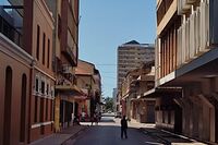
From top to bottom: Flats (Apartments) buildings of Flatiron, Broad Street a major street in Flatiron, A typical residential street | |
| Country | New Gough Island |
| District | Old Flatiron |
| Government | |
| • District Administrator | Lisa Haddock ( LDP) |
| Area | |
| • District | 50 sq mi (100 km2) |
| • Land | 40 sq mi (100 km2) |
| • Water | 10 sq mi (30 km2) |
| • Urban | 30 sq mi (80 km2) |
| Population (2024) | |
| • District | 280,000 |
| • Density | 7,000/sq mi (3,000/km2) |
| • Urban density | 9,333/sq mi (3,603/km2) |
| Demonym | Flatironer |
Old Flatiron is a district in New Gough Island. It is home to the Port of New Gough Island and the New Gough Island International Airport. It is also the poorest and most crime ridden area in the country. There are 10 neighborhoods in the district: Port and Industrial Area (non residential),New Gough Island International Airport (non residential), Broad Street Corridor, Davison Estates, Flatiron, Old Portlands, West Georgia, East Georgia, Kingston, and Cove Estates.
Neighborhoods


