North New Gough Island Wildlands: Difference between revisions
Jump to navigation
Jump to search
(Created page with "{{Infobox settlement |name = North New Gough Island Wildlands |native_name = |native_name_lang = <!-- ISO 639-1 code e.g. "fr" for French. If more than one, use {{lang}} instead --> |settlement_type = District |image_skyline = {{Photomontage | photo1a = | photo1b = | photo1c = | photo1d = | photo1e = | photo2a = | photo2b = | photo2c = | photo2d = | photo2e = | photo3a = | photo3b = | photo3c = | photo3d...") |
No edit summary |
||
| Line 6: | Line 6: | ||
|image_skyline = | |image_skyline = | ||
{{Photomontage | {{Photomontage | ||
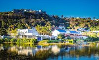
| photo1a = | | photo1a = Bohemian Bay.jpg | ||
| photo1b = | | photo1b = | ||
| photo1c = | | photo1c = | ||
| photo1d = | | photo1d = | ||
| photo1e = | | photo1e = | ||
| photo2a = | | photo2a = Forest Village.jpg | ||
| photo2b = | | photo2b = | ||
| photo2c = | | photo2c = | ||
| photo2d = | | photo2d = | ||
| photo2e = | | photo2e = | ||
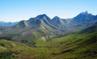
| photo3a = | | photo3a = NGI Mountians.jpg | ||
| photo3b = | | photo3b = | ||
| photo3c = | | photo3c = | ||
| photo3d = | | photo3d = | ||
| photo3e = | | photo3e = | ||
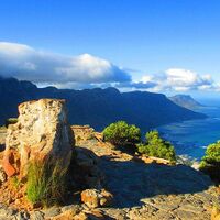
| photo4a = | | photo4a = NGI mountains 2.jpg | ||
| photo4b = | | photo4b = | ||
| photo4c = | | photo4c = | ||
| photo4d = | | photo4d = | ||
| photo4e = | | photo4e = | ||
| photo5a = | | photo5a = Forested Mountains .jpg | ||
| photo5b = | | photo5b = | ||
| photo5c = | | photo5c = | ||
| photo5d = | | photo5d = | ||
| photo5e = | | photo5e = | ||
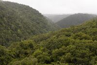
| photo6a = | | photo6a = NGI forest.jpg | ||
| photo6b = | | photo6b = | ||
| photo6c = | | photo6c = | ||
| Line 55: | Line 55: | ||
|imagesize = | |imagesize = | ||
|image_alt = | |image_alt = | ||
|image_caption = From top to bottom: | |image_caption = From top to bottom: Flats (Apartments) buildings of Flatiron, Broad Street a major street in Flatiron, A typical residential street, the Port of New Gough Island | ||
|image_flag = | |image_flag = | ||
|flag_alt = | |flag_alt = | ||
| Line 78: | Line 78: | ||
|subdivision_name = [[New Gough Island]] | |subdivision_name = [[New Gough Island]] | ||
|subdivision_type1 = District | |subdivision_type1 = District | ||
|subdivision_name1 = [[North New Gough Island Wildlands] | |subdivision_name1 = [[North New Gough Island Wildlands]] | ||
|subdivision_type2 = | |subdivision_type2 = | ||
|subdivision_name2 = | |subdivision_name2 = | ||
| Line 91: | Line 91: | ||
|leader_party = [[Wild and Free Party (New Gough Island)|WFP]] | |leader_party = [[Wild and Free Party (New Gough Island)|WFP]] | ||
|leader_title = District Administrator | |leader_title = District Administrator | ||
|leader_name = Jake | |leader_name = Jake Maine | ||
|unit_pref = US<!-- or UK --> | |unit_pref = US<!-- or UK --> | ||
<!-- ALL fields with measurements have automatic unit conversion --> | <!-- ALL fields with measurements have automatic unit conversion --> | ||
| Line 105: | Line 105: | ||
|area_blank2_title = | |area_blank2_title = | ||
<!-- square miles --> | <!-- square miles --> | ||
|area_total_sq_mi = | |area_total_sq_mi = 1,353.55 | ||
|area_land_sq_mi = 1,353.55 | |area_land_sq_mi = 1,353.55 | ||
|area_water_sq_mi = | |area_water_sq_mi = | ||
|area_urban_sq_mi = 15 | |area_urban_sq_mi = 15 | ||
|area_rural_sq_mi = 1,338.55 | |area_rural_sq_mi = 1,338.55 | ||
|area_metro_sq_mi = | |area_metro_sq_mi = | ||
|area_blank1_sq_mi = | |area_blank1_sq_mi = | ||
|area_blank2_sq_mi = | |area_blank2_sq_mi = | ||
| Line 130: | Line 130: | ||
|population_as_of = 2024 | |population_as_of = 2024 | ||
|population_total = 63,000 | |population_total = 63,000 | ||
|population_urban = 33,000 | |population_urban = 33,000 | ||
|population_rural = 30,000 | |population_rural = 30,000 | ||
| | |population_density_sq_mi = 46.5 | ||
|population_density_urban_sq_mi = 2,200 | |||
|population_density_rural_sq_mi = 22.4 | |||
|population_metro = | |||
|population_note = | |population_note = | ||
|population_demonym = North Wildlander | |population_demonym = North Wildlander | ||
| Line 150: | Line 151: | ||
|footnotes = | |footnotes = | ||
}} | }} | ||
'''North New Gough Island Wildlands''' is a district in New Gough Island. It is the largely a rural and nature filled area in the country. It is home to the North New Gough Island Nation Park. There are 4 neighborhoods in the district: | '''North New Gough Island Wildlands''' is a district in New Gough Island. It is the largely a rural and nature filled area in the country. It is home to the North New Gough Island Nation Park. There are 4 neighborhoods in the district: Bohemian Bay,Forest Village, North Wildlands Rural Area, South Wildlands Rural Area | ||
==Neighborhoods== | ==Neighborhoods== | ||
Revision as of 18:28, 4 May 2024
North New Gough Island Wildlands | |
|---|---|
District | |
From top to bottom: Flats (Apartments) buildings of Flatiron, Broad Street a major street in Flatiron, A typical residential street, the Port of New Gough Island | |
| Country | New Gough Island |
| District | North New Gough Island Wildlands |
| Government | |
| • District Administrator | Jake Maine (WFP) |
| Area | |
| • District | 1,353.55 sq mi (3,505.7 km2) |
| • Land | 1,353.55 sq mi (3,505.7 km2) |
| • Urban | 15 sq mi (40 km2) |
| • Rural | 1,338.55 sq mi (3,466.8 km2) |
| Population (2024) | |
| • District | 63,000 |
| • Density | 46.5/sq mi (18.0/km2) |
| • Urban | 33,000 |
| • Urban density | 2,200/sq mi (800/km2) |
| • Rural | 30,000 |
| • Rural density | 22.4/sq mi (8.6/km2) |
| Demonym | North Wildlander |
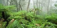
North New Gough Island Wildlands is a district in New Gough Island. It is the largely a rural and nature filled area in the country. It is home to the North New Gough Island Nation Park. There are 4 neighborhoods in the district: Bohemian Bay,Forest Village, North Wildlands Rural Area, South Wildlands Rural Area
Neighborhoods

