Mount Gori: Difference between revisions
No edit summary |
No edit summary |
||
| Line 56: | Line 56: | ||
}} | }} | ||
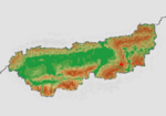
'''Mount Gori''' ([[Gregorian]]: मგორის მთა) is the highest and most prominent peak in [[Gregoria]] and the third highest in [[Thrismari]] as well as second highest in the [[Narinjinsperi Mountain Range]]. It is situated in the Southern Narinjinsperi, within the sub-range of the [[Gregorian Narinjinsperi]]. The {{wp|dormant volcano}} is the highest {{wp|stratovolcano}} in [[Thrismari]]. | '''Mount Gori''' ([[Gregorian]]: मგორის მთა) is the highest and most prominent peak in [[Gregoria]] and the third highest in [[Thrismari]] as well as second highest in the [[Narinjinsperi Mountain Range]]. It is situated in the Southern Narinjinsperi, within the sub-range of the [[Gregorian Narinjinsperi]]. The {{wp|dormant volcano}} is the highest {{wp|stratovolcano}} in [[Thrismari]]. The mountain stands in eastern [[Gregoria]] in the [[Naguru Canton]]. | ||
Gori has two summits, both of which are dormant volcano domes. The taller, the western summit, is 4539m (14,891ft); the eastern summit is 4519m (14826ft). The first ascension of the western summit was on the 12 July 1866 and the eastern summit on the 9 December 1867, both by expedition teams from the [[Gregorian Mountain Climbing Association]] in it's earliest form. | |||
==Etymology== | |||
==Geography== | |||
===Topography=== | |||
{{multiple image|align=center|Carte topographique Elbrouz.svg|288|Elbrus 3D version 1.gif|288|Elbrus 3D, version 2.gif|288|Topographic map and three-dimensional animations representing Elbrus.}} | |||
{{multiple image | |||
| align = center | |||
| direction = square | |||
| caption_align = center | |||
| header = Three-dimensional animations representing Gori | |||
| header_align = left/right/center | |||
| image1 = Elbrus 3D version 1.gif | |||
| width1 = 300 | |||
| image2 = Elbrus 3D, version 2.gif | |||
| width2 = 300 | |||
}} | |||
==Eruptive History== | |||
== | |||
{{Template:Anteria info pages}} | {{Template:Anteria info pages}} | ||
Revision as of 10:35, 14 May 2022
| Mount Gori | |
|---|---|
मგორის მთა | |
 Mount Gori, seen from the north | |
| Highest point | |
| Elevation | 4,539 m (14,892 ft) |
| Listing | Country High Point Canton High Point |
| Geography | |
 Location of Mount Gori in Gregoria.
| |
| Location | In the southern regions of the Gregorian Narinjinsperi. |
| Parent range | Gregorian Narinjinsperi (Narinjinsperi Mountain Range) |
Mount Gori (Gregorian: मგორის მთა) is the highest and most prominent peak in Gregoria and the third highest in Thrismari as well as second highest in the Narinjinsperi Mountain Range. It is situated in the Southern Narinjinsperi, within the sub-range of the Gregorian Narinjinsperi. The dormant volcano is the highest stratovolcano in Thrismari. The mountain stands in eastern Gregoria in the Naguru Canton.
Gori has two summits, both of which are dormant volcano domes. The taller, the western summit, is 4539m (14,891ft); the eastern summit is 4519m (14826ft). The first ascension of the western summit was on the 12 July 1866 and the eastern summit on the 9 December 1867, both by expedition teams from the Gregorian Mountain Climbing Association in it's earliest form.
Etymology
Geography
Topography
Eruptive History
==

