Gallatin: Difference between revisions
| Line 285: | Line 285: | ||
}} | }} | ||
== | ==Transportation== | ||
The Greater Gallatin Transit Authority or GGTA is the provider of public transportation in the Greater Gallatin area. The GGTA covers the city tram network of Gallatin, buses, buses rapid transit, taxis, para transit, and commuter rail. The Tram network has 28 lines city wide. The trams are the vintage Cava 2 (1949-1961) and Cava 3 (1962-1989) which has been kept up over the years. There are 30 city bus lines and 5 bus rapid transit lines. There are 50 bus lines serving the Greater Gallatin area. There are 10,000 taxis severing the Greater Gallatin area. There are 7 commuter rail lines serving the suburbs. As of 2009, the GGTA has been constructing the Gallatin Subway which will be completed in 2024. The subway will have 3 lines, the red, blue, and green lines will make travel easier throughout the city. | The Greater Gallatin Transit Authority or GGTA is the provider of public transportation in the Greater Gallatin area. The GGTA covers the city tram network of Gallatin, buses, buses rapid transit, taxis, para transit, and commuter rail. The Tram network has 28 lines city wide. The trams are the vintage Cava 2 (1949-1961) and Cava 3 (1962-1989) which has been kept up over the years. There are 30 city bus lines and 5 bus rapid transit lines. There are 50 bus lines serving the Greater Gallatin area. There are 10,000 taxis severing the Greater Gallatin area. There are 7 commuter rail lines serving the suburbs. As of 2009, the GGTA has been constructing the Gallatin Subway which will be completed in 2024. The subway will have 3 lines, the red, blue, and green lines will make travel easier throughout the city. | ||
The Greater Gallatin area is also served by 8 motorways. With The Perimeter Motorway as a ring | The Greater Gallatin area is also served by 8 motorways. With The Perimeter Motorway as a ring road traveling just outside city limits. There are no motorways in the city limits of Gallatin. Gallatin is connected to the rest of the county by the President Frank Berman Memorial Bridge which carries The Gallatin- Greycott Motorway as well as train service across the Queens Strait. Train service is frequent having the Gallatin Union Station as the only place in the city for train service. Gallatin Union Station will be the hub for the subway. | ||
It is estimated that 40% of city residents use public transportation regularly with 25% of commuters from the Greater Gallatin area using public transportation to go in and out of the city. | |||
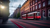
[[File:Tram in Gallatin.jpg|thumb|right|A Cava 2 Tram traveling down a City Center Street]] | [[File:Tram in Gallatin.jpg|thumb|right|A Cava 2 Tram traveling down a City Center Street]] | ||
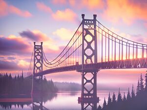
[[File:President Frank Berman Memorial Bridge.jpg|thumb|right|The President Frank Berman Memorial Bridge connects Gallatin amd Parasides Island with Gough Island (the mainland). The bridge carries 100,000 vehicles per day]] | [[File:President Frank Berman Memorial Bridge.jpg|thumb|right|The President Frank Berman Memorial Bridge connects Gallatin amd Parasides Island with Gough Island (the mainland). The bridge carries 100,000 vehicles per day]] | ||
| Line 297: | Line 300: | ||
==City Neighborhoods== | ==City Neighborhoods== | ||
There are 20 city neighborhoods | |||
• City Center | |||
• Fenburg Park | |||
• Pinehurst | |||
• Bernard Square | |||
• Stratford | |||
• Berlint | |||
• Mangata | |||
• Hanover Park | |||
• Raynham | |||
• Betty's Corner | |||
• Confier Forrest | |||
• Evergreen Terrace | |||
• Berman | |||
• Crossway | |||
• Newport Park | |||
• Harrison Heights | |||
• Westminster | |||
• Government Center | |||
• Marble Field | |||
• Kingston | |||
==Education== | ==Education== | ||
Revision as of 15:31, 9 April 2024
Gallatin | |
|---|---|
Capital City and Region | |
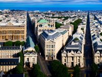
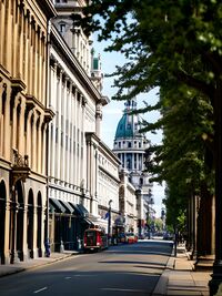
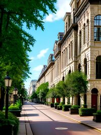
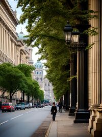
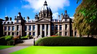
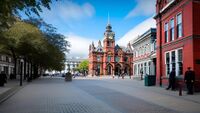
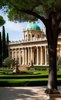
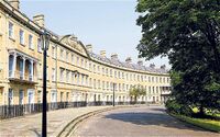
From top to bottom: Gallatin seen from the City Observatory, State Street in Central City, Pinehurst Neighborhood, Conifer Ave in Central City, Gallatin City Hall, Bernard Square, National Museum of Art, Fenburg Park Neighborhood, Cava 3 Tram traveling down a street in the Central City | |
| Country | New Gough Island |
| Region | Gallatin |
| Government | |
| • Executive Mayor | James Parker |
| Area | |
| • Capital City and Region | 80 sq mi (200 km2) |
| • Land | 75 sq mi (190 km2) |
| • Water | 5 sq mi (10 km2) |
| • Urban | 380 sq mi (1,000 km2) |
| • Metro | 1,982 sq mi (5,130 km2) |
| Population (2023) | |
| • Capital City and Region | 987,000 |
| • Density | 13,160/sq mi (5,080/km2) |
| • Urban | 2,190,000 |
| • Metro | 2,410,000 |
| Demonym | Gellatiner |
Gallatin is the capital city and largest city of the Republic of New Gough Island. It is the second largest city and the anchor of the Greater Gallatin Area which includes the Gallatin City Region and part of the Parasides Island Region. The city has a population of 987,000 people as of the 2023 estimate. The city is the most densely populated city in the country. Located in the northern area of the country which houses 84% of the national population in 20% of the land area.
The city was founded in 1718 but not proclaimed capital of the country until 1870. The city is well known for its historic architecture and art scene. Gallatin and the Parasides Island as a whole is connected to the mainland (Gough Island) by the 1 1/2-mile-long road and rail President Frank Berman Memorial Bridge. The city has a robust transit system connecting itself to the suburbs by commuter rail. Bus and street trams are the main features of the transit system. With a subway system under construction to improve transit in the city. The city has a network of freeways outside of the city limits.
The city attracts the largest amount tourists to the country, with many arriving in the city to travel to the nature and rugged outdoors oriented vast South Area. On average, 8-10 million tourists visit the city each year. For this reason, the city is called the Gateway to New Gough Island. Tourist attractions include: the several historic parks in the city, the National Museum of Art, Bernard Square, City Observatory, national monuments, and much more.
History
Geography
Climate
The climate of Gallatin is Subpolar Oceanic. With cool to mild summers and wet cold and sometimes snowy winters. The city is one of the wettest places in the country with the North West Rainforest being wetter. The city is in the path of a lot of low pressure systems. During the winter snow is common with most snow days bringing 1-2 in (2.5-5 cm) per snow day. Heavy snow storms and blizzards happen at least once a year. However, both heavy rainfall and snow events are becoming more common.
| Climate data for City Observatory, Gallatin, New Gough Island, 1991–2020 normals, extremes 1900–present | |||||||||||||
|---|---|---|---|---|---|---|---|---|---|---|---|---|---|
| Month | Jan | Feb | Mar | Apr | May | Jun | Jul | Aug | Sep | Oct | Nov | Dec | Year |
| Record high °F (°C) | 80 (27) |
79 (26) |
77 (25) |
72 (22) |
64 (18) |
59 (15) |
54 (12) |
52 (11) |
58 (14) |
63 (17) |
68 (20) |
73 (23) |
80 (27) |
| Average high °F (°C) | 63 (17) |
61 (16) |
55 (13) |
47 (8) |
44 (7) |
42 (6) |
41 (5) |
41 (5) |
43 (6) |
48 (9) |
54 (12) |
58 (14) |
50 (10) |
| Average low °F (°C) | 50 (10) |
46 (8) |
42 (6) |
36 (2) |
32 (0) |
27 (−3) |
24 (−4) |
25 (−4) |
28 (−2) |
34 (1) |
41 (5) |
45 (7) |
36 (2) |
| Record low °F (°C) | 36 (2) |
32 (0) |
22 (−6) |
10 (−12) |
1 (−17) |
−9 (−23) |
−14 (−26) |
−3 (−19) |
4 (−16) |
12 (−11) |
24 (−4) |
31 (−1) |
−14 (−26) |
| Average precipitation inches (mm) | 3.71 (94) |
4.01 (102) |
4.28 (109) |
4.89 (124) |
5.14 (131) |
5.56 (141) |
6.23 (158) |
6.28 (160) |
5.53 (140) |
4.83 (123) |
4.38 (111) |
4.12 (105) |
58.96 (1,498) |
| Average snowfall inches (cm) | 0 (0) |
0 (0) |
0 (0) |
1 (2.5) |
4 (10) |
9 (23) |
12 (30) |
10 (25) |
10 (25) |
9 (23) |
4 (10) |
1 (2.5) |
60 (151) |
| Average precipitation days (≥ 0.01 in) | 9 | 10 | 12 | 12 | 13 | 14 | 15 | 16 | 15 | 14 | 12 | 10 | 152 |
| Average snowy days (≥ 0.1 in) | 0 | 0 | 0 | 1 | 4 | 7 | 10 | 9 | 8 | 7 | 3 | 1 | 50 |
| Source: New Gough Island Weather Service | |||||||||||||
Transportation
The Greater Gallatin Transit Authority or GGTA is the provider of public transportation in the Greater Gallatin area. The GGTA covers the city tram network of Gallatin, buses, buses rapid transit, taxis, para transit, and commuter rail. The Tram network has 28 lines city wide. The trams are the vintage Cava 2 (1949-1961) and Cava 3 (1962-1989) which has been kept up over the years. There are 30 city bus lines and 5 bus rapid transit lines. There are 50 bus lines serving the Greater Gallatin area. There are 10,000 taxis severing the Greater Gallatin area. There are 7 commuter rail lines serving the suburbs. As of 2009, the GGTA has been constructing the Gallatin Subway which will be completed in 2024. The subway will have 3 lines, the red, blue, and green lines will make travel easier throughout the city.
The Greater Gallatin area is also served by 8 motorways. With The Perimeter Motorway as a ring road traveling just outside city limits. There are no motorways in the city limits of Gallatin. Gallatin is connected to the rest of the county by the President Frank Berman Memorial Bridge which carries The Gallatin- Greycott Motorway as well as train service across the Queens Strait. Train service is frequent having the Gallatin Union Station as the only place in the city for train service. Gallatin Union Station will be the hub for the subway.
It is estimated that 40% of city residents use public transportation regularly with 25% of commuters from the Greater Gallatin area using public transportation to go in and out of the city.
Culture
City Government
City Neighborhoods
There are 20 city neighborhoods
• City Center
• Fenburg Park
• Pinehurst
• Bernard Square
• Stratford
• Berlint
• Mangata
• Hanover Park
• Raynham
• Betty's Corner
• Confier Forrest
• Evergreen Terrace
• Berman
• Crossway
• Newport Park
• Harrison Heights
• Westminster
• Government Center
• Marble Field
• Kingston
Education
Economy
Sister Cities
Králowec, F.D., Morrawia (2000)
