This article belongs to the lore of Anteria.

Gallatin: Difference between revisions

Jump to navigation Jump to search
No edit summary
No edit summary
Line 1: Line 1:
{{DISPLAYTITLE:South Metro}}
{{Infobox settlement
|name                    = Gallatin
|name                    = South Metro
|native_name            =  
|native_name            =  
|native_name_lang        = <!-- ISO 639-1 code e.g. "fr" for French. If more than one, use {{lang}} instead -->
|native_name_lang        = <!-- ISO 639-1 code e.g. "fr" for French. If more than one, use {{lang}} instead -->
|settlement_type        = Capital City and Prefecture
|settlement_type        = Capital District
|image_skyline          =  
|image_skyline          =  
{{Photomontage
{{Photomontage
| photo1a = Greycott City Skyline.jpg
| photo1a = NGI City Center-South Metro.jpg
| photo1b =  
| photo1b =  
| photo1c =  
| photo1c =  
| photo1d =  
| photo1d =  
| photo1e =  
| photo1e =  
| photo2a = NGI - Imgur.jpg
| photo2a = NGI-3 - Imgur.jpg
| photo2b =  
| photo2b =  
| photo2c =
| photo2c =
| photo2d =
| photo2d =
| photo2e =
| photo2e =
| photo3a = NGI - Imgur (1).jpg
| photo3a = Government Center 2.jpg
| photo3b =  
| photo3b =  
| photo3c =
| photo3c =
| photo3d =
| photo3d =
| photo3e =
| photo3e =
| photo4a = NGI - Imgur (2).jpg
| photo4a = Government Center.jpg  
| photo4b =  
| photo4b =  
| photo4c =
| photo4c =
| photo4d =
| photo4d =
| photo4e =
| photo4e =
| photo5a = NGI - Imgur (3).jpg
| photo5a = University of NGI.jpg
| photo5b =  
| photo5b =  
| photo5c =
| photo5c =
Line 37: Line 37:
| photo6d =
| photo6d =
| photo6e =
| photo6e =
| photo7a = Gough City Government Square - Imgur.jpg
| photo7a =  
| photo7b =  
| photo7b =  
| photo7c =
| photo7c =
| photo7d =
| photo7d =
| photo7e =
| photo7e =
| photo8a = BC Art M - Imgur.jpg
| photo9a = Old Industrial Neighborhood.jpg
| photo10a = Tram in the city - Imgur.jpg
| size =  
| size =  
| spacing = <!-- Number indicating width of spacing between the images (default: 1) -->
| spacing = <!-- Number indicating width of spacing between the images (default: 1) -->
Line 56: Line 53:
|imagesize              =  
|imagesize              =  
|image_alt              =  
|image_alt              =  
|image_caption          = From top to bottom: Gallatin CBD, Gallatin seen from the City Observatory, Gallatin Mansion District, State Street in Central City, Pinehurst Neighborhood, Conifer Ave in Central City, Gallatin City Hall, Bernard Square, National Museum of Art, Fenburg Park Neighborhood, Cava 3 Tram traveling down a street in the Central City 
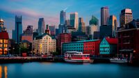
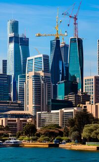
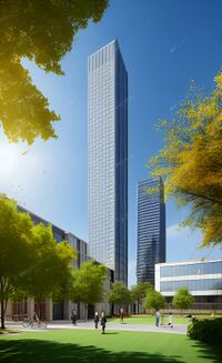
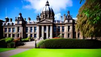
|image_caption          = From top to bottom: New Gough Island City Center Skyline, Orient Town, Government Center, Eastside, University of New Gough Island Campus
|image_flag              =
|flag_alt                =  
|flag_alt                =  
|image_seal              =  
|image_seal              =  
Line 78: Line 74:
|subdivision_type        = Country
|subdivision_type        = Country
|subdivision_name        = [[New Gough Island]]
|subdivision_name        = [[New Gough Island]]
|subdivision_type1      = Region
|subdivision_type1      = District
|subdivision_name1      = Queens Straits Metro
|subdivision_name1      = [[Gallatin| South Metro]]
|subdivision_type2      = Prefecture
|subdivision_type2      =  
|subdivision_name2      = [[Gallatin]]
|subdivision_name2      =  
|subdivision_type3      =  
|subdivision_type3      =  
|subdivision_name3      =  
|subdivision_name3      =  
Line 90: Line 86:
|seat                    =  
|seat                    =  
|government_footnotes    =  
|government_footnotes    =  
|leader_party            =  
|leader_party            = [[Liberal Democratic Party| LDP]]
|leader_title            = Executive Mayor
|leader_title            = District Administrator
|leader_name            = James Parker
|leader_name            = James Parker
|unit_pref              = US<!-- or UK -->
|unit_pref              = US<!-- or UK -->
Line 106: Line 102:
|area_blank2_title      =  
|area_blank2_title      =  
<!-- square miles -->
|area_total_sq_mi        = 100
|area_total_sq_mi        = 15
|area_land_sq_mi        = 60
|area_land_sq_mi        = 15
|area_water_sq_mi        = 40
|area_water_sq_mi        =  
|area_urban_sq_mi        = 1,034
|area_urban_sq_mi        = 15
|area_rural_sq_mi        =  
|area_rural_sq_mi        =  
|area_metro_sq_mi        = 4,700
|area_metro_sq_mi        =  
|area_blank1_sq_mi      =  
|area_blank1_sq_mi      =  
|area_blank2_sq_mi      =  
|area_blank2_sq_mi      =  
Line 129: Line 125:
|elevation_ft            =  
|elevation_ft            =  
|population_footnotes    =  
|population_footnotes    =  
|population_as_of        = 2020
|population_as_of        = 2024
|population_total        = 816,000
|population_total        = 100,000
|population_density_sq_mi = 13,600
|population_density_sq_mi = 6,667
|population_urban = 2,000,000
|population_urban =  
|population_metro = 2,100,000
|population_metro =  
|population_note        =  
|population_note        =  
|population_demonym      = Gallatiner
|population_demonym      = South Metropolitain
|timezone1              =  
|timezone1              =  
|utc_offset1            =  
|utc_offset1            =  
Line 149: Line 145:
|footnotes              =  
|footnotes              =  
}}
}}
'''Gallatin''' is the capital city and largest city of the Republic of [[New Gough Island]]. It is the largest city and the anchor of the Queens Strait Metro which includes the Gallatin City Prefecture, and the Greycott City Prefecture and 10 prefectures. The city has a population of 816,000 people as of the 2020 census. The city is the most densely populated city in the country. Located in the northern area of the country which houses 90% of the national population in 20% of the land area. The Queens Strait Metro area has a population of 2,100,000 with 2,000,000 people living in the urban area. 
'''Gallatin''' is a district in the New Gough Island. It is the capital of New Gough Island. The official capital is located in the neighborhood of Government Center. There are 5 neighborhoods of South Metro: New Gough Island City Center, Orient Town, Government Center, Eastside, and University Park.
 
The city was founded in 1718 but not proclaimed capital of the country until 1870. The city is on New Gough Island separated from its twin city of [[Greycott]] and the third largest city of [[Rainy Day Harbor]] on Parasides Island. The city is 60 sq mi in area. The city is well known for its historic architecture and art scene in South Gallatin. And the modern city of North Gallatin. The  North and South areas of Gallatin are connected by the Gallatin River Bridge. Gallatin city as a whole is connected to Greycott and Parasides Island  by the 1 mile-long road Queens Strait Bridge. The city has a robust transit system connecting itself to the suburbs by bus. Street trams, buses and taxis are the main features of the transit system. The city has a network of motorways in and outside of the city.
 
The city attracts the largest amount tourists to the country, with many arriving in the city to travel to the nature and rugged outdoors oriented vast South Area. On average, 8-10 million tourists visit the city each year. For this reason, the city is called the Gateway to New Gough Island. Tourist attractions include: the several historic parks in the city, the National Museum of Art, Bernard Square, City Observatory, national monuments, and much more.               
 
==History==
 
==Demographics==
As of the 2020 census the population stood at 816,000 people.  The city is younger than the national average. The median age for the nation is 35.8 years old. The city's median age is 29.5 years old. The religious makeup of the city is, 58% are atheist or agonistic, 38% are Christian, 2% are Jewish, 1% are Muslim and 1% are other. 62% of those who described themselves as Christian are Protestant while 38% of the city's Christian are Catholic.
 
The racial makeup of the city as of the 2020 census is: 75% white, 12% black, 8% mixed race, and 5% are natives. The age makeup of the city is, 25% are under the age of 18, 45% are in the age range of 18-34, 22% are the ages 35-55, and 8% are the age of 56 and older. 
 
The city is highly educated, 33% of residents have at least a Bachelor's degree, 14% of residents have a Master's degree, 3% have a professional degree, 3% have a doctorate degree, 8% have an Associate's degree, 39% have just a high school diploma. As a result the city is very wealthy, with the average income being ACU 54,000. 24% higher than the national average of ACU 41,000.
 
The city has 4% of it's population living at or below the poverty line of ACU 25,000. Majority of the city's residents are middle class, with 70% being in the category. 16% are considered upper middle class with a income of ACU 100,000 to 300,000. With 10% of the city's population being millionaires or higher. There are 81,600 millionaires in the city with 1 billionaire in the city.   
{{Historical populations
| 1730 | 180
| 1750 | 5,000
| 1800 | 12,000
| 1820 | 67,000
| 1850 | 139,000
| 1870 | 207,000
| 1880 | 254,000
| 1890 | 313,000
| 1900 | 361,000
| 1910 | 404,000
| 1920 | 473,000
| 1930 | 551,000
| 1940 | 634,000
| 1950 | 592,000
| 1960 | 521,000
| 1970 | 592,000
| 1980 | 631,000
| 1990 | 675,000
| 2000 | 707,000
| 2010 | 763,000
| 2020 | 816,000
}}
 
==Geography==
The city is located on New Gough Island across from Parasides Island which is part of the New Gough Islands chain. The city used to be conifer rainforest prior to human settlement. The city's average elevation is 152 feet. The city is divided into north and south by the Gallatin River. There are some hilly areas in the city. The highest elevation in the city is 258 feet. The city is largely built up however there are city parks. There are 50 parks and gardens throughout the city.
 
===Climate===
The climate of Gallatin is Subpolar Oceanic. With wet and cool to mild summers and cold and sometimes snowy winters. The city is one of the wettest places in the country with the North West Rainforest being wetter. The city is in the path of a lot of low pressure systems. During the summer it can be cool and rainy with some sunny and warm days. The highest temperature ever recorded was 90 degrees Fahrenheit. During the winter temperature can get as cold as 21 degrees Fahrenheit. Snow is abundant during the winter. Cold waves are common during the winter. With the coldest temperature ever recorded being 40 degrees Fahrenheit. 
 
{{Weather box|width=auto
|location = City Observatory, Gallatin, New Gough Island, 1991–2020 normals, extremes 1900–present
|single line = Y
| Jan high F = 63
| Feb high F = 61
| Mar high F = 55
| Apr high F = 44
| May high F = 32
| Jun high F = 27
| Jul high F = 21
| Aug high F = 23
| Sep high F = 28
| Oct high F = 34
| Nov high F = 46
| Dec high F = 54
|year high F =
|Jan mean F =
|Feb mean F =
|Mar mean F =
|Apr mean F =
|May mean F =
|Jun mean F =
|Jul mean F =
|Aug mean F =
|Sep mean F =
|Oct mean F =
|Nov mean F =
|Dec mean F =
|year mean F =
| Jan low F = 45
| Feb low F = 43
| Mar low F = 38
| Apr low F = 26
| May low F = 17
| Jun low F = 10
| Jul low F = 7
| Aug low F = 8
| Sep low F = 11
| Oct low F = 19
| Nov low F = 27
| Dec low F = 36
|year low F =
|Jan record high F = 90
|Feb record high F = 86
|Mar record high F = 77
|Apr record high F = 64
|May record high F = 58
|Jun record high F = 48
|Jul record high F = 42
|Aug record high F = 45
|Sep record high F = 52
|Oct record high F = 63
|Nov record high F = 72
|Dec record high F = 78
|year record high F = 90
|Jan record low F = 32
|Feb record low F = 28
|Mar record low F = 18
|Apr record low F = -9
|May record low F = -21
|Jun record low F = -36
|Jul record low F = -40
|Aug record low F = -38
|Sep record low F = -30
|Oct record low F = -18
|Nov record low F = -4
|Dec record low F = 14
|year record low F = -40
|precipitation colour = green
| Jan precipitation inch = 6.71
| Feb precipitation inch = 6.01
| Mar precipitation inch = 5.28
| Apr precipitation inch = 4.89
| May precipitation inch = 3.14
| Jun precipitation inch = 2.56
| Jul precipitation inch = 2.23
| Aug precipitation inch = 2.28
| Sep precipitation inch = 2.53
| Oct precipitation inch = 3.83
| Nov precipitation inch = 4.38
| Dec precipitation inch = 5.12
|year precipitation inch =
| unit precipitation days = 0.01 in
| Jan precipitation days = 15
| Feb precipitation days = 14
| Mar precipitation days = 12
| Apr precipitation days = 10
| May precipitation days = 9
| Jun precipitation days = 8
| Jul precipitation days = 7
| Aug precipitation days = 8
| Sep precipitation days = 9
| Oct precipitation days = 10
| Nov precipitation days = 12
| Dec precipitation days = 14
| year precipitation days =
|Jan snow inch = 0
|Feb snow inch = 0
|Mar snow inch = 1
|Apr snow inch = 6
|May snow inch = 24
|Jun snow inch = 36
|Jul snow inch = 40
|Aug snow inch = 32
|Sep snow inch = 22
|Oct snow inch = 20
|Nov snow inch = 7
|Dec snow inch = 1
|year snow inch =
|unit snow days = 0.1 in
|Jan snow days = 0
|Feb snow days = 0
|Mar snow days = 1
|Apr snow days = 2
|May snow days = 6
|Jun snow days = 8
|Jul snow days = 7
|Aug snow days = 8
|Sep snow days = 8
|Oct snow days = 7
|Nov snow days = 2
|Dec snow days = 1
|year snow days =
|source 1 = New Gough Island Weather Service
}}
 
==Transportation==
The Gallatin-Greycott Regional Transit Authority or GGRTA is the provider of public transportation in the Greater Gallatin area. The GGTA covers the city tram network of Gallatin, buses, buses rapid transit, taxis, and para transit. The Tram network has 20 lines city wide. The trams are the vintage Cava 2 (1949-1961) and Cava 3 (1962-1989) which has been kept up over the years. There are 30 bus lines and 5 bus rapid transit lines serving the Greater Gallatin-Greycott area.
 
The Greater Gallatin area is also served by 6 motorways. With The Waterfront Motorway as a ring road traveling just outside city limits along the waterfront of Parasides Island. There are no motorways in the city limits of Gallatin. Gallatin is connected to the rest of the county by the Queens Strait Bridge which carries The Gallatin-Greycott Motorway as well as train service across the Queens Strait. Train service is frequent having the Gallatin Union Station as the only place in the city for train service. Gallatin Union Station will be the hub for the subway.
 
It is estimated that 50% of city residents use public transportation regularly with 30% of commuters from the Gallatin-Greycott area using public transportation to go in and out of the city. 
 
===City Streets===
Gallatin city streets are largely in a planned grid system from the 1718, and have been modified multiple times afterwards. The city has a network of grand avenues which are usually tree lined and are 4 lanes wide, two lanes in each direction. The speed limit for the grand avenues which are main thoroughfares for traffic are 30 mph. One-way streets are also common in the city. Many streets have been redesigned for the inclusion of cycling lanes and traffic calming. There are no motorways in the city limits as the result of the Motorway Exclusion Act of 1950 which prohibited the construction of motorways in the city of Gallatin on the basis of cutting off historic neighborhoods and increasing traffic. It is estimated that 75% of city residents do not commute by a personal vehicle. As of 2023, 60% of residents take public transportation. While 10% walk to commute and 5% bike to work.
 
There are residential streets which are usually narrow and one-way have a speed limit of 15-20 mph. Many streets are paved with brick or cobblestone and slow careful driving is expected. Residential streets have space for street parking for residents. There are strict school and hospital slow zones which limit speed limits to 15 mph. These zones are on 24/7 regardless if the school is in session or not. Drivers will receive a ACU 150 fine and will be expected to pay within a reasonable amount of time.             
[[File:Uptown Greycott.jpg|thumb|Commerical Avenue]]
[[File:Modern Neighborhood.jpg|thumb|a residential neighborhood street]]
 
===Motorways===
There are 12 motorways in the Queens Strait Metro Area. The Sea to Sky Motorway, The Gallatin Crosstown Motorway, The Greycott Waterfront Motorway, The Queens Strait Motorway, The Northern Beltway Motorway, The Southern Beltway Motorway, The Eastern Bypass Motorway, New Gough Island Airport Motorway, The Harbor Motorway, The Southern Suburbs Motorway, The Parasides Island Motorway, and The Kingston Motorway.
         
[[File:The Perimeter Motorway.jpg|thumb|right|The Gallatin Crosstown Motorway is just outside of city limits on Parasides Island in a inner suburb]]
[[File:Gallatin River Bridge.jpg|thumb|right|Gallatin River Bridge]]
 
===Street Trams===
The street tram system dates back to the 1860's as horse drawn carriages. The street tram network became electrified in 1898 and rapidly expanded during the early 1900's. At its peak it had 70 lines in the city and the inner suburbs. The increase of car ownership and suburban growth caused ridership to decline in the late 1940's and 1950's. In the 1960's the city introduced bus routes and it replaced half of the tram system by 1968. The tram system was revitalized and expanded the track milage to better serve the South Gallatin population that wasn't able to access the buses. There are 108 miles of track across the city as of 2023. The tram system has 35 routes and is integrated with the rest of the public transportation system. The cost of the tram is ACU 1.25 per one way. At night there are only 5-night lines that run every hour only really serving the city center and government center. Trams run every 5 to 10 minutes at rush hour and 15 to 20 minutes at off peak hours. There are on average up to 150,000 people using the trams per day.   
[[File:Tram in Gallatin.jpg|thumb|right|A Cava 2 Tram traveling down a City Center street]]
 
===Buses and Bus Rapid Transit===
Buses were introduced in 1963 and rapidly expanded during the late 1960's and 1970's. The city has 30 bus lines within city limits. The city has 50 bus lines connecting to the suburbs. They run throughout the Queen Strait Metro area and cost ACU 1 one way. There are 5 Bus Rapid Transit lines which are as frequent as every 5 minutes during the rush hour and 10 minutes on off peak hours. BRT uses bus lanes and bus traffic signals to help keep the system efficient. The regular bus service is as frequent as every 15 minutes at rush hour and 30 minutes at off peak hours. The suburb to city buses run every 30 minutes during rush hour to every hour during off peak hours. The suburb to suburb or within suburb bus routes are less frequent and range from every 20 to 40 minutes at peak rush hour to every hour during off peak hours. There are 5 night lines for buses only serving the main thoroughfares. There are 2 city to suburb night bus lines. All night lines run every hour. Night lines are available 12 am to 5 am. There are 80,000 commuters that use the bus on average every day.     
 
===Cycling and Walkability===
The city has the highest walkability score in the country. The city has invested into the bike lanes and pathways in recent years. There are 100 miles of bike lanes and pathways across the city. 
 
===Queens Strait Metro===
{{Main|[[Gallatin-Greycott Metro|Queens Strait Metro]]}}
 
==Culture==
[[File:Gay Village of Greycott.jpg|thumb|The Gayborhood]]
==City Government==
The city of Gallatin is a region and city. Regions have some function in the Unitary state. Largely focusing on local matters with some autonomy in regard to governance. Regions have a Premier, a regional single chamber legislative assembly. The city region of Gallatin has an Executive Mayor and a City Assembly.  The Executive Mayor like all Premiers have a cabinet of departments. The departments include: the Department of Health, Department of Transportation, Department of Education, Department of Parks and Enviromental Protection, Department of Housing, Department of Police (Gallatin City Police), Department of Fire and Emergency Services, and Department of Sanitation and Utilities.
 
The City Assembly is made up of 1 assembly person per neighborhood. There are 42 members of the City Assembly elected to a 5 year term. A person cannot run if they are under the age of 18 and over the age of 70. The Executive Mayor can only run for two 5 year terms and the age limits apply for them as well.
 
The current Executive Mayor James Parker who was elected in 2020. He is the youngest Executive Mayor in the city's history at just 28 years old. He is the 3rd LGBT Executive Mayor and the first gay Executive Mayor in the city's history. He is the first Socialist Party member to win the election.
 
The city party known as Gallatin Beautiful Movement has the majority of seats in the City Assembly, with 21 seats. The second largest party is the Socialist Party with 8 seats, the third largest party is the Conservative Union with 7 seats, the fourth largest is the Liberal Nation 5 seats, and the smallest is the Green Party with 1 seat. 
[[File:Executive Mayor of Gallatin, James Parker - Imgur.jpg|thumb|right|The current Executive Mayor of Gallatin, James Parker]]
[[File:City Assembly of Gallatin - Imgur.png|thumb|right|The City Assembly makeup as of the 2020 Election]]
 
==City Neighborhoods==
There are 42 city neighborhoods
 
• South Gallatin City Center
 
• Fenburg Park
 
• Pinehurst
 
• Bernard Square
 
• Stratford
 
• Berlint
 
• Mangata
 
• Hanover Park
 
• Raynham
 
• Betty's Corner
 
• Confier Forrest
 
• Evergreen Terrace
 
• Berman
 
• Crossway
 
• Newport Park
 
• Harrison Heights
 
• Westminster
 
Government Center  
 
• Marble Field
 
• Kingston
 
• University Park
 
• Embassy Row
 
• The Gayborhood
 
• Wayland
 
• Waterfront Park
 
• East Fox Point
 
• West Fox Point
 
• Southbridge
 
• Hartridge
 
• New Oakridge
 
• Westerlin
 
• Zaledo
 
• Haymarket
 
Eastside
 
• Perimeter Heights
 
• Garden Estates
 
• Juniper Park
 
• Uptown North Gallatin
 
• Princeton
 
• North Gallatin CBD
 
• Park East
 
• Park West
 
[[File:Gallatin neighborhood.jpg|thumb|right|Princeton]]
[[File:Gallatin neighborhood 2.jpg|thumb|Juniper Park]]
 
==Education==
The Gallatin Public Schools is the largest school district in the country with 164,000 students as of 2023. There are 70 public schools, with 40 elementary schools, 20 middle schools, and 10 high schools throughout the city. High school times are from 8:30 am to 3:30 pm. Middle school times are from 7:30 am to 2:30 pm. And elementary school times are from 7 am to 2 pm. Gallatin Public Schools are considered the best public school system in the country.
 
There are 12 private academies throughout the city, tuition can range from ACU 500 per month to nearly ACU 2,000 per month at the most prestigious intuitions. During the spring all students regardless of public or private, must take the national college entrance exam known as the Excell Exam. The exam has all subjects, from advanced math, advanced Common, advanced science, advanced life skills, and advanced national and world history. The exam is held nationwide on every last Friday of November. The test can take up to 5 hours to complete. Students must list their universities of choice, based on the score combined from all 5 subjects that reaches 1,000. The higher the score the better chances you have to get into the top university of choice. Any score below a 500 is deemed failing and the applicant cannot attend university. The applicant can appeal to take the test again in a year; however, they must pay ACU 250 to retake the test. There are unlimited chances. Many students study all day sometimes for 2-3 years in addition to schoolwork, and if their parents can afford to pay for a private tutor. Public tutors are in easily available and applying for one is easier despite limited timeslots.
 
All universities in the country are public, there are 3 public universities in the city. The top school in the country, known as the University of Gallatin with 30,000 students, the second best as Hartridge University with 16,000 students, and University of New Gough Island main campus the third best in the country with 24,000 students. The University of New Gough Island has 4 other campuses across the country. 
 
There are 44 libraries in the city. 42 of them are part of the public university system of Gallatin.  With the main one being the Gallatin Public Library. The one library while public is restricted to appointment only is the National Library of New Gough Island. The other 41 libraries are neighborhood branch libraries.
[[File:University of Gallatin.jpg|thumb|right|University of Gallatin campus]]
 
==Economy==


==Neighborhoods==
==Sister Cities==  
==Sister Cities==  
[[Králowec, F.D.]], [[Morrawia]] (2000)
[[Králowec, F.D.]], [[Morrawia]] (2000)

Revision as of 18:18, 3 May 2024

South Metro
Capital District
NGI City Center-South Metro.jpg
NGI-3 - Imgur.jpg
Government Center 2.jpg
Government Center.jpg
University of NGI.jpg
Gough City Hall - Imgur.jpg
From top to bottom: New Gough Island City Center Skyline, Orient Town, Government Center, Eastside, University of New Gough Island Campus
CountryNew Gough Island
District South Metro
Government
 • District AdministratorJames Parker ( LDP)
Area
 • Capital District15 sq mi (40 km2)
 • Land15 sq mi (40 km2)
 • Urban
15 sq mi (40 km2)
Population
 (2024)
 • Capital District100,000
 • Density6,667/sq mi (2,574/km2)
DemonymSouth Metropolitain

Gallatin is a district in the New Gough Island. It is the capital of New Gough Island. The official capital is located in the neighborhood of Government Center. There are 5 neighborhoods of South Metro: New Gough Island City Center, Orient Town, Government Center, Eastside, and University Park.

Neighborhoods

Sister Cities

Králowec, F.D., Morrawia (2000)