Transport in Mascylla: Difference between revisions
m (→Roads) |
|||
| (42 intermediate revisions by the same user not shown) | |||
| Line 1: | Line 1: | ||
{{WIP}} | {{WIP}} | ||
[[File:Mascylla travel time map.png| | {{Region icon Aurorum}} | ||
[[File: | [[File:Mascylla travel time map.png|240px|thumb|right|Travel times by road in Mascylla from Königsreh]] | ||
[[File: | [[File:Frankfurt_am_Main_(Rhein-Main_AB)_(FRA_-_FRF_-_EDDF)_AN2337947.jpg|240px|thumb|right|[[Königsreh–Albert Polschnitz Airport]], one of the busiest airports in Berea by passenger and cargo traffic]] | ||
[[File:DB_AG_406_001-8.jpg|240px|thumb|right|A ILE 6A trainset entering Lensrau Hauptbahnhof]] | |||
'''Transportation in Mascylla''' relies on one of the world's densest {{wp|transportation}} and {{wp|infrastructure}} networks, with 712,000 km of roadway and 19.8 km of rail lines per 100 km<sup>2</sup>, and is needed by [[Mascylla]], a densely populated, [[Economy of Mascylla|economically developed]] country in northern [[Telmeria]]. {{wp|rail transport|Rail}}, {{wp|road transport|road}}, {{wp|aviation|air}}, and {{wp|maritime transport|water}} are all sophisticated and widely developed means of transportation in Mascylla. | |||
The [[Government of Mascylla|Ministry of Infrastructure]] and the [[Government of Mascylla|Ministry of Transport of the Realm]] of the [[Government of Mascylla|Mascyllary government]] jointly oversees all activities and affairs relating to transportations; however, a large portion has been {{wp|privatization|privatized}} and shared with various companies. | |||
One of the world's first large-scale {{wp|limited-access highway}} systems, the ''{{wp|Autobahn}}'' is a nationwide system of {{wp|highway|highways}} and {{wp|road|roads}}. The country's most important {{wp|waterway|waterways}} are the rivers [[River Blaugold|Blaugold]], Rohrn, Lehr, Lanne, and Warne, and a {{wp|canal|canal system}} connecting the three rivers and [[Lake Sigismund]] respectively; the most important {{wp|maritime port}} is that of Pereuth at the mouth of the River Rohrn. [[Königsreh–Albert Polschnitz Airport]] is the largest {{wp|airport}} in Mascylla and a sizeable international hub of air travel and transport in Temaria. {{wp|Air travel}} is rarely used for inland flights, mainly due to its sophisticated road and rail network, but it competes with Mascylla's numerous privately owned railway operators nevertheless. High and medium-speed trains such as the ILE (''InterLandExpress'') connect urban areas, with passengers and cargo able to move at 370 km/h between cities. Most Mascyllary cities have a connection to {{wp|rapid transit}} capabilities, most notably the [[Königsreh U-Bahn]], and other {{wp|public transport}}; most of the infrastructure is provided by the state itself. | |||
One of the world's first large-scale highway systems, the ''{{wp|Autobahn}}'' is a | |||
==Railways== | ==Railways== | ||
The network of {{wp|railway|railways}} is one of the most developed and oldest of its kind in the world. The backbone is made up of five major lines or corridors radiating away from Königsreh, the ''Nordlandpfad'', ''Südlandpfad'', ''Zentralpfad'', ''Sigismundpfad'', and ''Warnenpfad''. These are served and supported by numerous regional and local lines, as well as dense networks in urban agglomerations. The HGB network, largely operated with the ''ILE'' train family, is responsible for {{wp|high speed train}} travel in the country. Generally, the high-speed network is extensive and provides an exceptional standard of service. | |||
[[File:Hauptbahnhof_Berlin.jpg|260px|thumb|left|[[Königsreh|Königsreh Hauptbahnhof]], the busiest {{wp|railway station}} in Mascylla by the number of daily passengers, and one of the busiest stations in Berea]] | |||
The first railroad line with passenger carriage, the ''Hubertsburg-Merzenich-Landeisenbahn'', assumed operation in 1846, and in 1855, the first line was opened, connecting two major cities (''Augusthal und Weidenau-Bahn''). In its wake, hundreds of railroad companies were founded that slowly merged into six conglomerates by the beginning of the 20th century. However, they would be quickly {{wp|nationalization|nationalized}} and centralized by authorities in 1898. In 1950, these companies, having been temporarily unified as ''Reichsbahn'' (RB), were separated again, and its rolling stock, passenger-carrying and freight subsidies were divided among its successors. The maintenance and providing of the infrastructure remained government-controlled to avoid the rise of a network {{wp|monopoly}}. Thus, the six original companies were retained and the network doubled in size between 1951 and 1975. | |||
In Mascylla, the railroad infrastructure, including all tracks, stations, maintenance workshops and signalling, is in possession of the nationalized and {{wp|nonprofit corporation|non-profit-oriented}} ''Nationalnetzwerk''. Passenger travel is made available by private companies and firms, who comply with regulations posed by the Ministry of Transport of the Realm to accomplish running by {{wp|franchising}} principle. Freight and cargo travel is divided among state-owned and private transportation companies. However, they abide to different restrictions and laws to respect as their counterparts in public transport. Oftentimes, companies rent or lend rolling stock items from public providers, as they often lack the financial ability to maintain a fleet independently. | |||
The network in Mascylla encompasses 534,726 kilometers of tracks which use the {{wp|standard gauge}} of 1,435 mm. 310,242 kilometers of which are electrified, and 228,591 kilometers are double or multi-track. The maximum velocity of ''ILE'' trains on {{wp|InterCity}} routes is 240 {{wp|kilometer per hour|km/h}} (149 {{wp|miles per hour|mph}}); in comparison, on specific segments of the [[HGZ Telmeria]] in Mascylla, a velocity of up to 370 km/h (230 mph) is permitted. | |||
The network in Mascylla encompasses | |||
===Rapid transit (''U-Bahn'')=== | ===Rapid transit (''U-Bahn'')=== | ||
[[File:MP73 RATP-1.JPG|230px|thumb|right|Train on the [[Königsreh U-Bahn]] arriving at the station ''Henriettenweg'']] | |||
[[File:K4500 VB Presentation.jpg|230px|thumb|right|Tram of the ''Südtransit'' in Lannbrück]] | |||
Four Mascyllary cities have a {{wp|rapid transit}} (in Hesurian "{{wp|U-Bahn}}") network, the most famous of which being the ''[[Königsreh U-Bahn]]'' in Königsreh, the oldest and most full-fledged rapid transit network in Mascylla. The other systems are located in major cities such as in Flussmund with the ''[[Flussmund Metro]]'', in Lancaide and proximity with the ''[[Langquaid U-Bahn]]'', and in Konreid with the ''[[Konreid Untergrund]]''. | |||
===Suburban transit (''S-Bahn'')=== | |||
All metropolitan areas and cities maintain a suburban transit or {{wp|commuter railway}} system (in Hesurian "{{wp|S-Bahn}}") that link city centers with, as its name suggests, suburban areas and often other surrounding towns. Königsreh and Flussmund have a linkage system that integrates S-Bahn activities to the U-Bahn network via {{wp|third rail|third rails}}, despite former separation. In particular, Königsreh developed a shared agreement with the surrounding states of Eustria-Folnery and Shwesia to integrate its network with nearby urban regions such as Carlsweil and Lensrau as the entity ''Verkehrsverbund Zentralmaskillien'' (VVZM). | |||
Often cities build up or extend existing tramways to light rail transportation that share the same tasks as S-Bahnen, but are called "{{wp|Stadtbahn|Stadtbahnen}}" ("city train"; ST-Bahn). | |||
=== | ===Trams (''Straßenbahn'')=== | ||
The establishment of electrified {{wp|tram}} networks in Mascyllary cities began in the late 19th century, and by 1920, every major city had a developed system. The rise of individual motor transport led to a sharp decrease in interest in preserving public transport capabilities. Thereafter, a large portion of the network saw retirement and deconstruction ; Augusthal was the last city to maintain a tramway network in 1960. However, since the 1970s, tram reconstruction and revival has been a continuous trend, and most of the original systems were reinstituted by the turn of the century. The introduction of {{wp|tram-train}} lines became prominant in entirely new systems, such as in Ihleburg, Pereuth, or Sudhaven. Some of the most extensive tramways include the ''Königsreh Metrolink'' in Königsreh, the ''Dockfurt Stadttram'' in Dockfurt, the ''Herzensland Tram'' in Lensrau/Reifurt, the ''Tramlink'' in Augusthal/Weidenau and the ''Südtransit'' in Lannbrück/Mackrau. | |||
==Roads== | |||
[[File:Autobahn map Mascylla.png|240px|thumb|right|Map of the Mascyllary ''Autobahn'' road network]] | |||
Mascylla maintains approximately 712,000 kilometers of {{wp|road|roads}}, of which 298,000 kilometers are non-regional, inter-state or national roads. The ''{{wp|Autobahn}}'', officially known as ''Reichsautobahn'' or ''Reichsbahn'', is a national {{wp|controlled-access highway}} system that links urban regions and provides inter-state motor travel on a national dimension. The network had a total length of 18,707 kilometers in 2016, making it one of the world's densest systems of its kind. While no actual speed limit is postulated, a specific {{wp|advisory speed limit}} for a segment of the ''Autobahn'' is provided. The navigational sign of the ''Autobahn'' is a distinctive blue sign and is named using the capital letter A and a number (for example, ''A4''). | |||
Apart from the ''Autobahnen'', the country is traversed by a dense network of four-lane roads, termed ''Herrsstraßen'' ("lord roads"), on which every vehicle is allowed, and roads may intersect. They serve as mid-speed roads for more rural areas and connect local cities and towns. It is designated with a yellow sign and named with a capital "H" followed by its number (for example, ''H16''). Other road types include the ''Landesstraße'' ("state road"), maintained by the states of Mascylla and prefixed with "L", the ''Stadtstraße'' ("city road") in the country's Free Cities, prefixed with "St", and the ''Kreisstraße'' ("district road"), regulated and overseen by the ''Landkreise'' or local districts and municipalites and prefixed with "K". They lack uniformed signs, and numbers are uniquely chosen and dependant on the state in question. | |||
The | The responsibility of maintenance of the ''Autobahnen'' and other national roads is broadly diversified but loosely centralized in the ''Reichsstraßenamt'', an agency of the Ministry of Infrastructure of the Realm. Despite this, ''Kreissstraßen'' in particular are administrated by local and communal authorities. Mascyllary ''Autobahnen'' are mostly free of {{wp|toll}} requirements; however, certain locations such as tunnels or bridges introduced a mandatory toll in the 2000s. City centres such as in Königsreh are designated {{wp|environmental zone|environmental zones}}, minimizing the presence of trucks and buses via fee payment by their private owners. The country has used {{wp|right-hand traffic}} since 1756. | ||
<gallery> | |||
Reichsautobahn sign.png|''Autobahn'' (Reichs-<br>autobahn sign) | |||
Example Autobahn A5 Mascylla sign.png|''Nummernzeichen für Autobahnen'' (Auto-<br>bahn route sign) | |||
Example Autobahn Mascylla junction sign.png|''Abzweigung der Autobahn'' (Auto-<br>bahn junction sign) | |||
Herrsstraße sign.png|''Herrsstraße'' (Herrs-<br>straße sign) | |||
Example Herrsstraße H12 Mascylla sign.png|''Nummernzeichen für Herrsstraßen'' (Herrs-<br>straße route sign) | |||
Example Herrsstraße junction sign.png|''Wegweiser zur Herrs-<br>straße'' (Herrsstraße<br>junction sign) | |||
Speed limits in Mascylla.png|Speed limits in urban and rural areas (advisory for ''Autobahnen'') | |||
</gallery> | |||
==Air transport== | ==Air transport== | ||
[[File:Airports in Mascylla map.png|240px|thumb|right|Map of international and regional airports of Mascylla]] | |||
The Mascyllary network for air travel is mainly orientated toward international or outbound flights. In contrast, flights to and from domestic destinations have become far less attractive and uncompetitive as extensive overhauling of rail and motorway capabilities allowed for cheaper travel. Nonetheless, planes are widely in use for freight and more minor domestic services, while they are a highly important part of international transportation for Mascylla. Thus, airlines have an extensive catalogue of destinations abroad and major internationally recognized competitors, due to Mascylla's large air market potential. | |||
Mascylla's air market has historically been under the supervision of the Mascyllary government and only recently witnessed, beginning in the 1980s under [[Prime Minister of Mascylla|Charlotte Mayn]]'s government, a trend of modernization and privatization. | |||
===Airlines=== | ===Airlines=== | ||
[[File:Maskillea Airlines A310 aircraft at Königsreh.png|240px|thumb|right|A [[Maskillea Airlines]] {{wp|Airbus A310|C828}} at [[Königsreh–Albert Polschnitz Airport]]]] | |||
[[File:Aerial_View_of_Frankfurt_Airport_1.jpg|240px|thumb|right|Königsreh-Albert Polschnitz Airport]] | |||
The biggest {{wp|airline}} in Mascylla is its {{wp|flag carrier}} and one of the world's largest private airline companies, [[Maskillea Airlines]]. With numerous subsidies, such as the autonomously operating Maskillea Express and Maskillea InLand, the airline operates a massive network of regional and international flight routes. Its predecessor was [[Interflug]], one of the largest airlines in the world between the 1970s and 2000s. Other charter and leisure airlines include ''Firmament'', ''Himmelsexpress'', ''Adler Airways'' and ''FliegWeg''. | |||
Numerous air cargo companies also comprise a sizeable amount of Mascyllary air-bound travel, with operators such as Maskillea Cargo, MKH Transport, and [[AeroBote]] (jointly owned by Maskpost and [[Skytrain]]) dominating the industry. | |||
===Airports=== | ===Airports=== | ||
462 {{wp|airport|airports}} and {{wp|airfield|airfields}} are located in Mascylla, of which 353 have paved runways as of 2010. The country's largest airport is [[Königsreh–Albert Polschnitz Airport]], receiving among the most passengers and amount of cargo in Berea, and therefore being an international center of traffic. In 2018, the airport handled around 40 million passengers and some 980 thousand tons of freight. The second and third largest airports are [[Flussmund-Lachsen International Airport]] and [[Lannbrück-Meißhardt International Airport]] respectively; other airports of international importance include Königsreh-Stadter, Breisgau International, Lancaide-Leinitzer International, Augusthal International and Septberg International. | |||
==Water transport== | ==Water transport== | ||
Water transport in Mascylla has repeatedly faced significant issues due to the country's rugged and highly varied [[Geography of Mascylla|topography]]. Nonetheless, travel on water is an integral means of transport for freight in particular and has its origin at the beginning of the {{wp|Industrial Revolution}} in the mid-18th century. | |||
===Harbours and terminals=== | |||
[[File:Landungsbrücken,_Hamburg.JPG|230px|thumb|left|The Port of Pereuth, Mascylla's largest {{wp|seaport}} and second-busiest port in Berea]] | |||
Approximately 19% of all goods reach Mascylla via ships, the second-most important method of the import of international goods after trucks and cars. The four biggest harbours of the country are Pereuth, Flussmund, Mogdburg, and Fahnerhaven respectively. Apart from these, Mascylla features numerous inland harbours, of which the most important are Mackrau, Trevermünde, Ihleburg, Brunswald, and Rothenau. The ports in Pereuth and Flussmund also operate petroleum, natural gas, and coal terminals for imports. Additionally, Mascylla maintains the second-largest {{wp|merchant navy}} in the world. | |||
===Waterways=== | |||
[[File:Mascylla waterways map.png|240px|thumb|right|Map of artifical waterways and canals in Mascylla]] | |||
At the beginning of the Second Industrial Revolution, several networks of {{wp|canal|canals}} were constructed throughout the country that were largely used by small ships and {{wp|narrowboat|narrowboats}} (''Schmalboote''), specifically retrofitted in their size and composition for use on canals. In the late 18th century, the system was fully developed and most of the cargo and goods were transported via the canal network. The importance of waterways diminished significantly after the mass introduction of railroads in the 1840s, however, and construction and maintenance stopped almost entirely. | |||
Today, Mascylla features around 3100 kilometers of traversable inland waterways, most of which are used for recreational and other public activities. Another 580 kilometers of which are still used for commercial purposes. The Ankstedt Canal connects the White Sea and the North Sea and is one of the busiest waterways in the world. The [[River Blaugold]] is one of the most significant rivers in Telmeria, providing the drainage for [[Lake Sigismund]] and serving as the principal waterway for the economies of [[Valtriva]], [[Rovina]], and parts of [[Cuthland]]. | |||
==See also== | |||
* [[Economy of Mascylla]] | |||
[[Category:Mascylla]] {{Template:Mascyllatopics}} | [[Category:Mascylla]] | ||
{{Template:Mascyllatopics}} | |||
Latest revision as of 13:56, 31 December 2022
This article is incomplete because it is pending further input from participants, or it is a work-in-progress by one author. Please comment on this article's talk page to share your input, comments and questions. Note: To contribute to this article, you may need to seek help from the author(s) of this page. |

_(FRA_-_FRF_-_EDDF)_AN2337947.jpg)

Transportation in Mascylla relies on one of the world's densest transportation and infrastructure networks, with 712,000 km of roadway and 19.8 km of rail lines per 100 km2, and is needed by Mascylla, a densely populated, economically developed country in northern Telmeria. Rail, road, air, and water are all sophisticated and widely developed means of transportation in Mascylla.
The Ministry of Infrastructure and the Ministry of Transport of the Realm of the Mascyllary government jointly oversees all activities and affairs relating to transportations; however, a large portion has been privatized and shared with various companies.
One of the world's first large-scale limited-access highway systems, the Autobahn is a nationwide system of highways and roads. The country's most important waterways are the rivers Blaugold, Rohrn, Lehr, Lanne, and Warne, and a canal system connecting the three rivers and Lake Sigismund respectively; the most important maritime port is that of Pereuth at the mouth of the River Rohrn. Königsreh–Albert Polschnitz Airport is the largest airport in Mascylla and a sizeable international hub of air travel and transport in Temaria. Air travel is rarely used for inland flights, mainly due to its sophisticated road and rail network, but it competes with Mascylla's numerous privately owned railway operators nevertheless. High and medium-speed trains such as the ILE (InterLandExpress) connect urban areas, with passengers and cargo able to move at 370 km/h between cities. Most Mascyllary cities have a connection to rapid transit capabilities, most notably the Königsreh U-Bahn, and other public transport; most of the infrastructure is provided by the state itself.
Railways
The network of railways is one of the most developed and oldest of its kind in the world. The backbone is made up of five major lines or corridors radiating away from Königsreh, the Nordlandpfad, Südlandpfad, Zentralpfad, Sigismundpfad, and Warnenpfad. These are served and supported by numerous regional and local lines, as well as dense networks in urban agglomerations. The HGB network, largely operated with the ILE train family, is responsible for high speed train travel in the country. Generally, the high-speed network is extensive and provides an exceptional standard of service.

The first railroad line with passenger carriage, the Hubertsburg-Merzenich-Landeisenbahn, assumed operation in 1846, and in 1855, the first line was opened, connecting two major cities (Augusthal und Weidenau-Bahn). In its wake, hundreds of railroad companies were founded that slowly merged into six conglomerates by the beginning of the 20th century. However, they would be quickly nationalized and centralized by authorities in 1898. In 1950, these companies, having been temporarily unified as Reichsbahn (RB), were separated again, and its rolling stock, passenger-carrying and freight subsidies were divided among its successors. The maintenance and providing of the infrastructure remained government-controlled to avoid the rise of a network monopoly. Thus, the six original companies were retained and the network doubled in size between 1951 and 1975.
In Mascylla, the railroad infrastructure, including all tracks, stations, maintenance workshops and signalling, is in possession of the nationalized and non-profit-oriented Nationalnetzwerk. Passenger travel is made available by private companies and firms, who comply with regulations posed by the Ministry of Transport of the Realm to accomplish running by franchising principle. Freight and cargo travel is divided among state-owned and private transportation companies. However, they abide to different restrictions and laws to respect as their counterparts in public transport. Oftentimes, companies rent or lend rolling stock items from public providers, as they often lack the financial ability to maintain a fleet independently.
The network in Mascylla encompasses 534,726 kilometers of tracks which use the standard gauge of 1,435 mm. 310,242 kilometers of which are electrified, and 228,591 kilometers are double or multi-track. The maximum velocity of ILE trains on InterCity routes is 240 km/h (149 mph); in comparison, on specific segments of the HGZ Telmeria in Mascylla, a velocity of up to 370 km/h (230 mph) is permitted.
Rapid transit (U-Bahn)


Four Mascyllary cities have a rapid transit (in Hesurian "U-Bahn") network, the most famous of which being the Königsreh U-Bahn in Königsreh, the oldest and most full-fledged rapid transit network in Mascylla. The other systems are located in major cities such as in Flussmund with the Flussmund Metro, in Lancaide and proximity with the Langquaid U-Bahn, and in Konreid with the Konreid Untergrund.
Suburban transit (S-Bahn)
All metropolitan areas and cities maintain a suburban transit or commuter railway system (in Hesurian "S-Bahn") that link city centers with, as its name suggests, suburban areas and often other surrounding towns. Königsreh and Flussmund have a linkage system that integrates S-Bahn activities to the U-Bahn network via third rails, despite former separation. In particular, Königsreh developed a shared agreement with the surrounding states of Eustria-Folnery and Shwesia to integrate its network with nearby urban regions such as Carlsweil and Lensrau as the entity Verkehrsverbund Zentralmaskillien (VVZM).
Often cities build up or extend existing tramways to light rail transportation that share the same tasks as S-Bahnen, but are called "Stadtbahnen" ("city train"; ST-Bahn).
Trams (Straßenbahn)
The establishment of electrified tram networks in Mascyllary cities began in the late 19th century, and by 1920, every major city had a developed system. The rise of individual motor transport led to a sharp decrease in interest in preserving public transport capabilities. Thereafter, a large portion of the network saw retirement and deconstruction ; Augusthal was the last city to maintain a tramway network in 1960. However, since the 1970s, tram reconstruction and revival has been a continuous trend, and most of the original systems were reinstituted by the turn of the century. The introduction of tram-train lines became prominant in entirely new systems, such as in Ihleburg, Pereuth, or Sudhaven. Some of the most extensive tramways include the Königsreh Metrolink in Königsreh, the Dockfurt Stadttram in Dockfurt, the Herzensland Tram in Lensrau/Reifurt, the Tramlink in Augusthal/Weidenau and the Südtransit in Lannbrück/Mackrau.
Roads

Mascylla maintains approximately 712,000 kilometers of roads, of which 298,000 kilometers are non-regional, inter-state or national roads. The Autobahn, officially known as Reichsautobahn or Reichsbahn, is a national controlled-access highway system that links urban regions and provides inter-state motor travel on a national dimension. The network had a total length of 18,707 kilometers in 2016, making it one of the world's densest systems of its kind. While no actual speed limit is postulated, a specific advisory speed limit for a segment of the Autobahn is provided. The navigational sign of the Autobahn is a distinctive blue sign and is named using the capital letter A and a number (for example, A4).
Apart from the Autobahnen, the country is traversed by a dense network of four-lane roads, termed Herrsstraßen ("lord roads"), on which every vehicle is allowed, and roads may intersect. They serve as mid-speed roads for more rural areas and connect local cities and towns. It is designated with a yellow sign and named with a capital "H" followed by its number (for example, H16). Other road types include the Landesstraße ("state road"), maintained by the states of Mascylla and prefixed with "L", the Stadtstraße ("city road") in the country's Free Cities, prefixed with "St", and the Kreisstraße ("district road"), regulated and overseen by the Landkreise or local districts and municipalites and prefixed with "K". They lack uniformed signs, and numbers are uniquely chosen and dependant on the state in question.
The responsibility of maintenance of the Autobahnen and other national roads is broadly diversified but loosely centralized in the Reichsstraßenamt, an agency of the Ministry of Infrastructure of the Realm. Despite this, Kreissstraßen in particular are administrated by local and communal authorities. Mascyllary Autobahnen are mostly free of toll requirements; however, certain locations such as tunnels or bridges introduced a mandatory toll in the 2000s. City centres such as in Königsreh are designated environmental zones, minimizing the presence of trucks and buses via fee payment by their private owners. The country has used right-hand traffic since 1756.
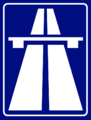
Autobahn (Reichs-
autobahn sign)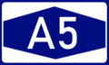
Nummernzeichen für Autobahnen (Auto-
bahn route sign)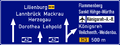
Abzweigung der Autobahn (Auto-
bahn junction sign)
Herrsstraße (Herrs-
straße sign)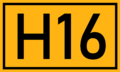
Nummernzeichen für Herrsstraßen (Herrs-
straße route sign)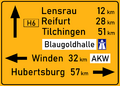
Wegweiser zur Herrs-
straße (Herrsstraße
junction sign)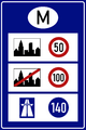
Speed limits in urban and rural areas (advisory for Autobahnen)


Air transport

The Mascyllary network for air travel is mainly orientated toward international or outbound flights. In contrast, flights to and from domestic destinations have become far less attractive and uncompetitive as extensive overhauling of rail and motorway capabilities allowed for cheaper travel. Nonetheless, planes are widely in use for freight and more minor domestic services, while they are a highly important part of international transportation for Mascylla. Thus, airlines have an extensive catalogue of destinations abroad and major internationally recognized competitors, due to Mascylla's large air market potential.
Mascylla's air market has historically been under the supervision of the Mascyllary government and only recently witnessed, beginning in the 1980s under Charlotte Mayn's government, a trend of modernization and privatization.
Airlines


The biggest airline in Mascylla is its flag carrier and one of the world's largest private airline companies, Maskillea Airlines. With numerous subsidies, such as the autonomously operating Maskillea Express and Maskillea InLand, the airline operates a massive network of regional and international flight routes. Its predecessor was Interflug, one of the largest airlines in the world between the 1970s and 2000s. Other charter and leisure airlines include Firmament, Himmelsexpress, Adler Airways and FliegWeg.
Numerous air cargo companies also comprise a sizeable amount of Mascyllary air-bound travel, with operators such as Maskillea Cargo, MKH Transport, and AeroBote (jointly owned by Maskpost and Skytrain) dominating the industry.
Airports
462 airports and airfields are located in Mascylla, of which 353 have paved runways as of 2010. The country's largest airport is Königsreh–Albert Polschnitz Airport, receiving among the most passengers and amount of cargo in Berea, and therefore being an international center of traffic. In 2018, the airport handled around 40 million passengers and some 980 thousand tons of freight. The second and third largest airports are Flussmund-Lachsen International Airport and Lannbrück-Meißhardt International Airport respectively; other airports of international importance include Königsreh-Stadter, Breisgau International, Lancaide-Leinitzer International, Augusthal International and Septberg International.
Water transport
Water transport in Mascylla has repeatedly faced significant issues due to the country's rugged and highly varied topography. Nonetheless, travel on water is an integral means of transport for freight in particular and has its origin at the beginning of the Industrial Revolution in the mid-18th century.
Harbours and terminals

Approximately 19% of all goods reach Mascylla via ships, the second-most important method of the import of international goods after trucks and cars. The four biggest harbours of the country are Pereuth, Flussmund, Mogdburg, and Fahnerhaven respectively. Apart from these, Mascylla features numerous inland harbours, of which the most important are Mackrau, Trevermünde, Ihleburg, Brunswald, and Rothenau. The ports in Pereuth and Flussmund also operate petroleum, natural gas, and coal terminals for imports. Additionally, Mascylla maintains the second-largest merchant navy in the world.
Waterways

At the beginning of the Second Industrial Revolution, several networks of canals were constructed throughout the country that were largely used by small ships and narrowboats (Schmalboote), specifically retrofitted in their size and composition for use on canals. In the late 18th century, the system was fully developed and most of the cargo and goods were transported via the canal network. The importance of waterways diminished significantly after the mass introduction of railroads in the 1840s, however, and construction and maintenance stopped almost entirely.
Today, Mascylla features around 3100 kilometers of traversable inland waterways, most of which are used for recreational and other public activities. Another 580 kilometers of which are still used for commercial purposes. The Ankstedt Canal connects the White Sea and the North Sea and is one of the busiest waterways in the world. The River Blaugold is one of the most significant rivers in Telmeria, providing the drainage for Lake Sigismund and serving as the principal waterway for the economies of Valtriva, Rovina, and parts of Cuthland.
