Durnstaal: Difference between revisions
(Created page with "{{Infobox country |native_name = |conventional_long_name = Federated Union of Durnstaal |common_name = Durnstaal |image_flag...") |
Pretzelbomb (talk | contribs) |
||
| Line 94: | Line 94: | ||
==Geography== | ==Geography== | ||
Durnstaal's geography is overall mountainous with large changes in elevation between the north and south of the nation. The climate becomes drier the closer to the center of the nation you travel with several small patches of desert along the northern face of the Kalater mountains. The nation experiences rainfall in two separate systems, the north fed by Lakes Gravenna and Lovap and the south fed by the Albarine Sea. The lowest elvation is -2m above sea level and the highest is Drukov Point which sits 1,742m above sea level. | |||
Durnstaal's geography varies across the nation and is generally divided into four distinct zones: '''The Cohn Lowlands''', '''The Novada Highlands''', '''The Stretch''', and '''The Coastal Expanse'''. The Cohn Lowlands include the rolling hills and dry grasslands bordering Lake Gravenna and Lake Lovap in the northeast. The Novada Highlands include the dense forests and elevated plateaus that run along the western border. The Stretch encompasses the Kalater mountains and the habitable valleys and hills that run along its northern edge. The Coastal Expanse includes all subtropical or near-subtropical Durnstall lands south of the Kalater mountains. | |||
==Demographics== | ==Demographics== | ||
Revision as of 19:54, 26 August 2020
Federated Union of Durnstaal | |
|---|---|
|
Flag | |
 | |
| Capital | Durnen |
| Government | |
| Date format | mm-dd-yyyy |
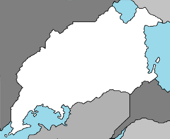
The Federated Union of Durnstaal, most commonly known as Durnstaal, is a nation in the Coalition of Crown Albatross located on the continent of Adula, bordered by Saudi Jiddiya.
History
Geography
Durnstaal's geography is overall mountainous with large changes in elevation between the north and south of the nation. The climate becomes drier the closer to the center of the nation you travel with several small patches of desert along the northern face of the Kalater mountains. The nation experiences rainfall in two separate systems, the north fed by Lakes Gravenna and Lovap and the south fed by the Albarine Sea. The lowest elvation is -2m above sea level and the highest is Drukov Point which sits 1,742m above sea level.
Durnstaal's geography varies across the nation and is generally divided into four distinct zones: The Cohn Lowlands, The Novada Highlands, The Stretch, and The Coastal Expanse. The Cohn Lowlands include the rolling hills and dry grasslands bordering Lake Gravenna and Lake Lovap in the northeast. The Novada Highlands include the dense forests and elevated plateaus that run along the western border. The Stretch encompasses the Kalater mountains and the habitable valleys and hills that run along its northern edge. The Coastal Expanse includes all subtropical or near-subtropical Durnstall lands south of the Kalater mountains.

