Austrolis
Federation of Austrolis Austroliarisa | |
|---|---|
|
Flag | |
 | |
| Capital | Austrolisia |
| Government | |
| Lional Ferosan | |
| Gidean Il'Jarro | |
| Population | |
• 2020 estimate | 51,255,000 |
| Date format | mm-dd-yyyy |
The Federation of Austrolis, most commonly known as Austrolis, is a nation in the Coalition of Crown Albatross located in Western Adula, bordered by Kantoalina, Kint, Murzi, and Montanian. It has an extensive coastline along the Strait of Austrolis, allowing maritime access to the Toyana Ocean and the Albarine Sea. Austrolis is considered to be a middle and regional power with a significant economy (the second largest in Western Adula after Cadair), and is an emerging global leader in several industrial and technological sectors. It is a highly developed country with a very high standard of living, it offers social security and a universal health care system, environmental protections, and a tuition-free university education. Known for its long and rich cultural history, Austrolis has many heritage sites and is among the top tourism destinations in the world.
History
Geography
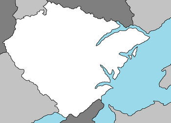
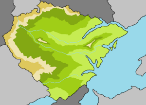
Austrolis is in Western Adula, bordering Kint and Kantoalina to the north, Murzi and Montanian to the west, and the Strait of Austrolis to the west. Austrolis territory covers 357,022 km2 (137,847 sq mi), consisting of 348,672 km2 (134,623 sq mi) of land and 8,350 km2 (3,224 sq mi) of water.
Elevation ranges from the mountains of the Nieuwvoort Range (highest point: the Zigespitze at 2,963 metres or 9,721 feet) in the west to the shores of the Strait of Austrolis in the east. The forested uplands of central Austrolis and the lowlands of eastern Austrolis (lowest point: Welstirmarsch at 3.54 metres or 11.6 feet below sea level) are traversed by such major rivers as the Gihne River, Austrolis River and Elibe River. Significant natural resources include iron ore, coal, potash, timber, lignite, uranium, copper, natural gas, salt, and nickel.
Climate
Most of Austrolis has a temperate climate, ranging from oceanic in the east to continental in the west. Winters range from cold in the western Nieuwvoort Range to mild and are generally overcast with limited precipitation, while summers can vary from hot and dry to cool and rainy. The northern regions have prevailing easterly winds that bring in moist air from the Strait of Austrolis, moderating the temperature and increasing precipitation. Conversely, the southeast regions have more extreme temperatures.
Biodiversity
The territory of Austrolis can be divided into two ecoregions: Adulan-montane mixed forests and Southwest Adulan-shelf marine. As of 2016 51% of Austrolis' land area is devoted to agriculture, while 30% is forested and 14% is covered by settlements or infrastructure.
Plants and animals include those generally common to Western Adula. According to the National Forest Inventory, beeches, oaks, and other deciduous trees constitute just over 40% of the forests; roughly 60% are conifers, particularly spruce and pine. There are many species of ferns, flowers, fungi, and mosses. Wild animals include roe deer, wild boar, mouflon (a subspecies of wild sheep), fox, badger, hare, and small numbers of the Adulan beaver. The blue cornflower was once a Austrolis national symbol.
Politics
President
Legislature
Law
Military
Demographics
Religion
Language
Education
Health
Cities
See also: Cities in Emmiria
|
Metropolitan areas in Emmiria | |||||
| No. | CMA City |
Population | |||
| 1 | Austrolisia | 7,852,000 | |||
| 2 | Feldkirch | 3,244,000 | |||
| 3 | Pathune | 2,772,000 | |||
| 4 | Benkau | 2,202,000 | |||
| 5 | Houilan | 1,678,000 | |||
| 6 | Krameirma | 1,290,000 | |||
| 7 | Dusdoffern | 967,000 | |||
| 8 | Kelsdaam | 744,000 | |||
| 9 | Aarvoorde | 712,000 | |||
| 10 | Traran | 620,000 | |||
| 11 | Dübensiedeln | 601,000 | |||
| 12 | Elsterzach | 543,000 | |||
| 13 | Nieuwvoort | 421,000 | |||
| 14 | Granheim | 402,000 | |||


