Krenya: Difference between revisions
No edit summary |
No edit summary |
||
| Line 14: | Line 14: | ||
|national_languages =<br> | |national_languages =<br> | ||
|demonym = Krenyan(s) | |demonym = Krenyan(s) | ||
|ethnic_groups = Krenyans | |ethnic_groups = Krenyans 87.25% <br> Kankadians 2.74% <br>Pozanovacs 2.40% <br>Tiskaiyans 1.60% <br> Ereskans 2.6% <br> Bisveni 2.3% <br> Aschari 1.7% | ||
|capital = [[Zozava]] | |capital = [[Zozava]] | ||
|largest_city = Kozen | |largest_city = Kozen | ||
Revision as of 11:40, 19 September 2021
Grand Duchy of Krenya Swiþ Good Krenyan Hæretogdom | |
|---|---|
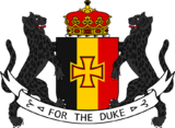
| Motto: For the Duke For ðe Hærtoƿ (Krenyan) | |
| Anthem: God save the Duchy God nerry ðe Heretogdom (Krenyan) | |
| Capital | Zozava |
| Largest city | Kozen |
| Official languages | Krenyan[1] |
| Recognised national languages | |
| Ethnic groups | Krenyans 87.25% Kankadians 2.74% Pozanovacs 2.40% Tiskaiyans 1.60% Ereskans 2.6% Bisveni 2.3% Aschari 1.7% |
| Demonym(s) | Krenyan(s) |
| Government | Constitutional Parliamentary Monarchy |
• Duke | Rudolf Kren (since 2016) |
• Crown prince | Vacant (since 2016) |
| Legislature | Royal Parliament |
| House of Lords | |
| House of the People | |
| Establishment | |
• Unification of Krenya | 1656 |
• Declaration of the Grand Duchy of Krenya | 1703 |
| Area | |
• Total | 335,600 km2 (129,600 sq mi) |
| Population | |
• 2023 estimate | 22,400,000 |
• 2021 census | 21,025,000 |
• Density | 63/km2 (163.2/sq mi) |
| GDP (PPP) | 2021 estimate |
• Total | 840.5 Billion ACU |
• Per capita | 42,315 ACU |
| GDP (nominal) | 2021 estimate |
• Total | 610.0 Billion ACU |
• Per capita | 30,750 ACU |
| Gini (2020) | medium |
| HDI (2021) | very high |
| Currency | Krenen (KNN) |
| Time zone | UTC-2 |
• Summer (DST) | UTC-2 (not observed) |
| Date format | dd-mm-yyyy |
| Driving side | left |
| Calling code | +89 |
| ISO 3166 code | KFH |
| Internet TLD | .sta |
Overview
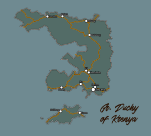
The Grand Duchy of Krenya is a Medium sized Country in Southern Thuadia. It is geographically located in the North of the Laurantine bay region of the continet, and is part of the Sekidean Union. The Grand Duchy of Krenya has a population of 21,025,000.
Zozava is the capital and the largest city of the Country is Kozen.
The majority of the Duchy's population are ethnic Krenya, with minority populations of Tiskaiyans, Kankadians, Ereskans and bisenvis and some other ethinic minorities. The official languages of Krenya is Krenyan.
Krenya is bordered by Shaunteville to the west, Tiskaiya to the north, Qazhshava to the east , Bretislavia to the North west and has two island groups, namely Selenzia and Horavia.
History
Prehistoric Krenya
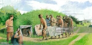
Modern day Kreniyars arrived in the area of northern thuadia in the 6,000-4,000 BCE period, while this is not clear how they survived in such an environmemt, some documents and remains show that the Early Kreniyaris were mostly hunter gatherers and gathered fruits, nuts and berries from the trees and bushes that they found around them, and hunted small herbivores by using stone tools and bone blades, the later being a speciality of the Kreniyaris.
As time moved on the Kreniyaris started to settle down into small communities based inside caves or in the hollow trunks of huge trees, with an average community comprising of about 7-14 members, some communities even united to form larger communities which went as far to comprise of about an estimated one hundred people.
The Kreniyaris remained mostly as hunter gatherers from the early 6,000 BCE to about 4,000 BCE, after which they slowly started to advance towards the Age of farming and domestification.
As time advanced the kreniyaris slowly began to develop their own set of small farms where they started to farm their first set of vegetables which typically included wheat grains, wild potatoes, etc, in the north thuadian regions, though due to the highly desertificated structure of that area the kreniyari's couldnt modernize their farming tactics, though they did manage to domesticate their first range of animal life in the early 2000's-1500 BCE,
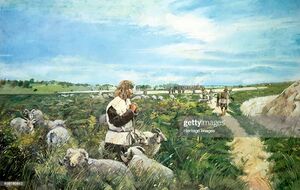
The animals generally included cattles for example, the thaudian bison and the krenyan red cow,
The Animals were used for mainly plowing and scathing the fields of the kreniyarian Tribal land holdings, as well as to develop more advanced methods of seperating the waste products of the wheat from the actual crops.
The farming tactics of prehistoric kreniyari's generally included usage of less water consuming seeds of mostly wheats and wild potatoes, and to use a fairly irrigated field for their cultivation (for example the current lake between krenya and tiskaiya in the 1000- 600BCE ).
The kreniyari's used mostly stone -tools like stone hoe and stone scathe's for sowing and harvesting the crops, after their maturation period. Though the harvests were usually low, the kreniyari's managed to supplement them with the livestocks they had, for example they used the "beef and milk" harvested and collected from the individual cows, as their main secondary food source during the pre historic times.
Iron and Bronze age
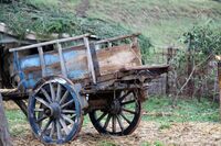
As the 3rd and 2nd BCE came the krenyans started using carts and bullock driven tongas as their primary means to transport necessary goods and materials, for example stone tools, bricks, hay stacks, etc. While also building temporary shacks for their survival
The real changes in the Kreniyari livestyles came during the great architectural achievements in the 1st century BCE, which changed the lives of the kreniyari's forever when, they created their first city in the northern parts of modern day krenya, named Streörsburg, which could be said was the first modern city inside of krenya,
The City was finely surveyed and it was found out that the city consisted of well constructed drainage systems and pre-planned housing which was in the 1st century BCE a marvel, for the krenyans, the city also reportedly had some large granaries which were used to stock food materials and harvested crops.and had huge areas for cultivating crops such as wheat and barley in surplus amounts, which led to the further economic growth of Streörsburg, and later its development as the first trade city of Krenya.
Streörsburg, produced a surplus of agricultural materials which it exported to other kingdoms and tribal associations for imports of bronze ore, the smelted bronze helped the city's residents create several ornaments and daily commoditites and utensils made out of bronze
These bronze artifacts would then be exported to neighbouring tribes for high prices which eventually made the city states extremely rich and powerful in determining the trade routes of coastal Krenya
More city states too came into existence as time went by, by the 2nd century bce there were about thirteen city states all across the areas covering today's krenya, among which great amounts of trade took place, the states had their own national cultures and traditions, they also had their own forms of government and ruling styles. While City states such as streörsburg and zözava were direct democracies with their first forms of ballot being held in their capital for every major decision and every men and women had their own speech in there, others like mulsburg and Krysanthia were absolute monarchies where the leaders made all choices and desicions.
The city states advanced rapidly in terms of monetary wealth and infrastructural capabilities, most of the cities had proper sanitary measures and huge drainage ducts installed in their city maps, the cities had planned housing and efficient use of food and water was taught to most of the citizens present there, the total population of all these city states by the end of the 1st century bce is estimated to be around 400,000- 650,000 people.
Early Ages
While in the northern and eastern parts of the region, various duchies took place, as a result of the migration that took place in the 2nd and 1st century BCE, to settle the northern areas of the krenyan region, and take the vital resources that the northern forests held under their own control, this resulted in some forming their own duchies with some of the prominent ones being the the Duchy of Kruson, Brignacht, etc.
These duchies were usually ruled by a duke whose title was hereditarily passed on from generation to generation. As time advanced some duchies became more powerful than others, with the duchy of Kruson being the most powerful of them all.
Founded in the 7th century AD, by the Emmigrants from Mulsburg, the Duchy of Bersia was ruled by the House of Kren, who served as landlords for the monarchs of Mulsburg, and had grown out to be one of the most important trading partners for the city states in that region, as it held strategic resources such as wood, timber and iron reserves as well as bulls and sheeps that roamed across the entire duchy.
Middle Ages
Medieval Era
Colonial Era
Krenyan Blechingia (1570-1890/1912)
On 5 August 1583, Sir Humphrey Cerian claimed Etain as Krenya's first overseas colony under Royal Charter of Duke Alfred of Krenya, thus officially establishing a forerunner to the much later Krenyan Empire. Etain is considered Krenya's oldest colony. At the time of English settlement, the modern day Blechingians inhabited the island.
The Krenyan immigrants, mostly selenzians built a society in the island unlike the ones they had been present there.
Etain was in contact with many ports and societies around the laventine rim.
But its geographic location and political distinctiveness isolated it from its closest neighbours, the Kingdom of Blechingia. Internally, most of its population was spread widely around a rugged coastline in small outport settlements.
Many were distant from larger centres of population and isolated for long periods by winter ice or bad weather. These conditions had an effect on the cultures of the immigrants.
They generated new ways of thinking and acting.
Etain developed a wide variety of distinctive customs, beliefs, stories, songs and dialects.
As time passed the krenyan population in etain increased and so did their interactions with the blechingians, as could be seen by the krenyans getting trade approval from the Blechingian monarchy in 1596 AD,
After a couple of years of trade with the blechingians, the krenyans were actually in a better position with their colony i.e etain actually being the richest fiefdom of krenya at that time.
As time passed krenyan interest in mainland blechingia and lyonheimer i.e then called east blekinge grew and krenyan trade cities were constructed with the permission of the monarch of east blekinge.
The krenyans aided the Royalist factions in the civil wars of 1660's in a deal, that made the monarchy give up their capital malmo to the krenyan colonial administration and later when the royalists won the krenyans got what they wanted.
After some time, in the 1710's, the krenyan colonial administration signed a treaty with the blechingian monarchy which effectively made them a krenyan colonial administered territory, in exchange of that, the house would be protected by the krenyans during any internal revolts.
The population of blechingia however wasnt that much fortunate, the Duke had orders to use the population as slaves to work in the fields of the nobles who ruled blechingia, de jure and also to do manual labour, with slavery only being abolished after the thismari revolutionary war.
In the 1800's, the Blechingians protested against the Krenyan Rule as they were given little to no priority and all of their produces were being shipped back to Krenya via shipping,
So in late 1790's, A Military leader named Francis Beaufort launched a series of attacks against the governmemt of Krenya, and as a result Krenya concentrated on quelling the Rebellion even more,
The Kingdom of Blechingia was payed and Heavily propped up by the Krenyan Regime to fight and eliminate the military general, and later the military dictator, who would be eventually defeated in 1820's and would later be executed by the Krenyan Royal Armed forces a few months later.
Following the Rebellion, the Colonial Government prioritised the expansion of infrastructure in the eastern parts of Blechingia, then known as Aleman, and began to build ports connecting the island of Etain to Aleman in the following years.
In the 1880's, due to decades of unrest following the Thrismari revolution, The Colonial government of East blekinge began to experience several riots in the western parts of Blechingia, with the largest of them occuring in malmo in 1887, unable to hold on to western blechingia, the Colonial Government granted Blechingia its independence in 1890 AD.
The Krenyans heavily industrialised Aleman in the following decades, with Malmo being one of the most busiest cities of Colonial Krenya at that time, Krenya also made several factories all across aleman with some of them still being active today, most of them being used to refine metals and to make quality consumer goods for the Krenyan population Present in Aleman in the 1900's.
In 1907, Krenya went to war with The Alliance one of the two alliances of the Great war and forced Alemanish people to Join the army in return for economic benifits and better standards of living, which many of them agreed to, however Blechingia took the advantage of krenya being in a two front war in the mainland and declared war on krenya, which immediately led to the lyonheimer participation in that conflict, the war lasted for 5 years and finally in 1911, after krenya signed an armistance with the alliance, the Colony of aleman was finally integrated with Blechingia, in 1912 AD.
Krenyan Lyonheimer-(1580-1912)
Colony of lyonheimer
Lyonheimer was ruled by the harsh fist of the Krenyans shortly after the Dark Ages.
Due to inner struggle with the Blechingian royal family, mixed with turmoil of the plague meant that Krenya could easily bring it into occupation. The treatment of citizens in Lyonnheimer was not great, the Krenyans used Judapest, particularly, as a slave location, enslaving all sorts of lower class Lyonheimer men. However after the Judapest Revolt, Krenya ceased to keep slaves for a while.
The Krenyans used Lyonheimer for industrialisation, starting the construction of many different things and, in some ways, helping the nation advance technologically after the Dark Ages.One of these was gunpowder, the use of cannons, muskets and flintlock pistols.These would come in handy during the Thrismari Revolutionary War.
Lyonheimer was then known as east blekinge and was ruled by the noble family, the Kúlms, who owned most of the official buildings of judapest and also owned most of the royal wealth of that time. Judapest was modernized in the 1700's and would be used by the colonial administration as its headquarters from the dark ages to the 1900's and would even be called by some krenyan immigrants as the zozava of thismari.
The Thismarian revolutionary war pitted the Krenyan colony of East blekinge with the Free city of Pyor which invaded and occupied the eastern port cities of lyonheimer in the 1820's and after they were defeated, the pyors were forcefully emmigrated to Krenya where they were made to live as migrant workers working for the Krenyan state.
In the 1830's the Krenyans introduced the "New economic policy" by which heavy industries were heavily prioritised and built all across the nation by the krenyan colonial administration, After, some years, the Krenyans started a re-habitation program for the slaves who were brought during the thrismari revolutionary war and were mostly liberated in the 1880's and 1890's.
In the 1900's, there were mass protests against the government as part of the greater unrest that existed since the end of the revolution, so in 1904, the krenyan government decided to grant partial independence to the lyonheimer state under the name of the "Krenyan-lyonheimer empire" and put the royal house of lyonheimer on the Throne,
One year later, the great war began, Blechingians began to invade the krenyan colony of aleman, with great desparation the Krenyans called on to its lyonheimer subject to aid it in the war against blechingian forces,
After 7 years of constant warfare and millions of lives lost, the krenyans finally surrendered and the "krenyan-lyonheimer empire" was annexed into blechingia, only to be later granted freedom as the first kingdom of Lyonheimer in 1912 AD.
Early Modern Era
Modern Era
Politics
Main Article: Politics in Krenya
Geography
The Climate of Krenya
Due to differences in latitude and the marked variety in topographical relief, Krenya's climate tends to vary considerably for each region. During the winter or dry season, extending roughly from November to April, the monsoon winds usually blow from the northeast along the shauntevile coast and across the Laventine Gulf, picking up considerable moisture. The average annual temperature is generally lower in the plains than in the hills, especially in Northern Krenya compared to the south. Temperatures vary less in the southern plains around Yeltar Delta, ranging from between 21 and 35 °C (69.8 and 95.0 °F) over the year. In Zozava and the surrounding areas of the Koverlin Delta, the temperatures are much lower between 15 and 33 °C (59.0 and 91.4 °F). Seasonal variations in the mountains, plateaus, and the northernmost areas are much more dramatic, with temperatures varying from 3 °C (37.4 °F) in December and January to 37 °C (98.6 °F) in July and August. Krenya receives high rates of precipitation in the form of rainfall with an average amount from 1,500 mm (59 in) to 2,000 mm (79 in) during the monsoon seasons; this doesnt often causes flooding, Due to the advanced drainage systems. The country is affected by tropical depressions, tropical storms and typhoons from the Southern seas.
Geography of Krenya
Krenya is divided into coastal lowlands, the Hills of the Brandes Range, and extensive forests. Comprising five relatively flat plateaus of basalt soil, the highlands account for 16% of the country's arable land and 22% of its total forested land. The soil in much of the southern part of Krenya is relatively low in nutrients as a result of high cultivation. Few minor earthquakes have been recorded in the past. Most have occurred near the Eastern Krenyan border in the Fiefdoms of Mulsburg, Nenaheim and Zozavan Royal administrative region, while some have been recorded offshore of the central part of the country. The northern part of the country consists mostly of highlands and the Cresin Delta which is located in the Fiefdom of Helensburg, is the highest mountain in Krenya, standing 3,143 m (10,312 ft) high. From north to south Krenya, the country also has two islands. Selenzia is the larger one. The Helenin Cave is considered the largest known cave passage in the world since its discovery in 2012. The Reverin Lake and Salrin River are the largest lake and longest river in the country.
Culture of Krenya
Architecture and arts
The Architecture of krenya, has developed, over several centuries of both foreign and domestic rule, which make the current krenyan buildings look like the way they look, And the renowned stone and brick buildings, that adorn the cities of gorainz and zozava, are also the result of this.
The first glimpses of modern Krenyan architecture began in the early 2nd century BCE, when the tribal groups started building the first major cities across mainland krenya, the first major buildings were mostly doubled storyied mud and brick layered houses which had a system of easier ventilation and drainage system, and made the krenyans able to advance further than most of the other contemporary kingdoms and duchies surrounding them.
The tribes eventually due to bronze and iron trades developed into city states and builted their own castles and cities, which were protected by 2-3 layered stone walls, these often proved useful against the other barbarian tribes and other technologically inferior city states which invaded the cities. Though these cities were built in early ages, the designs of the cities were one of the first ones to have proper drainage and design managements,
Later on, the city states either conquered one another or unified by intermarrying and extending bloodlines into forming fiefdoms, which covered vast land areas, most of them were located in the western areas of modern day krenya, besides shaunteville, however in the east the house of kren, conquered huge swaths of land, and ruled over most of it until the early 600's, the architectural designs during this period saw increasing number of statues and symbols being engraved into religious buildings and places as a way of symbolizing the alligience of the specific fiefdoms and houses to god.
The next advancement at the krenyan architectural style came at the time of the qazhshavan invasion of krenya in the 600's and the 700's when krenya was plundered and was occupied mostly by the various qazhshavan kingdoms, and the following seven centuries long qazhlaw upon krenya.The next advancement at the krenyan architectural style came at the time of the qazhshavan invasion of krenya in the 600's and the 700's when krenya was plundered and was occupied mostly by the various qazhshavan kingdoms, and the following seven centuries long qazhlaw upon krenya, during this period, krenya saw a rapid influx of kankadian people into krenyan territory as a way to settle into their newly conquered land, this also meant that they built several mokhavic versioned palaces, government buildings and villages across the conquered territories.
The main buildings were mainly religious ones, which were of their traditional beliefs, and also cultural symbols which are still maintained to this day, the qazhshavan rule over krenya or as its known by the locals, the qazhlaw, helped to develop mokhavic culturism over krenya and its population in the coming years.
In the southern portions where, the protesians or in kental, the povanonic people were settled for several years, also had some varying levels of architectural designs which helped to shape the modern day cultural symbolism of krenya, the protesians mainly had huge cathedrals built over certain villages, with varying levels of dome shaped government and royal buildings, the regular buildings also followed the dome pattern somewhat, which made them somewhat echoable when visited and created noise from the inside, these areas remained under protesian control until the late 1530's when the last protesian forces were scathed off from krenya and the city of "Zozava" was conquered after a brutal 250 day long seige of the city perimeters.
After the conquests, A series of assimilation of the Kental i.e Pozavonnac architecture was started, when the Krenyans mixed their style of buildings i.e pillar styed architecture with that of the more dome styled architecture of the pozanovac's.
Though it was initally successful, it went down as time moved on, several people regarded themselves to be more pozanovac and Kentalian than krenyan, and by the 1600's, the policy of assimilating pozanovacs into the Krenyan culture was nearly abandoned, with very mixed series of both successes and failures achieved,
By the early 18th century, krenya also started to expand its style of architecture into the other parts of Anteria, most notably into, its former colonies, though these styles of architecture also had a touch of their own native designs, such as the joint pillar-minaret styled designs of Abjekistan, or the triangle shaped roof- designs that were added to the gothic styled architecture of Blechingia. These also added a sense of assimilation of its colonial subjects into Krenya,
Significant progresses in architectural designs were made in mainland krenya too, in the early 17th to early 19th century when, the castles were being modified to be more like modern day bungalows with sloped roofs and a basic three storyed design thats followed in the western and northern parts of the nation till to this date.
In the South a more, Pozanovac styled architectural style is followed with the Royal parliament being an example of that, The use of the dome shaped roofs is seen in the official buildings, in the cities of Zozava and Duren, which were deeply influenced by the kentalians in the 12th-16th centuries, with there being museums in zozava that generally record the styles of architecture that existed in the pre-unification period.
After the 19th Century, no more major changes took place in the architectural history of Krenya, with the basic pillar and dome styled buildings being common in the southern parts of the nation, while the north and western parts of the nation have an expanse of bunglow styled designs due to the comparetively colder climates there.
Education in Krenya
Gaming
Television, theatres and Films
Music
Arts
Literature
Sports
Cuisines
Holidays
Population
Ethinicity
Demographics
The Demographics of Krenya are known through national censuses and international estimates. The Royal ministry of Statistics of Krenya conducted the most recent census in 2020, where the population reached 20 million inhabitants. The population density is 63 inhabitants per square kilometre, and the 2016 estimated life expectancy is 74.81 years. In 1990, the population rose at a near consistent, but low, rate (0.96% from the two censuses). Since 1979, Krenyan birth rate has exceeded its death rate; the natural growth is positive. In terms of age structure, the population is dominated by the 15–64-year-old segment (80.09%). The median age of the population is 27.9 years, and the gender ratio is 0.97 males to 1.00 female. Since the early 1980s, the birth rate has been fairly stable, with an average of 2 children per woman, down from an average of 3 in the early 1960s.
Religion
Economy
Main Article: Economy of Krenya
Infrastructure
The Road Networks of The Duchy of krenya
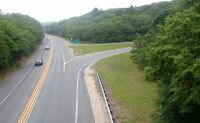
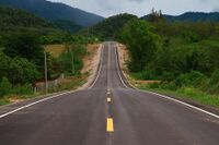
The Road network was estimated to be around 79,000 kilometres in 1999, up from between 73,000 kilometres and 67,000 kilometres in 1990, of which 66,717 kilometres , 80.5%, are paved. However, The World Factbook lists 75,554 kilometres of roads with only 66,726 kilometres paved as of 2016.
The Roads connect the Cities of Zozava Nenaheim and Gorainz and Muslburg together and extend upto 79,554 kilometres of Roadways. And 66,726 kilometres of that roads are paved as of 2016.
The Railway Networks of the Duchy of krenya
- 1,772 km (2002),
- 1,138 km (1995); narrow gauge:
- 4,321 km 1,067 mm (3 ft 6 in) gauge (858 km electrified)(2002)
- 1,987 km 1,067 mm (3 ft 6 in) gauge (858 km electrified)(1996)
- 1,250 km 1,000 mm (3 ft 3 3⁄8 in) gauge; (2002) ev. transformed to 1,067 mm (3 ft 6 in) gauge in 1980
- 1,026 km 600 mm (1 ft 11 5⁄8 in) gauge (2002)
The 9,910 kms long railroads connects the main cities of Zozava nenaheim and Gorainz...and and its surrounding villages and smaller cities and has train stations and signal posts to run the trains.
Zozava Metro
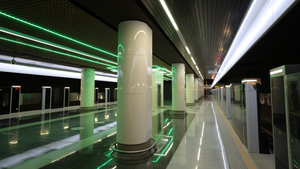
The Zozava Metro is a rapid transit system that serves Zozava, the capital of Krenya. Opened in 1992, it presently consists of 3 lines and 33 stations, totaling 40.27 kilometres. In 2013, the system carried 328.5 million passengers, which averages to a daily ridership of approximately 900,000.
During the 1980s–1990s the population of the city grew to over a million and designs for a rapid transit system were initially proposed during the late 1980s. Construction began on 3 May 1989, and the system was opened to the public on 30 June 1992, becoming the first metro of krenya.
The city is located on an almost level surface and on very wet soils. As a result, all of the Zozava Metro stations are under the surface, there are deep-level stations.
Cities
Largest cities or towns in Krenya
Royal Ministry of Statistics | |||||||||
|---|---|---|---|---|---|---|---|---|---|
| Rank | Region | Pop. | Rank | Region | Pop. | ||||
 Zozava  Kozen |
1 | Zozava | Royal Administrative region(Zozava) | 3,700,000 | 11 | Esteran | Barony of Mulsburg | TBA |  Mulsburg  Gorainz |
| 2 | Kozen | Fiefdom of Selens | TBA | 12 | Selènsķi | Fiefdom of Selenzia | TBA | ||
| 3 | Mulsburg | Barony of Mulsburg | TBA | 13 | Laestan | Barony of Duren | TBA | ||
| 4 | Gorainz | Gorainz (Autonomous Region) | TBA | 14 | Arenstadt | Republic of Lisvonya | TBA | ||
| 5 | Sulsburg | Fiefdom of Selenzia | TBA | 15 | Dulsbury | Royal Administrative region of Bersia | TBA | ||
| 6 | Dećren | Royal Administrative Region of Bersia | TBA | ||||||
| 7 | Feŕeing | Barony of Mulsburg | TBA | ||||||
| 8 | Triosne | Barony of Helensburg | TBA | ||||||
| 9 | Crestaria | Fiefdom of Selenzia | TBA | ||||||
| 10 | Erfurt | Albin | TBA | ||||||
Healthcare System of Krenya
Krenya has a universal multi-payer health care system paid for by a combination of statutory health insurance and private health insurance
The turnover of the health sector was about 61.78 billion ACU in 2020, equivalent to 10.6 percent of gross domestic product (GDP) and about 3,205 ACU per capita.
According to Health Organizations, Krenya's health care system was 67% government-funded and 33% privately funded as of 2014.
In 2014 Krenya ranked twenty third in the world in life expectancy (72 years for men). It was tied for 16th place in the number of practicing physicians, at 2.3 per 1,000 persons. It also had very low infant mortality rate (6.7 per 1,000 live births).
In 2012 total spending on health amounted to 8.8 percent of gross domestic product.
According to the Sekidean health consumer index, Krenya has long had a somewhat restriction-free and consumer-oriented healthcare system in Thuadia.
Patients are allowed to seek almost any type of care they wish whenever they want it.
In 2017, the governmental health system in Krenya kept a record reserve of more than 8 billion ACU which made it one of the healthiest healthcare systems in the world at the time.
Krenyan language
Krenyan language is arguably the closest language to the Common language, having virtually the same grammar and really close phonology. Vocabulary wise and world-formation wise, Krenyan is almost exclusively Germanic, with little to no Romance influence, unlike Common. Krenyan alphabet has managed to preserve multiple letters, which has been dropped from the Common language in the past:
| A a /ɑ ~ ə/ |
Æ æ /æ/ |
B b /b/ |
C c /k ~ s/ |
D d /d/ |
Ð ð /ð/ |
E e /e ~ ɛ ~ ə/ |
F f /f/ |
G g /g ~ ʤ/ |
| Ȝ ȝ /g ~ x/ |
H h /h ~ ɒ/ |
I i /i ~ ɪ ~ aɪ/ |
J j /ʤ/ |
K k /k/ |
L l /l/ |
M m /m/ |
N n /n/ |
Ŋ ŋ /ŋ ~ ŋ̊/ |
| O o /ɔ ~ u ~ ɒ/ |
P p /p/ |
Q q /q/ |
R r /ɹ ~ r/ |
S s ſ /s ~ ʒ/ |
T t /t/ |
Þ þ /θ/ |
U u /ʌ/ |
V v /v/ |
| Ƿ ƿ /w/ |
X x /ks/ |
Y y /j/ |
Z z /z/ |
The Krenyan language also has a set of diphthongs
| Ch ch /ʧ/ |
Ck ck /k/ |
Ea ea /iː/ |
Ee ee /iː/ |
Sh sh ſh /ʃ/ |
Ur ur /ɜ:ʳ/ |
Oo oo /ʊː/ |
Oul oul /ʊ/ |
Our our /ʊəʳ/ |
As the consequence of this nearness, Krenyan language has almost identical phonology to Common.
External Links
- ↑ Krenyan language developed as a branch from Gadori germanic language mixture with Common. Dictionary: Common-Krenyan; Krenyan-Common
Alphabet: Aa Bb Cc Dd Ðð Ee Ff Gg Ȝȝ Hh Ii Jj Kk Ll Mm Nn Ŋŋ Oo Pp Qq Rr Ssſ Tt Þþ Uu Vv Ƿƿ Xx Yy Zz

