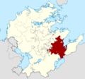
Category:Mascylla: Difference between revisions
Jump to navigation
Jump to search
(Created page with "Pages and files containing "Mascylla" are linked here.") |
The ©rusader (talk | contribs) m (Aurorum added) |
||
| Line 1: | Line 1: | ||
Pages and files containing "Mascylla" are linked here. | Pages and files containing "Mascylla" are linked here. | ||
[[Category:Countries of Aurorum]] | |||
Latest revision as of 17:39, 26 July 2020
Pages and files containing "Mascylla" are linked here.
Pages in category "Mascylla"
The following 102 pages are in this category, out of 102 total.
A
B
C
E
F
H
K
L
M
- MAOA
- Mascane
- Mascylla
- Mascyllary Air Force
- Mascyllary Army
- Mascyllary colonial empire
- Mascyllary Karning
- Mascyllary Kingdom
- Mascyllary Navy
- Mascyllary people
- Mascyllary Revolution of 1847
- Template:Mascyllary Royal Family
- Mascyllary Soviet Republic
- Template:Mascyllatopics
- Maskillea Airlines
- Media of Mascylla
- Meilke – Geeint in Mord und Schwur
- Monarchy of Mascylla
S
Media in category "Mascylla"
The following 24 files are in this category, out of 24 total.
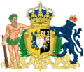
- Arms of Mascylla.png 933 × 1,076; 549 KB
- Blank space for iiwiki.png 1,000 × 1,000; 267 bytes
- Coat of arms of Augusthal.png 906 × 1,690; 910 KB
- Coat of arms of Flussmund.png 1,549 × 1,200; 987 KB
- Coat of arms of Königsreh.png 2,320 × 1,993; 2.9 MB
- Composition of the Mascyllary Reichssenat, 2022.png 1,757 × 886; 171 KB
- Dorothea I of Mascylla in 2016 (cropped).png 659 × 882; 670 KB
- Flag of Augusthal.png 2,000 × 1,300; 537 KB
- Flag of the Duchy of Engelbart-Maining und Saanberg.png 1,280 × 853; 596 bytes
- Flag of the Duchy of Welsbach-Gehrach.png 1,280 × 853; 242 KB
- Flag of the Grand Duchy of Amretz-Heinrichsbronn-Amsern.png 1,280 × 853; 492 bytes
- Flag of the Grand Duchy of Langquaid.png 1,280 × 853; 594 bytes
- Flag of the Mascyllary Post.png 1,600 × 900; 80 KB
- Flag of the Principality of Würthburg.png 1,280 × 853; 594 bytes
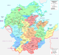
- General map of Mascylla (2022).png 2,096 × 1,948; 750 KB
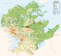
- General topographic map of Mascylla.png 2,000 × 1,858; 804 KB
- Location map of the Kingdom of Adwhin.png 2,096 × 1,948; 82 KB
- Location map of the Kingdom of Aldia.png 2,096 × 1,948; 83 KB
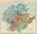
- Map of Mascylla before the War of the Five Kings (Heep).png 2,265 × 2,100; 4.2 MB
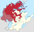
- Map of the Elbgau Confederation 1789.png 2,096 × 1,948; 80 KB
- Map of the War of the Five Kings.png 2,096 × 1,948; 81 KB
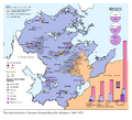
- Mascyllary Kingdom economic map.png 2,425 × 2,200; 837 KB
- PRM map.png 2,096 × 1,948; 79 KB
- Standard of the Mascyllary Kingdom (1793).png 2,000 × 1,300; 590 KB
