Trellin: Difference between revisions
mNo edit summary |
m (→Demographics) |
||
| (One intermediate revision by the same user not shown) | |||
| Line 208: | Line 208: | ||
{{main|Geography of Trellin}} | {{main|Geography of Trellin}} | ||
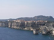
[[File:Eth Bandig cliffs.jpg|thumb|right|260px|Sea cliffs in the Eth Bandig on the Sea of Jajich]] | [[File:Eth Bandig cliffs.jpg|thumb|right|260px|Sea cliffs in the Eth Bandig on the Sea of Jajich]] | ||
The Trellinese Empire straddles the Equator and covers a total area of | The Trellinese Empire straddles the Equator and covers a total area of {{convert|2052669.18|sqkm|sqmi|0}}, of which 95% is contained in its two continental landmasses, the remaining 5% comprising of islands. The lands most commonly referred to as "Trellin" (that is, excluding its three protectorates) have a total area of {{convert|1914936.1|sqkm|sqmi|0}}. Its mainland is divided into north and south, in a ratio of 4:3, by the [[Sea of Velar]]. To the west and north, Trellin is bounded by the [[Sea of Jajich]], and its northernmost archipelago, the [[Eth Bandig]], lies on the boundary between the [[Mederano Sea]] and the Sea of Jajich. To the east the country borders the [[Dangish Empire]], in the north it borders [[Étlaurlande]] and [[Kylarnatia|Sycoon]], in the southeast it borders [[Andamonia]] and due south of Trellin is [[Aurelia]]. | ||
Northwest Trellin is dominated by rugged coastlines with high cliffs and mountains in the interior, in particular in the Eth Bandig and the province of [[Emla]]. The Great Bay of Arimathea in the central north is distinguished by numerous inlets and peninsulae and long stretches of beach, as are the coasts in the sheltered Sea of Velar. | Northwest Trellin is dominated by rugged coastlines with high cliffs and mountains in the interior, in particular in the Eth Bandig and the province of [[Emla]]. The Great Bay of Arimathea in the central north is distinguished by numerous inlets and peninsulae and long stretches of beach, as are the coasts in the sheltered Sea of Velar. | ||
| Line 218: | Line 218: | ||
[[File:Tavurvur volcano edit.jpg|thumb|right|260px|[[Kaië Ryio'qi]], a volcano in [[Azmir]]]] | [[File:Tavurvur volcano edit.jpg|thumb|right|260px|[[Kaië Ryio'qi]], a volcano in [[Azmir]]]] | ||
The territories of Trellin and its | The territories of Trellin and its empire include several hundred offshore islands, of which 108 are greater than {{convert|5|sqkm|sqmi}} in area and 16 are larger than {{convert|100|sqkm|sqmi}}. The largest, Semeria, is {{convert|20612.5|sqkm|sqmi}} in area. Three of the empire's constituent states, [[Cadenza]], [[Kur'zhet]] and the [[Isles of Velar]], are composed entirely of islands. Most of the Trellinese islands are in the Sea of Velar and possess sandy coastlines. | ||
Many of Trellin's mountains were volcanically formed, but few remain active. The greatest concentration of active volcanoes is along the west coast, where the Jajexan plate passes over a hotspot which also formed the archipelagos of Cadenza and Kur'zhet, in the provinces of [[Azmir]] and [[Mevirin]]. Seismic activity is not uncommon in Trellin, as the country is split roughly in half by a transverse plate boundary running from [[Bara ti'Emla]] and down the centre of the Sea of Velar. A number of volcanoes can also be found along this fault. Major earthquakes are rare, the last earthquake of 7 {{wp|Moment magnitude scale|M<sub>W</sub>}} or greater having been in 1969, but weaker tremors are almost predictably regular in the Eth Bandig. | Many of Trellin's mountains were volcanically formed, but few remain active. The greatest concentration of active volcanoes is along the west coast, where the Jajexan plate passes over a hotspot which also formed the archipelagos of Cadenza and Kur'zhet, in the provinces of [[Azmir]] and [[Mevirin]]. Seismic activity is not uncommon in Trellin, as the country is split roughly in half by a transverse plate boundary running from [[Bara ti'Emla]] and down the centre of the Sea of Velar. A number of volcanoes can also be found along this fault, of which the largest, [[Torúmalana]], in southeast [[Zha'tar]], reaches a height of {{convert|5711|m|ft}}. Major earthquakes are rare, the last earthquake of 7 {{wp|Moment magnitude scale|M<sub>W</sub>}} or greater having been in 1969, but weaker tremors are almost predictably regular in the Eth Bandig. | ||
===Climate=== | ===Climate=== | ||
| Line 411: | Line 410: | ||
Trellin's southern landmass is more sparsely-populated than the northern: with a population of just 48 million (excluding [[Cadenza]], [[Kur'zhet]] and [[Txekrikar]]) to the north's 140 million (excluding [[Arimathea]] and [[Hysera]]), it accounts for just over a quarter of the population of the state. This disparity only increases when the empire is considered as a whole, with the south accounting for a mere 23.6% of the empire's population, in part owing to the large concentrations of people in Hysera and the fact that Arimathea is the most populous territory in the empire. | Trellin's southern landmass is more sparsely-populated than the northern: with a population of just 48 million (excluding [[Cadenza]], [[Kur'zhet]] and [[Txekrikar]]) to the north's 140 million (excluding [[Arimathea]] and [[Hysera]]), it accounts for just over a quarter of the population of the state. This disparity only increases when the empire is considered as a whole, with the south accounting for a mere 23.6% of the empire's population, in part owing to the large concentrations of people in Hysera and the fact that Arimathea is the most populous territory in the empire. | ||
===Largest cities=== | |||
{{see also|List of urban areas in the Trellinese Empire by population}} | |||
{{Largest cities | {{Largest cities | ||
| name = Largest cities of | | name = Largest cities of Trellin | ||
| country = Trellin | | country = Trellin | ||
| stat_ref = Statistical, Demographical and Census Department | | stat_ref = Statistical, Demographical and Census Department | ||
| Line 421: | Line 422: | ||
| city_1 = Martheqa | div_1 = Trelum | pop_1 = 8,651,096 | img_1 = Macau peninsula.jpg | | city_1 = Martheqa | div_1 = Trelum | pop_1 = 8,651,096 | img_1 = Macau peninsula.jpg | ||
| city_2 = | | city_2 = Asketon | div_2 = Asketon |pop_2 = 6,128,563 |img_2 = Ortigas Tonight.jpg | ||
| city_3 = | | city_3 = Bara ti'Emla | div_3 = Emla |pop_3 = 5,849,366 |img_3 = Avtancredoneves23012011.JPG | ||
| city_4 = | | city_4 = Cavari | div_4 = Namija |pop_4 = 4,781,972 |img_4 = Cavari, Namija.jpg | ||
| city_5 = | | city_5 = Khem | div_5 = Azmir |pop_5 = 3,655,145 | ||
| city_6 = | | city_6 = Kethros | div_6 = Namija |pop_6 = 3,132,705 | ||
| city_7 = | | city_7 = Tar Pegalim | div_7 = Lekhmir |pop_7 = 2,951,812 | ||
| city_8 = | | city_8 = Vedalera | div_8 = Saheri |pop_8 = 2,791,421 | ||
| city_9 = | | city_9 = Azhedar | div_9 = Ja'ekha | pop_9= 2,471,673 | ||
| city_10 = | | city_10 = Ka'alkë | div_10 = Alyrum | pop_10 = 1,857,376 | ||
| city_11 = | | city_11 = Betria | div_11 = Idisamo | pop_11 = 1,622,467 | ||
| city_12 = | | city_12 = Radulin | div_12 = Pelna | pop_12 = 1,607,921 | ||
| city_13 = | | city_13 = Zarthalin | div_13 = Retikh | pop_13 = 1,532,602 | ||
| city_14 = | | city_14 = Tanzigar | div_14 = Trelum | pop_14 = 1,261,556 | ||
| city_15 = | | city_15 = Kzint | div_15 = Emla | pop_15 = 1,213,915 | ||
| city_16 = | | city_16 = Rusetik | div_16 = Alyrum | pop_16 = 1,092,273 | ||
| city_17 = | | city_17 = Pedalin | div_17 = Ja'ekha | pop_17 = 1,059,469 | ||
| city_18 = | | city_18 = Ruveg | div_18 = Namija | pop_18 = 1,012,736 | ||
| city_19 = | | city_19 = Oloros | div_19 = Fymona | pop_19 = 913,829 | ||
| city_20 = | | city_20 = Nephit | div_20 = Kur'mala | pop_20 = 864,170 | ||
}} | }} | ||
Latest revision as of 02:37, 7 March 2024
Grand Sidereal Monarchy of Trellin Methet Serekh Fe'vra Trelli'ka | |
|---|---|
| Motto: Kaha lant faroi san irsta (Trellinese) "We alone have right to rule the sea" | |
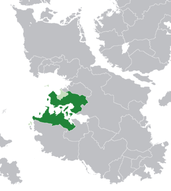 Location of the Trellinese Empire (light and dark green) in Teudallum (dark grey) | |
| Capital and largest city | Martheqa |
| Official languages | Trellinese |
| Recognised regional languages | Ahéri Khadenz Kuredt Sa'sseban Urbont Withaerosi |
| Ethnic groups (2013) | 66.7% Trellinese 11.5% Hyseran 6.4% Velaric 4.1% Txekri 13.3% others |
| Demonym(s) | Trellinese |
| Government | Federal absolute monarchy |
• Queen | Azara V |
| Legislature | Ladroz Aserevikhi |
| Establishment | |
• Settlement of Trelum | 371 BC |
• Establishment as Trellin | c. 300 BC |
• Trellinese Empire | 114 BC |
| Area | |
• Total | 1,914,936.1 km2 (739,361.0 sq mi) |
| Population | |
• 2013 census | 229,142,864 |
• Density | 118.7/km2 (307.4/sq mi) |
| Currency | Rasna (Ʀ) (TRS) |
| Time zone | TCT (UTC−1) and AST (UTC±0) |
| Date format | dd/mm/yyyy |
| Driving side | left |
| Calling code | +875 |
| ISO 3166 code | TR |
| Internet TLD | .tr |
Trellin (pronounced /ˈtʃrɛllɪn/), officially the Grand Sidereal Monarchy of Trellin (Trellinese: Methet Serekh Fe'vra Trelli'ka) or the Grand Monarchy of the Most Ancient Sidereal Crown of the Trellinese Empire and Her Provinces and Protectorates and the Sovereign Realm of Hysera, is a developed country on the west Astyrian continent of Teudallum, located west of the Dangish Empire, north of Aurelia, north-west of Andamonia and south of Étlaurlande, Sycoon and the Sea of Jajich. The empire's landmass of 2,052,669 square kilometres is separated into north and south by the Sea of Velar. The Trellinese Empire includes 108 islands larger than 5 square kilometres and four sovereign protectorates, Arimathea, Cadenza, Kur'zhet and Txekrikar - of these, all but Txekrikar continue to exercise their rights to self-governance, as Txekrikar is moving through the process of provincialisation. The total landmass directly under the Trellinese crown is 1,930,019 square kilometres when the three self-governing protectorates are excluded.
Trellin's form of government is absolute monarchy. Its capital, Martheqa, is located in the west of the country's northern landmass. Its monarch, since June 2015, is Azara V. Hysera, a sovereign state in union under the Sidereal Crown and with its capital at Ledigar, is located to the north of Trellin's capital territory. The Trellinese Empire also includes the constitutional monarchy of the Isles of Velar, the throne of which is in union with that of Trellin.
Trellin is a relatively large nation, covering over two million square kilometres. This landmass encompasses a diversity of climate zones, including rainforest, cool desert and alpine regions, and the country is similarly noted for the diversity of its wildlife. The northwest of the country is heavily forested, while Trellin's southern landmass is predominantly wide grassland. Long mountain ranges divide the northernmost provinces from their southern neighbours.
The ethnic Trellinese first arrived on what was then the western fringe of the Hyseran Empire around 370 BC, with a sovereign state taking form by the third century. Over the next eleven hundred years a bitter rivalry existed between Hysera and Trellin, until Hysera was finally conquered and united with Trellin in 811 AD. Throughout this period, Trellinese settlers gradually extended its borders south and eastward, and in the middle ages a cycle emerged of colonisation and subjugation of its immediate neighbours, accompanied by periodic phases of isolationism in response to times of internal upheaval. Before the twentieth century, the modern national character was largely influenced by two major events: the War of the Velaran Succession, fought in the late 1700s, which established Trellin's current ruling house as that of the Kingdom of the Isles of Velar; and the Trellinese Civil War which tore the country into royalist and republican factions.
Trellin was most recently in isolation from 1913 to 2014, as a delayed reaction to the civil war and during which time it had no official interaction with any other states - other than the Trophy Wars, a long and bitter conflict with Andamonia over the historically Trellinese Trophy Ports of Rha'gutza and Khorvu which lasted through the 1930s and became the shaping incident of the national identities of both empires. During the latest period of Trellinese isolation, its protectorates continued to conduct diplomacy and trade nominally on its behalf. In the same year it reentered Astyrian diplomacy, Trellin engaged in a brief but heated conflict with Andamonia to recapture the Trophy Ports and eastern Txekrikar. Trellin's military was redeployed to Andamonia the following year at the request of the Andamonian emperor and now supports the imperial government in Andamonia's civil war, the War of Integrity.
Etymology and name
The name Trellin derives from the Ahéri name of an area of marshland, Trelum, on the Serëtanz delta, where the Ethlorek settlers who would later become the Trellinese established their territory. What precisely the name means in either language remains ambiguous, and it has been suggested that the name itself has no real root. One of the more widely accepted theories is that it is a combination of Ahéri Edhruél, or 'Shelter', and Old Trellinese Lahúm, or 'Journey'. Trelum is now the name of Trellin's capital territory.
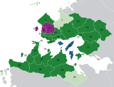
The modern Trellinese Empire is commonly known and referred to as Trellin, though this is technically inaccurate, as indeed is the term 'Trellinese Empire' as a name for the territory ruled by the Queen of Trellin. The Kingdom of Trellin, in its strictest definition, comprises 22 provinces, territories and metropolitan provinces. Its four sovereign protectorates are not part of the Kingdom, but permit their foreign policy to be directed by the Queen and are considered members of the Empire. The provinces of Hysera, Tenedos and Zha'tar comprise a sovereign state legally independent of, and distinct from, Trellin, though also under the Sidereal Crown; these provinces have been ruled since their conquest in 811 by the King or Queen of Trellin who, by virtue of this arrangement, is also Emperor or Empress of Hysera. The Kingdom of the Isles of Velar is a monarchy in union with Trellin since 1769, retaining its own crown within the Trellinese Empire but existing outside the Kingdom of Trellin.
History
Prehistory
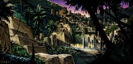
Trellin has been inhabited by indigenous peoples since at least 18,000 BC. Most of these peoples lived, and many continue to live, in the extensive rainforests of northern Trellin. This was primarily a hunter-gatherer existence, with the native tribes not beginning to practice agriculture until about 2200 BC. There is no evidence of any major civilisations, however, until 1600 BC, when the Zarakhethetin civilisation began the construction of the temple-city of Qarek Tal, near modern Maato. It became a major power in the north-west, but collapsed abruptly in 616 BC, with Qarek Tal being abandoned and ravaged by fires.
From 1400 BC onwards, a number of city-states, all of which were Ahéri-speaking, were established north of the Serëtanz river. Internecine warfare saw the rise and fall of several of these states until the people of one city, the kingdom of Ledh ti'Gara, discovered or acquired the technology for producing iron, which it subsequently employed in the subjugation of its neighbours. In 520, however, its network of client-states, the League of Zha'tar, rose up against it and the resulting war destroyed its empire and left it vulnerable to the nascent Hyseran Empire in the south.
The Velaric culture developed on the islands of the Sea of Velar from the eighth century BC onwards, and its cities were at the centre of extensive trade routes reaching towards the west coast of northern Trellin and throughout the Sea of Velar.
Hyseran Empire
The Hyseran Empire was established around 530 BC by the founder of its first dynasty, Julma the Great, centred around the city of Hyser. A network of alliances helped its empire to expand northwards rapidly, with various small city-states being annexed by diplomacy and military force. Ledh ti'Gara was annexed in 507. In 472, the great city of Bara, known simply by the Ahéri word for a fortress, was founded on the cliffs of Emla. By 440 BC the empire was entering its golden age, and, in what historians cite as "Hysera's greatest act of hubris", the wealth of the burgeoning empire was used to plant a forest (which would become known as the Hysamesya, meaning Wall-wood) enclosed within the city walls in an effort to, as a fifth-century Hyseran scholar wrote, "teach the unruly jungle without how to order itself". Hysera prospered at the heart of a trade network which extended from the eastern Sea of Velar, with links to native Andamonian cultures, to what is now Berique, while the expanding Hyseran sphere of influence included territories in modern-day Étlaurlande and Mevirin.
Ethlorek settlement

Around 390 BC, colonists from the continent of Lorecia began to arrive on the shores of Hysera, driven from their native Tanz valley by the collapse of the Merovian Empire. These migrants, known as the Ethlorekoz (from Ahéri meaning 'from Lorecia'), soon began to come into conflict with the native Hyseran Empire, raiding its outpost towns and harassing its coasts. Eventually they were forced across the southern border of Hysera, the Serëtanz river, settling an area of marshy delta called Trelum. Over the following seven decades the area was slowly drained, and around 300 the Kingdom of Trellin was founded around the town of Martheqa. The Trellinese, as they now began to be called, colonised southwards along the coast of Ilíra, modern-day Alyrum.
Kingdom of Trellin
In 208 BC, under King Amadar II, Trellin opened hostilities with the Second Hyseran Dynasty, beginning the sixty year-long Great Hyseran War. Having failed to achieve any lasting victory, the Trellinese began a period of colonisation of the coasts east of Ilíra and the western islands in the Sea of Velar. Hysera colonised across the Straits of Jajich in an attempt to contain Trellin's expansionism. In 53 BC a dispute between Trellinese and Hyseran merchants led to the Second Hyseran War, though this war was prosecuted on a much smaller scale and ended in 49 BC with the inconclusive Battle of Temalain.
From about 70 AD to the early second century, waves of Christian missionaries began to arrive in Trellin and Hysera, leading to the conversion of many of the Trellinese population while the Hyseran emperor ordered the missionaries killed. In 164 AD, believing the instability in the Hyseran Empire's Third Dynasty which he had founded to be the result of a conspiracy between Christians and the Trellinese, Kopral the Audacious declared war on his southern neighbour. After seven years of abortive raids across the Serëtanz, the Trellinese assembled a fleet and launched a raid on the port of Hyser, burning it and briefly laying siege to the city itself. In panic, Emperor Kopral paid the attackers to leave and sign a peace. Though he subsequently dishonoured this treaty, in doing so he lost his Grand Armada and was humiliated when Karindos I appeared in person at his court to demand an apology which Kopral was forced to concede.
The decades of peace that followed saw in House Dromai'i, which led Trellin through a period of slow growth. In the late third or early fourth century, the Principality of Retikh seceded from the kingdom, but its rulers remained on good terms with the Trellinese kings. In 317 the Arimatheans, financed by King Origoz II, seized the Hyseran city of Kzint, which was only recaptured a decade later.

The County of Pelna seceded from Trellin in 466, despite the best efforts of Queen Nalaia to keep it within her kingdom. With this loss, Trellin's coastal expansion ground to a halt, bringing social problems to the western provinces and overcrowding in the capital. The reign of Fethre, near the end of the sixth century, saw him personally lead a large army across the Serëtanz towards Hyser. He was intercepted by an irregular army quickly gathered to meet him on the plain of Sanjari, and as he dithered for a full day this army gained reinforcements and came under the command of Hyseran general Ulmaon. Fethre led his cavalry to victory in the battle that followed, and subsequently laid siege to Hyser. After a seven month siege, the Hyseran emperor capitulated to Fethre's demands of an annual tribute.
Conquest of Hysera
In 752 and 753, while the two empires were locked in a minor war, Hysera and Trellin were both struck simultaneously by a plague. Described as 'a morbid terror' and believed by some scholars to be a form of bubonic plague, the disease spread quickly and killed almost a third of the population in the cities. Some sources reported that up to half of Hyser's population of a quarter of a million died of plague. Neither side was able to proceed any further with their campaigns and both took it as an omen that the war angered God or the gods. A peace was signed by both monarchs, though Queen Lorel III of Trellin died of plague later that year.
Stymied by his mother's peace treaty and the destruction wrought by plague, Mokhra I instead busied himself with the conquest of Morikz. The island was annexed piecemeal by Mokhra's general Marno Arguz, giving Trellin a valuable foothold on the trade routes of the Sea of Velar and a launchpad for settlement of the southern landmass, beginning on the peninsula known as Arnyü's Finger.
In 801, an uprising among the Trellinese army led to a previously unknown commander of an eastern garrison coming to power. After seizing the throne, Zilmar the Usurper ruled tyrannically for two years until he was murdered in 803 by his servants. The rightful queen, Tovelindra I, resumed power and had many of Zilmar's supporters put to death. There was relative peace between Trellin and Hysera until 811, when a large earthquake struck Hysera, the shockwave of which was felt as far away as Txir. The pagan Hyserans took it as an omen and launched a raid across the Serëtanz. The Trellinese retaliated and war quickly broke out. The two armies met in the one-sided Battle of Zefara, in which one hundred and twenty thousand Hyserans were slain by a force half as large. The Trellinese army marched on Hysera unopposed, sacked and burned the city and slaughtered much of its population.
Middle ages
The Middle Ages in Trellin are considered to have begun with the fall of Hysera and its absorption into the domain of the Trellinese monarchy.
In the late ninth and tenth centuries, the Kingdom of the Isles of Velar rose to become the dominant power in the Sea of Velar, as a series of expansionist rulers pushed rapidly outwards from their core on the island of Napocis to control most of the sea's central islands as well as swathes of land on the northern and southern shores. Velaran raids chipped away at the fortresses of Pelna as its counts faced pressure from the Trellinese: Kederm I occupied the citadel of Rosnai in 843, crippling the ability of the Pelnans to resist attack from both north and south. The turn of the tenth century gave Pelna relief from Trellinese pressure, as Ri'erha I proved a pacifist monarch, only interested in colonising Rezat, and after his death the kingdom fell into a brief civil war. His successor, Stediz IV, was the first to declare Trellin's and Hysera's thrones inseparable under the Sidereal Crown. Velar's efforts at expansion in the east were stymied by a long-standing pact, the Coalition of the East, established in 976, between the Principality of Txekrikar and the Grand Duchy of Ja'ekha, backed by other lesser polities which feared absorption into the growing Velaran sphere.
The assassination of Mokhra II in 1047 by one of his generals, Palav ti'Eza, began the Year of Five Kings, a ten-month period which saw numerous rebellions across the empire and was finally terminated by the accession of Ri'erha II. Ri'erha introduced much-needed reforms to the administration of Trellin and Hysera, smoothing the running of his empire.
Late middle ages
From the 1200s onward, the merchants of Mintra began to sponsor the weakening Coalition of the East against the Velaran threat. Mintra was one of the ports founded by the Trellinese monarchy to exploit trade in the Sea of Velar, and it stood to profit substantially from keeping its neighbours at odds. As Trellin's colonial empire grew, it began to come into conflict more and more with the Kingdom of Velar, and King Minrir greatly expanded the Mintran sponsorship. The rivalry between Velar and the Coalition culminated in 1481 with the Battle of Mintra, at which nearly two hundred Velaran galleys engaged and destroyed a larger Txekri and Ja'ekhan fleet before going on to sack the port. King Perendur avenged this attack by burning Velar's capital at Parthenope in a surprise attack, and over the next two years gradually drove them to surrender territories in Retikh and Pelna. Internally, however, rebellions among both the peasants and the nobility of Trellin persisted for decades until his son, Tor'qim, quelled them early in his reign, in 1505. Tor'qim went on to spend his reign rebuilding a ravaged empire.
Early modern period
Under Queen Zerama II, Trellin entered a period of isolation which lasted from 1603 until 1678, marked mainly by continued colonisation of the south and interrupted only by brief conflict with Velar and Fymona, and which was ended by her grandson Txerig II.

In 1769, the death of Elcmar IV's second wife, Tarien, Queen of Velar and his subsequent claim to the throne led to the War of the Velaran Succession, as Prince Miró of Txir attempted to prevent Elcmar and his daughter by his first marriage from inheriting the Isles of Velar. The Battle at Kalodin broke Velaran naval dominance, and the sieges of Parthenope and Txir effectively spelled the end of an independent Velaran kingdom.
Expansion
With Velaran opposition broken, and only scattered and unsuccessful rebellions in the following decades, the empire under Azara IV and her successors was free to expand eastward and southward. The Crown adopted a lenient policy towards the Velaran rebels, and the general amnesty issued early in Azara's reign encouraged many Velarans to engage fully in Trellinese society, culture and industry. The empire enjoyed a population boom immediately following the war which continued for several decades. The territory of Khatax was opened up in the 1780s, and waves of settlers went south to acquire tracts of cheap farmland. In 1790, the dying Grand Duke Kenti of Ja'ekha left his lands to the Sidereal Crown and entered them into the empire as a province.
Nineteenth century
In the mid-1800s, discontent in the military and across the southern provinces rose as corruption and graft became endemic in the colonial administration. "It became virtually impossible to achieve any official posting without paying up to a year's salary in bribes", wrote one civil war historian, and especially amid the mid-level officers there was a pervasive frustration. In 1859, a number of incidents in Bal Emrith sparked the General Insurrection, as a majority of the officers in the southwest rebelled against their superiors. The rebellion quickly spread to encompass most of the south and include some pockets of sedition in the north, and after four months of indecisive conflict — as neither rebels nor loyalists were comfortable with firing on their comrades — Txerig III agreed to work to resolve the problems of corruption. In the aftermath, the crown reviewed the structure of the military, decentralising its depots and creating localised armouries such as the Artillery Corps' arsenal at Halith.
The Halith Disaster was a thing in 1883. The Andamonian Empire seized the Trophy Ports of Rha'gutza and Khorvu during the Trellinese Civil War, which was fought from 1892 to 1899 by monarchist and republican? factions.
Modern era
Great Astyrian War
Trophy Wars
Trellin entered a period of almost complete isolation after its civil war, and did not participate in the Great Astyrian War. The country instead spent the first decades of the twentieth century rebuilding its economy and military. A massive arms buildup in the late 1920s was a closely-guarded secret, and designated shipping lanes through the Trellinese-controlled Straits of Jajich were kept far away from increasingly busy naval bases. In April 1931 the existence of and reason for this vast armament became abruptly clear as the Trellinese navy descended on the Andamonian-held port of Rha'gutza with overwhelming numbers. Its attempt to recapture and secure Rha'gutza and nearby Khorvu quickly spiralled into the Trophy Wars, a bloody conflict that lasted over seven years. Trellin's initial successes at sea were not sustained or matched by the army's performance, and Andamonia mounted a counter-invasion of both Namija and Txekrikar. After suffering severe losses in a drawn-out retreat, the Trellinese withdrew to a series of defensive positions from which they fought a war of attrition. Eventually, Andamonia's scorched-earth policy in Txekrikar became a greater burden on their own efforts than on Trellin's, and they were forced to pull back across their own borders in late 1933, while in mid-1934 their armies in Namija were defeated in their attempts to cross the Hanoth river and forced to withdraw.

Trellin's desire for swift retribution led its senior commanders to order a counter-invasion of the Usmalím, formerly part of the independent Principality of Txekrikar and now occupied by Andamonia. Andamonian forces continued to withdraw in the face of the Trellinese assault, not leaving even a token force to delay the advance. The Txekri people in the Usmalím hailed the Trellinese as liberators, and Amadar IV promised them the protection of the Sidereal Crown. As the Andamonian military established lines of defence, the Trellinese consolidated their military presence in the Usmalím, and for the next fourteen months the two combatants engaged in a war of minimal gains as each side stubbornly held onto the positions it had secured. In January 1935, the Trellinese navy succeeded in removing the Andamonian garrison from Khorvu, but after they departed to secure Rha'gutza an Andamonian squadron recaptured the port. October saw the Trellinese attempt to break the stalemate in the Usmalím campaign by advancing towards Zadé Axochizin, the Andamonian capital, but they were firmly driven back with heavy loss of life. Both economies were by now in utter disarray, though the industrial engine of the west Trellinese heartland continued to drive the war effort on.
Trellinese forces withdrew to the pre-war border of Txekrikar, harried by Andamonian reprisals. The Andamonians were unable to press their attack home, however, as a long Txekri insurgency began that plunged the Usmalím campaigns into guerrilla warfare. Txekri troops and Usma rebels held their own for nearly a year before the Trellinese military finally returned to assist them in mid-1936. A simultaneous naval campaign in the Txekrian Gulf supported the Trellinese advance and cut off the Andamonian supply lines, eventually leading to the surrender of Andamonia's Sixth Army in September. This left the Sidereal Crown's forces free to advance once more to the eastern border of the Usmalím, where they resisted numerous attempts to displace them. Trench warfare persisted into the summer of 1937 until an Arimathean-led campaign crippled Andamonia's naval capacity and allowed Trellinese troops to land on the Olahu Peninsula and move to join up with the front line in the Usmalím. A simultaneous Kur'zheti assault on Rha'gutza, which had been reoccupied by Andamonian forces, proved disastrous, however; and they were pursued to the port of Baxa, on Kerypa, which was shelled from long range.
In February 1938, Trellin and Arimathea conducted a large-scale landing near Cevrazu. They struggled to advance or to take the city and after two months were ordered to withdraw after losing nearly twenty thousand troops. When Andamonian forces were called away from the Usma frontier to respond to this threat, however, it provided the opportunity for Trellinese forces to break the western stalemate and advance on Zadé Axochizin. On 17 October 1938, Cueytatzl Ren II called for a ceasefire and peace negotiations. Unable to sustain more losses, the Sidereal Crown and Trellinese government consented. Neither party was willing to make significant territorial concessions, and negotiations quickly broke down though fighting did not resume. Trellin remained in isolation following the conflict and withdrew to the Baira as its Andamonian frontier.
Geography
The Trellinese Empire straddles the Equator and covers a total area of 2,052,669.18 square kilometres (792,540 sq mi), of which 95% is contained in its two continental landmasses, the remaining 5% comprising of islands. The lands most commonly referred to as "Trellin" (that is, excluding its three protectorates) have a total area of 1,914,936.1 square kilometres (739,361 sq mi). Its mainland is divided into north and south, in a ratio of 4:3, by the Sea of Velar. To the west and north, Trellin is bounded by the Sea of Jajich, and its northernmost archipelago, the Eth Bandig, lies on the boundary between the Mederano Sea and the Sea of Jajich. To the east the country borders the Dangish Empire, in the north it borders Étlaurlande and Sycoon, in the southeast it borders Andamonia and due south of Trellin is Aurelia.
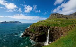
Northwest Trellin is dominated by rugged coastlines with high cliffs and mountains in the interior, in particular in the Eth Bandig and the province of Emla. The Great Bay of Arimathea in the central north is distinguished by numerous inlets and peninsulae and long stretches of beach, as are the coasts in the sheltered Sea of Velar.
The inland regions of northern Trellin are predominantly covered in dense rainforest, most of which has been in existence since prehistoric times and with only a small portion cleared since then, and drained by a number of major rivers. Of these rivers, the largest by volume is the Serëtanz which flows 810 km from Retikh to the Sea of Jajich. In northwest Trellin, natural forest cover extends with an almost unbroken canopy from the Sea of Velar to the Vekra Retiqa and from there northward to the Sea of Jajich. This vast rainforest gives way to plains in Lekhmir, eastern Retikh and the Kaedroth valley of Arimathea. The province of Namija, in eastern Trellin, is also predominantly forest-covered, particularly around the Hanoth river, though the rainforest does not extend as far north as Ja'ekha.
The coastal areas of southern Trellin are also heavily forested, though forestry has had a greater impact here than in the north of the country. Inland, the rainforest gives way to a mix of savannah and desert in what is the most sparsely populated region of the Empire. Bal Emrith, Jajich and Mëhidan are among the most agriculturally-inclined provinces, boasting fertile plains and an ideal climate. The maritime regions of Txekrikar and Ternos consist of extensive grasslands whose soil declines in fertility as it gets further from the coast.
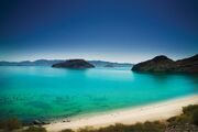
The territories of Trellin and its empire include several hundred offshore islands, of which 108 are greater than 5 square kilometres (1.9 sq mi) in area and 16 are larger than 100 square kilometres (39 sq mi). The largest, Semeria, is 20,612.5 square kilometres (7,958.5 sq mi) in area. Three of the empire's constituent states, Cadenza, Kur'zhet and the Isles of Velar, are composed entirely of islands. Most of the Trellinese islands are in the Sea of Velar and possess sandy coastlines.
Many of Trellin's mountains were volcanically formed, but few remain active. The greatest concentration of active volcanoes is along the west coast, where the Jajexan plate passes over a hotspot which also formed the archipelagos of Cadenza and Kur'zhet, in the provinces of Azmir and Mevirin. Seismic activity is not uncommon in Trellin, as the country is split roughly in half by a transverse plate boundary running from Bara ti'Emla and down the centre of the Sea of Velar. A number of volcanoes can also be found along this fault, of which the largest, Torúmalana, in southeast Zha'tar, reaches a height of 5,711 metres (18,737 ft). Major earthquakes are rare, the last earthquake of 7 MW or greater having been in 1969, but weaker tremors are almost predictably regular in the Eth Bandig.
Climate
| Martheqa, Trellin | ||||||||||||||||||||||||||||||||||||||||||||||||||||||||||||
|---|---|---|---|---|---|---|---|---|---|---|---|---|---|---|---|---|---|---|---|---|---|---|---|---|---|---|---|---|---|---|---|---|---|---|---|---|---|---|---|---|---|---|---|---|---|---|---|---|---|---|---|---|---|---|---|---|---|---|---|---|
| Climate chart (explanation) | ||||||||||||||||||||||||||||||||||||||||||||||||||||||||||||
| ||||||||||||||||||||||||||||||||||||||||||||||||||||||||||||
| ||||||||||||||||||||||||||||||||||||||||||||||||||||||||||||
Most of Trellin experiences tropical climates, with the provinces on the Sea of Jajich receiving torrential rains in the monsoon season. Intense tropical storms affect most regions within 100 kilometres (62 mi) of the coast from March/April to mid-October with a high degree of predictability. The capital, Martheqa, receives an average of 2,870 millimetres (113 in) annually, compared to a national average of roughly 1,200 millimetres (47 in). Hurricanes are not uncommon on the northern coast of Trellin, and the coasts of the Great Bay of Arimathea often take severe damage from strong storms. The southwest coast, from Jajich to Cadenza, also experiences severe storms on occasion.
Inland regions tend to be substantially drier than the coast, though the dominant climate type in the interior of northern Trellin is that of a tropical rainforest. The southern Trellinese interior is subject to savannah climates, ranging towards a semi-arid steppe climate in Khatax, southern Mëhidan and western Ternos. Regions of Khatax are considered dry desert under the Köppen climate classification system, though the majority is grass or scrubland.
Several of Trellin's mountain ranges, such as the Vekra Retiqa (which extends through Emla, Retikh, Lekhmir and Arimathea and into western Sycoon) and the Vekra Yarsali of the west coast of Azmir experience highland climates, as do the ranges on the Dangish border. On the empire's northern border with Sycoon, some peaks of the Vekra Retiqa have been known to remain snow-clad year round, and a small region in the west-central Vekra Retiqa is regarded as alpine tundra.
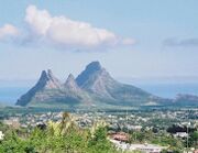
Vekh Süilya, the highest mountain on the island of Morikz
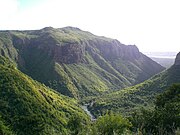
Cadenza's Tamari Valley, source of the river Temloth
Eastern foothills of the Vekra Retiqa
Flora and fauna
Because of its numerous distinct geographical subregions, including tropical rainforest, coral reef and semi-arid desert, Trellin has a diverse wildlife. Its multiplicity of biomes include some of the most ecologically significant regions in Astyria; the Tambodi and Namijan rainforests contains more unique species per square kilometre than almost any other biome in Teudallum. The habitats of some native species have been threatened by urban sprawl in recent decades, but the empire's various habitats generally remain stable in both size and population.
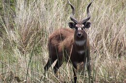
Terrestrial species endemic to Trellin include large mammals such as the Qeqsaraken antelope and the Tambodi tiger, as well as birds such as the blood thrush and Cadenzan woodpecker and invertebrates such as the giant Semerian millipede. Other species migrate to Trellin to winter in its warmer climes. Some non-indigenous species have also been introduced to Trellin as permanent residents, of which the most iconic is the tasarin flower, brought en masse with the Ethlorek migrations and introduced to Arimathea in the fourth century BC.
Politics
Trellin is a union of three monarchies under two crowns. The monarchies of Trellin and Hysera have been, since the early tenth century, inseparable under the Sidereal Crown, and both are ruled as absolute monarchies. The Isles of Velar, however, are governed by a constitutional monarchy. Hysera and the Isles of Velar are both unitary states, but the Kingdom of Trellin is divided into numerous provinces with varying degrees of power resting with each provincial legislature. Collectively, these legislative bodies are referred to as Ladroz Aserevikhi, or Councils of Imperial Authority. Many of these councils retain their pre-imperial structure in part or in whole: Asketon retains its republican administration, with the addition of a ceremonial duke.
The ruler of Trellin traditionally resides at the Palace of Tor'qim in Martheqa. The current monarch of Trellin, Hysera and the Isles of Velar is Queen Azara V.
Law
Local government
Subdivisions
|
Protectorates
The Kingdom of Trellin acts as protector to four other states within its sphere: Arimathea, Cadenza, Kur'zhet and Txekrikar. Txekrikar is actively going through the process of integration as a province of the empire, but the other three states continue to exercise their sovereignty, including managing their own foreign affairs and border policies. Only Cadenza and Txekrikar still maintain militaries independent of the Trellinese military infrastructure, the Arimathean and Kur'zheti armed forces having been integrated as units of the Trellinese.
Foreign relations
Military
Economy
The Trellinese economy is a modernised, developed economy, focused on its primary and manufacturing industries with a number of key hubs of service industries. Trellin has had a very minor role in regional trade as a result of its isolationist policies, though its three protectorates hold significant influence as key ports in west Astyria.
The main industrial heartlands of Trellin are found in the northwest, with focal points along the coast from Ka'azar in Arimathea to western Alyrum. Other manufacturing centres include Cavari, the Trophy Ports and western Kur'zhet. Traditionally, these centres have focused on heavy industries such as steelworking and shipbuilding geared towards a highly maritime economy, while inland hubs such as Asketon and Tar Pegalim lean more towards construction and automotive and aircraft production industries.
In recent years the Trellinese economy has begun to shift from its strong manufacturing base towards a greater emphasis on tertiary industries. At the forefront of this development are Cadenza, which now hosts one of Astyria's leading financial centres, and Bara ti'Emla, a major tourist centre and IT and pharmaceuticals hub.
Most of the Trellinese Empire, including Hysera, the Isles of Velar and Txekrikar, uses as the Rasna as its official currency, which is issued exclusively by the Imperial Bank of the Sidereal Crown. The exceptions to this are Cadenza, which uses the Tezahr, Kur'zhet, which uses the Fioren, and Arimathea, which uses the Mor'ed.
Energy
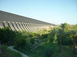
Energy production in Trellin comes from a wide range of sources. It continues to rely on fossil fuels such as coal and natural gas for over half of its power supply, but the proportion generated by renewables such as hydropower and solar energy has seen an increase of 60% between 2012 and 2015, from 25% to 40%. Several of the country's major rivers have been dammed for energy production, and the province of Khatax has extensive arrays of solar panels. Major offshore wind farms exist off the coast of Alyrum, Mevirin and the Jajexan Peninsula, which receive the highest wind speeds from the Transjajexan Air Stream. A number of nuclear power plants provide for 8% of the national power consumption. Petroleum is chiefly sourced from domestic reserves, mostly located offshore in the seas of Jajich and Velar, although in recent decades, due to rising levels of automobile ownership, external providers such as Costa de Ouro have helped to fuel Trellin's transport industry.
Trellin has three nation-wide commercial energy providers and eight region-specific providers, creating a highly competitive market in some parts of the country. The largest providers are NamiKaka, TanzPetro and TL Fünselg, which together hold 64% of the market.
Transport
Because of the large distances separating many Trellinese cities, the country has come to rely heavily on its railway networks. A comprehensive system of high-speed rail has been put in place in the last decade, one of the largest non-military capital investments made in the history of the Sidereal Crown. This network is primarily inward-focused, with few connections to Trellin's neighbours, and primarily follows the coast and rivers.
As no bridges or tunnels attempt to traverse the Sea of Velar, there is a substantial emphasis on sea traffic, particularly ferries, and on air traffic for travel between north and south Trellin. Additionally, access to the remote areas of the Trellinese rainforest, or some islands, is facilitated almost exclusively by air. A number of domestic airlines compete on internal routes, as no foreign company has yet been granted a license to fly between Trellinese airports. The two largest domestic airlines are Trellinese Airlines and Sidereal Airways.
Demographics
Population distribution
The majority of Trellin's people live in coastal areas, with the greatest concentration in a strip from Aloyu, Zha'tar to Tikeset, Alyrum, stretching inland in Trelum and Hysera. Most major cities are coastal or located on large, navigable rivers that facilitate trade, such as Martheqa, Asketon and Cavari, on the Serëtanz, Flotir and Hanoth, respectively. The major exception to this is Bara ti'Emla which, though on the Lasara river, is not connected to the sea because of the high falls at the end of the river. Other major population centres include the lower Flotir valley and along the Bay of Pedalin, extending westward along the Pelnan coast to Betria in Idisamo. Beyond the narrow strips of the densely-inhabited litoral lie vast tracts of uninhabited wilderness, encompassing rainforests and mountain ranges.
Trellin's southern landmass is more sparsely-populated than the northern: with a population of just 48 million (excluding Cadenza, Kur'zhet and Txekrikar) to the north's 140 million (excluding Arimathea and Hysera), it accounts for just over a quarter of the population of the state. This disparity only increases when the empire is considered as a whole, with the south accounting for a mere 23.6% of the empire's population, in part owing to the large concentrations of people in Hysera and the fact that Arimathea is the most populous territory in the empire.
Largest cities
Largest cities or towns in Trellin
Statistical, Demographical and Census Department | |||||||||
|---|---|---|---|---|---|---|---|---|---|
| Rank | Province | Pop. | Rank | Province | Pop. | ||||
 Martheqa  Asketon |
1 | Martheqa | Trelum | 8,651,096 | 11 | Betria | Idisamo | 1,622,467 |  Bara ti'Emla  Cavari |
| 2 | Asketon | Asketon | 6,128,563 | 12 | Radulin | Pelna | 1,607,921 | ||
| 3 | Bara ti'Emla | Emla | 5,849,366 | 13 | Zarthalin | Retikh | 1,532,602 | ||
| 4 | Cavari | Namija | 4,781,972 | 14 | Tanzigar | Trelum | 1,261,556 | ||
| 5 | Khem | Azmir | 3,655,145 | 15 | Kzint | Emla | 1,213,915 | ||
| 6 | Kethros | Namija | 3,132,705 | 16 | Rusetik | Alyrum | 1,092,273 | ||
| 7 | Tar Pegalim | Lekhmir | 2,951,812 | 17 | Pedalin | Ja'ekha | 1,059,469 | ||
| 8 | Vedalera | Saheri | 2,791,421 | 18 | Ruveg | Namija | 1,012,736 | ||
| 9 | Azhedar | Ja'ekha | 2,471,673 | 19 | Oloros | Fymona | 913,829 | ||
| 10 | Ka'alkë | Alyrum | 1,857,376 | 20 | Nephit | Kur'mala | 864,170 | ||
Ethnicity
The population of the Trellinese Empire is ethnically diverse, with extensive mixture of its major ethnic and cultural groups. Historically such intermingling was restricted to border areas away from conflict zones: for example, in Jajich, a former territory of Hysera, centuries of contact and colonisation have led to the Hyseran majority being displaced by a Trellinese one, although an increasing percentage of the population is of mixed Hyseran-Trellinese ancestry. On the whole, majority populations within each territory reflect their historic ownership: the dominant ethnic group in Velar is Velaran, in Hysera is Hysera and throughout most of Trellin it is Trellinese. Where boundaries have since shifted, the population of the former owner has often remained, particularly when such realignments occurred under a tolerant monarchy. Notable relict populations include the significant Velaran populations in Pelna, Retikh and elsewhere around the Sea of Velar, with nearly four million ethnic Velarans in these areas.
Religion
Culture
Art
Cuisine
Modern Trellinese cuisine is a fusion of several native and imported traditions, and varies widely across the country. In the northwest, particularly around the capital region, fish dishes predominate, frequently in rich mixtures with spices and tender vegetables, especially tomatoes. In southern Trellin and the northern grasslands, meat is much more common, especially steak.
Trellinese breads are light
Music and theatre

Sport
vroom vroom Azmir Grand Prix


