Euronia: Difference between revisions
No edit summary |
No edit summary |
||
| Line 68: | Line 68: | ||
==Geography== | ==Geography== | ||
===Regions=== | ===Regions=== | ||
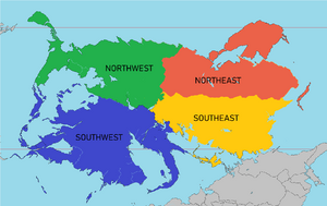
[[File:EuroniaRegionsUpdated2021.png|thumb|right|The four distinct and commonly referenced divisions of the continent of Euronia; Northwest, Southwest, Northeast, | [[File:EuroniaRegionsUpdated2021.png|thumb|right|The four distinct and commonly referenced divisions of the continent of Euronia; Northwest, Southwest, Northeast, Southeast.]] | ||
Euronia, due to its immense size, is generally divided into four subcontinental categories: Northwest, Southwest, Northeast, and Southeast. These are generally categorized by geographical features. | Euronia, due to its immense size, is generally divided into four subcontinental categories: Northwest, Southwest, Northeast, and Southeast. These are generally categorized by geographical features. Some classify the Toyana Islands as a fifth subcontinental category, although most classify it within the Southwest. | ||
The Northwest is defined to the south by the [[Danaska River]] and the [[Great Southern Mountain Range]] and to the east by the [[Asarana Mountains]] in [[West Chanchajilla]], [[East Chanchajilla]], [[Paraboca]], [[Gladysynthia]], and the [[Slavic Union]]. Included in these peaks is [[Acadagua]], which is the tallest mountain on the continent and the fourth-largest in [[Iearth|the world]] at 6,959 m (22,831 ft) above sea level. | The Northwest is defined to the south by the [[Danaska River]] and the [[Great Southern Mountain Range]] and to the east by the [[Asarana Mountains]] in [[West Chanchajilla]], [[East Chanchajilla]], [[Paraboca]], [[Gladysynthia]], and the [[Slavic Union]]. Included in these peaks is [[Acadagua]], which is the tallest mountain on the continent and the fourth-largest in [[Iearth|the world]] at 6,959 m (22,831 ft) above sea level. | ||
The Southwest is defined by the [[Zamastan]]ian subcontinent and [[Drambenburg]], as well as its former states of [[Shoassau]], [[Chaesia]], [[Blaoria]], and [[Lutharia]]. | The Southwest is defined by the [[Zamastan]]ian subcontinent and [[Drambenburg]], as well as its former states of [[Shoassau]], [[Chaesia]], [[Blaoria]], and [[Lutharia]]. Depending on the interpretation of this region, it also includes the [[Toyana Ocean]] Island Nations of [[Janapa]], [[Lillestola]], and [[Ossinia]]. | ||
The Southeast consists of the expanse of the [[Siena Bay]] countries stretching from [[Avergnon]], through [[Murzi]], [[Zitasso]], [[Larinthia]], and [[Tinten]]. | The Southeast consists of the expanse of the [[Siena Bay]] countries stretching from [[Avergnon]], through [[Murzi]], [[Zitasso]], [[Larinthia]], and [[Tinten]]. | ||
Revision as of 22:51, 12 August 2021
 | |
| Area | 44,579,000 km2 |
|---|---|
| Population | 3,200,000,000 |
| Religions | Christianity (75.2%)
No religion (18.2%) Islam (5.9%) Others (0.7%) |
| Demonym | Euronian |
| Countries | List of sovereign states and dependent territories (Iearth) |
| Languages | Caticeze-English, French, Drambenburgian, Avergnonian, Spanish, Vulkari |
| Largest cities | Tofino, Arinals, Vessalia, Lerbin, Emerald, San Beausoleil, Mönusÿnthys, Ponamu, Heimdahl'ia, Danaska, Titania, Providence, Jade Harbor, Vilanja, Cardoza, Ivora, Viitaniemi, |
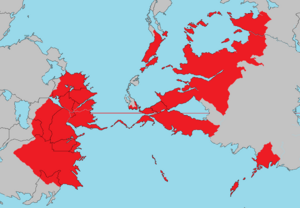
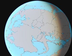
Euronia is the largest continent located on the planet of Iearth. The vast continent is bounded by the bustling Olympic Ocean to the west, the Northern Ocean to the north, the Samson Ocean to the east, and the expansive Toyana Ocean to the south. A narrow land bridge connects Euronia to Ausiana through the country of Vulkaria, though it is bisected by the Vulkarian Pass.
Humans first settled Euronia between 42,000 and 17,000 years ago. The development and civilization varied around the continent, as some nation states and kingdoms were formed throughout ancient time and remained prevelant in their respective regions, while other areas remained largely tribal or nomadic. Exploration and colonization from Adula led to these nomadic civilizations conquered mostly in the west in Zamastan, Caspiaa, Ruskayn, and Gladysynthia. Diseases introduced from Adula and Nortua devastated the indigenous peoples, and the Adulan powers colonized the western end of the continent. However, many indigenous populations developed into naturally powerful lasting cultures both in politics and dominance, as seen with Drambenburg, Egilanak, Avergnon, and Paraboca. Mass emigration from Adula and Ausiana from the 1500s-2000s, including large numbers of indentured servants and slaves, largely replaced the indigenous peoples.
Decolonization of the west began with the Zamastan War of Independence in the early 1800s and largely ended with the Skithan exit from Ossinia and Rio Palito in the late 1840s. Currently, almost all of the population of Euronia resides in independent countries; however, the legacy of the colonization and settlement by Adulans is that the Euronians share many common cultural traits, most notably Christianity and the use of similar languages.
Euronia is home to some of the most influential nations in the world both in terms of historical impact and modern day connection. Euronia is home to nearly 3 billion inhabitants, one-fifth of whom reside in Zamastan, Gladysynthia, Drambenburg, D.S.C., and Vulkaria. It is home to several megacities (metropolitan areas with ten million inhabitants or more), such as Tofino, Mönusÿnthys, Ponamu, Durenurbergering, Vessalia, Vilanja, Cardoza, and Emerald.
Etymology
History
Pre-Euronia period
Middle Ages period (1-1500 AD)
Over time, indigenous cultures in Zamastan grew increasingly complex, and some, such as the Catica First Nations (Kelowna) culture in the northwest, developed advanced agriculture, grand architecture, and state-level societies. The Kelowna culture flourished in the south from 800 to 1600 AD, extending from the Gladysynthian border down through Rio Palito. Its city state Kelowna is considered the largest, most complex pre-historical archaeological site in modern-day Zamastan.
During this period, the Egilanakan Empire came and went. The upcoming of power of Frensez I in the 800's took over large portions of Eastern Euronia and at the time of his death, was considered one of the greatest military masterminds of all time. The empire slowly grew until the late 900's when its size was at its maximum. It was another 100 years until the local Duchies and Provinces fought back and over 100's of years resulted in where Egilanak is today by 1638, just a fraction of what it previously was.
In the east, the Kingdom of Mayotte formed with the collective federations of other kingdoms in 1200 AD. The Second Drambenburg Empire and the Kingdom of Mayotte fought the Fifty Years War from 1337-1389 due to each side claiming legitimate power over the palatinate of Aunistria. Aunistria was ultimately conquered by Drambenburg.
Modern period (1500-present day)
Growth of Empires
In 1670, the seven provinces of Gladysynthia combined to create the Gladysynthian Empire, which expanded into a large regional powerhourse of Northern Euronia, governing areas in Baytonia and Llihc. Much of current day Jade was also part of Gladysynthia, but upon Zamastan's founding, they purchased the territory in 1824.
In the late 17th and 18th century, the Empire of Skith took over vast swaths of southwestern Euronia in what is current day Zamastan, Gladysynthia, Ruskayn, Rio Palito, and Ossinia. In 1804, the country of Zamastan was formed following the victory of rebel forces in the Zamastan War of Independence, and this event marked the downfall of the Skith Empire on Euronia.
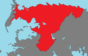
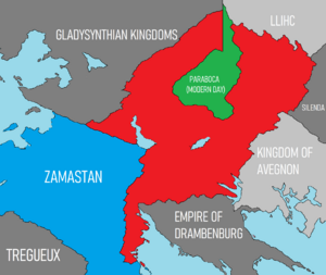
The Empire of Paraboca conquered Chanchajilla (East and West), also extended their territory into northern Drambenburg, Avergnon, and Mayotte. The subsequent Great Cardoza War in which Zamastan was initially invaded and eventually pushed back the imperial forces, resulting in extensive infighting, rebellions, and economic instability, Paraboca's empire collapsed.
Avergnon had a moderate-sized regional empire located along the coast and lowland regions of Siena Bay on the Toyana Ocean, which eventually expanded into the Avergnon highlands and modern day Tinten through Lewis Pontegnone's conquests in the 1700's. Vessalia became a regional powerhouse, trading with other imperial cities such as Cardoza, Ivora, and Vilanja. Several devestating wars throughout the centuries with Drambenburg prevented either side's larger expansion into each other's territory.
Rise of Nationstates
Industrialization, colonization, and the World War
Cold War-present day
Geography
Regions
Euronia, due to its immense size, is generally divided into four subcontinental categories: Northwest, Southwest, Northeast, and Southeast. These are generally categorized by geographical features. Some classify the Toyana Islands as a fifth subcontinental category, although most classify it within the Southwest.
The Northwest is defined to the south by the Danaska River and the Great Southern Mountain Range and to the east by the Asarana Mountains in West Chanchajilla, East Chanchajilla, Paraboca, Gladysynthia, and the Slavic Union. Included in these peaks is Acadagua, which is the tallest mountain on the continent and the fourth-largest in the world at 6,959 m (22,831 ft) above sea level.
The Southwest is defined by the Zamastanian subcontinent and Drambenburg, as well as its former states of Shoassau, Chaesia, Blaoria, and Lutharia. Depending on the interpretation of this region, it also includes the Toyana Ocean Island Nations of Janapa, Lillestola, and Ossinia.
The Southeast consists of the expanse of the Siena Bay countries stretching from Avergnon, through Murzi, Zitasso, Larinthia, and Tinten.
The Northeast consists of

