Aayan Empire: Difference between revisions
Jump to navigation
Jump to search
m (→See Also) |
m (clean filenames) |
||
| Line 5: | Line 5: | ||
| status = | | status = | ||
| life_span = {{line-height|1.3em|{{nowrap|from 100s BCE – to 50s CE}}}} | | life_span = {{line-height|1.3em|{{nowrap|from 100s BCE – to 50s CE}}}} | ||
| image_flag = File: | | image_flag = File:Flag of the Aayan Empire.png | ||
| flag_border = no | | flag_border = no | ||
| alt_flag = Flag of Aayan Empire | | alt_flag = Flag of Aayan Empire | ||
| Line 13: | Line 13: | ||
| alt_coat = Coat of arms | | alt_coat = Coat of arms | ||
| symbol_type = Coat of arms | | symbol_type = Coat of arms | ||
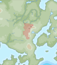
| image_map = [[File: | | image_map = [[File:Map of the Aayan Empire.png|200px]] | ||
| image_map_caption = Maximum extent of the Aayan Empire, as shown by the location of Nabendu's inscriptions, and visualized by historians: {{wp|Vincent Arthur Smith|Vincent Arthur Morgan}}; {{wp|R. C. Majumdar|R. J. Majumdar}}; and historical geographer Jacksten E. Schlossberg. | | image_map_caption = Maximum extent of the Aayan Empire, as shown by the location of Nabendu's inscriptions, and visualized by historians: {{wp|Vincent Arthur Smith|Vincent Arthur Morgan}}; {{wp|R. C. Majumdar|R. J. Majumdar}}; and historical geographer Jacksten E. Schlossberg. | ||
| capital = {{unbulleted list | | capital = {{unbulleted list | ||
Revision as of 18:08, 3 February 2022
Aayan Empire Āyana Sāmrājya | |
|---|---|
| from 100s BCE – to 50s CE | |
|
Flag of the Aayan Empire (reconstructed) | |
 Maximum extent of the Aayan Empire, as shown by the location of Nabendu's inscriptions, and visualized by historians: Vincent Arthur Morgan; R. J. Majumdar; and historical geographer Jacksten E. Schlossberg. | |
| Capital |
|
| Government | Absolute Monarchy |
| Today part of | |
The Aayan Empire (Mahanan: Āyana Sāmrājya or आयन साम्राज्य) was an iron-age empire in Oriental Europa, based around the Patuan region of Mahana and Mekabiri. At the empire's greatest extent, it spread from southern Kotowari to northern Mekabiri and west through the great plains of central Europa. The empire was centralised by the first emperor's conquest of the Careleon Plateau.
At any time, the empire was led by an absolute monarch, the emperor. The most famous of these emperors was Emperor Ujesh who established recorded history in Mahana during his religious pilgrimage in 53BC.
