Natural Wonders of Eurth: Difference between revisions
Jump to navigation
Jump to search
(Removal of Rihan from Eurth canon) |
No edit summary |
||
| (18 intermediate revisions by 8 users not shown) | |||
| Line 1: | Line 1: | ||
This list of '''natural wonders of [[Eurth]]''' has been gathered in order to document the wurld's most wonderful and impressive natural features. | |||
{|class="wikitable sortable" | {|class="wikitable sortable" | ||
! style="width:15%;" scope="col"| Site | ! style="width:15%;" scope="col"| Site | ||
! class="unsortable" scope="col"| Image | ! class="unsortable" scope="col"| Image | ||
! style="width:12.5%;" scope="col" | Location | ! style="width:12.5%;" scope="col" | Location | ||
! style="width: | ! style="width:55%;" scope="col" class="unsortable" | Description | ||
|- | |- | ||
! scope="row" | [[ | ! scope="row" | Ettiny Pass | ||
| align="center" | [[File:Ettiny_Pass.jpg|150x150px|Ettiny Pass]] | |||
| {{flag|Dolchland}} | |||
| One of the most treacherous routes into the Kingdom of [[Dolchland]], the Ettiny Pass is unique as due to its shape and geography, it has been filled with thick fog constantly for all of recorded history. Largely considered too dangerous for armies to march through due to the risk of avalanches and ambushes, it has only ever seen small scale settlement and travel through it by those very familiar with its characteristics. | |||
|- | |||
! scope="row" | Jokultitbjarg | |||
| align="center" | [[File:Jokultithlidth.jpeg|150x150px|Jokultitbjarg]] | | align="center" | [[File:Jokultithlidth.jpeg|150x150px|Jokultitbjarg]] | ||
| {{flag| | | {{flag|Dolchland}} | ||
| Rising in the centre of | | Rising in the centre of Dolchland's [[Dolchland#Geography|Apf Kadirn]] mountain range, Jokultitbjarg is the tallest mountain in the empire, with a height of some {{convert|29030|ft}} about sea level. It is permanently covered in layers of ice and snow at the top, with few venturing up atop it. | ||
|- | |- | ||
! scope="row" | | ! scope="row" | Kemper Stones | ||
| align="center" | [[File:Kemperstones.JPG|150x150px|Kemper Stones]] | | align="center" | [[File:Kemperstones.JPG|150x150px|Kemper Stones]] | ||
| {{flag| | | {{flag|Dolchland}} | ||
| An outcropping of stones in the south of | | An outcropping of stones in the south of Dolchland with a long history, as it is commonly believed that the first of the Dolchlander camped around them when they originally arrived. Paintings upon them and archaeological evidence also shows that lesser peoples also spent time around them, dating back to at least around M20 B.T.E. These rocks are also interesting, as they appear to be deeply embedded into the hill and surrounding areas where they are found. | ||
|- | |- | ||
! scope="row" | | ! scope="row" | Mount Gwyrddfa | ||
| align="center" | [[File:MtGwyrddfa.jpeg|150x150px|Mt Gwyrddfa]] | | align="center" | [[File:MtGwyrddfa.jpeg|150x150px|Mt Gwyrddfa]] | ||
| {{flag|PyeMcGowan}} | | {{flag|PyeMcGowan}} | ||
| Mt Gwyrddfa is PyeMcGowan’s tallest mountain, standing at | | Mt Gwyrddfa is PyeMcGowan’s tallest mountain, standing at {{convert|4810|m}}. It is located in the Eryr National Park, home to the PyeMcGowian Eagle, and PyeMcGowan’s largest national park. The Mountain was first climbed by Sir William Mabdyfed. | ||
|- | |- | ||
! scope="row" | | ! scope="row" |Mount Monjara | ||
| align="center" | [[File: | | align="center" | [[File:Mount Monjara.jpg|150x150px|Mount Monjara]] | ||
| {{flag| | | {{flag|Mahana}} | ||
| | | The tallest of the [[Samripe Mountain Range|Samripe Mountains]], [[Mount Monjara]] is one of [[Eurth]]'s tallest mountains standing at 7,963m tall. The mountain is the source of huge tourism to [[Mahana]], being one of the primary sources of income for [[Mahana]]'s economy. The mountain has only been summited a total of 5,700 times throughout history, being a task taken on by many tourists however being rarely achieved. | ||
|- | |- | ||
! scope="row" | Mount Silesto | ! scope="row" | [[Orioni#Geography|Mount Silesto]] | ||
| align="center" | [[File:VvWatD0.jpg|150x150px|Mount Silesto Lava]] | | align="center" | [[File:VvWatD0.jpg|150x150px|Mount Silesto Lava]] | ||
| {{flag|Orioni}} | | {{flag|Orioni}} | ||
| Mount Silesto is an active volcano in the northeast of [[Orioni]]. It last [ | | Mount Silesto is an active volcano in the northeast of [[Orioni]]. It last erupted in February 2016.<ref>[https://www.europans.com/topic/1966-roiters-%C2%BB-know-now/?do=findComment&comment=22054507 Spectacular eruption of Silesto volcano after years of quiet] (8 February 2016)</ref> The mountain is part of the [[National Parks and Preserves of Eurth|Amilaki Wildlife Reserve]], and was created in conjunction with the establishment of the [[Entente of Oriental States]]. | ||
|- | |||
! scope="row" |Mount Tarodpai | |||
| align="center" | [[File:Tarodpai 2.jpg|150x150px|Mount Tarodpai]] | |||
| {{flag|Rhava}} | |||
|[[Ho Heak Mountain Range|Ho Heak Mountains]], [[Mount Tarodpai]] is one of [[Eurth]]'s being 5,526 m tall. Being over 82 million years old, it is associated with the creation of the island Rhava is situated on me. It is also a religious sight of many island religions. It is a huge tourist sight in Rhava's Phong Neeb province, bringing thousands anually to climb it. In recent years it has been harder to climb and see it, with new Rhavanese laws being passed. | |||
|- | |||
! scope="row" | [[Old Jakasse]] | |||
| align="center" | [[File:Great-Zimbabwe.jpg|150x150px|Old Jakasse]] | |||
| {{flag|Batsweda}} | |||
| Located 50 km northeast of modern-day [[Jakasse]], Old Jakasse ({{wp|Bassa language|Banno}}: ''Jǎkasì-súá'') was a Banno fortified settlement (''hwɔɖɔ''), first settled in the 2nd century BCE. A main centre for trade on the [[Tsweda River]], Old Jakasse became the capital for both the [[Kingdom of Jakasse]] and the [[Batsweda Empire]] until the city's decline in the mid-1500s, when the capital being moved to the coast in 1567. The settlement was completed abandoned and destroyed by 1670, during the War of the Broken Fetish. | |||
|- | |||
! scope="row" |Lake Bishimu | |||
| align="center" | [[File:琵琶湖 マキノ町中庄 Lake Biwa - panoramio.jpg|150x150px|Lake Bishimu]] | |||
| {{flag|Esonice}} | |||
|[[Lake Bishimu|Lake Bishimu]] is the largest lake and {{wp|fresh water|freshwater}} lake in Esonice, at a depth of 183 m it is also the deepest lake in the country. The lake is home to a plethora of freshwater life and is crucial to the {{wp|ecosystem|ecosystem}} of [[Kunho|Kunho]], making it an area of {{wp|Nature conservation|conservation}}. The lake is protected by law from excessive fishing amd other forms of environmental harm, breaking them resulting in hefty fines. Along with its environmental importance, the lake is also very important to Esonian culture and religion, often depicted in art and literature. The lake is also home to several religious sites located on the lake's islands. | |||
|} | |} | ||
[[Category: | |||
==References== | |||
{{Reflist}} | |||
{{Eurth}} | |||
[[Category:Lists of Eurth]] | |||
Latest revision as of 22:12, 21 September 2024
This list of natural wonders of Eurth has been gathered in order to document the wurld's most wonderful and impressive natural features.
| Site | Image | Location | Description |
|---|---|---|---|
| Ettiny Pass | 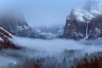
|
One of the most treacherous routes into the Kingdom of Dolchland, the Ettiny Pass is unique as due to its shape and geography, it has been filled with thick fog constantly for all of recorded history. Largely considered too dangerous for armies to march through due to the risk of avalanches and ambushes, it has only ever seen small scale settlement and travel through it by those very familiar with its characteristics. | |
| Jokultitbjarg | 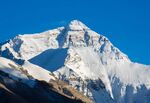
|
Rising in the centre of Dolchland's Apf Kadirn mountain range, Jokultitbjarg is the tallest mountain in the empire, with a height of some 29,030 feet (8,850 m) about sea level. It is permanently covered in layers of ice and snow at the top, with few venturing up atop it. | |
| Kemper Stones | 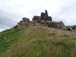
|
An outcropping of stones in the south of Dolchland with a long history, as it is commonly believed that the first of the Dolchlander camped around them when they originally arrived. Paintings upon them and archaeological evidence also shows that lesser peoples also spent time around them, dating back to at least around M20 B.T.E. These rocks are also interesting, as they appear to be deeply embedded into the hill and surrounding areas where they are found. | |
| Mount Gwyrddfa | 
|
Mt Gwyrddfa is PyeMcGowan’s tallest mountain, standing at 4,810 metres (15,780 ft). It is located in the Eryr National Park, home to the PyeMcGowian Eagle, and PyeMcGowan’s largest national park. The Mountain was first climbed by Sir William Mabdyfed. | |
| Mount Monjara | 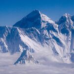
|
The tallest of the Samripe Mountains, Mount Monjara is one of Eurth's tallest mountains standing at 7,963m tall. The mountain is the source of huge tourism to Mahana, being one of the primary sources of income for Mahana's economy. The mountain has only been summited a total of 5,700 times throughout history, being a task taken on by many tourists however being rarely achieved. | |
| Mount Silesto | 
|
Mount Silesto is an active volcano in the northeast of Orioni. It last erupted in February 2016.[1] The mountain is part of the Amilaki Wildlife Reserve, and was created in conjunction with the establishment of the Entente of Oriental States. | |
| Mount Tarodpai | 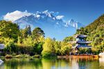
|
Ho Heak Mountains, Mount Tarodpai is one of Eurth's being 5,526 m tall. Being over 82 million years old, it is associated with the creation of the island Rhava is situated on me. It is also a religious sight of many island religions. It is a huge tourist sight in Rhava's Phong Neeb province, bringing thousands anually to climb it. In recent years it has been harder to climb and see it, with new Rhavanese laws being passed. | |
| Old Jakasse | 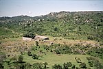
|
Located 50 km northeast of modern-day Jakasse, Old Jakasse (Banno: Jǎkasì-súá) was a Banno fortified settlement (hwɔɖɔ), first settled in the 2nd century BCE. A main centre for trade on the Tsweda River, Old Jakasse became the capital for both the Kingdom of Jakasse and the Batsweda Empire until the city's decline in the mid-1500s, when the capital being moved to the coast in 1567. The settlement was completed abandoned and destroyed by 1670, during the War of the Broken Fetish. | |
| Lake Bishimu | 
|
Lake Bishimu is the largest lake and freshwater lake in Esonice, at a depth of 183 m it is also the deepest lake in the country. The lake is home to a plethora of freshwater life and is crucial to the ecosystem of Kunho, making it an area of conservation. The lake is protected by law from excessive fishing amd other forms of environmental harm, breaking them resulting in hefty fines. Along with its environmental importance, the lake is also very important to Esonian culture and religion, often depicted in art and literature. The lake is also home to several religious sites located on the lake's islands. |
References
- ↑ Spectacular eruption of Silesto volcano after years of quiet (8 February 2016)