List of cities in Orioni
Most cities in Orioni from the First Empire carry the classical suffix -polis (/ˈpɒlɨs/; plural poleis (/ˈpɒleɪz/, [póleːs]), which literally means "city". Historically, most of these poleis organised themselves as monarchy and mainly focussed on trade. Certain cities specialised in one particular type of commodity. Some colonies experimented with other forms of government, such as the oligarch republic of Primahoris.
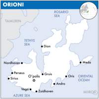
About 53% of Orioni is either forested or mountainous, making it largely unsuitable for agricultural, industrial, or residential use. This means that coastal areas contain the habitable zones and have high population densities. The population tends to cluster around fresh-water sources and seaports. As a result, these coastal regions of Orioni are some of the most densely populated areas on Eurth.
Opolis
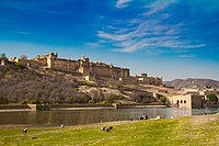
![]() O'polis (Oharic: Obil) is the capital city of Orioni. The official name is the O'polis NCR (National Capital Region). Both internationally and in daily conversations, the city is referred to as O’polis. With a population of approximately 5,037,655, it is the capital of O'polis province. It is the second city in Orioni. It contains important government facilities, offices and headquarters, and contain the primary residence of the nation's leadership. It is the 'brain' of the country. The city welcomes visitors, but is complex in both history and layout. There’s a reason that people come back time and time again: this is not a place you can fully comprehend with just one trip. The Orinese capital is both socially tolerant and deeply conservative; its businesses are often friendly but difficult to find. It’s a city where both an old monarchy and a young creative class find common ground. Sites to visit: the Bētuni Imperial Palace, Adhamed Arch and Sun Tower.
O'polis (Oharic: Obil) is the capital city of Orioni. The official name is the O'polis NCR (National Capital Region). Both internationally and in daily conversations, the city is referred to as O’polis. With a population of approximately 5,037,655, it is the capital of O'polis province. It is the second city in Orioni. It contains important government facilities, offices and headquarters, and contain the primary residence of the nation's leadership. It is the 'brain' of the country. The city welcomes visitors, but is complex in both history and layout. There’s a reason that people come back time and time again: this is not a place you can fully comprehend with just one trip. The Orinese capital is both socially tolerant and deeply conservative; its businesses are often friendly but difficult to find. It’s a city where both an old monarchy and a young creative class find common ground. Sites to visit: the Bētuni Imperial Palace, Adhamed Arch and Sun Tower.
Its history dates to the 8th century. It was the site of a royal mint during the queendom of Erwanin. After the Orinese Civil War and subsequent sacking of Hierapolis (1174), it became the political capital of Orioni on 11 May 1182. Later, Empress Moriino (1180-1182) further divided the expanded city into 5 regions and ornamented it with public works worthy of an imperial metropolis. The court was supplied from the rich gardens and sophisticated workshops of oriental Europa, with treasuries filled by the wealthiest provinces of the Empire. The name is believed to be composed of Proto-Europan roots 'Urim' (city) and 'Bilum' (high) or 'Belu' (master). This is presumed to be a reference to its location on higher, mountainous upper regions, in contrast to cities on the lower river deltas. The city was called Upala ("gem") in the Oriental dialect of nearby Shakyan, and Upija by the Memopotamians in Azania. Classical Aromans mistakenly believe it to be an abbreviation for Omnipolis ("city of all").
O'polis is twinned with the following cities:
Major cities
Andro
![]() Andro (Oharic: Entiro), from Andron (Aroman: ἀνδρών andrōn) or andronitis (Aroman: ἀνδρωνῖτις andrōnitis), established itself as a city-state ruled by a line of male monarchs. This in contrast to most other city-states in the Empire which were matriarchies. Ancient Andro was built into a steep hillside. It was an important maritime centre. The breakwater of its harbour can still be seen underwater.
Andro (Oharic: Entiro), from Andron (Aroman: ἀνδρών andrōn) or andronitis (Aroman: ἀνδρωνῖτις andrōnitis), established itself as a city-state ruled by a line of male monarchs. This in contrast to most other city-states in the Empire which were matriarchies. Ancient Andro was built into a steep hillside. It was an important maritime centre. The breakwater of its harbour can still be seen underwater.
In 1775 the Andro Academy of Fine Arts (AAFA) in Andro was there as a cost-free training centre for the printing of silk and cotton textiles; this later included the plastic arts. Scholarships permitted many students to travel to O'polis and other Europan centres of studies, where they could dedicate themselves to copying grandmasters' works, a common method of study at the time. The academy's focus evolved toward the fine arts. The academy organised its first exhibition of prize-winning student work in 1786; in the next year's exhibition, other non-student artworks were also displayed. Other courses offered include painting, music, sculpture, architecture and other fine arts.
Corona Borealis
![]() Corona Borealis (Oharic: Korontaj). City in the far north of the Empire. The name evolved from Boreapolis ("city of the north") into Borealis. When the civil war erupted in 1023, it forced the imperial family to flee in 1063 to the loyalist northern part of the island. Because of this, they temporarily moved the political capital to Boreapolis, prompting the name change to Corona Borealis ("northern crown").
Corona Borealis (Oharic: Korontaj). City in the far north of the Empire. The name evolved from Boreapolis ("city of the north") into Borealis. When the civil war erupted in 1023, it forced the imperial family to flee in 1063 to the loyalist northern part of the island. Because of this, they temporarily moved the political capital to Boreapolis, prompting the name change to Corona Borealis ("northern crown").
Cygnus
![]() Cygnus (Oharic: Hangsa of Hamsa). Colony-city found by merchants from Vega, it became famous for its high-quality metallurgy, thanks to the nearby rich ore veins in the Mendakh mountains.
Cygnus (Oharic: Hangsa of Hamsa). Colony-city found by merchants from Vega, it became famous for its high-quality metallurgy, thanks to the nearby rich ore veins in the Mendakh mountains.
- The origins of the name "Hangsa" are lost in antiquity. The name first appears in the 11th century BCE: a vassal lord from the Hangsa area sent a type of softshell turtle known as "Hangsa softshell turtle" to the Dion king as a tribute. In the 2nd century CE, historian Ying Šao wrote that the Nintoku dynasty use of the name Hangsa for the area was a continuance of its old name. https://en.wikipedia.org/wiki/Changsha
- The port of Cygnus is the largest iron ore loading port in Orioni and one of the largest in Europa. Located in the XXX Region of Northern Orioni, the port recorded a throughput of over 550 million tons between 2016 and 2017. In March 2017, Port Cygnus had its record single shipment of 297.000 tons, which was aboard the HL Bedok, a 340 m long (1,115-foot) vessel from Miiros. http://dailyoverview.tumblr.com/post/177768196524/port-hedland-is-the-largest-iron-ore-loading-port
Dion
![]() Dion (Oharic: Dion). City of king Dion, who believed he had magical powers that granted his forests exceptional quality. Dion was a major exporter of timber for shipbuilding. The name evolved from Dionpolis ("city of Dion") into Dion. The Dion Naval Base is a nearby military facility.
Dion (Oharic: Dion). City of king Dion, who believed he had magical powers that granted his forests exceptional quality. Dion was a major exporter of timber for shipbuilding. The name evolved from Dionpolis ("city of Dion") into Dion. The Dion Naval Base is a nearby military facility.
Gruis
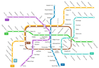
![]() Gruis (Oharic: Tigray) is a coastal city known for its massive harbour cranes. It was the most important transfer port between the central and northern regions. Gruis is led the way to find creative solutions that balanced the need for growth and the preservation of urban spaces. Under then-mayor Rezovi the public transportation network saw a necessary expansion. An order for 300 new buses was placed last year and extensions are ongoing for its light rail and one of its subway lines. This expansion wasn't always well received when a new bill called Proposition 404 threatened to halt further expansion plans and put money towards building more roads instead. Another trend is the ban on e-scooter companies.[1] The name evolved from Tigray over Tigrui into Gruis. The Tigrayans primarily inhabit the highlands between Alnitak and Alnilam. The first mention of Tigray dates from around 900 BCE when they entered into conflict with the Erwanin queendom.
Gruis (Oharic: Tigray) is a coastal city known for its massive harbour cranes. It was the most important transfer port between the central and northern regions. Gruis is led the way to find creative solutions that balanced the need for growth and the preservation of urban spaces. Under then-mayor Rezovi the public transportation network saw a necessary expansion. An order for 300 new buses was placed last year and extensions are ongoing for its light rail and one of its subway lines. This expansion wasn't always well received when a new bill called Proposition 404 threatened to halt further expansion plans and put money towards building more roads instead. Another trend is the ban on e-scooter companies.[1] The name evolved from Tigray over Tigrui into Gruis. The Tigrayans primarily inhabit the highlands between Alnitak and Alnilam. The first mention of Tigray dates from around 900 BCE when they entered into conflict with the Erwanin queendom.
Meda
![]() Meda (Oharic: Mideya) is one of the oldest cities in Orioni. Meda is a changed city. The recent metamorphosis has been fuelled by the economic crisis and led by a new generation of determined Medanese who have transformed the old city for the better. Both tradition and modernity can be found at the same time. You can marvel at centuries-old masterpieces one moment and enjoy new dishes made by brave chefs the next.
Meda (Oharic: Mideya) is one of the oldest cities in Orioni. Meda is a changed city. The recent metamorphosis has been fuelled by the economic crisis and led by a new generation of determined Medanese who have transformed the old city for the better. Both tradition and modernity can be found at the same time. You can marvel at centuries-old masterpieces one moment and enjoy new dishes made by brave chefs the next.
The city of Meda grew rich because of their alchemical knowledge. Remains of highly prized perfumes from Meda have been discovered as far away as Aroma, thanks to the classical Pearl Road trade. The essential components of these perfumes remain unknown, despite their international reputation. Even the MedPharm Group, the multinational pharmaceutical conglomerate that's headquartered in Meda, cannot reconstruct the original chemical combination.[2]
The former capital city of the Medani Empire, the city is named after the goddess Medea, a renowned sorceress and daughter of the sun goddess Osiri. The gates of the ancient cities were built in the four directions, like temples. The shrine of the divine city founder stood in the city centre. The inhabitants of Meda were known as experienced sailors, many of whom longed for a return to the original homeland of Amma. They call this desire nostoi. To support their endeavour, the cult of Medea used up vast amounts of resources, sadly never achieving their goal. Other cities continued selling goods to Medea, while the city itself wasted all on their hopeless quest. This story gave easterners the reputation of being stubborn and wasteful.
One famous story from Meda is the legend of the Stoned Emperor. People believe the last Medanese Emperor Debideba didn't die at the Siege of Meda but was taken by angels, which turned him into stone and placed him at the bottom of the Torineti gulf. And that when the time comes, he'll rise again and take back the city.
Nordhaven
![]() Nordhaven (Oharic: Uttura) lies beside the seaway from northern to southern Europa. From this location it controlled the Strait of $Name. The city was founded in 1131 by Buran mercenaries were recruited to support the Loyalist cause. In exchange for their assistance, they were allowed to operate as a free port. More Buran settled there and soon formed an influential and rich community within the city. The name Nordhaven refers to this harbour of the "Nords". By the 16th century, Nordhaven became an important port and commercial hub. Education is superb in Nordhaven, and it has attracted a lot of attention. Many new cultures have left their mark not just on the city's development, but also upon the city's identity. What historically was a city of monotony has grown into a fusion of everything. In Oharic the city is referred to as Uttara, although in daily conversations they use the name Nordhaven.
Nordhaven (Oharic: Uttura) lies beside the seaway from northern to southern Europa. From this location it controlled the Strait of $Name. The city was founded in 1131 by Buran mercenaries were recruited to support the Loyalist cause. In exchange for their assistance, they were allowed to operate as a free port. More Buran settled there and soon formed an influential and rich community within the city. The name Nordhaven refers to this harbour of the "Nords". By the 16th century, Nordhaven became an important port and commercial hub. Education is superb in Nordhaven, and it has attracted a lot of attention. Many new cultures have left their mark not just on the city's development, but also upon the city's identity. What historically was a city of monotony has grown into a fusion of everything. In Oharic the city is referred to as Uttara, although in daily conversations they use the name Nordhaven.
Oris
![]() Oris (Oharic: Horisi) was named after Horis, the god of war. The ancient city was run as an oligarchic republic. Its financial clout reached soaring levels thanks to its important role in the now-forbidden regional slave trade. The name evolved from Primahoris ("first warriors") into Oris. This location is currently used by the Oris Naval Base.
Oris (Oharic: Horisi) was named after Horis, the god of war. The ancient city was run as an oligarchic republic. Its financial clout reached soaring levels thanks to its important role in the now-forbidden regional slave trade. The name evolved from Primahoris ("first warriors") into Oris. This location is currently used by the Oris Naval Base.
At present, it is a city that hits you between the eyes with its natural beauty, glorious coastline, dramatic mountains and urban rainforest. But there’s plenty to discover here that isn’t instantly self-evident. From lively neighbourhood bars and intricate beach culture to sculptural gardens and concrete modernist buildings, there is a lot more to Oris than bronzed bodies on Ikurē Beach.
Perseus
![]() Perseus (Oharic: Parishya). City bids home to the Persei tribe, renowned for their intricate textiles. The name evolved from Persipolis ("city of the Persei") into Persis, and later became Perseus. This location is currently used by the Perseus Naval Base.
Perseus (Oharic: Parishya). City bids home to the Persei tribe, renowned for their intricate textiles. The name evolved from Persipolis ("city of the Persei") into Persis, and later became Perseus. This location is currently used by the Perseus Naval Base.
WIP with inspiration backlog:
- Opone. RL ancient city "known for its trade with the Ancient Egyptians, Romans, Greeks, Persians, and the states of ancient India. [...] Flourished between the 16th and 11th century BC." This could work for my backstory, as a connection between east and west along the Pearl Road.
- Persea. Alternative origin for the name as a region known for cultivating this type of avocado (in stead of carpets, lol). Does this even grow in my climate? "The best-known member of the genus is the avocado, P. americana, widely cultivated in subtropical regions for its large, edible fruit."
Pontus
![]() Pontus (Oharic: Bandas). A city that is known for its fish exports and whale hunting. Its excellent location on both the high-seas and enclosed sea provided for a diverse supply of marine food. The name evolved from Pontipolis ("city of the sea") into Pontis, and later became Pontus.
Pontus (Oharic: Bandas). A city that is known for its fish exports and whale hunting. Its excellent location on both the high-seas and enclosed sea provided for a diverse supply of marine food. The name evolved from Pontipolis ("city of the sea") into Pontis, and later became Pontus.
Sirius
![]() Sirius (Oharic: Siriyus). A city known for its wheat export, produced by its productive hinterland on the fertile western plains. This compact and environmentally conscious city of 1.2 million people has a bountiful urban environment: miles of lush parks and a striking blend of contemporary and historic architecture. It’s also the birthplace of New Irishan cuisine and Orinese Modern design, and the quality of the food, drink and shopping upholds these legacies. In 2019 this city ranked #1 best city in Orioni. Sirius gives you the feeling that all is right with the Eurth. From its clean-swept streets to punctual transport. On a bright summer's day, you'd be forgiven for thinking you've landed in the Mediargic thanks to lively pavement cafés serving aperitif and people hopping into the lake for a midday swim between meetings.[3] For seven days from mid- to late April, the Cerealia was celebrated, a major festival for the grain goddess Ceres. The name evolved from Cerespolis ("city of bread") into Sirius.
Sirius (Oharic: Siriyus). A city known for its wheat export, produced by its productive hinterland on the fertile western plains. This compact and environmentally conscious city of 1.2 million people has a bountiful urban environment: miles of lush parks and a striking blend of contemporary and historic architecture. It’s also the birthplace of New Irishan cuisine and Orinese Modern design, and the quality of the food, drink and shopping upholds these legacies. In 2019 this city ranked #1 best city in Orioni. Sirius gives you the feeling that all is right with the Eurth. From its clean-swept streets to punctual transport. On a bright summer's day, you'd be forgiven for thinking you've landed in the Mediargic thanks to lively pavement cafés serving aperitif and people hopping into the lake for a midday swim between meetings.[3] For seven days from mid- to late April, the Cerealia was celebrated, a major festival for the grain goddess Ceres. The name evolved from Cerespolis ("city of bread") into Sirius.
Tauri
![]() Tauri (Oharic: Dari) is located in Alnilam on the northern edge of the Mendakh mountains. The area was first conquered in 218 BCE by the First Empire of Orioni and a colony was established shortly thereafter.
The name derives from the later Darini, a Buranian people who sided with the Loyalists during the Orinese civil war. Before their mercenary activities, the Darini were rarely mentioned in any historical documents, with one source describing how they "live by plundering and war".[4] After the civil war the settled down in northeastern Asehayi and became farmers.
Tauri (Oharic: Dari) is located in Alnilam on the northern edge of the Mendakh mountains. The area was first conquered in 218 BCE by the First Empire of Orioni and a colony was established shortly thereafter.
The name derives from the later Darini, a Buranian people who sided with the Loyalists during the Orinese civil war. Before their mercenary activities, the Darini were rarely mentioned in any historical documents, with one source describing how they "live by plundering and war".[4] After the civil war the settled down in northeastern Asehayi and became farmers.
Vega
![]() Vega is city located on the Caroni river. The name Vega comes from a loose transliteration of na-sran la vāqi‘ (Oharic: "the landing eagle"). This "eagle" was a ship type that could sail in both coastal waters and on rivers, making it an ideal transport for small traders. Colonists from Vega founded the northern daughter-city of Cygnus. This location is currently used by the Vega Naval Base.
Vega is city located on the Caroni river. The name Vega comes from a loose transliteration of na-sran la vāqi‘ (Oharic: "the landing eagle"). This "eagle" was a ship type that could sail in both coastal waters and on rivers, making it an ideal transport for small traders. Colonists from Vega founded the northern daughter-city of Cygnus. This location is currently used by the Vega Naval Base.
Zuidhaven
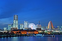
![]() Zuidhaven (Oharic: Ierakshini). A city located in the Orinoco river delta south of O'polis. Beneath its inimitable skyline Zuidhaven is a teeming, triumphant metropolis with imperial history, intrigue and entrepreneurial zeal written into its streets. It’s a city constantly being remade and reimagined, and the resulting sense of opportunity and vigour is palpable. From the domes of its temples to the frantic pace of its traffic, Istanbul is awe-inspiring, unflinchingly and gregariously urban. The original name was either Hierropolis ("iron city") or Hierapolis ("sacred city"). The city earned its wealth thanks to the trade of ores. Sri Seymond Adhamed sacked the city in 1174, marking the end of the civil war. In 1224 a band of Borean merchants re-founded the city as Zuidhaven ("harbour of the south"), drawing inspiration from earlier successes in Nordhaven. In Oharic the city was referred to as Irebuli. Zuidhaven is the nation's economic centre, with a population of over 10 million inhabitants. The unofficial metropolitan area extends far beyond, housing about 13 million inhabitants, granting it the classification as a megalopolis.
Zuidhaven (Oharic: Ierakshini). A city located in the Orinoco river delta south of O'polis. Beneath its inimitable skyline Zuidhaven is a teeming, triumphant metropolis with imperial history, intrigue and entrepreneurial zeal written into its streets. It’s a city constantly being remade and reimagined, and the resulting sense of opportunity and vigour is palpable. From the domes of its temples to the frantic pace of its traffic, Istanbul is awe-inspiring, unflinchingly and gregariously urban. The original name was either Hierropolis ("iron city") or Hierapolis ("sacred city"). The city earned its wealth thanks to the trade of ores. Sri Seymond Adhamed sacked the city in 1174, marking the end of the civil war. In 1224 a band of Borean merchants re-founded the city as Zuidhaven ("harbour of the south"), drawing inspiration from earlier successes in Nordhaven. In Oharic the city was referred to as Irebuli. Zuidhaven is the nation's economic centre, with a population of over 10 million inhabitants. The unofficial metropolitan area extends far beyond, housing about 13 million inhabitants, granting it the classification as a megalopolis.
Minor cities
- Anada Varaba is a port city in Orioni’s Semeni region, with a history dating to the Middle Ages.
- Deseti is a city on the western island of the same name. From the 4th Century BCE, it was included in the Orioni Empire. It was a centre of pearl trading along the Pearl Road.
- Harçalmiye is a city in the Amilaki Mountains between the Weledi Gulf and the Kitelu Bight.
- Iwineti is a town near Pontus. In 1921, Baron Liyoni Kinigiyariti of Iwineti was elected as the first male mayor in Orioni.
- Maryama, a far-eastern city in the Meda province of Asehayi.
- Mehala (Velorum) in the dry Semeni region.
- Lumbini is an Elitist pilgrimage site in the Amilaki region. It is the place where, according to religious tradition, the first Elite revolution against corrupt rulers took place in 563 CE.
- Mar (common pronunciation) or Mor is a title of honour given to saints. The Pope of Salvia is referred to as Mar Baba by the Orinese.
Former cities
- Arrochar.
- Doriapolis ("city of Dorias”). A city ruled by Dorias I the Great and famous for its library. The city lost much of its former glory when local power shifted towards O'polis. It was ultimately abandoned in 356 CE.
- Eridanus ("city of the river"). A city located near the inlet east of Sirius. Abandoned when its river dried out. The name lives on as Eridanus bay.
- Iskandropolis (“city of Iskander”). City founded by Iskander, a general from Andro(polis) who was a crucial figure in the colonisation of the northeast. The name lives on as a reference to the Hiskandria river.
- Kourma was the capital city of an Iron Age culture, located in eastern Weriki.
- Ophir (Oharic: Oper). From the ancient Memopotamian symbol Pr meaning 'house' or 'house of'. Ophir was the capital city of the first dynasties of ancient Orioni. This coastal city grew rich thanks to its trade in timber and ores. Ophir remains undiscovered but is well attested by ancient writers. The exact location of Ophir is uncertain because any architecture left behind would have almost disappeared considering the great timescale. The city is most likely buried somewhere in central Orioni, specifically along the river delta region between Vega and Zuidhaven. Probably due to siltation, river navigation could not be continued. Onshore explorations revealed the presence of significant pot shards of redware, red polished ware, dull redware, red and black ware and buff ware. Literary, epigraphic and archaeological evidences suggest that Ophir was one of the flourishing ports on the west coast during the early Iron Age (3rd millennium BCE).
- Tarabulus (Anglish: Tripolis, "three cities"). A city that started out as a collection of three cities, located in the inlet of Great Sea of Dragon Tears ($Rename). The city was lost in 79 CE when a massive landslide pushed the entire city into the sea. There are also various legends of medieval origin about cities that sank underground or into the sea because of some collective sin committed by the inhabitants. These towns return to earth every hundred years for a few hours, only to sink back to their eternal existence in perpetual limbo. Seeing this as an omen from the gods, no effort was made to re-found the city.
Tamanyi cities
The Tamanyi cities (Anglish: loyal or good) were the most important cities of the loyalist rump state during the Civil war (1023–1174). In 1121, there were a total of 21 “Good Cities”, all located within the present-day region of Semeni. The most important cities were: Korontaj, Dion and Hangsa. If considered a Tamanyi City, the city was allowed to maintain a city wall and hold special trade privileges and exemptions. These rights persisted for several centuries after the Memelesi (Anglish: reconquest). Other cities were differentiated them from the ”Good Cities” as they were not allowed to be represented at the Gizatochi, an early precursor to the Sibiseba.
References
- ↑ Urban development in Orioni (5 December 2020)
- ↑ Lost arts of Orioni (11 December 2020)
- ↑ Top 10 cities in Orioni revealed (10 July 2019)
- ↑ Herodotus, Histories (Herodotus)#Book IV (Melpomene), 4.103, "The Tauri live by plundering and war."
